March 27 , 2026.
Hawaii , Kilauea :
HAWAIIAN VOLCANO OBSERVATORY DAILY UPDATE , U.S. Geological Survey
Thursday, March 26, 2026, 9:14 AM HST (Thursday, March 26, 2026, 19:14 UTC)
19°25’16 » N 155°17’13 » W,
Summit Elevation 4091 ft (1247 m)
Current Volcano Alert Level: WATCH
Current Aviation Color Code: ORANGE
Activity Summary:
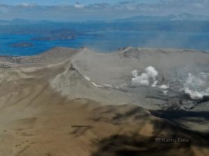
The Halemaʻumaʻu eruption of Kīlauea is paused. The summit is currently inflating slowly; overnight, occasional glow was visible from the south and north vents and gas-pistoning continues. Rare spatter was visible at the south vent last night from the V3cam. The forecast window is now April 5-15 based upon modeling of the continued slow re-inflation of the summit.
No significant activity has been noted along Kīlauea’s East Rift Zone or Southwest Rift Zone.
HVO’s monitoring network is gradually recovering from power and storm related outages. The Uēkahuna (UWD) tiltmeter is back online, however, no data was recovered from during the outage, so an offset was applied using data from other summit tiltmeters. Several summit stations, including the SDH tiltmeter, will remain offline until we are able to re-establish access across the deep tephra field south of the caldera.
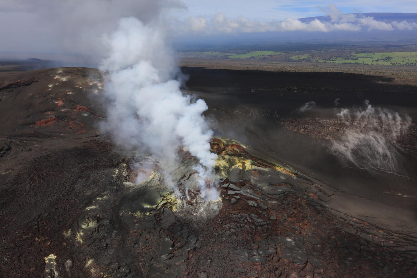
On March 25, 2026, U.S. Geological Survey Hawaiian Volcano Observatory staff conducted a routine helicopter overflight to collect samples from the crater floor and thermal and visual images around Halemaʻumaʻu after episode 43 that occurred on March 10, 2026. The north and south vents have a robust gas plume emanating from them and spatter could be seen far down in the south vent (not visible in photo). Yellow sulfur crystals are visible over much of the edifice of the north and south vents.
Summit Observations:
Overnight, intermittent glow was observed at the south and north vents, along with rare spatter at the south vent. Spattering was seen within the south vent during an overflight yesterday as well. Currently, both vents are emitting gas plumes.
Seismic tremor continues and is punctuated by tremor bursts at intervals of 5–10 minutes. These bursts correlate with glow on the V3 camera and peak temperatures recorded by the F1 thermal camera at the south vent, consistent with ongoing gas-pistoning within the vents. One earthquake was recorded at the summit during the past day.
Summit tiltmeters IKI and SMC continue to record slow inflation since the end of episode 43. UWD tiltmeter is back online and is also recording slow inflation at the summit. The UWD tiltmeter has recorded an estimated 15.3 microradians of tilt since the end of episode 43, an increase of 0.7 microradians in the last 24 hours.
Rift Zone Observations:
Rates of seismicity and ground deformation remain low in the East Rift Zone and Southwest Rift Zone. SO2 emissions from the East Rift Zone remain below the detection limit.
Source : HVO.
Photo : USGS / D. Downs.
Alaska , Shishaldin :
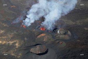
Unrest continues at Shishaldin Volcano. Seismic and infrasound activity remains elevated, with numerous small earthquakes, seismic tremor, and infrasound detections observed over the past day. A small steam plume was seen in clear webcam imagery. Satellite images detected sulfur dioxide with this plume drifting to the south.

Local seismic and infrasound sensors, web cameras, and a geodetic network are used to monitor Shishaldin Volcano. In addition to the local monitoring network, AVO uses nearby geophysical networks, regional infrasound and lightning data, and satellite images to detect eruptions
Source : AVO
Photo : Loewen, Matt
Indonesia , Semeru :
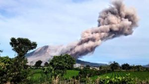
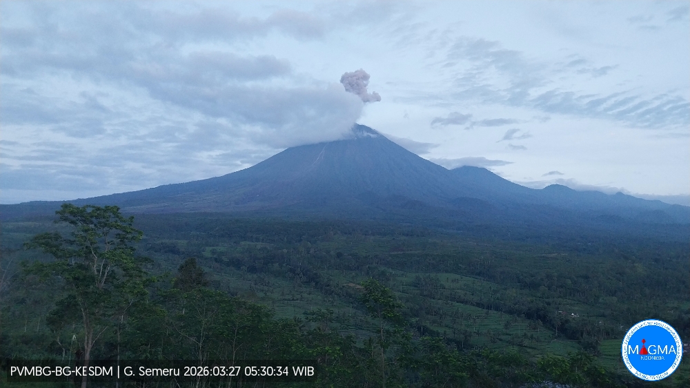
Mount Semeru experienced an eruption on Friday, March 27, 2026 at 5:27 AM WIB. An ash column was observed approximately 1,000 meters above the summit (at an altitude of about 4,676 meters). This ash column was gray and dense, oriented to the north and northeast. The eruption was recorded by a seismograph with a maximum amplitude of 22 mm and a duration of 168 seconds.
VOLCANO OBSERVATORY NOTICE FOR AVIATION – VONA
Issued : March 27 , 2026
Volcano : Semeru (263300)
Current Aviation Colour Code : ORANGE
Previous Aviation Colour Code : orange
Source : Semeru Volcano Observatory
Notice Number : 2026SMR600
Volcano Location : S 08 deg 06 min 29 sec E 112 deg 55 min 12 sec
Area : East java, Indonesia
Summit Elevation : 11763 FT (3676 M)
Volcanic Activity Summary :
Eruption with volcanic ash cloud at 22h27 UTC (05h27 local).
Volcanic Cloud Height :
Best estimate of ash-cloud top is around 14963 FT (4676 M) above sea level or 3200 FT (1000 M) above summit. May be higher than what can be observed clearly. Source of height data: ground observer.
Other Volcanic Cloud Information :
Ash cloud moving from north to northeast. Volcanic ash is observed to be gray. The intensity of volcanic ash is observed to be thick.
Remarks :
Eruption recorded on seismogram with maximum amplitude 22 mm and maximum duration 168 second.
Source et photo : PVMBG
Colombia , Puracé – Los Coconucos Volcanic Range :
Popayán, March 24, 2026, 4:30 PM
Regarding the monitoring of activity at the Puracé volcano – Los Coconucos volcanic chain – the Colombian Geological Survey (SGC), an agency under the Ministry of Mines and Energy, reports the following:
During the week of March 17-23, 2026, seismicity related to fluid movements within the volcanic edifice continued to be recorded. This seismicity included long-period (LP) earthquakes, tremor pulses (TR), and continuous tremor. These earthquakes were located below the crater of the Puracé volcano, at depths of less than 1 km, and were related to circulation processes and the release of volcanic gases into the atmosphere. These gases dispersed according to the wind direction, reaching a maximum altitude of 700 m above the summit of the volcano.
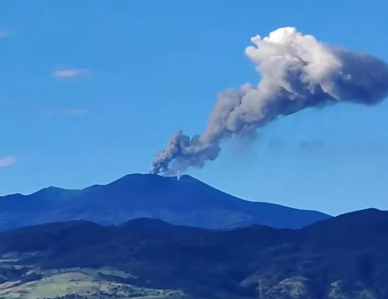
Fracture seismicity remained stable compared to previous weeks, both in terms of frequency and seismic energy released. It was primarily localized between the Puracé and Piocollo volcanoes, at depths of 1 to 3 km, with a maximum calculated magnitude of 2.5. Low sulfur dioxide (SO₂) emissions were recorded, and gases continue to escape from fissures in the craters of the Curiquinga and Piocollo volcanoes, although no ash emissions were observed. Satellite observations indicate that the thermal anomaly in the Puracé volcano crater persists. Furthermore, the slow deformation process continues between the Puracé, Piocollo, and Curiquinga volcanoes, as demonstrated by the eruptive episode of Curiquinga on January 20, 2025.
In conclusion, the observed variations in the Los Coconucos volcanic chain (Puracé volcano) indicate that the system continues to evolve and that further emissions and ashfall are possible, depending on the prevailing wind direction. The public is advised to refrain from climbing to the upper reaches of the volcanic chain and to remain attentive to official bulletins from the Colombian Geological Survey (SGC).
The alert level for volcanic activity remains yellow: active volcano showing changes in monitored parameters and other manifestations.
Source : SGC.
Photo : SGCOL ( archive)
Guatemala , Santiaguito :
Atmospheric conditions: Clear skies
Wind: Northeast
Rainfall: 0.0 mm
Activity:
Constant outgassing is observed above the Caliente dome, reaching a height of 400 meters and dispersing to the southwest. Low- to medium-intensity explosions have been recorded, with a column of gas and ash rising up to 800 meters above the dome and dispersing to the southwest. During the night and early morning, incandescence can be observed on the dome itself as well as on its western and southwestern flanks, resulting from recurring avalanches cascading down these slopes.
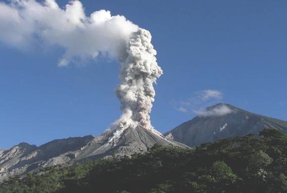
The possibility of pyroclastic density currents cannot be ruled out; therefore, it is essential to follow the recommendations of Special Bulletin BESAN-063-2025.
Given the presence of rain within the volcanic perimeter, low- to medium-intensity lahars may occur along the riverbeds on the southern flank (Nimá i Tambor, Cabello de Ángel, among others); therefore, follow the recommendations of Special Bulletin BESAN-012-2025.
Source : Insivumeh.
Photo : Conred ( archive)