July 23 , 2026.
Italy , Stromboli :
WEEKLY BULLETIN, July 13, 2026 – July 19, 2026 (issue date: July 22, 2026)
SUMMARY OF ACTIVITY STATUS
Based on monitoring data, the observations are as follows:
1) VOLCANOLOGICAL OBSERVATIONS: Ordinary Strombolian eruptive activity across both crater zones. The frequency of total explosive activity—encompassing the North crater zone and the Central-South crater zone—is at a medium level, with predominantly medium explosion intensities in both zones.
2) SEISMOLOGY: Monitored seismic parameters show no significant variations.
3) GROUND DEFORMATION: The time series of distance variations between the Timpone del Fuoco and San Vincenzo GNSS stations indicates a slight upward trend. Tiltmeters at Punta Labronzo and Elipista (near Pizzo) showed no significant variations.
4) GEOCHEMISTRY: SO2 flux (data up to July 12) is at a medium-low level.
Soil CO2 flux (Pizzo zone – STR02): No update available.
Plume C/S ratio: Average values.
Helium isotope ratio (R/Ra): No update available.
Soil CO2 flux in the San Bartolo zone: High levels.
5) SATELLITE OBSERVATIONS: Satellite-observed thermal activity in the summit area was generally low, with a few isolated anomalies of moderate intensity.
VOLCANOLOGICAL OBSERVATIONS
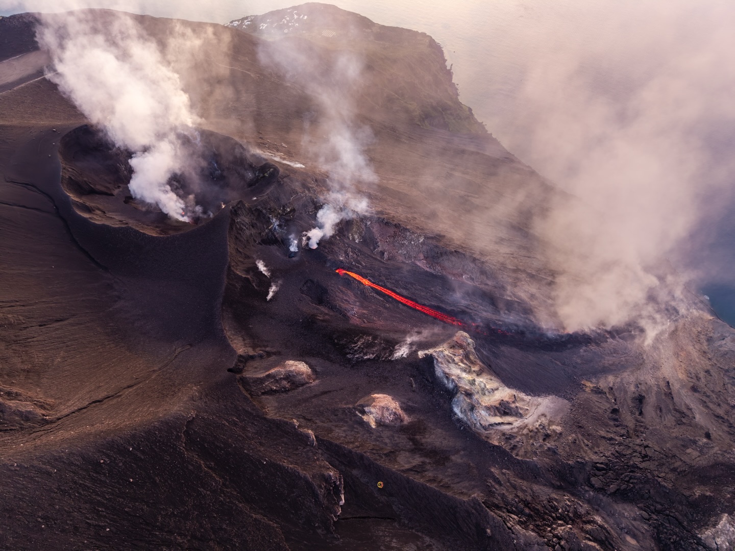
During the observation week, Stromboli’s eruptive activity was characterized through the analysis of images recorded by INGV-OE surveillance cameras located at an elevation of 190 m above sea level (SCT and SCV) and at Punta dei Corvi (SPCT). Explosions in the North crater area (Zone N) primarily produced coarse material (bombs and lapilli). In the Central-South crater area (Zone CS), explosions predominantly produced coarse material, sometimes accompanied by small clouds of fine material.
The total average hourly explosion frequency remained at a moderate level, with a slight increase in the North crater area (Zone N) starting on July 19. Explosions in the North crater area (Zone N) were fed by three main vents: one active in the N1 sector and two in the N2 sector. These three vents primarily produced coarse material (bombs and lapilli). The average explosion frequency in the North area was initially low, gradually increasing to moderate levels; intensity remained within a low-to-moderate range. In the Central-South area, two explosive vents were observed producing fine material mixed with coarse material; the average explosion frequency remained predominantly low. The intensity of explosive activity was generally moderate.
Source : INGV
Photo : Stromboli stati d’animo / Sebastiano Cannavo
Italy / Sicily , Etna :
WEEKLY BULLETIN, July 13, 2026 – July 19, 2026 (issue date: July 22, 2026)
SUMMARY OF ACTIVITY STATUS
Based on monitoring data, the observations are as follows:
1) VOLCANOLOGICAL OBSERVATIONS: Intra-crater explosive activity at the Northeast Crater and (with ash emissions) at the Bocca Nuova crater; degassing at the Voragine and Southeast craters.
2) SEISMOLOGY: Low-intensity fracturing seismic activity. The average amplitude of volcanic tremor remains predominantly at moderate levels; significant fluctuations persist.
3) INFRASOUND: Low-energy, low-frequency infrasonic activity.
4) GROUND DEFORMATION: A slight upward trend was observed in the time series of distance variations between the Monte Corruccio (ECOR) and Crisimo (ECRI) GNSS stations, along the Pernicana fault system.
5) GEOCHEMISTRY: SO2 flux at a moderate level.
Soil CO2 flux (Etnagas network): moderate to high levels.
Partial pressure of dissolved CO2 in groundwater (EtnaAcque network): no update.
Helium isotope ratio at peripheral sites: no update; the last recorded value was high (July 9, 2026).
6) SATELLITE OBSERVATIONS: Over the past week, satellite-observed thermal activity in the summit area remained at a low level.
VOLCANOLOGICAL OBSERVATIONS
During the week in question, monitoring of Etna’s volcanic activity was conducted through the analysis of images from INGV Etna Observatory (INGV-OE) surveillance cameras and satellite imagery, as well as through direct field observations by INGV-OE personnel.
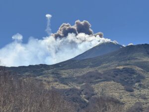
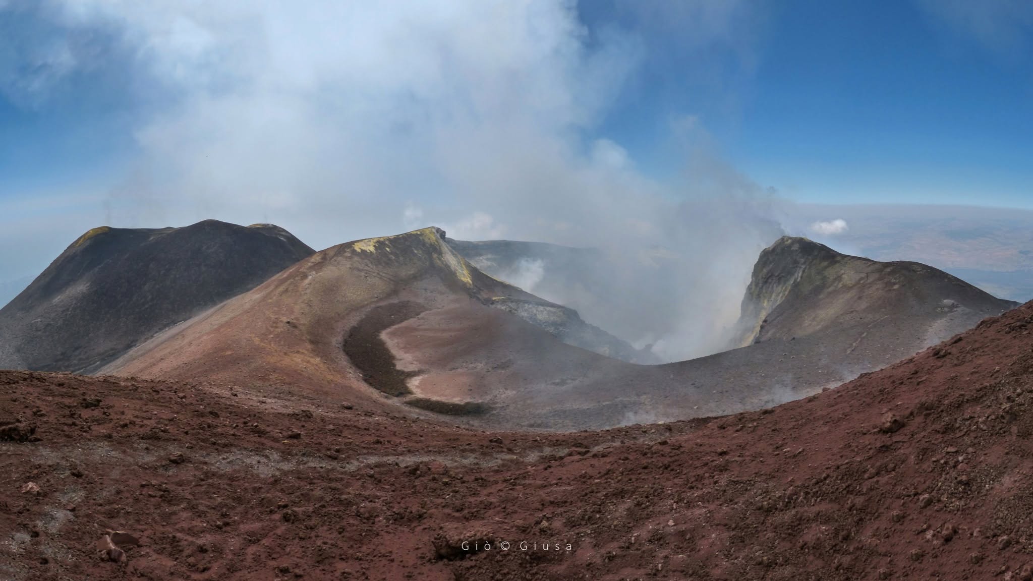
During this observation period, Etna’s activity was characterized by degassing at the Southeast Crater and the Voragine crater. More specifically, regarding the latter, gas emissions were concentrated along the eruptive fissure that had appeared on the morning of July 5, 2026. Observations made during field missions by INGV-OE personnel on July 16 and 18 revealed sporadic explosions within the Northeast Crater (CNE), as well as brownish-yellow ash emissions from the western vent of the Bocca Nuova crater (BN 1).
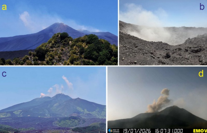
Activity at the Bocca Nuova crater. (a) Light-brown ash emissions viewed from the Valle del Bove, July 15, 2026. (b) The BN 1 funnel viewed from the western rim of the Bocca Nuova crater, July 18, 2026. (c) Rhythmic ash emissions viewed from Piano Vetore, July 19, 2026. (d) Impulsive explosive event occurring at 16:07 UTC on July 19, 2026, recorded by the visual surveillance camera located at Montagnola (EMOV).
On July 18 and 19, ash emissions from BN 1 became quasi-continuous—often displaying an impulsive character—generating brownish-gray plumes that rose several hundred meters above the summit of Etna (Fig. 3.2c). A particularly energetic event occurred on July 19 at 16:07 UTC, generating a gray ash cloud that rose approximately 300 m above the vent (Fig. 3.2d); this event was also recorded as an anomaly in images from the EMOT thermal camera
(Montagnola).
Source : INGV
Photo : Gio Giusa , INGV.
Japan , Tokachidake :
BREAKING: MOUNT TOKACHI ERUPTS IN HOKKAIDO
Mount Tokachi, an active volcano in Hokkaido, erupted shortly after 11:00 a.m. on Wednesday, July 22, sending a thick, dark volcanic plume into the sky.
The volcanic alert had already been raised to Level 2 in June due to increased activity, with access restricted around the crater.
This is the first confirmed eruption of Mount Tokachi since 2004 — the first in 22 years.
People nearby are advised to follow official safety updates.
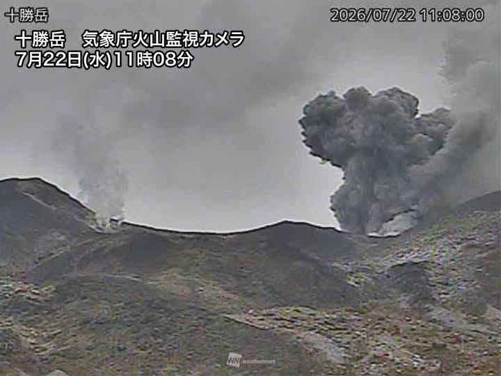
Tokachidake volcano consists of a group of dominantly andesitic stratovolcanoes and lava domes arranged on a NE-SW line above a plateau of welded Pleistocene tuffs in central Hokkaido. Numerous explosion craters and cinder cones are located on the upper flanks of the small stratovolcanoes, with the youngest Holocene centers located at the NW end of the chain. Frequent historical eruptions, consisting mostly of mild-to-moderate phreatic explosions, have been recorded since the mid-19th century. Two larger eruptions occurred in 1926 and 1962. Partial cone collapse of the western flank during the 1926 eruption produced a disastrous debris avalanche and mudflow.
Sources: Weathernews , GVP.
Indonesia , Ili Lewotolok :
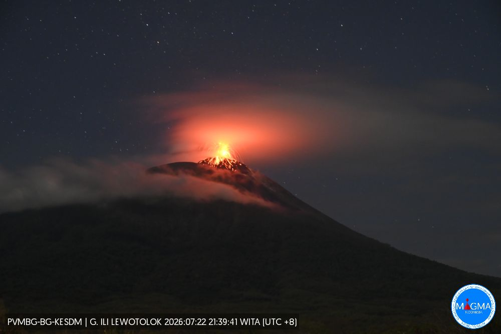
An eruption of Mount Ili Lewotolok occurred on Thursday, July 23, 2026, at 07:21 WITA; the ash plume height was estimated at approximately 200 m above the summit (or about 1,623 m above sea level). The dense, gray plume drifted eastward. The eruption was recorded by a seismograph, showing a maximum amplitude of 40 mm and a duration of 45 seconds.
Seismic observations
43 eruption earthquakes, with amplitudes of 11.1 to 40 mm and durations of 30 to 235 seconds.
88 emission earthquakes, with amplitudes of 6.6 to 39 mm and durations of 23 to 48 seconds.
1 shallow volcanic earthquake, with an amplitude of 6.6 mm and a duration of 15 seconds.
2 distant tectonic earthquakes, with amplitudes of 11.7 to 19.4 mm and durations of 37 to 97 seconds.
Recommendations
1. Communities living near Mount Ili Lewotolok, as well as visitors, climbers, and tourists, must not enter or conduct activities within a 2 km radius of the Mount Ili Lewotolok activity center.
2. Vigilance is advised regarding potential risks of lava avalanches/landslides and pyroclastic flows in the southern, southeastern, western, and northeastern sectors of Mount Ili Lewotolok.
Source et photo : PVMBG.
Colombia , Chiles / Cerro Negro :
San Juan de Pasto, July 21, 2026, 4:20 PM.
Based on monitoring of activity at the Chiles-Cerro Negro volcanic complex (CVCCN), the Colombian Geological Service (SGC)—an entity attached to the Ministry of Mines and Energy—reports the following information:
For the period from July 14 to July 20, 2026, the main changes in monitored parameters compared to the previous week are as follows:
● Amidst fluctuating seismic activity, a slight increase was recorded in both the frequency of events and the seismic energy released. Predominant seismicity remains associated with rock-fracturing processes, followed by activity linked to fluid dynamics.
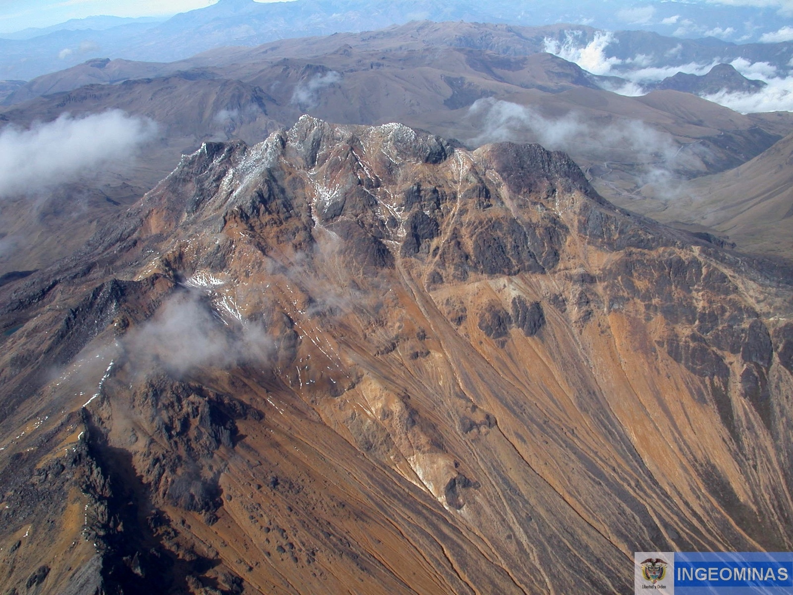
● Localized earthquakes occurred near the upper section, south of the Chiles volcano, at depths ranging from 3.0 to 3.7 km and with a maximum magnitude of 1.6. Other earthquakes were scattered toward the southern part of Chiles, at distances of 2.7 to 4.5 km and depths of 2.5 to 5.8 km relative to the summit of the Chiles volcano (4,700 m elevation), with a maximum magnitude of 0.8. None of the recorded earthquakes were felt by local residents.
● Analysis of data from satellite sensors and ground stations continued to show variations associated with deformation processes in the volcanic zone.
Based on the assessment and correlation of monitored parameters, the SGC recommends closely monitoring the situation via weekly bulletins and other information published through our official channels, as well as adhering to the instructions of local and departmental authorities and the National Unit for Disaster Risk Management (UNGRD).
Volcanic activity remains at the yellow alert level: an active volcano showing changes in the baseline behavior of monitored parameters and other manifestations.
Source : SGC.
Photo : Ingeominas.