July 20 , 2026 .
Indonesia , Semeru :
PYROCLASTIC DENSITY CURRENT EVENT AT MOUNT SEMERU, EAST JAVA – JULY 18, 2026
Mount Semeru, located across the Lumajang and Malang regencies in East Java Province, currently remains at Alert Level III (Alert/Siaga). Volcanic activity remains high, characterized by recurring pyroclastic density current events.
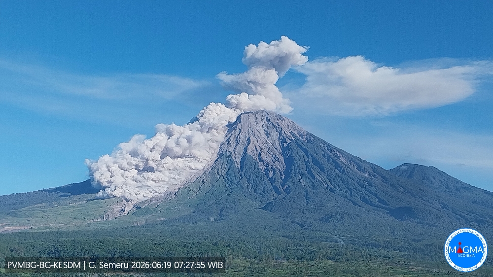
Today, July 18, 2026, at 06:21 WIB, an eruption occurred, followed by a pyroclastic density current that traveled 3,500 meters from the summit in a southeasterly direction. Visual and instrumental observations indicate that between July 1 and July 17, 2026, two southeast-directed pyroclastic density current events were recorded. Seismic activity is dominated by eruption-related earthquakes, avalanche-related earthquakes, emission earthquakes, and harmonic tremors. The recorded earthquakes indicate a continuous supply of material at depth beneath Mount Semeru, coinciding with the expulsion of material at the surface during eruptions and emissions. Seismic velocity variation parameters (dv/v) have fluctuated around zero since mid-February 2026, signaling that the volcanic system is in a relaxation phase and not undergoing a pressure buildup, although it remains highly sensitive to pressure increases. Deformation monitoring data show a relatively stable trend, indicating no pressure accumulation within the volcanic edifice; instead, a constant transfer of pressure from the interior to the surface is observed as material is expelled during eruptions and emissions.
Based on this analysis and assessment, Mount Semeru’s activity level remains at Level III (Siaga). The primary recommendation is that the public, visitors, and hikers are prohibited from engaging in activities within a 5-kilometer radius of the Jonggring Seloko crater and from entering the southeast sector—an area extending 13 kilometers southeast from the summit, which is liable to expand up to 17 kilometers along the path of the Besuk Kobokan flow. The public is urged to remain vigilant regarding the risks of pyroclastic flows, lava avalanches, and lahars along the watercourses and valleys descending from the summit of Mount Semeru—particularly along the Besuk Kobokan, Besuk Bang, Besuk Kembar, and Besuk Sat—as well as the risk of lahars in the secondary tributaries of the Besuk Kobokan.
Source et photo: PVMBG.
Hawaii , Kilauea :
HAWAIIAN VOLCANO OBSERVATORY DAILY UPDATE ,U.S. Geological Survey
Sunday, July 19, 2026, 9:06 AM HST (Sunday, July 19, 2026, 19:06 UTC)
19°25’16 » N 155°17’13 » W,
Summit Elevation 4091 ft (1247 m)
Current Volcano Alert Level: ADVISORY
Current Aviation Color Code: YELLOW
Summary:
The Halemaʻumaʻu eruption is paused. The next fountain episode is likely between July 24 and July 30.
Overview:
The summit eruption of Kīlauea in Halemaʻumaʻu is paused after the end of episode 51 on July 15. Summit inflation and glow from both vents continued overnight. Preliminary models indicate that the forecast window for episode 52 fountains is between July 24 and July 30 with July 26-28 most likely.
No significant activity has been noted along Kīlauea’s East Rift Zone or Southwest Rift Zone.
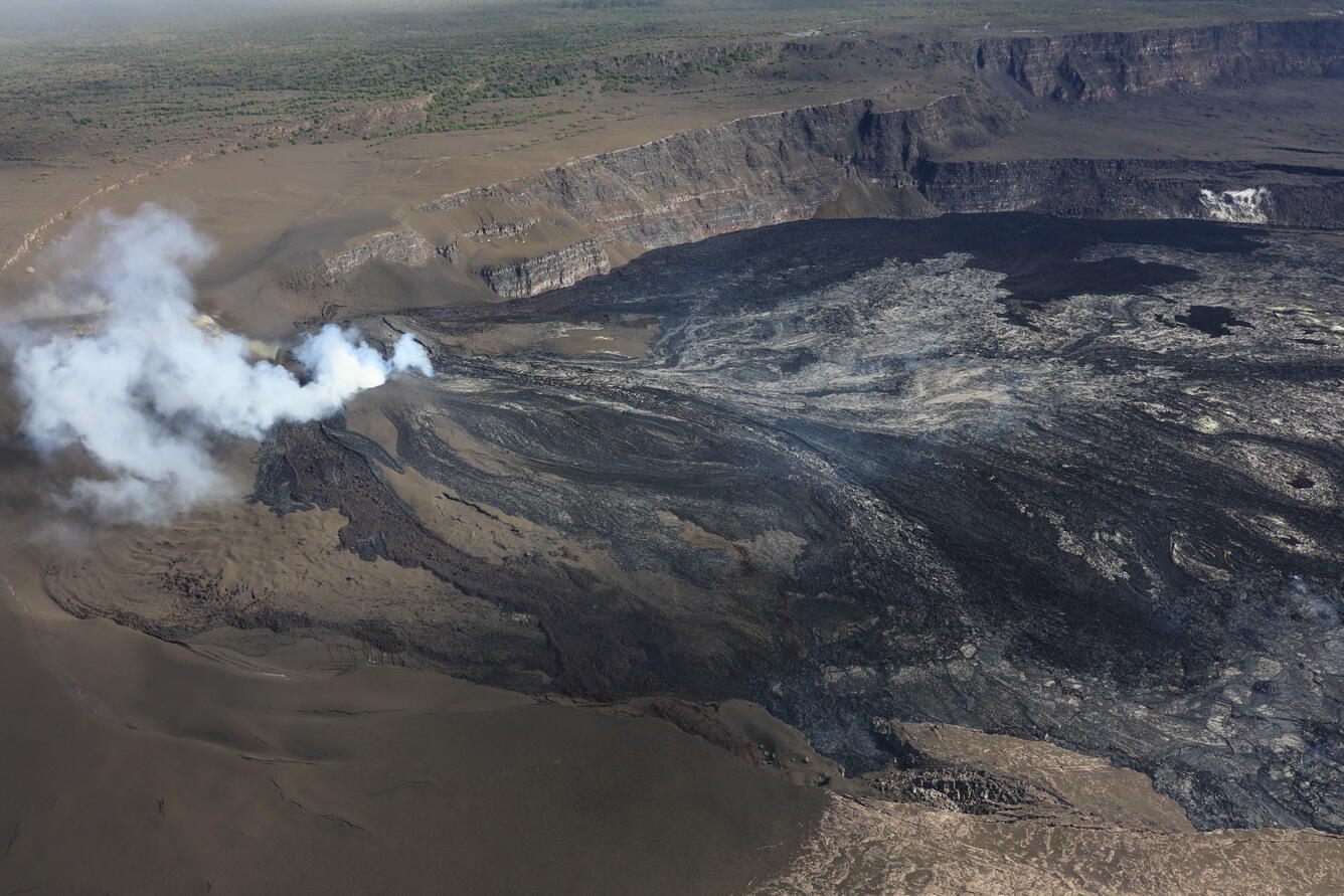
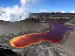
USGS Hawaiian Volcano Observatory scientists completed a helicopter overflight of Halema‘uma‘u on July 16, following Kīlauea summit eruption episode 51 the day before. Nearly the entire western portion of the crater floor was resurfaced with lava flows, including some of the down-dropped block with a remnant section of former Crater Rim Drive, collapsed in 2018 and visible in the lower right of this frame. Areas that are brown-colored on the left side of the photograph are draped in tephra fallout from the lava fountaining. Due to residual heat, it was not possible to fly directly over the eruptive vents, but it appeared there was persistent incandescence in the north vent following its eight hours of lava fountaining during episode 51.
NOTE:
The V1 camera has returned to normal duty of watching the north vent. Thank you for your patience.
Summit Observations:
Continuous strong glow with periodic flames was visible overnight from the south vent. The intermittent glow from the north vent remained weak most of the night but became moderate a few hours before dawn.
Tremor is more continuous but still marked by ragged tremor bursts. There was only one small, shallow earthquake beneath the summit of Kīlauea summit in the past 24 hours.
Since episode 51 ended, inflation resumed and has recovered 6.6 microradians of tilt at the summit tiltmeter at Uēkahuna (UWD). Kīlauea summit deflation totaled 14.7 microradians during episode 51.
The sulfur dioxide (SO2) emission rate from the summit is likely now varying within a typical range of 1,000 to 5,000 tonnes per day. Degassing plumes from both vents are being blown toward the southwest this morning.
Rift Zone Observations:
Rates of seismicity and ground deformation remain low in the East Rift Zone and Southwest Rift Zone. SO2 emissions from the East Rift Zone remain below the detection limit.
Source : HVO.
Photo : USGS / E. Johnson
Colombia , Cumbal :
San Juan de Pasto, July 14, 2026, 5:25 PM.
Based on monitoring of activity at the Cumbal Volcanic Complex (CVC), the Colombian Geological Service (SGC)—an agency attached to the Ministry of Mines and Energy—reports the following information:
During the week of July 7–13, 2026, the main changes in monitored parameters compared to the previous week were as follows:
● A decrease was recorded in both earthquake frequency and energy release.
Most seismic activity was linked to rock fracturing processes, although events associated with fluid dynamics were also recorded.
● The bulk of the seismic activity was concentrated in the immediate vicinity of the volcanic complex summit, at depths of less than 3 km (relative to the La Plazuela crater, located at an elevation of 4,700 m) and within a 2 km radius of the complex’s center. The maximum recorded magnitude was 0.9.
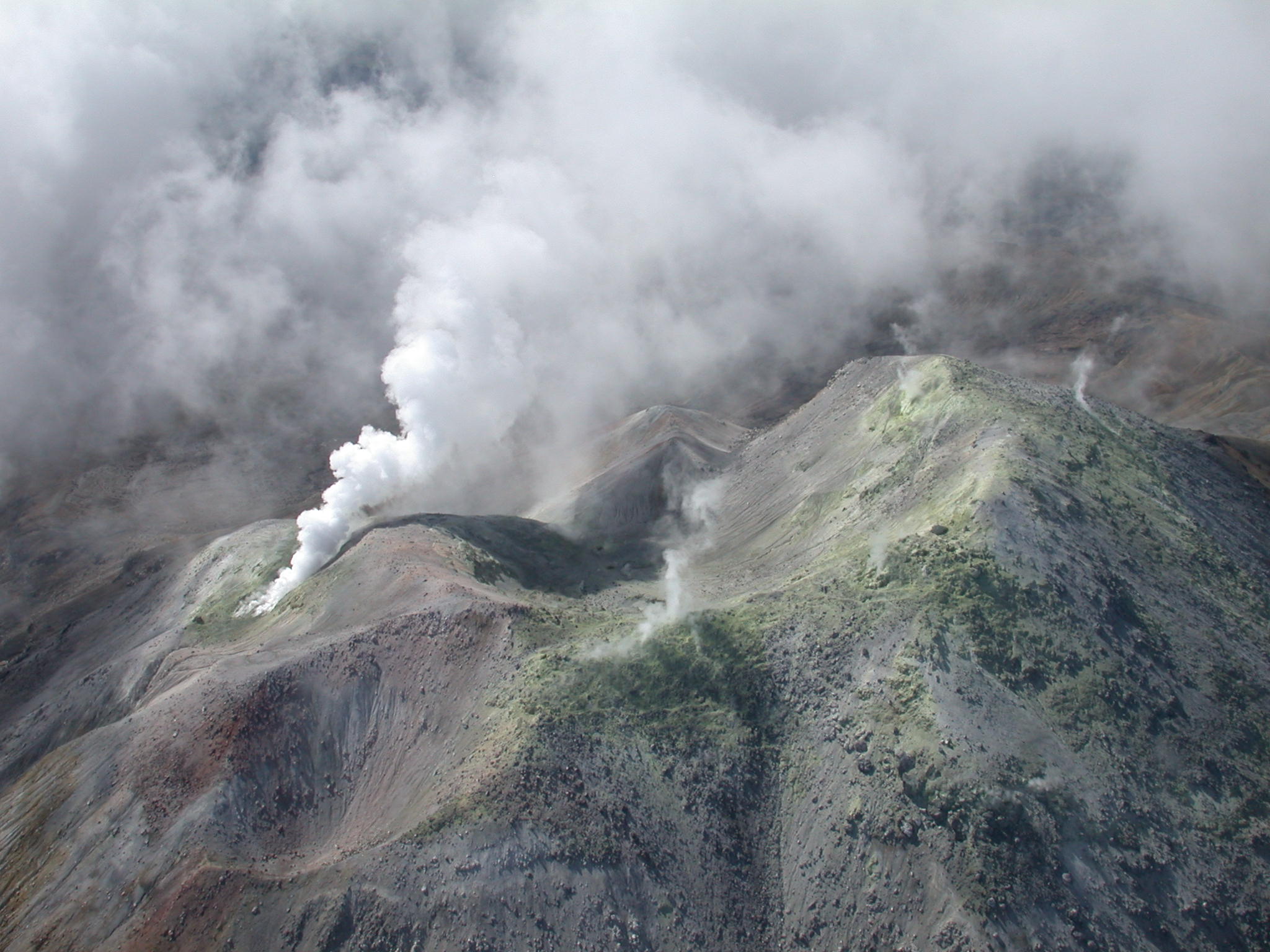
● Due to adverse weather conditions during this period, no gas emissions were observed at the volcanic complex’s fumarole fields.
● Other volcanic monitoring parameters remained stable.
In light of the above, the SGC recommends closely monitoring the situation via weekly bulletins and other information released through our official channels,
as well as adhering to the instructions issued by local and departmental authorities and the National Unit for Disaster Risk Management (UNGRD).
Volcanic activity remains at the yellow alert level: an active volcano showing changes relative to the baseline behavior of monitored parameters and other manifestations.
Source et photo : SGC.
Ecuador , Sangay :
DAILY STATUS REPORT FOR SANGAY VOLCANO, Sunday, July 19, 2026.
Information from the Geophysical Institute – EPN.
Surface activity level: Moderate; Surface trend: Decreasing
Internal activity level: Moderate; Internal trend: Decreasing
Seismicity: From July 18, 2026, 11:00 AM to July 19, 2026, 11:00 AM:
Seismicity:
Here is the count of seismic events recorded at the reference station:
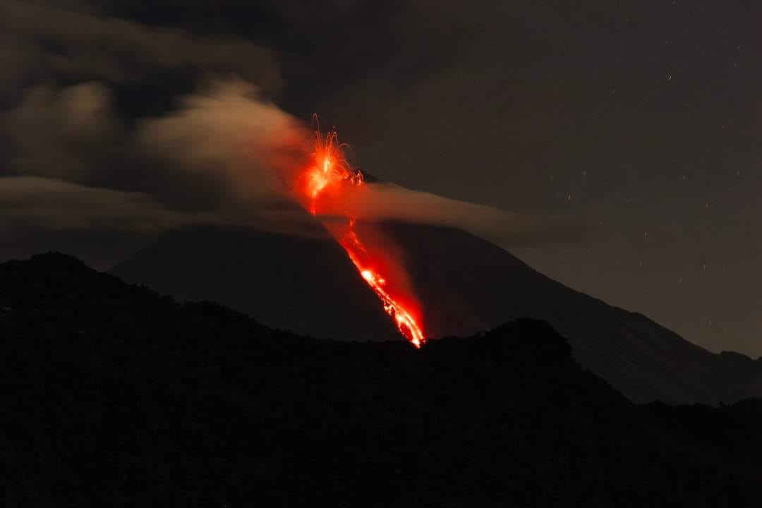
Explosion (EXP): 20
Precipitation / Lahars:
No precipitation was recorded in the volcano area. **In the event of heavy rain, accumulated material could be remobilized, generating mud and debris flows that would rush down the volcano’s flanks and into adjacent rivers.**
Emission plume / ash:
Due to cloud cover over the volcano, it was not possible to observe gas and/or ash emissions using surveillance cameras or the GOES-19 satellite system. The Washington VAAC has not issued an emission report for this volcano either.
Gas:
The MOUNTS satellite system did not detect any sulfur dioxide (SO2) concentrations.
Observation:
From yesterday afternoon until the time of this report, weather conditions around the volcano remained predominantly cloudy.
Alert level: Yellow
Source : IGEPN
Photo : Luis Lema via volcan Sangay FB , 30/03/2024
Guatemala , Fuego :
Weather conditions: Clear skies
Wind: North-northeasterly
Precipitation: 0.0 mm
Activity
Fuego Volcano continues to exhibit Strombolian and Vulcanian explosions, ranging in intensity from low to moderate or even strong. These explosions generate gas and ash plumes reaching between 4,200 and 4,700 meters above sea level, dispersing approximately 30 km to the west and southwest. The activity triggers avalanches of incandescent blocks on the western and southwestern flanks, as well as ashfall in Panimaché, Morelia, Santa Sofía, El Porvenir, San Pedro Yepocapa, and other nearby localities.
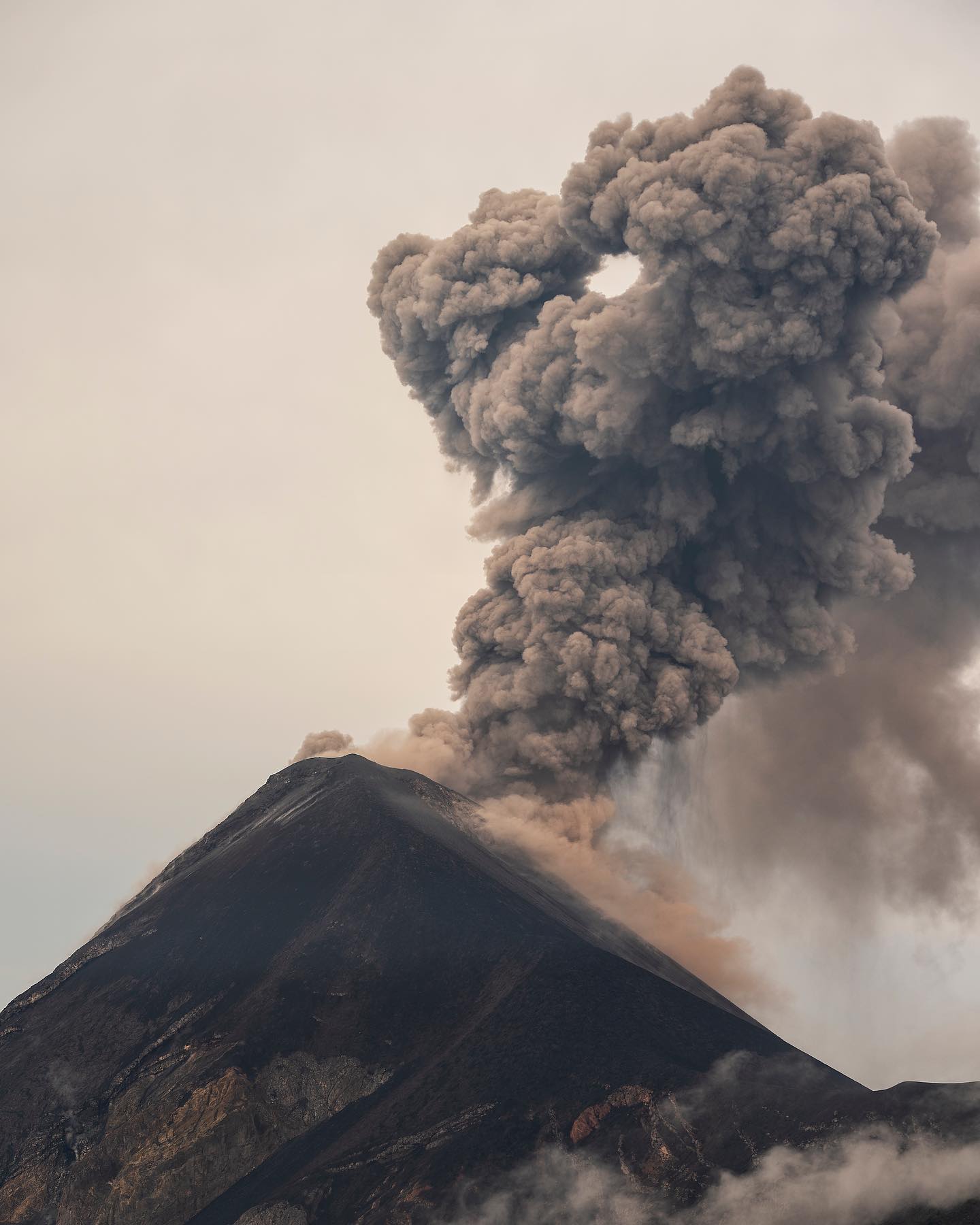
The most intense explosions generate rumbling, shockwaves, and sounds resembling a locomotive, which can be heard in the areas surrounding the volcano. Due to the ejection of ballistic material that can travel more than 700 meters from the crater, parking on the plateau or in its immediate vicinity is not recommended. Those climbing the volcano should wear clothing and use equipment suitable for high-mountain conditions, while also taking into account the likelihood of precipitation during the afternoon and overnight.
Source : Insivumeh.
Photo : Diego Rizzo / @diegorizzophoto .