July 19 2026.
Indonesia , Sorikmarapi :
INCREASE IN DEEP VOLCANIC EARTHQUAKES AT SORIKMARAPI VOLCANO, NORTH SUMATRA – JULY 18, 2026
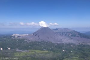
Sorikmarapi Volcano (2,145 meters above sea level) is located in the Mandailing Natal Regency, North Sumatra Province. Its activity is monitored both visually and instrumentally from the volcanological observation post located in the village of Sibangor Tonga. The current activity level of Sorikmarapi Volcano is Level II (Vigilance/Waspada).
Seismic activity at Sorikmarapi Volcano fluctuates and is generally dominated by deep volcanic earthquakes. During May 2026, the following events were recorded: 458 deep volcanic earthquakes, 46 local tectonic earthquakes, 2 felt earthquakes, and 82 distant tectonic earthquakes. In June 2026, 172 deep volcanic earthquakes, 49 local tectonic earthquakes, 1 felt earthquake, and 106 distant tectonic earthquakes were recorded. From July 1 to July 17, 2026, 182 deep volcanic earthquakes, 31 local tectonic earthquakes, and 51 distant tectonic earthquakes were recorded.
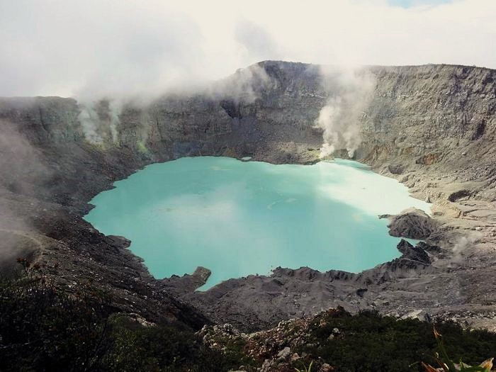
Today, July 18, 2026, seismic activity at the Sorikmarapi volcano has shown a significant increase. This rise in seismic activity was preceded by the recording of a local tectonic earthquake at 11:56:36 WIB (not felt, but recorded by the BMKG with a magnitude of 2.9) and a felt tectonic earthquake at 14:11:59 WIB (felt with an intensity of I MMI, but not recorded by the BMKG). In total, between 00:00 and 18:30 WIB, the following events were recorded: 40 deep volcanic earthquakes, 5 local tectonic earthquakes, 1 felt earthquake (I MMI scale), and 2 distant tectonic earthquakes. However, the seismograph at the Mount Sorikmarapi observation post has not yet recorded any shallow or surface seismic activity. In response to this intensification of seismic activity, the Center for Volcanology and Geological Hazard Mitigation (PVMBG) of the Geological Agency is continuously and closely monitoring the volcano’s activity. At present, the activity level of Mount Sorikmarapi remains at Level II (Vigilance/Waspada).
Source : PVMBG
Photo : Gunung Bagging blog, Jun 2016
Colombia , Nevado del Ruiz :
Manizales, July 14, 2026, 5:45 PM.
Based on monitoring of activity at the Nevado del Ruiz volcano, the Colombian Geological Service (SGC)—an agency under the Ministry of Mines and Energy—reports the following information:
During the week of July 7 to 13, 2026, the volcano continued to exhibit unstable behavior.
Compared to the previous week, the main variations in monitored parameters were as follows:
– Seismic activity associated with rock-fracturing processes within the volcanic edifice showed a slight increase in both the number of detected earthquakes and the seismic energy released. These earthquakes were located primarily on the volcano’s northeast flank, at an average distance of 2 km from the crater. To a lesser extent, events also occurred at the Arenas crater and on the north-northwest and west-south-southwest flanks of the volcano, at distances of up to 6 km from the crater. Earthquake depths ranged from less than 2 km (at the Arenas crater) to 7 km below the volcano’s summit. The maximum magnitude recorded was 1.4, corresponding to an earthquake on July 10 at 1:28 AM, located 5 km west of the Arenas crater at a depth of 5 km.
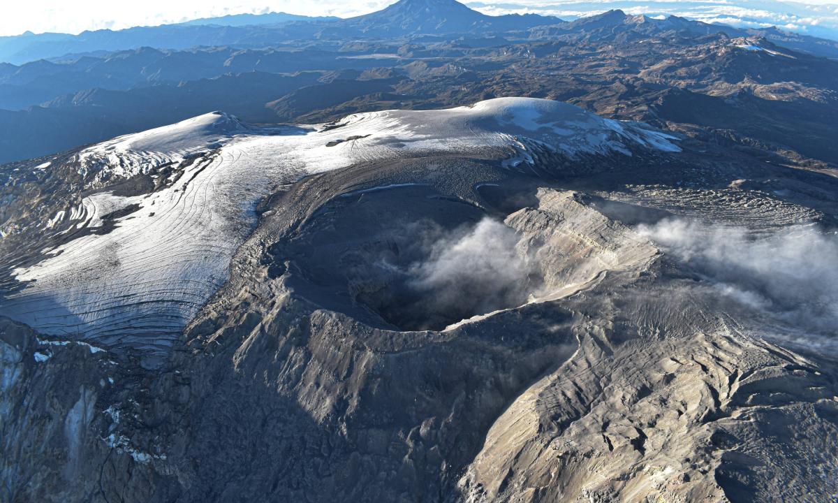
– Seismicity linked to fluid dynamics within the volcanic conduits remained at comparable levels in terms of the number of events and seismic energy released. This activity was characterized solely by short-duration, low-energy seismic signals. As in previous weeks, no long-duration seismic signals were recorded, and no pulsatile ash emissions or variations in the apparent temperature of the gas plume were confirmed.
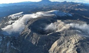
– Emissions of water vapor and volcanic gases—primarily sulfur dioxide (SO₂)—into the atmosphere continued from the Arenas crater. The estimated SO₂ flux associated with degassing processes decreased slightly compared to the previous week. Supplementary monitoring using satellite data platforms continued to show low levels of SO₂ emissions. The vertical height of the gas and water vapor plume remained around 300 m above the volcano’s summit, reaching a maximum of 600 m on the morning of July 10. The plume showed a prevailing orientation toward the northwest flank and, to a lesser extent, toward the west-northwest and west-southwest flanks.
– Satellite monitoring of thermal anomalies at the bottom of the Arenas crater remained limited due to persistent cloud cover in the area. A low-intensity thermal anomaly was recorded during the past week.
Source et photo : SGC.
Alaska , Atka volcanic complex :
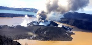
Typical elevated temperatures were seen in clear overnight satellite images form the Korovin Volcano crater lake. Minor seismic activity was also seen. Both observations are typical for the Atka volcanic complex and no unusual unrest has been detected following the July 16 explosion.
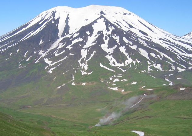
The Atka volcanic complex includes several vents, including Korovin Volcano, Mount Kliuchef and Sarichef Volcano. Korovin has been the site of most historical eruptions that typically produce minor amounts of ash and occasional but small lava flows. The Atka volcanic complex is monitored by local seismic and infrasound sensors and webcam, satellite data, and regional lightning detection instruments.
Source : AVO
Photo : Fournier, Tom / AVO/UAF-GI
Costa Rica , Poas / Rincon de la Vieja :
Daily volcano status report. OVSICORI-UNA, July 16, 2026. Update time: 10:23 AM.
Volcano: Poás
Latitude: 10.200
Longitude: -84.233
Elevation: 2,687 m above sea level
Observed activity:
Camera:
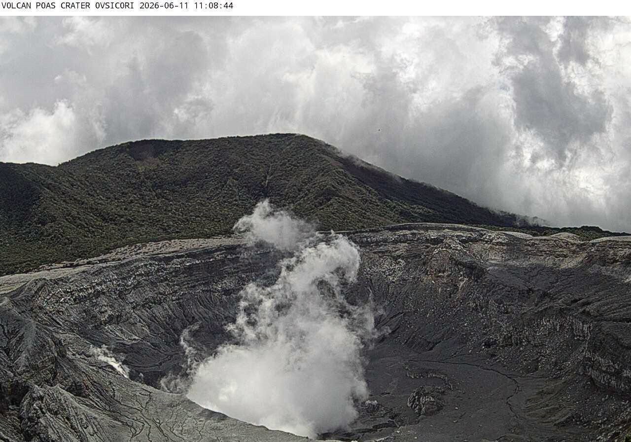
The crater was obscured by clouds in the morning, but the plume and fumaroles on the western flank remain very active. Another interruption in video transmission was noted overnight, between 3:00 AM and 5:50 AM.
Seismicity:
A tremor of moderate amplitude (1e6) was recorded, with frequencies ranging from 1 to 9 Hz.
Multi-gas:
CO2/SO2 and H2S/SO2 ratios remain stable, with an average SO2 concentration of 20 ppm over the past three days.
Environmental conditions:
The wind was blowing from the southwest at 10–12 km/h, with gusts reaching 45 km/h. The crater remained cloudy for most of the day before clearing in the afternoon, around 3:30 PM.
Activity level: Warning (2)
Volcano: Rincón de la Vieja
Latitude: 10.83
Longitude: -85.324
Elevation: 1,916 m above sea level
Observed activity:
Camera:
It was not possible to observe the volcano during the day due to cloud cover and dense fog at the summit.
Seismicity:
Continuous low-frequency tremor was recorded between 1 and 5 Hz, peaking at 1.2 Hz. No eruptions were detected in the seismic or acoustic signals.
Environmental conditions:
Wind speeds ranged from 18 to 22 km/h, with gusts reaching 70 km/h. The volcano remained shrouded in clouds throughout the day.
Activity level: Advisory (2)
Source : Ovsicori.
Ecuador , El Reventador :
DAILY STATUS REPORT FOR REVENTADOR VOLCANO, Saturday, July 18, 2026.
Information from the Geophysical Institute – EPN.
Surface activity level: High; Surface trend: Unchanged
Internal activity level: Moderate; Internal trend: Unchanged
From July 17, 2026, 11:00 AM to July 18, 2026, 11:00 AM:
Seismicity:
Explosions (EXP): 64
Long-period events (LP): 7
Emission tremor (TREMI): 10
Harmonic tremor (TRARM): 10
Precipitation / Lahars:
Precipitation was recorded in the region, but it did not trigger lahars. **Heavy rains can remobilize accumulated material and generate debris-laden mudflows (lahars), which could rush down the volcano’s flanks and flow into nearby rivers.**
Ash emissions/plumes:
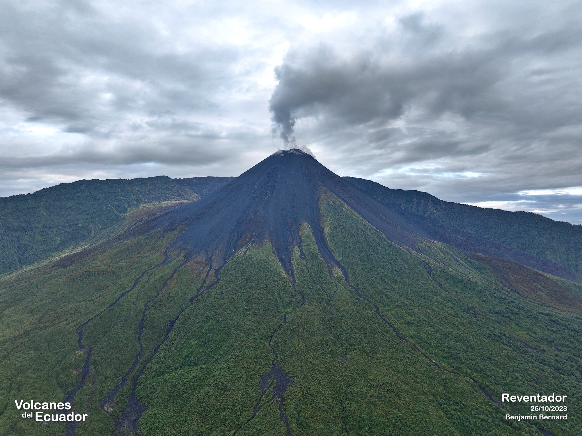
The surveillance camera system detected several gas and ash emissions reaching heights of 300 to 1,000 meters above the crater rim, drifting toward the northwest, west-northwest, and west. In connection with this activity, the Washington VAAC issued two reports noting plume heights of 1,300 meters above the crater rim, drifting west-northwest.
Observations:
During the night and early morning, several episodes of incandescent material descending the volcano’s flanks were recorded, reaching approximately 1,000 meters below the crater rim. At the time of writing, the volcano remains obscured by cloud cover.
Alert Level – SGR: Orange
Source : IGEPN.
Photo : Benjamin Bernard