February 28 , 2026.
La Réunion Island , Piton de la Fournaise :
Press release from the Paris Institute of Earth Physics / Piton de la Fournaise Volcanological Observatory, February 28, 2026 – 7:45 a.m. local time – 3:45 a.m. UTC.
Eruption in progress
The eruption that began on February 13, 2026, shortly after 10:00 a.m. (local time), at Piton de la Fournaise continues.
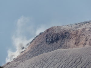
Only one eruptive site remains active on the south-southeast flank of the volcano, with lava fountains still visible from Piton de Bert. A cone is being built by the progressive accumulation of lava flows. This cone is now closed laterally. As of February 27, the cone reached a height of 19 meters on its northeastern rim, and the highest lava flows rose approximately 20 meters above its summit. Numerous small rockfalls have been observed inside and on the edges of the cone.
With the lateral closure of the cone, significant lava tube activity is now established downstream. Lava flow resurgences and active above-water sections are concentrated downstream of the eruption site and upstream of the Grandes Pentes fault, where the lava field is widening and thickening. The lava flow front, however, remains stationary in the lower part of the Grandes Pentes, approximately 2.6 km from National Route 2 and at an altitude of 660 m.
As in previous days, seismic activity remains low. The resumption of inflation of the edifice, both in the near and far fields, appears to be confirmed. This development indicates a repressurization of the magma supply system, possibly linked to magma recharge from the shallow reservoir.
The eruptive tremor (an indicator of lava and gas emissions at the surface) remains relatively stable and of low amplitude. Peaks in amplitude are still observed, likely linked to variations in degassing or morphological changes in the eruptive cone.
Surface flow rates, estimated from satellite data via the HOTVOLC platforms (OPGC – Clermont Auvergne University), have indicated values between 1 and 12 m³/sec over the past 24 hours. It should be noted that these estimates can vary rapidly depending on cloud cover and become zero in the event of total cloud cover.
Estimating surface lava flow rates allows us to track the volume of lava emitted at the surface; thus, since the beginning of the eruption, approximately 8 million cubic meters have been emitted at the surface.
Summary
For the past few days, GNSS network data have suggested a slight inflation of the edifice. This development is linked to a repressurization of the magma supply system, possibly related to a new phase of magma recharge in the shallowest reservoir.
Given the current low seismic activity, the probability of new eruptive fissures opening remains low in the short term.
Nevertheless, the first signs of possible repressurization could increase this probability.
It should also be noted that in the past, eruptive fissures have opened during an eruption without any warning signs, such as in August 1998, July 1999, October 1999, December 2006, and March 2019. Indeed, magma propagation at shallow depths can occur aseismically, particularly when the magma has already degassed.
Alert Level 2.1
Source et photo : OVPF/IPGP.
Italy , Stromboli :
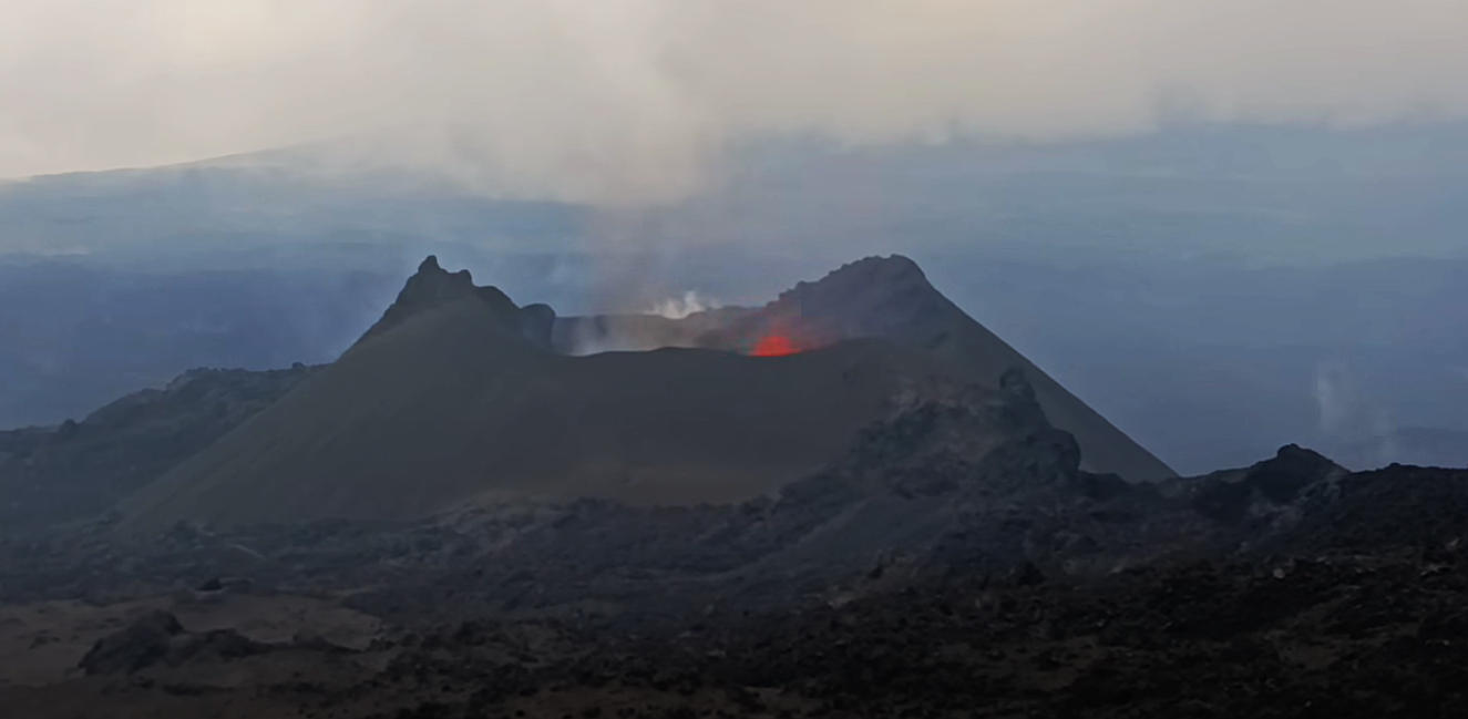
Stromboli Volcano Activity Report, February 27, 2026, 5:10 PM (4:10 PM UTC).
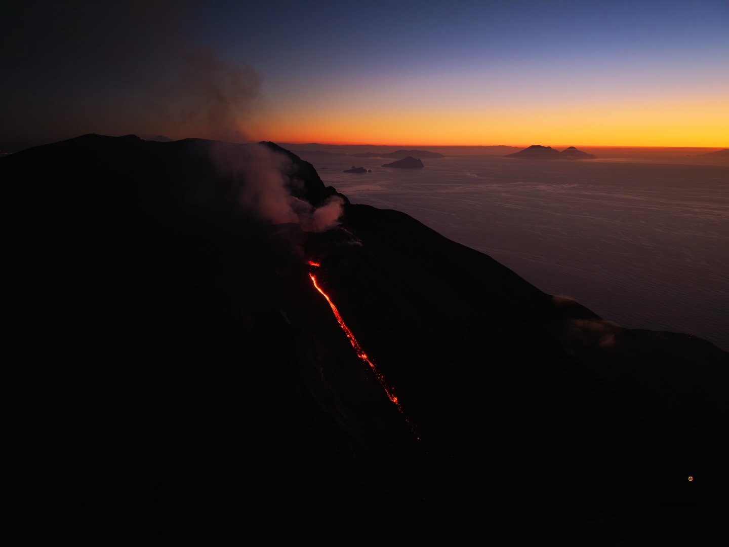
The National Institute of Geophysics and Volcanology, Etna Observatory, announces that analysis of surveillance camera images shows moderate effusive activity in the North Crater area, producing a lava flow whose fronts are located in the upper part of the Sciara del Fuoco.
From a seismic perspective, the average amplitude of volcanic tremor is currently within normal limits. No significant changes have been reported in the frequency and amplitude of explosion earthquakes.
The GNSS network shows no significant changes.
Further updates will be provided shortly.
Source : INGV
Photo : Stromboli stati d’animo / Sebastiano Cannavo.
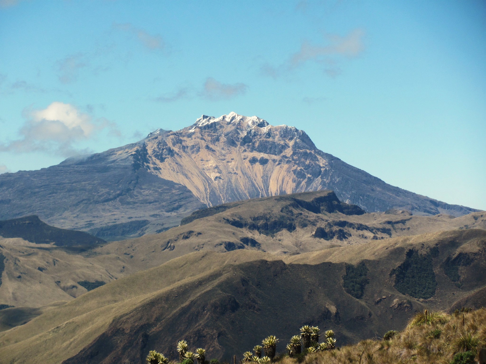
Colombia , Chiles / Cerro Negro :
San Juan de Pasto, February 24, 2026, 3:30 PM
Regarding the monitoring of activity at the Chiles-Cerro Negro Volcanic Complex (CVCCN), the Colombian Geological Survey (SGC), an agency under the Ministry of Mines and Energy, reports the following:
During the period from February 17 to 23, 2026, the main variations in monitored parameters compared to the previous week were as follows:
● Within the context of fluctuating seismic activity, a decrease in the number of seismic events was recorded; however, a slight increase in energy released was observed. Seismicity associated with rock fracturing processes remained predominant, followed by seismicity related to fluid dynamics.
● Most of the localized earthquakes were concentrated at the summit of Chiles Volcano and on its western and southern flanks. In general, depths ranged from 1.0 km to 9.0 km below the summit (4,700 m altitude). The maximum magnitude of 1.9 was recorded on February 22 at 5:10 a.m., with an epicenter located west of the summit of Chiles and a depth of 3.5 km. No tremors were reported.
● Analysis of data from satellite sensors and ground stations continues to indicate variations related to deformation processes in the volcanic zone.
Based on the assessment and correlation of monitored parameters, the Geological Survey of Colombia (SGC) recommends closely monitoring its evolution through weekly bulletins and other information published via its official channels, as well as following instructions from local and departmental authorities and the National Unit for Disaster Risk Management (UNGRD).
Volcanic activity remains at the yellow alert level: active volcano with changes in the baseline behavior of monitored parameters and other manifestations.
Source et photo : SGC.
Hawaii , Kilauea :
HAWAIIAN VOLCANO OBSERVATORY DAILY UPDATE , U.S. Geological Survey
Friday, February 27, 2026, 9:03 AM HST (Friday, February 27, 2026, 19:03 UTC)
19°25’16 » N 155°17’13 » W,
Summit Elevation 4091 ft (1247 m)
Current Volcano Alert Level: WATCH
Current Aviation Color Code: ORANGE
Activity Summary:
The Halemaʻumaʻu eruption of Kīlauea is paused. Episode 42 ended February 15 at 11:38 p.m. HST. Preliminary models suggest the likely forecast window for the onset of episode 43 lava fountaining is March 6-16.
No significant activity has been noted along Kīlauea’s East Rift Zone or Southwest Rift Zone.
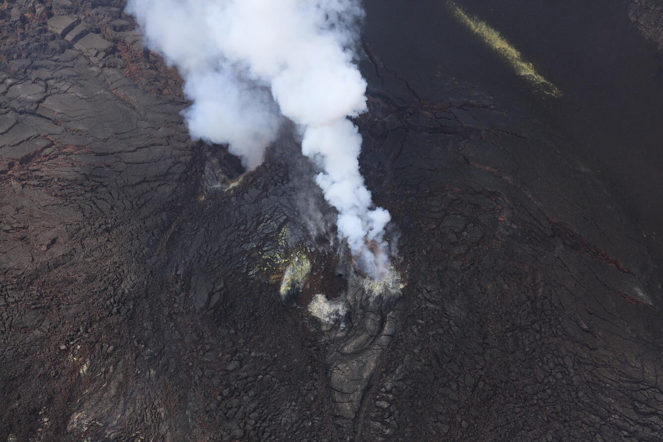
Despite hazy conditions on Thursday, February 26, the USGS Hawaiian Volcano Observatory monitoring overflight crew had clear views of the Kīlauea summit eruptive vents during a low pass over western Halema‘uma‘u crater. No lava or incandescence was visible in either the north (lower-right) or south (upper-left) vent.
Summit Observations:
Little-to-no glow could be seen from the vents last night. This morning, both vents remain quiet and emitting steady gas plumes. Low seismic tremor continues at the summit, punctuated by more energetic bursts every 5-10 minutes. These bursts have been associated with brief increases in gas emission and increases in glow from the vents at night. There were two earthquakes less than M1.0 located in the summit region in the past 24 hours.
Summit tiltmeters began recording mild deflation early yesterday morning, and this trend continue throughout the day. The UWD tiltmeter has recorded recovery of nearly 17.6 microradians of inflationary tilt since the end of episode 42, with about 0.2 microradians of net deflation over the past 24 hours.
Sulfur dioxide (SO2) emission rates from the summit have been averaging 1000-1500 t/d, typical of these eruptive pauses. This morning, due to weak southerly winds, gas is rising slowly from the vents and blanketing the caldera and surrounding areas.
Rift Zone Observations:
Rates of seismicity and ground deformation remain very low in the East Rift Zone and Southwest Rift Zone. SO2 emissions from the East Rift Zone remain below the detection limit.
Source : HVO.
Photo : USGS / M. Zoeller.
Costa Rica , Poas :
Latitude: 10.20°N
Longitude: 84.23°W
Altitude: 2687 m
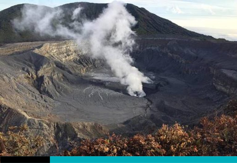
Current Activity Level: Alert
This week, the amplitude of seismic tremors remained relatively stable. The number of long-period events increased. High-frequency events are now almost nonexistent. The geodetic network is not recording any significant deformation. The MultiGAS station recorded SO₂/CO₂ values close to 1.2 and H₂S/SO₂ values close to 0.2 ± 0.2, similar to those of the previous week.
DOAS stations detected a sulfur dioxide (SO₂) flux of 66 ± 21 t/d, lower than the previous week’s (121 ± 43 t/d). Heavy precipitation was recorded this week at the observation point (IMN data), and visibility was good for several days. SO₂ was detected in the atmosphere by satellite with a maximum mass of 42 tonnes on February 26.
Source et photo : Ovsicori