August 13 , 2026.
Italy / Sicily , Etna :
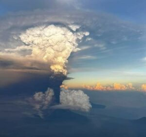
Statement on Etna’s activity, August 12, 2026, 17:57 (15:57 UTC).
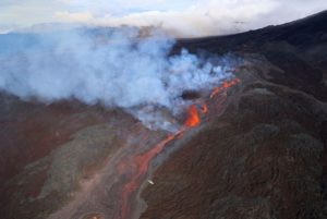
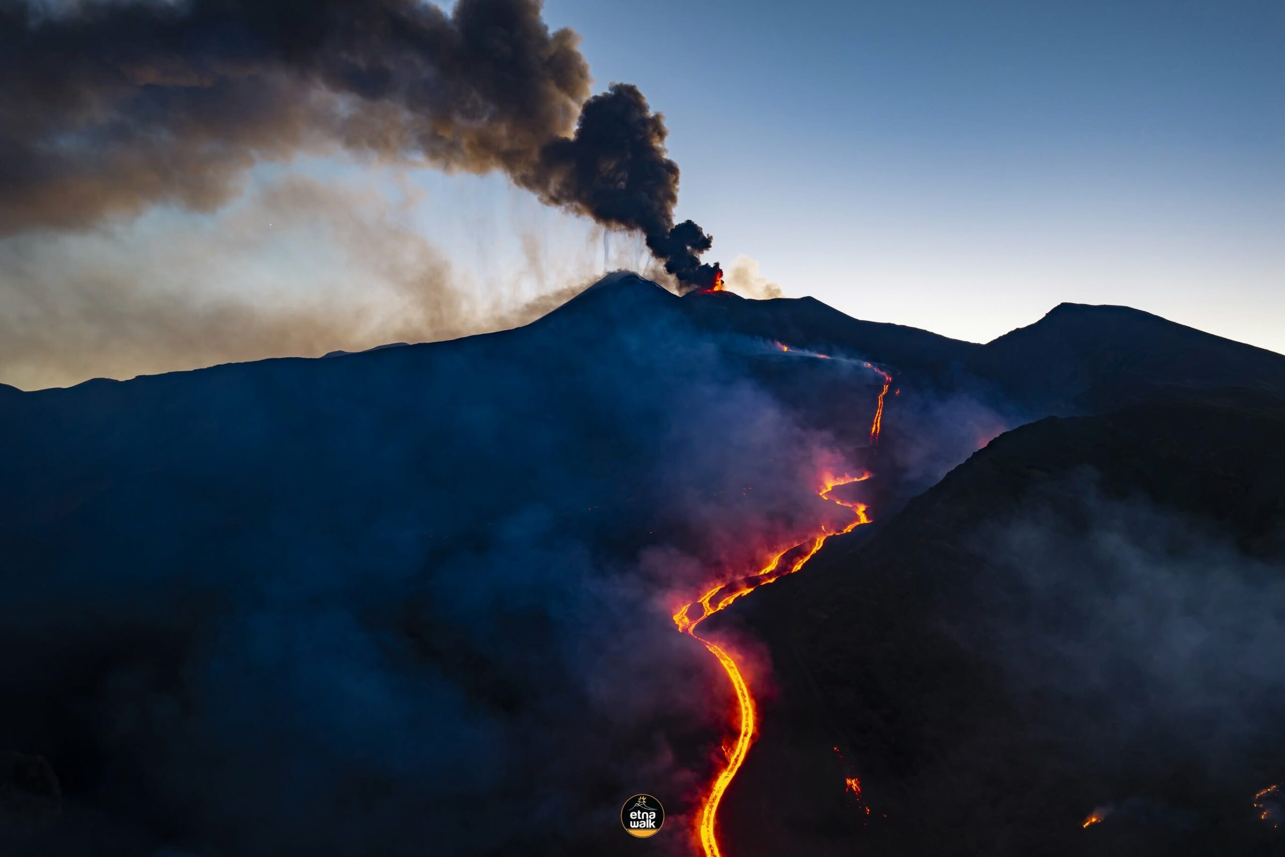
The National Institute of Geophysics and Volcanology (INGV), Osservatorio Etneo, reports that video surveillance images and field inspections conducted by INGV-OE personnel indicate ongoing effusive activity at eruptive vents located at elevations of 2,750 m, 2,090 m (see statement from August 11, 10:41 UTC), and 1,900 m (see statement from August 10, 22:25 UTC). Lava flow fronts fed by the vent at an elevation of 2,360 m appear to be cooling. The most advanced active fronts—associated with the vent at 1,900 m elevation—were located at an elevation of 1,365 m at 11:00 UTC, near Rocca Capra (Valle del Bove).
Explosive activity at the Voragine crater continues with varying intensity, emitting ash that is dispersing towards the south.
Seismically, compared to the last update, the average amplitude of volcanic tremor shows no significant change and remains high, with a clear, gradual upward trend. The tremor source centroid is located in the Voragine crater area, at an elevation of approximately 3,000 m above sea level. Since the start of the day, infrasonic activity has generally decreased; it is currently at a moderate level, with events of generally medium amplitude located primarily in the Voragine crater area. Signals from ground deformation monitoring stations show no significant changes compared to previous observations.
Further updates will be provided as soon as possible.
Source : INGV.
Photo : Etna Walk / Giuseppe Distefano / Marco Restivo.
Hawaii , Kilauea :
HVO/USGS Volcanic Activity Notice , 2026-08-13 01:53:49 UTC
Current Volcano Alert Level: WATCH
Current Aviation Color Code: ORANGE
Issued: Wednesday, August 12, 2026, 3:53 PM HST
Source: Hawaiian Volcano Observatory
Notice Number: 2026/H385
Location: N 19 deg 25 min W 155 deg 17 min
Elevation: 4091 ft (1247 m)
Area: Hawaii
Summary:
Episode 53 of the ongoing Halemaʻumaʻu eruption began at 3:45 p.m. HST on August 12, 2026.
Volcanic Activity:
Episode 53 of lava fountaining in Halemaʻumaʻu at the summit of Kīlauea began from the north vent at 3:45 p.m. HST on August 12, 2026. Fountaining is currently 80-100 ft (25-30 meters) high and expected to reach a maximum height in 1-2 hours.
Fountain activity transitioned gradually from precursory lava flows from the north vent. Small glimpses of spatter were seen after 10:00 a.m. HST but spatter was not consistently visible until 11:04 a.m. HST. This was followed by a series of short-lived lava overflows that began at 11:20 a.m., 11:35 a.m., 11:45 a.m., and 12:23 p.m. HST, each lasting 1-4 minutes. A fifth sluggish flow began around 1:00 p.m. HST and became sustained, gradually growing for about 45 minutes. At 1:45 p.m. HST, there was a dramatic increase in output correlated with a switch to deflationary tilt.
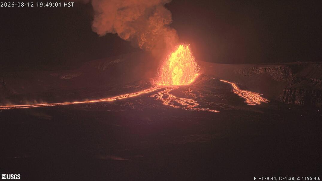
A double dome fountain formed and began feeding a broad overflow that rapidly extended more than 2000 feet (600 meters) from the vent. Large overflows from the south vent began at 3:26 p.m. and 3:38 p.m. HST and lasted approximately 5-6 minute each. A small flow was also visible from the collapse crater behind the south vent beginning at 3:31 p.m. HST.
Ground-level sensors near the eruptive vents indicate that winds are blowing from the northeast direction, which suggests that volcanic gas emissions and volcanic material may be distributed to the southwest direction from Halemaʻumaʻu. Winds above the inversion layer are more easterly and expected to carry tephra westward, if the fountains are high enough. The volcanic gas plume is currently 6,000 ft above ground level.
All eruptive vents and lava flows are confined to Halemaʻumaʻu crater within Hawaiʻi Volcanoes National Park. Tephra fall from volcanic ash clouds is greatest within 3 miles (5 km) of the vents, lighter ash and Pele’s Hair may stay suspended for large distances from the vents.
Source et photo : HVO.
Indonesia , Semeru :
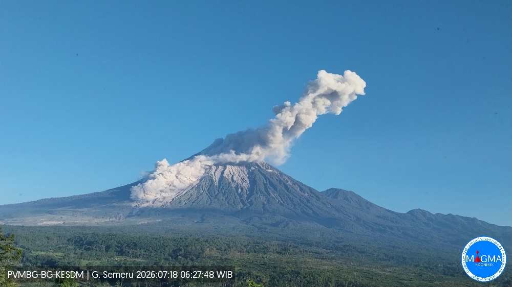
An eruption of Mount Semeru occurred on Wednesday, August 12, 2026, at 10:56 a.m. (Western Indonesia Time), with an ash column reaching a height of approximately 1,100 m above the summit (or about 4,776 m above sea level). The ash column, which was dense and white to gray in color, drifted eastward. The eruption was recorded by a seismograph with a maximum amplitude of 22 mm and a duration of 90 seconds.
Seismic observations
28 eruption earthquakes, with amplitudes of 10–22 mm and durations of 69–133 seconds.
2 avalanche earthquakes, with amplitudes of 2–4 mm and durations of 54–70 seconds.
1 emission earthquake, with an amplitude of 7 mm and a duration of 30 seconds.
1 distant tectonic earthquake, with an amplitude of 18 mm and a duration of 35 seconds.
Recommendations
1. Do not conduct any activities in the southeast sector along the Besuk Kobokan River within a 13 km radius of the summit (eruption center). Beyond this distance, the public must not conduct activities within 500 meters of the banks of the Besuk Kobokan, due to the potential risk of pyroclastic flows and lahars extending up to 17 km from the summit.
Source et photo : PVMBG.
Chile / Argentina , Nevados de Chillan :
During the reporting period, volcano-tectonic (VT) seismic activity—associated with rock fracturing within the volcano—continued to be recorded. The most energetic VT event recorded had a local magnitude (ML) of 1.4.
The dominant seismic activity was linked to fluid movements within the volcano, manifesting as long-period (LP) events, Tornillo-type (TO) events, and tremors (TR).
LP events were the most frequent and showed an increase in released energy values, with a maximum reduced displacement (RD) of 52 cm².
The occurrence of hybrid (HB) events—associated with both rock fracturing and fluid dynamics within the volcano—was also noted.
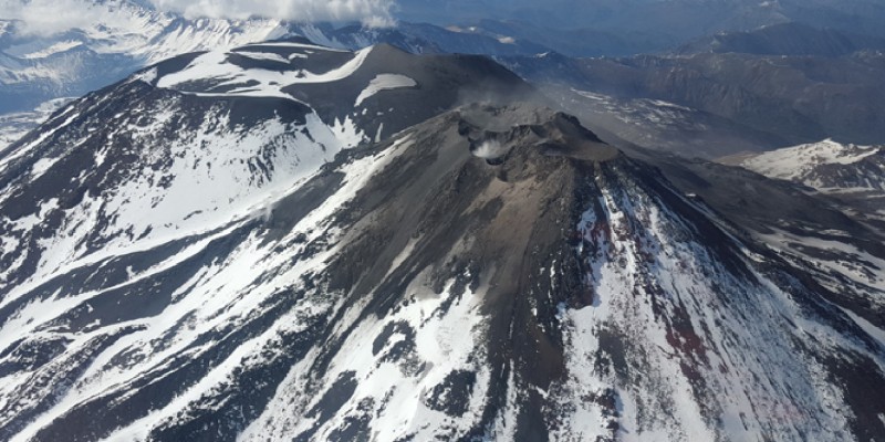
Analysis of images from OVDAS surveillance cameras—when weather conditions permitted—revealed low-magnitude surface activity,
with degassing plumes reaching a maximum height of 120 m above the crater rim.
No high-energy explosive events were recorded during this two-week period.
Furthermore, no incandescence or other volcanic phenomena were observed during this time.
During the period analyzed, satellite imagery processing detected one (1) very low-magnitude thermal anomaly via VIIRS375, with a maximum radiative power (VRP) of 0.02 MW.
Analysis of high-resolution satellite imagery (PlanetScope and Sentinel-2 L2A) revealed no morphological changes to the volcanic complex.
Source : Segemar.
Photo : Sernageomin.
Colombia , Chiles / Cerro Negro :
San Juan de Pasto, August 11, 2026, 7:00 PM.
Based on monitoring of activity at the Chiles-Cerro Negro volcanic complex (CVCCN), the Colombian Geological Service (SGC)—an agency attached to the Ministry of Mines and Energy—reports the following information:
For the period from August 4 to August 10, 2026, the main changes in monitored parameters compared to the previous week were as follows:
● Amidst the fluctuating behavior characteristic of this volcanic complex, seismic activity showed an increase in the number of events. Likewise, the energy released rose significantly following the recording of three earthquakes with a magnitude of 4.0 or greater. Seismicity associated with rock-fracturing processes remained predominant, followed by activity linked to fluid dynamics.
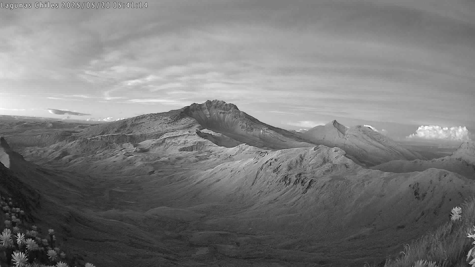
● Three main seismic sources were observed during this period. The first source was located to the south, near the Chiles volcano. Nine earthquakes were located there within a 3 km radius, at depths of less than 6 km relative to the summit of the Chiles volcano (4,700 meters above sea level), with a maximum magnitude of 1.9.
The second source is located approximately 20 km south of the Chiles volcano, at depths ranging from 6 to 18 km. The most energetic earthquake in this zone reached a magnitude of 4 and occurred on August 5 at 5:37 a.m.; it was felt by residents of the town of Ipiales.
The third seismic source was located to the east, 10 km from the Chiles volcano, at depths ranging from 5 to 8 km relative to the volcano’s summit. Three notable earthquakes occurred in this sector: on August 7 at 12:49 p.m., 1:14 p.m., and 9:11 p.m., with magnitudes of 4.5, 2.8, and 4.3, respectively. These events were felt by residents of the indigenous communities of Chiles and Nazate, as well as by those in the municipality of Cumbal.
● Analysis of data collected by satellite sensors and ground stations continued to reveal variations associated with deformation processes in the volcanic zone.
Based on the assessment and correlation of the monitored parameters, the SGC recommends closely following the situation’s evolution via weekly bulletins and other information released through our official channels, as well as adhering to the instructions of local and departmental authorities and the National Unit for Disaster Risk Management (UNGRD). Volcanic activity remains at the yellow alert level: an active volcano exhibiting changes in the baseline behavior of monitored parameters and other manifestations.
Source et photo : SGC.