April 3 , 2026.
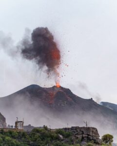
La Réunion Island , Piton de la Fournaise :
Press release from the Paris Institute of Earth Physics / Piton de la Fournaise Volcanological Observatory, April 3, 2026 – 12:40 a.m. local time – April 2, 8:40 p.m. UTC
Eruption halted
After a halt on March 25 and a resumption on March 28, 2026, the eruption that began on February 13, 2026, has again ceased today, April 3, 2026, at 12:10 a.m. local time (April 2, 8:10 p.m. UTC). On April 2nd at 10:20 PM (local time, 6:20 PM UTC), the amplitude of the eruptive tremor (an indicator of lava and gas emissions at the surface) dropped sharply, then gave way to a very low-amplitude intermittent tremor (known as « gas piston »), corresponding to a discontinuous seismic signal probably linked to brief degassing phases.
No hypothesis is being ruled out regarding the future evolution of the situation (definitive cessation, resumption of activity at the same site, resumption of activity at another site). In the past, episodes of abrupt cessation of similar eruptions have been observed where a sudden resumption of eruptive activity occurred after a period of inactivity (for example, during the eruption from August to October 2015).
Furthermore, degassing continues at the eruptive site and lava flows remain visible despite the cessation of the eruption, due to the gradual emptying of the lava tubes. The plume at the platform and the fumaroles on the flows can remain active for several days to several weeks after the end of an eruption.
Press Release from the Paris Institute of Earth Physics / Piton de la Fournaise Volcanological Observatory, April 3, 2026 – 03/04/2026 – 7:30 a.m. local time – 3:30 a.m. UTC
Earthquake Felt
On Friday, April 3, at 3:39 a.m. (local time – 11:39 p.m. UTC on April 2), an earthquake was felt by residents of the island, primarily in the northern sector.
This earthquake was recorded by the seismometers of the Piton de la Fournaise Volcanological Observatory. Initial analyses of this earthquake located it 8 km south-southwest of Sainte-Clotilde, at a depth of 13 km. Its magnitude was measured at 2.1.
OVPF staff are working to refine the calculations for the location of this event. Therefore, the information concerning the location and intensity may change slightly.
This type of event, felt by the population, is recorded several times a year. This event is isolated and of tectonic origin. Currently, this earthquake has not been followed by aftershocks.
Source : OVPF / IPGP.
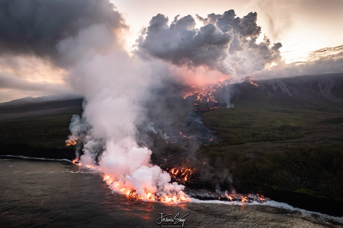
Photo : Jeremixage .
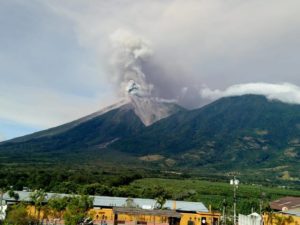
Philippines , Bulusan :
The Philippine Institute of Volcanology and Seismology (PHIVOLCS) reported that a period of low-level unrest with a sustained series of volcanic earthquakes continued at Bulusan. The seismic network detected 475 volcanic earthquakes during 15-22 March. The seismicity mostly consisted of weak volcano-tectonic earthquakes associated with rock fracturing at shallow depths. The signal characteristics were similar to the seismicity that had occurred prior to the June 2022 and April 2025 eruptions. Additionally, inflation of the W and SE flanks was detected in ground deformation data from continuous GPS and electronic tilt monitoring instruments during the last week of January and the first week of March. Weak-to-moderate gas emissions rose from active vents; sulfur dioxide emissions were below background levels on 17 March averaging 91 tonnes per day (t/d).
At 12h00 on 22 March PHIVOLCS raised the Alert Level to 1 (the second lowest level on a scale of 0-5). Seismicity continued with 19-55 daily volcanic earthquakes during 22-25 March. Sulfur dioxide emissions averaged 94 t/d on 23 March. The public was reminded not to enter the 4-km-radius Permanent Danger Zone (PDZ) and to be vigilant within the 2-km Extended Danger Zone (EDZ) on the SE flank. Pilots were warned not to fly close to the summit as ash from any sudden phreatic eruption could be hazardous to aircraft.
Sources: Philippine Institute of Volcanology and Seismology (PHIVOLCS) , GVP.
Photo : Archive Phivolcs.
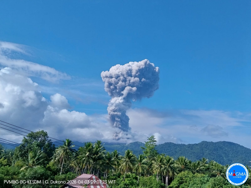
Indonesia , Dukono :
Mount Dukono erupted on Friday, April 3, 2026, at 8:49 a.m. WIT. An ash column was observed approximately 2,000 meters above the summit (about 3,087 meters above sea level). This ash column, white to gray in color, was highly concentrated and drifted southwest. At the time of writing, the eruption was still ongoing.
Seismicity Observations
174 eruption earthquakes with amplitudes ranging from 6 to 34 mm and durations from 31.7 to 133.75 seconds.
4 felt earthquakes, intensity II to III on the MMI scale, with an amplitude of 34 mm and durations from 153.5 to 376.38 seconds.
56 distant tectonic earthquakes with amplitudes ranging from 6 to 34 mm and durations from 61.28 to 151.7 seconds.
Continuous seismic tremor with amplitudes between 1 and 4 mm, primarily 2 mm.
Recommendations
(1) Residents living near Mount Dukono and visitors/tourists are advised to refrain from any activity, climbing, or approaching the Malupang Warirang crater within a 4 km radius.
(2) Considering that volcanic ash eruptions occur periodically and that the distribution of ash follows the direction and speed of the wind, so that the area where ash lands is not constant, people living around Mount Dukono are advised to always carry masks/face coverings and mouth coverings to use as needed to avoid the threat that volcanic ash poses to the respiratory system.
Source et photo : PVMBG.
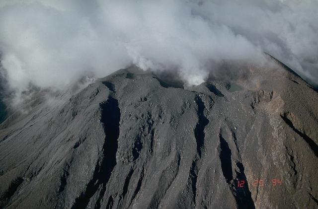
Vanuatu Archipelago , Ambae :
The eruption at Ambae continued from March 19 to 24, according to ash alert bulletins from the Wellington Volcanic Ash Advisory Centre (VAAC). The VAAC reported that plumes of gas, steam, and ash were visible on webcam and satellite images, rising to an altitude of 4.6 km (approximately 3 km above the summit) and drifting southward most days. These plumes were intermittent, sometimes obscured by clouds, and occasionally only gas and steam plumes were observed. Sulfur dioxide emissions were detected on March 21. The alert level remained at 3 (on a scale of 0 to 5), and the population was advised to stay outside danger zone B, defined as a 3 km radius around the active eruptive vents of Lake Voui, and to stay away from waterways in case of heavy rain.
Ambae Island, also known as Aoba, is an imposing 2,500 km³ basaltic shield volcano, the largest in the New Hebrides archipelago. A pronounced northeast/southwest rift zone, dotted with numerous cinder cones, gives this 16 x 38 km island its elongated shape. A large pyroclastic cone containing three crater lakes (Manaro Ngoru, Voui, and Manaro Lakua) sits at the summit, within the most recent of at least two nested calderas, the larger of which is 6 km in diameter. This imposing central edifice is also called Manaro Voui or Lombenben volcano. Post-caldera explosive eruptions formed the summit craters approximately 360 years ago. A tuff cone formed within Lake Voui (or Vui) approximately 60 years later. The last known lateral eruption, which occurred around 300 years ago, wiped out the population of the Nduindui region, near the west coast.
Sources : Wellington Volcanic Ash Advisory Center (VAAC), GVP.
Photo : Ambassade de France / Vanuatu via Sherine France.
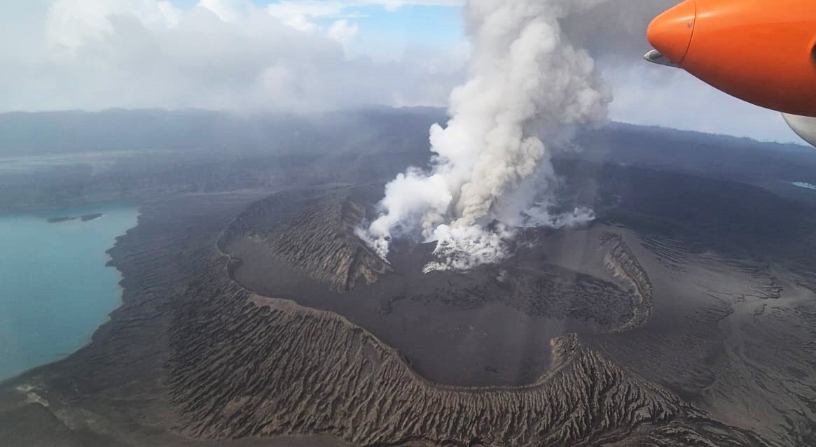
Colombia , Puracé – Los Coconucos Volcanic Chain :
Popayán, March 31, 2026, 3:00 PM
Regarding the monitoring of activity at the Puracé volcano and the Los Coconucos volcanic chain, the Colombian Geological Survey (SGC), an agency under the Ministry of Mines and Energy, reports the following:
During the week of March 24-30, 2026, seismicity related to fluid movements within the volcanic edifice continued to be recorded. This seismicity included long-period (LP) earthquakes, tremor pulses (TR), and continuous tremor. These earthquakes were located below the crater of the Puracé volcano, at depths of less than 1 km, and were related to circulation processes and the release of volcanic gases into the atmosphere. These gases dispersed according to the wind direction, reaching a maximum altitude of 900 m above the summit of the volcano. Similarly, on March 27, continuous tremor signals were identified below the crater of the Curiquinga volcano at depths of less than 2 km, also related to fluid dynamics in the volcanic system.

Fracture seismicity remained at similar levels to previous weeks, both in number and seismic energy released, and was primarily located between the Puracé and Piocollo volcanoes at depths of 1 to 3 km, with magnitudes less than 1. Low sulfur dioxide (SO₂) emissions were recorded, and gases continue to escape from fissures in the craters of the Curiquinga and Piocollo volcanoes, with no evidence of ash emissions. Satellite observations indicate that the energy of the thermal anomaly in the Puracé volcano crater persists. Furthermore, the slow deformation process continues between the Puracé, Piocollo, and Curiquinga volcanoes, as demonstrated by the eruptive episode of Curiquinga on January 20, 2025.
In conclusion, the observed variations in the Los Coconucos volcanic chain (Puracé) indicate that the system continues to evolve and that further ash emissions and fallout are possible, depending on the prevailing wind direction.
The public is advised to refrain from climbing to the higher elevations of the volcanic chain and to remain attentive to official bulletins from the Colombian Geological Survey (SGC). The alert level for volcanic activity remains yellow: active volcano showing changes in monitored parameters and other manifestations.
Source et photo : SGC.