April 23 , 2026.
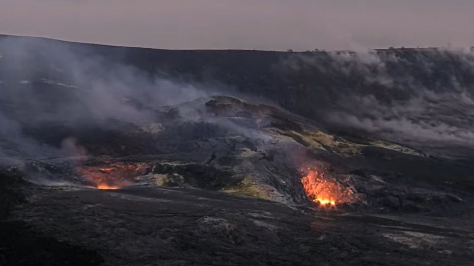
Hawaii , Kilauea :
HAWAIIAN VOLCANO OBSERVATORY DAILY UPDATE , U.S. Geological Survey
Wednesday, April 22, 2026, 8:58 AM HST (Wednesday, April 22, 2026, 18:58 UTC)
19°25’16 » N 155°17’13 » W,
Summit Elevation 4091 ft (1247 m)
Current Volcano Alert Level: WATCH
Current Aviation Color Code: ORANGE
Overview:
Lava flowed from the north vent in Halemaʻumaʻu on Monday night, marking the start of lava fountaining episode 45 precursory activity at the summit of Kīlauea. The Kīlauea Alert Level and Aviation Color Code were raised from ADVISORY/YELLOW to WATCH/ORANGE at that time, reflecting this change in activity. Forecast models currently suggest that lava fountaining episode 45 will start sometime between today, April 22, and Sunday, April 26.
No significant activity has been noted along Kīlauea’s East Rift Zone or Southwest Rift Zone.
Summit Observations:
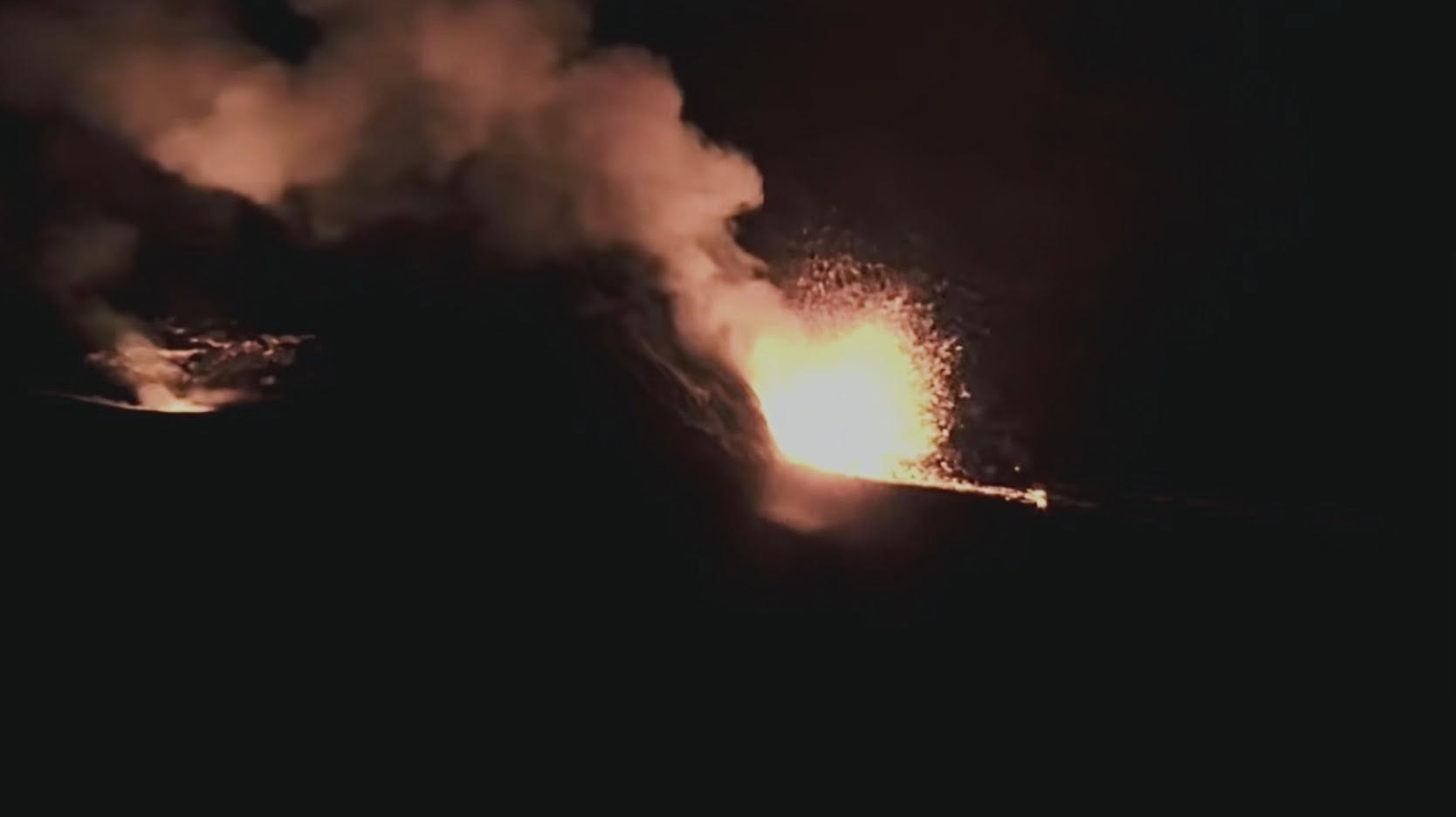
No additional lava flows have occurred within Halemaʻumaʻu since Monday night. However, a strong burst of spatter at 11pm Tuesday night sent lava a short distance from the north vent. Glow remains consistently visible at both vents in Halemaʻumaʻu overnight, along with occasional spatter from the north vent and periods of flaming visible in the south vent—likely caused by the ignition of volcanic gases escaping the vent.
Low-level seismic tremor continues during the ongoing eruptive pause, and 14 small-magnitude earthquakes were recorded in Kīlauea summit region in the past 24 hours. Since the end of lava fountaining episode 44 on April 9, the Uēkahuna tiltmeter (UWD) has tracked approximately 17.3 microradians of inflationary tilt, with about 0.8 microradians of inflationary tilt in the past 24 hours. This instrument recorded 17.6 microradians of deflationary tilt in total during episode 44.
During periods of low-level activity precusory to lava fountaining episodes, the sulfur dioxide (SO2) emission rate from Halemaʻumaʻu likely varies within a typical range of 1,000 to 5,000 tonnes per day. The National Weather Service reports that winds near the eruptive vents will be light today, southerly during the day and northerly overnight and into the early morning hours.
Rift Zone Observations:
Rates of seismicity and ground deformation remain low in the East Rift Zone and Southwest Rift Zone. SO2 emissions from the East Rift Zone remain below the detection limit.
Source et photo : HVO.
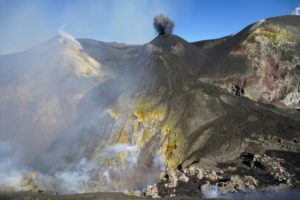
Indonesia , Lewotobi Laki-laki :
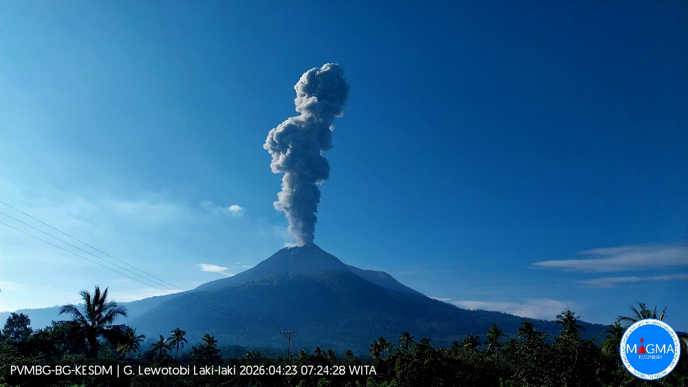
An eruption of Mount Lewotobi Laki-laki occurred on Thursday, April 23, 2026, at 7:21 AM WITA. The observed ash column rose approximately 1,800 meters above the summit (about 3,384 meters above sea level). This gray ash column was highly intense and directed southwest. The eruption was recorded by a seismograph with a maximum amplitude of 22.2 mm and a duration of 103 seconds.
Seismic Observations
9 eruption earthquakes with amplitudes ranging from 3.7 to 14.8 mm and durations from 82 to 227 seconds.
1 emission earthquake with amplitude 4.4 mm and duration 37 seconds.
1 harmonic tremor with amplitude 5.7 mm and duration 40 seconds.
6 non-harmonic tremors with amplitudes ranging from 2.9 to 3.7 mm and durations from 64 to 80 seconds.
10 low-frequency earthquakes with amplitudes ranging from 4.4 to 22.2 mm and durations from 24 to 30 seconds.
3 deep volcanic earthquakes with amplitudes ranging from 2.9 to 10.5 mm and durations from 14 to 23 seconds.
Eight local tectonic earthquakes with magnitudes ranging from 2.9 to 10.5 mm and durations of 24 to 37 seconds.
A distant tectonic earthquake with a magnitude of 14.8 mm and a duration of 60 seconds.
Recommendations
1. Residents living near Mount Lewotobi Laki-laki and visitors/tourists are advised to avoid all activity within a 4 km radius of the eruption’s epicenter.
2. The public is urged to remain calm, follow the instructions of local authorities, and disregard rumors from unknown sources.
Source et photo : PVMBG.
Colombia , Chiles / Cerro Negro :
San Juan de Pasto, April 21, 2026, 5:00 PM
Regarding the monitoring of activity at the Chiles-Cerro Negro Volcanic Complex (CVCCN), the Colombian Geological Survey (SGC), an agency under the Ministry of Mines and Energy, reports the following:
For the period from April 14 to 20, 2026, the main variations in monitored parameters, compared to the previous week, were as follows:
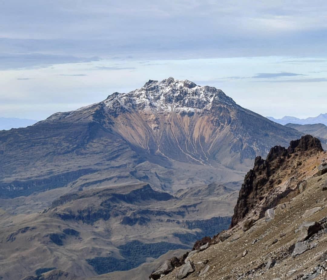
● In a context of fluctuating seismic activity, an increase in the number of earthquakes was recorded; however, the total energy released decreased, with a magnitude 3.4 earthquake contributing the majority of this energy. The predominant seismicity remained associated with rock fracturing processes, followed by that related to fluid dynamics, originating from both persistent and transient sources. Most of the earthquakes occurred near the Chiles volcano, south of the collapse zone, as well as to the west and northwest of it, at distances of up to 3.2 km and at depths of between 0.5 and 4.5 km from the summit of the Chiles volcano (4,700 m altitude).
During this period, the fracture earthquake recorded on April 16 at 7:53 a.m. was particularly noteworthy. It occurred 3.4 km west of the Chiles volcano, at a depth of 1.6 km, and had a magnitude of 3.4. This event was not felt by the population living in the volcano’s area of influence.
Analysis of information collected by satellite sensors and ground stations continued to highlight variations related to deformation processes in the volcanic zone.
Following the evaluation and correlation of monitored parameters, the Colombian Geological Survey (SGC) recommends closely monitoring the evolving situation by consulting the weekly bulletins and other information disseminated through its official channels, as well as the instructions of local and departmental authorities and the National Disaster Risk Management Unit (UNGRD).
Volcanic activity remains at the yellow alert level: active volcano showing changes in the reference behavior of monitored parameters and other manifestations.
Source et photo : SGC.
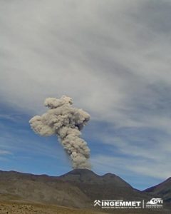
Peru , Sabancaya :
Local date and time: April 20, 2026 – 12:37 PM
Bulletin analysis period: April 13-19, 2026
Orange alert level:
The volcano’s eruptive activity has increased significantly. Increased seismic activity, frequent explosions, and emissions of ash and ballistic fragments have been observed.
Conclusions:
The IGP (Geophysical Institute of Peru) reports that the eruptive process of the Sabancaya volcano continues. During this period, no volcanic explosions were detected; however, emissions of ash, water vapor, and gases were recorded, reaching a maximum altitude of 1,900 meters above the volcano’s summit. Seismic activity associated with the movement of magmatic fluids and internal fracturing was also observed. Consequently, the volcanic alert level remains orange.

Recommendations:
Adopt prevention and preparedness measures in accordance with the current orange volcanic alert level.
Do not approach within 12 km of the crater. In case of ashfall, cover your nose and mouth with damp cloths or a mask. Keep doors and windows closed.
Outlook:
The occurrence of future volcanic explosions generating eruptive columns more than 2 km high is considered likely, with a risk of impact on districts in the Colca Valley and surrounding areas due to the dispersal of volcanic ash. Therefore, the volcanic alert level remains orange.
Source et photo : Cenvul .
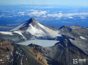
Costa Rica , Poas / Rincon de la Vieja :
Daily Volcanic Activity Bulletin. OVSICORI-UNA, Date: April 21, 2026. Updated at: 11:16 AM
Volcano: Poás
Latitude: 10.200
Longitude: -84.233
Altitude: 2,687 m
Observed Activity:
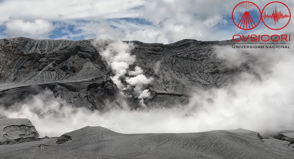
No eruptions have been recorded in the last 24 hours. Seismicity has changed significantly in recent days, with an increase in tremor, the occurrence of proximal volcano-tectonic (VT) earthquakes, and a decrease in the number of long-period (LP) earthquakes. Crater subsidence has been observed since March 10. CO₂/SO₂ and H₂S/SO₂ ratios do not show significant changes.
Environmental Conditions:
Cloudy skies with intermittent visibility at the volcano summit. Southwest wind.
Activity level: Alert (2)
Volcano: Rincón de la Vieja
Latitude: 10.83
Longitude: -85.324
Altitude: 1,916 m
Observed Activity:
Yesterday at 8:24 PM, a minor eruption was recorded, with magnitudes of 2.9 and 2.8 respectively on the seismic and acoustic sensors at the VRBA station. No images of the eruption are available. The seismic signal indicates the presence of tremors, with variations in amplitude and duration. The geodetic network does not record any significant deformation.
Environmental Conditions:
Overcast skies above the volcano. Southwest wind.
Activity Level: Alert (2)
Source et photo : Ovsicori . (Poas).