April 13 , 2026.
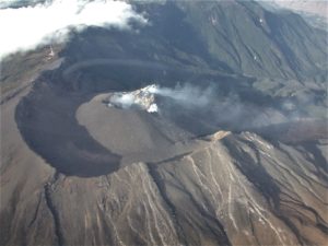
La Réunion Island , Piton de la Fournaise :
Press release from the Paris Institute of Earth Physics / Piton de la Fournaise Volcanological Observatory, April 13, 2026 – 6:00 a.m. local time – 2:00 a.m. UTC
Eruption halted
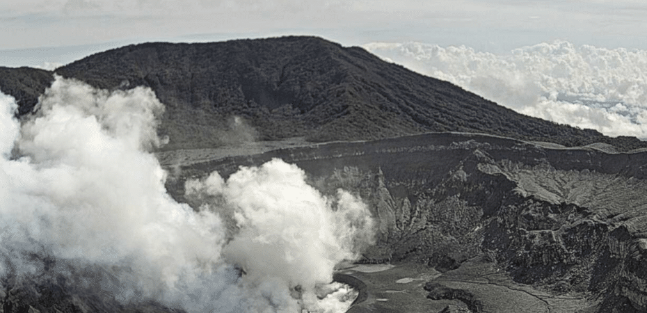
After two periods of cessation (between March 25 and 28 and between April 3 and 8), the eruption stopped again last night, April 12, 2026, at approximately 11:10 p.m. local time (7:10 p.m. UTC). At 11:10 p.m. local time (7:10 p.m. UTC) on April 12, the amplitude of the eruptive tremor (an indicator of lava and gas emissions at the surface) dropped sharply.
Red glows are still visible on the eruptive cone, and tunnel drainage may continue for a few more hours.
No hypothesis is ruled out regarding the evolution of the future situation (definitive shutdown, resumption of activity on the same site, resumption of activity on another site), particularly due to the persistence of seismicity.
The Piton de la Fournaise volcano continues to surprise us. This Sunday, April 12, volcanologists noted a slight decrease in tremor but an increase in seismicity: « Seismic activity has been rising since April 10, with 34 and 401 shallow volcano-tectonic earthquakes recorded on April 10 and April 11, respectively. These earthquakes are located between 1.5 and 2 km deep beneath the volcano’s summit. »
As a reminder, before the pause and resumption of activity this Friday, the volcano had resumed its activity on Saturday, March 28, while on Wednesday, March 25, the eruption that began on Friday, February 13 at the Piton de la Fournaise ended after 41 days of activity.
Sources : OVPF / IPGP , Imaz Press.
Photo : Loic Abadie / FB.
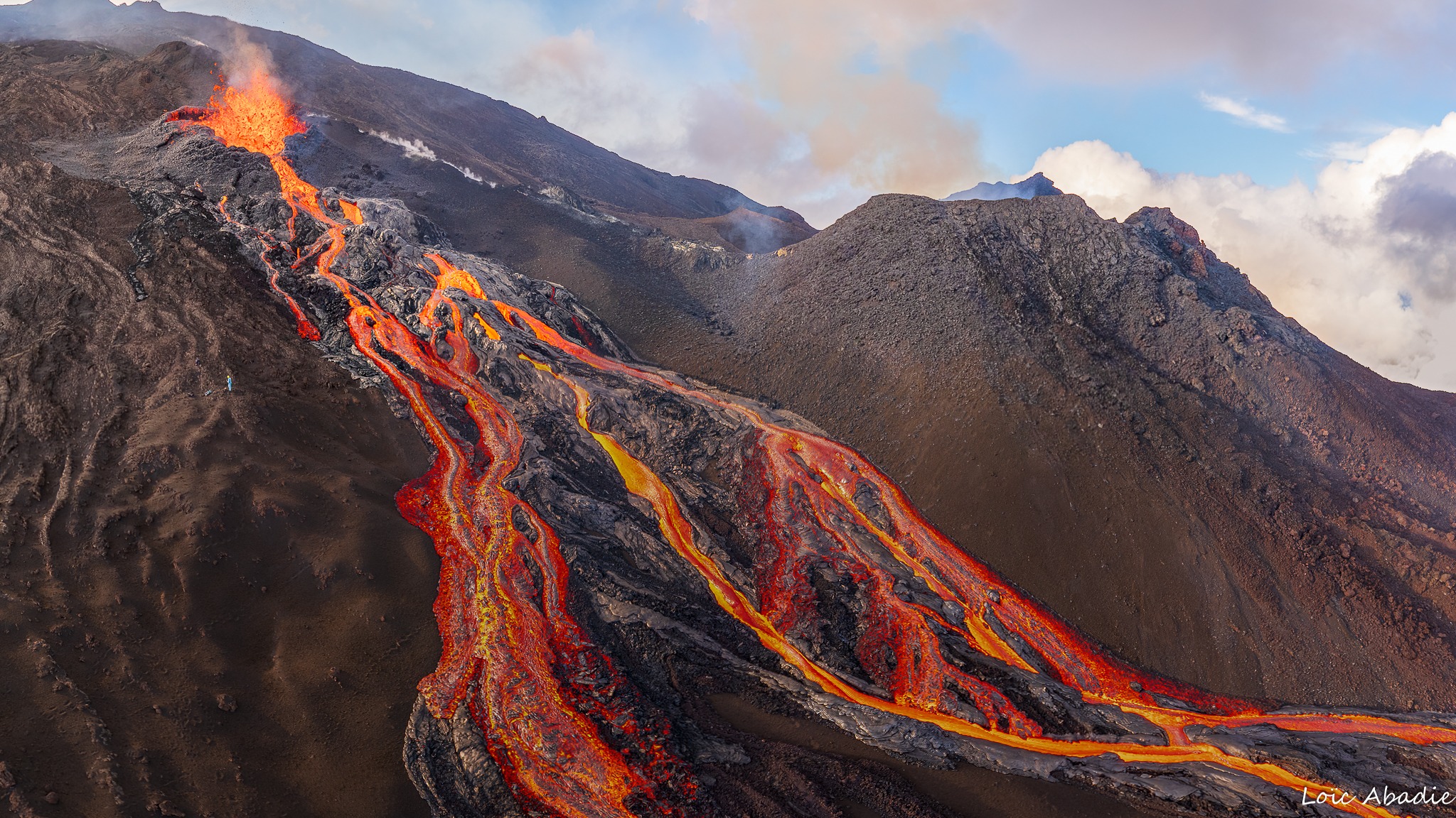
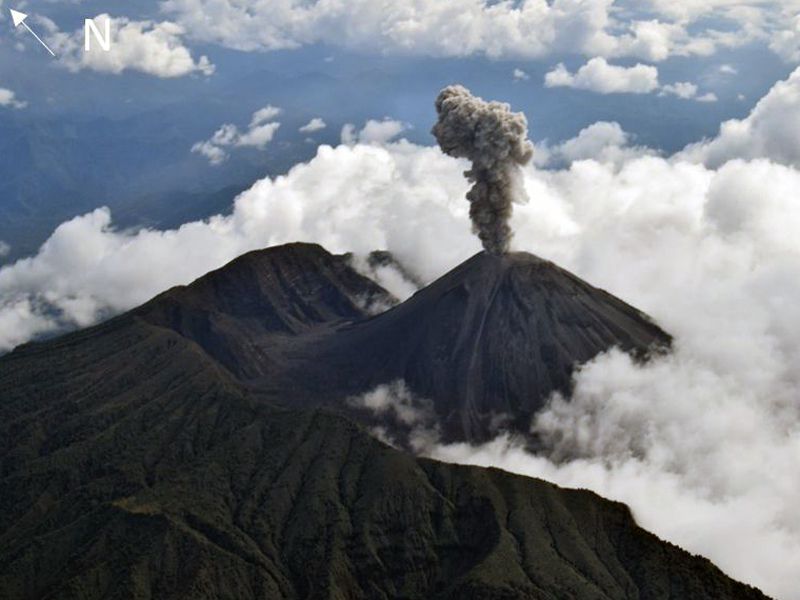
Italy , Stromboli :
Press release on Stromboli activity, April 12, 2026, 6:29 PM (4:29 PM UTC)
The National Institute of Geophysics and Volcanology, Etna Observatory, announces that analysis of surveillance camera images shows that since 3:36 PM UTC, effusive activity has been underway due to lava overflowing from the North Crater area; this activity is producing a lava flow whose front is located in the upper-middle part of the Sciara del Fuoco.
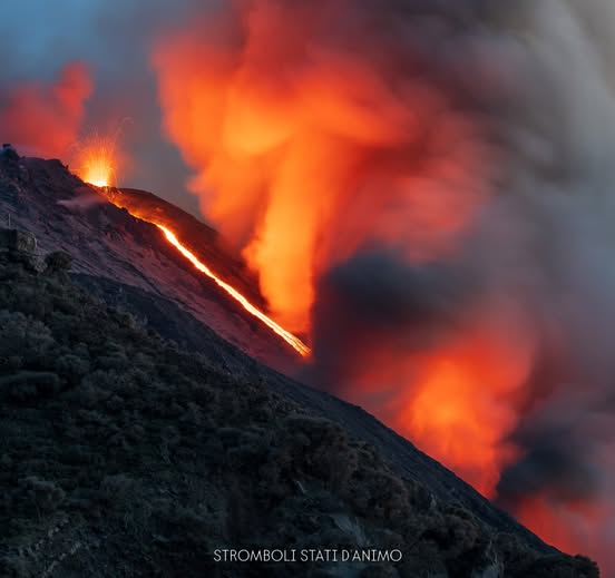
From a seismic perspective, the average amplitude of volcanic tremor is currently high. No significant changes have been reported in the frequency and amplitude of explosion earthquakes.
No significant changes have been recorded in the high-frequency GNSS network deformation data.
Further updates will be provided soon.
Source : INGV
Photo : Stromboli stati d’animo / Sebastiano Cannavo
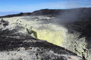
Colombia , Chiles / Cerro Negro :
San Juan de Pasto, April 7, 2026, 3:30 PM
Regarding the monitoring of activity at the Chiles-Cerro Negro Volcanic Complex (CVCCN), the Colombian Geological Survey (SGC), an agency under the Ministry of Mines and Energy, reports the following:
For the period from March 31 to April 6, 2026, the main variations in monitored parameters, compared to the previous week, were as follows:
● In a context of fluctuating seismic activity, a decrease was recorded in both the number of events and the energy released. Seismicity associated with rock fracturing remained predominant, followed by seismicity related to fluid dynamics.

● Most of the localized earthquakes were concentrated south and southwest of Chiles Volcano and east of Cerro Negro Volcano. Generally, the depths were between 2 and 4 km below the summit of Chiles Volcano (4,700 m above sea level). During this period, seven fracture earthquakes, ranging in magnitude from 2.1 to 2.9, were recorded, located at the aforementioned sources. The earthquake with the highest magnitude, 2.9, was recorded on April 5 at 2:42 PM, with its epicenter located east of Cerro Negro Volcano. None of these earthquakes were felt.
● Analysis of data collected by satellite sensors and ground stations continued to reveal variations related to deformation processes in the volcanic zone.
Based on the assessment and correlation of monitored parameters, the Geological Survey of Colombia (SGC) recommends closely monitoring the evolving situation by referring to weekly bulletins and other information published through its official channels, as well as instructions from local and departmental authorities and the National Disaster Risk Management Unit (UNGRD). Volcanic activity remains at the yellow alert level: active volcano with changes in the baseline behavior of monitored parameters and other manifestations.
Source et photo : SGC.
Costa Rica , Poas :
OVSICORI-UNA Volcanic Monitoring Weekly Bulletin, April 10, 2026
Latitude: 10.20°N;
Longitude: 84.23°W;
Elevation: 2,687 m
Current Activity Level: Alert
The number of long-period events decreased this week. Four distal volcano-tectonic earthquakes and two short-duration tremors were recorded. Background tremor remains stable. The geodetic network is not recording any significant crustal deformation around the crater. Stations located on the southern flank show slight contraction. This week, DOAS stations recorded an average SO₂ flux of 103 ± 40 t/d, slightly higher than the previous week (67 ± 27 t/d). The SENTINEL satellite has frequently detected the plume in recent weeks, with a mass close to or greater than 100 tonnes on three occasions (March 23 and 25, and April 7).
The level of the hyperacidic lake fluctuated due to sporadic torrential rains, notably on April 3, before generally decreasing and stabilizing this week. On two occasions, the water surface at the bottom of the crater split into two lakes. The lake’s temperature was measured directly this week, confirming a high value of 75°C (the apparent temperature of the lake, measured remotely from El Mirador at a distance of 700 meters on April 7, was 69°C). The lake is a pale milky green color, and its surface emits strong acidic vapors, making it difficult to observe.
The fumarole field at the base of the inner southern wall of the crater recorded a maximum apparent temperature of 69°C, measured remotely from El Mirador, similar to that of the hyperacidic lake. During the last sampling campaign carried out on the Agrio River on April 7, 2026, it was found that the temperature and acidity of this watercourse had remained relatively stable, with few fluctuations, at least over the last 38 years (the temperature has fluctuated between 17°C and 21.7°C, while the pH has varied between 2.0 and 2.8).
Source et photo : Ovsicori .
Ecuador , El Reventador :
REVENTADOR VOLCANO DAILY STATE REPORT, Sunday, April 12, 2026.
Information Geophysical Institute – EPN.
Surface Activity Level: High, Surface Trend: No Change
Internal Activity Level: Moderate, Internal Trend: No Change
From April 11, 2026, 11:00 AM to April 12, 2026, 11:00 AM:
Seismicity:
Explosion (EXP) 72
Long Period (LP) 8
Emission Tremor (TREMI) 10
Harmonic Tremor (TRARM) 6
Rainfall/Lahars:
No rainfall has been recorded in the volcano area. **Heavy rainfall could remobilize accumulated material, generating mudflows and debris flows that would cascade down the volcano’s flanks and into nearby rivers.
Emissions/Ash:
Yesterday afternoon, the GOES-19 satellite system detected several gas and ash emissions reaching an altitude of 800 to 1,000 meters above the crater, drifting northwest and west. The Washington VAAC agency issued a report indicating ash emissions reaching an altitude of 1,000 meters above the crater, drifting northwest.
Observation:
The volcano’s surface activity is high. However, the volcano has remained mostly shrouded in clouds since yesterday afternoon until the time of writing.
Alert Level – SGR: Orange
Source : IGEPN.
Photo : F-Naranjo , GVP. ( archive).