November 22 , 2026.
Japan , Sakurajima :
ADVISORY
VAAC: TOKYO
VOLCANO: SAKURAJIMA (AIRA CALDERA) 282080
AREA: JAPAN
SOURCE: JMA HIMAWARI-9
ERUPTION DETAILS: EXPLODED AT 20261121 EXTD SE
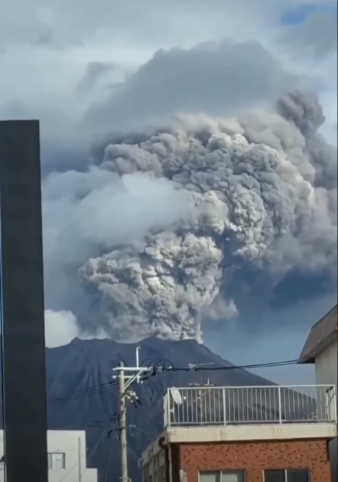
Explosive Eruption of Sakurajima Volcano in Japan , — November 21, 2026 —
On November 21 at 2:35 p.m. local time, an explosive eruption occurred at Sakurajima Volcano in Kagoshima Prefecture. According to the Japan Meteorological Agency (JMA), the volcanic plume rose to 1,200 meters. The ash plume spread in a southeasterly direction.
The explosion occurred in the Minamidake crater. According to the JMA, no ejection of large volcanic fragments was recorded.
Volcanic Alert Level 3 remains in effect—restricting access to the volcano. Within a radius of approximately 2 km from the Minamidake and Showa craters, there remains a risk of large volcanic rock ejections and pyroclastic flows. Warnings are also in effect regarding the risk of ash and small rocks falling on the leeward side.
Indonesia , Semeru :
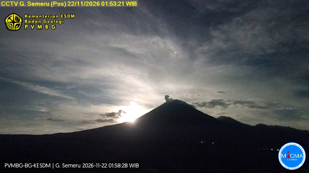
An eruption of Mount Semeru occurred on Sunday, November 22, 2026, at 01:51 WIB; an ash column was observed, reaching approximately 200 m above the summit (± 3,876 m above sea level). This ash column, which was white to gray in color and quite dense, drifted toward the southwest. The eruption was recorded by a seismograph, showing a maximum amplitude of 17 mm and a duration of 97 seconds.
Seismic Observations
21 eruption-related earthquakes, with amplitudes of 10–22 mm and durations of 56–141 seconds.
1 earthquake associated with a pyroclastic flow (avalanche-type), with an amplitude of 22 mm and a duration of 257 seconds.
7 earthquakes linked to emissions, with amplitudes of 4–8 mm and durations of 50–104 seconds.
5 harmonic tremors, with amplitudes of 3–4 mm and durations of 136–237 seconds.
Recommendations
1. Do not conduct any activities in the southeastern sector, along the Besuk Kobokan riverbed, within a 13 km radius of the summit (eruptive center). Beyond this distance, the public is advised to avoid any activity within 500 meters of the banks of the Besuk Kobokan, due to the risk of pyroclastic flows—which can reach up to 17 km from the summit—as well as the occurrence of lahars (volcanic mudflows).
2. Do not conduct any activities within a 5 km radius of the crater/summit of Mount Semeru, as this area is exposed to the risk of falling rocks (incandescent projectiles).
3. Remain vigilant regarding the risk of pyroclastic flows, lava avalanches, and lahars along the riverbeds and valleys descending from the summit of Mount Semeru—particularly along the Besuk Kobokan, Besuk Bang, Besuk Kembar, and Besuk Sat—as well as the risk of lahars in smaller watercourses that are tributaries of the Besuk Kobokan.
Source et photo : PVMBG.
Colombia , Galeras :
San Juan de Pasto, November 17, 2026, 3:40 PM.
As part of the ongoing monitoring of activity at the Galeras volcano, the Colombian Geological Service (SGC)—an agency affiliated with the Ministry of Mines and Energy—reports the following:
During the week of November 10 to 16, 2026, the primary variations in monitored parameters, compared to the previous week, were as follows:
● Seismic activity showed a significant increase in frequency, accompanied by a decrease in the energy released. The predominant seismicity was associated with rock fracturing, with a smaller contribution from events linked to fluid dynamics.
● The earthquakes were located within 8 km of the volcanic edifice and at depths of less than 10 km relative to the summit (4,276 m above sea level), reaching a maximum magnitude of 1.4.
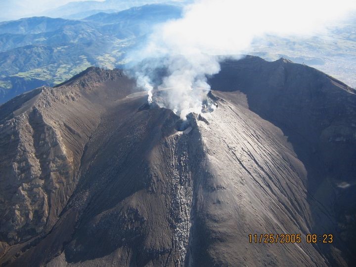
● White-colored gas emissions, occurring in pulses and rising to a low altitude, have been observed; these dispersed according to the wind direction.
These emissions originated primarily from the « El Paisita » (to the north) and « Las Chavas » (to the west) fumarole fields, as well as from the main crater.
● Other volcanic monitoring parameters have remained stable.
Based on the assessment and correlation of the monitored parameters, the SGC recommends closely following the evolution of the situation through weekly bulletins and other information released via our official channels. It is also advised to adhere to the instructions provided by local and departmental authorities, as well as those from the National Unit for Disaster Risk Management (UNGRD).
Volcanic activity remains at the « Yellow » alert level: an active volcano exhibiting changes in the baseline behavior of monitored parameters, along with other manifestations.
Source et photo : SGC.
Ecuador , El Reventador :
DAILY STATUS REPORT FOR REVENTADOR VOLCANO, Saturday, November 21, 2026.
Information from the Geophysical Institute – EPN.
Surface activity level: Moderate; Surface trend: Unchanged
Internal activity level: Moderate; Internal trend: Unchanged
From November 20, 2026, 11:00 AM to November 21, 2026, 11:00 AM:
Seismicity:
Explosions (EXP): 87
Long-period (LP) events: 15
Emission tremors (TREMI): 8
Harmonic tremors (TRARM): 5
Rainfall / Lahars:
At the time of this report, no precipitation has been recorded in the vicinity of the volcano. **In the event of heavy rainfall, accumulated materials could be remobilized, triggering mud and debris flows that would descend the volcano’s flanks and reach adjacent rivers.**
Emission Plumes / Ash:
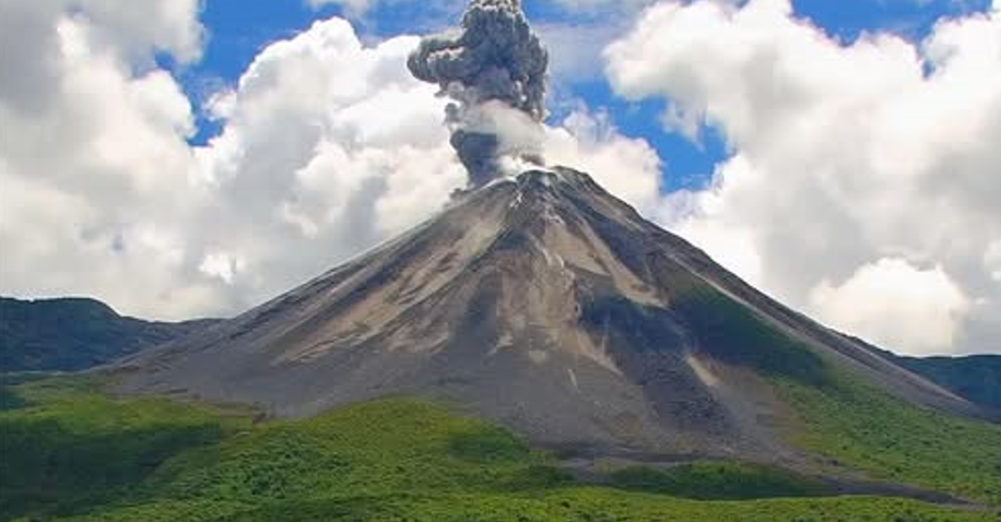
The surveillance camera system captured several gas and ash emissions; the plumes reached heights ranging from 300 to 1,100 meters above the crater rim, moving toward the west, north, northeast, and northwest. In connection with this activity, the Washington VAAC issued three emission reports, noting plume heights of up to 1,000 meters above the crater rim, directed toward the northwest and northeast.
Other Monitoring Parameters:
Over the past 24 hours, the MIROVA-MODIS satellite system recorded 2 thermal anomalies, the MIROVA-VIIRS 750 system recorded 1, and the FIRMS system detected 2.
Observation:
Surface activity at the volcano is at a moderate level. During the night and early this morning, the surveillance camera system captured several instances of incandescent material descending the slopes, reaching a point 1,100 meters below the crater rim. At the time of this report, the volcano is obscured by clouds.
Alert Level – SGR: Orange
Source : IGEPN.
Photo :Afar TV.
Guatemala , Santiaguito :
Atmospheric conditions: Partly cloudy
Wind: From the west
Precipitation: 41.8 mm
Volcanic activity:
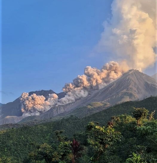
White-colored degassing is observed above the active dome; fumaroles are rising up to 400 meters and dispersing toward the east and northeast. During the night, between 2 and 4 explosions per hour were recorded, ranging from low to moderate intensity. Furthermore, incandescence has been reported within the crater, accompanied by collapses and the descent of incandescent blocks along the flanks. Given the high level of volcanic activity, the potential formation of long-range pyroclastic density currents cannot be ruled out; it is therefore recommended to follow the instructions provided in special bulletin BESAN-002-2026.
Source : Insivumeh .
Photo : Edgar Cabrera / CONRED