November 18 , 2026.
Italy , Stromboli :
WEEKLY BULLETIN, from November 9, 2026, to November 15, 2026. (Date of issue: November 17, 2026)
SUMMARY OF ACTIVITY STATUS
Based on monitoring data, the following observations are noted:
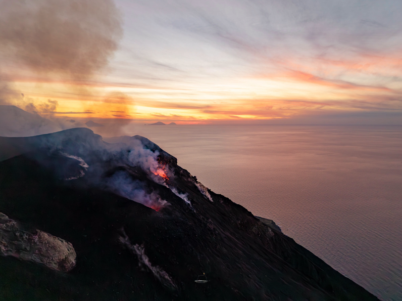
1) VOLCANOLOGICAL OBSERVATIONS: Ordinary Strombolian eruptive activity is occurring across both crater zones. The overall frequency of explosive activity—encompassing both the North crater zone and the Central-South crater zone—is at a moderate level, with low-intensity explosions observed in both areas.
2) SEISMOLOGY: Monitored seismological parameters show no significant variations.
3) GROUND DEFORMATION: No significant changes have been detected in the time series from ground deformation monitoring stations over the past week.
4) GEOCHEMISTRY: SO2 flux is at a moderate-to-high level.
Soil CO2 flux (Pizzo zone – STR02): Fluxes remain at high levels.
C/S ratio in the plume: No update available.
Helium isotopic ratio (R/Ra): No update available.
Soil CO2 flux in the San Bartolo zone: At moderate-to-high levels.
Soil CO2 flux in the Scari zone: At moderate levels.
5) SATELLITE OBSERVATIONS: Thermal activity in the summit area, as observed by satellite, has remained at a low level, with a few isolated, moderate-intensity anomalies.
VOLCANOLOGICAL OBSERVATIONS
Observations of explosive activity captured by surveillance cameras
During the observation week, Stromboli’s eruptive activity was characterized through the analysis of images recorded by INGV-OE surveillance cameras, located at an altitude of 190 m above sea level and at Punta dei Corvi (designated SCT-SCV and SPCT, respectively). Explosions in the north crater area (Zone N) primarily produced coarse material (bombs and lapilli), while explosions in the central-south crater area (Zone CS) generated material that was predominantly fine, mixed with some coarse material. The mean frequency of explosions in Zone N was at an average level, while the intensity remained generally low. In Zone CS, the mean explosion frequency remained low, and the intensity of the explosive activity stayed, overall, at a low level. The total daily mean hourly frequency of explosions (Zone N + Zone CS) was at an average level.
Source : INGV
Photo : Stromboli stati d’animo / Sebastiano Cannavo.
Hawaii , Kilauea :
HAWAIIAN VOLCANO OBSERVATORY DAILY UPDATE , U.S. Geological Survey
Tuesday, November 17, 2026, 8:31 AM HST (Tuesday, November 17, 2026, 18:31 UTC)
19°25’16 » N 155°17’13 » W,
Summit Elevation 4091 ft (1247 m)
Current Volcano Alert Level: ADVISORY
Current Aviation Color Code: YELLOW
Summary:
The Halema’uma’u eruption of Kīlauea remains paused following episode 56 fountaining on November 5. The summit is reinflating and the episode 57 forecast window is November 19-22.
Overview:
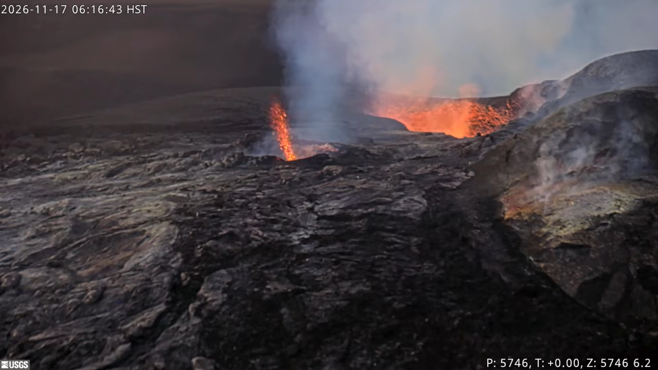
The Kīlauea summit eruption within Halema’uma’u is currently paused after episode 56 fountaining ended on November 5. The summit has been reinflating since the end of episode 56, and spatter was visible overnight from both the north and southwest vents. Another fountaining episode remains likely and the current forecast window for episode 57 fountaining is November 19-22.
Summit Observations:
Summit webcams recorded strong glow from both the north and southwest vents overnight. Views from the V1cam livestream webcam overnight showed intermittent spatter bursts and flames from the north vent and rare spatter from the southwest vent.
Seismic tremor remains elevated during the eruption pause. No earthquakes were located at the summit in the past day.
The Uēkahuna tiltmeter (UWD) has recorded nearly continuous summit inflation since the end of episode 56 lava fountaining, however, tilt flattened out around midnight which could slow inflation recovery. This morning, UWD has recovered a total of about 14.8 microradians of inflationary tilt since the end of episode 56.
The average sulfur dioxide (SO2) emission rate recorded by the summit gas monitoring array yesterday, November 16, was about 2,500 tonnes per day. Trade winds this morning are carrying volcanic gases to the southwest.
Rift Zone Observations:
Rates of seismicity and ground deformation remain low in the East Rift Zone and Southwest Rift Zone. SO2 emissions from the East Rift Zone remain below the detection limit.
Source et photo : HVO.
Indonesia , Karangetang :
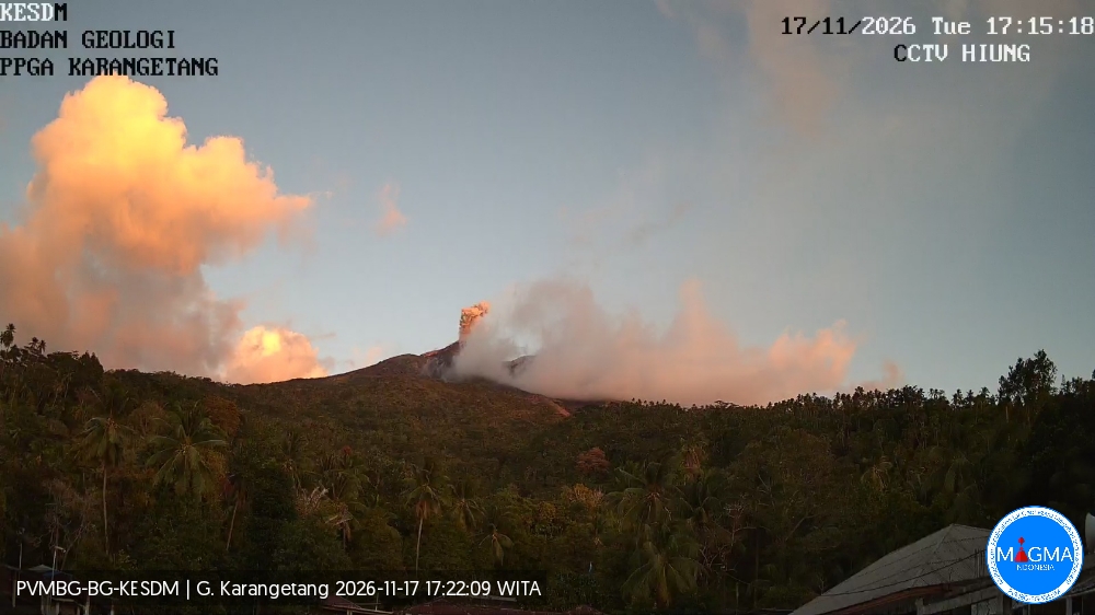
An eruption of Mount Karangetang occurred on Tuesday, November 17, 2026, at 17:14 WITA (Central Indonesian Time). The observed ash column reached a height of approximately 400 meters above the summit (about 2,184 meters above sea level). This column—ranging in color from white and gray to brown—was highly dense and moved toward the south. At the time this report was published, the eruption was still ongoing.
Seismic observations:
2 eruption-related earthquakes, with an amplitude of 50 mm and a duration of 101 to 207 seconds.
15 earthquakes associated with rockfalls, with an amplitude of 2 to 15 mm and a duration of 25 to 102 seconds.
301 emission-related earthquakes, with an amplitude of 5 to 50 mm and a duration of 18 to 101 seconds.
42 harmonic tremors, with an amplitude of 3–50 mm and a duration of 50–335 seconds.
46 non-harmonic tremors, with an amplitude of 2–50 mm and a duration of 41–482 seconds.
2 shallow volcanic earthquakes, with an amplitude of 13 mm and a duration of 8–12 seconds.
2 deep volcanic earthquakes, with an amplitude of 11–47 mm and a duration of 8–12 seconds.
5 distant tectonic earthquakes, with an amplitude of 4–50 mm and a duration of 52–780 seconds.
Recommendations
(1) The public, as well as visitors and tourists, are advised not to approach, hike in, or conduct any activities within the designated danger zone. This zone encompasses a 1.5 km radius around the summits of Kawah Dua (North crater) and the main crater (South crater), as well as an extended sectoral zone reaching 2.5 km toward the south-southwest.
(2) Remain vigilant regarding the risk of lava avalanches and pyroclastic flows, which could occur at any time due to the instability of accumulated volcanic materials—which remain prone to collapse—particularly in the southern, southeastern, western, and southwestern sectors.
Source et photo : PVMBG.
Colombia , Chiles – Cerro Negro :
San Juan de Pasto, November 17, 2026, 3:40 PM.
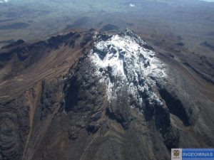
Based on the monitoring of activity at the Chiles-Cerro Negro Volcanic Complex (CVCCN), the Colombian Geological Service (SGC)—an agency affiliated with the Ministry of Mines and Energy—
reports the following:
During the period from November 10 to November 16, 2026, the primary variations in the monitored parameters, compared to the previous week, were as follows:
● Amidst a context of fluctuating seismic activity, a decrease in the number of events was observed, while the energy released showed a slight increase. The dominant process remains that associated with rock fracturing, followed by fluid dynamics, which registered an uptick.
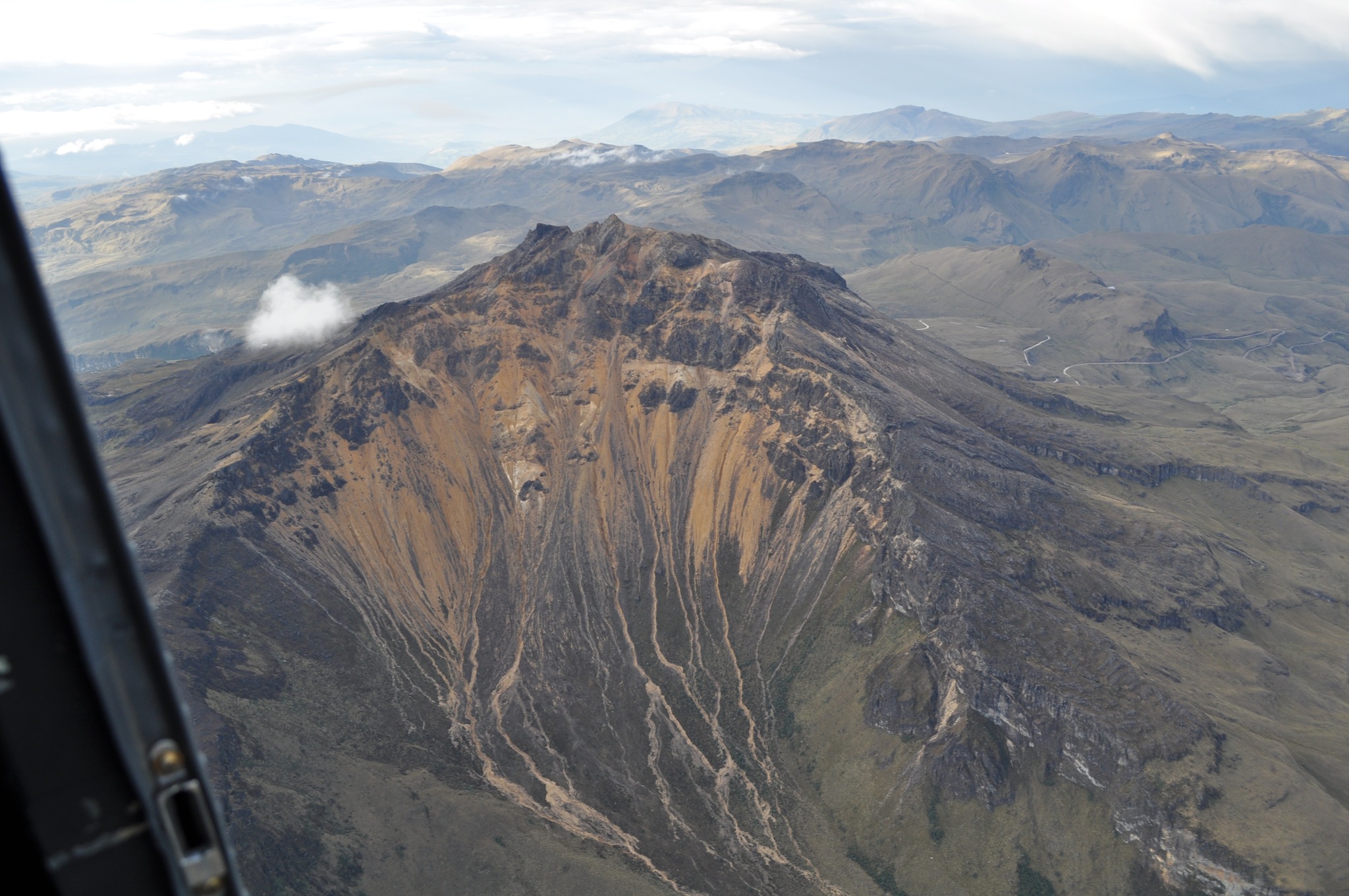
● The earthquakes were located at distances of less than 9 km and at depths ranging from 2 to 11 km relative to the summit of the Chiles volcano (4,700 m above sea level), with a maximum magnitude of 1.6.
● Analysis of data collected by satellite sensors and ground-based stations has continued to reveal variations linked to deformation processes within the volcanic zone.
Based on the assessment and correlation of the monitored parameters, the SGC recommends closely following the evolution of the situation through weekly bulletins and other information released via our official channels. It also advises adhering to the instructions provided by local and departmental authorities, as well as those from the National Unit for Disaster Risk Management (UNGRD).
Volcanic activity remains at the « Yellow » alert level: an active volcano exhibiting changes in the baseline behavior of monitored parameters, along with other manifestations.
Source et photo : SGC.
Tongas Archipelago , Pelorus Reef :
Volcanic activity at Pelorus Reef, a submerged volcano, in the Tongatapu group was reported between 12-16 November.
In a public notice tonight, the Tonga Geological Services (TGS) stated that it had reviewed external reports of volcanic activity in the vicinity of Pelorus Reef after receiving reports from outside agencies about activity in the area between the 12 and 16 of November 2026:
A series of possible eruptions that produced ash and pumice
Underwater sound signals in the area were interpreted as high-frequency underwater volcano explosions.
Satellite images of thermal anomalies on the 13 and 15 November 2026, detected in the Pelorus location.
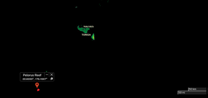
The image above was captured in NASA WorldView on 13 November 2026, which shows the location of Pelorus Reef and a small red anomaly next to the location. The red dots indicate thermal anomaly that was detected by satellites. Similar thermal anomaly was detected on 15 November 2026.
Pelorus Reef location (-22.8333°, -176.4667°) is a Pleistocene submerged volcano with a large stratovolcano and caldera system under the sea, which sits about 60 km South-South-West of Ata Island and about 217 km South West of ‘Eua, and 220 km South West of Tongatapu island.
TGS advised that monitoring of Pelorus Reef will continue as new information is detected or received to ensure maritime activity in the area is safe from potential hazards.
The public notice was issued by the Volcano Watch Team Tonga Geological Services, Natural Resources Division Ministry of Lands, Survey, Spatial Planning and Natural Resources
Source : Matangitonga
Photo : NASA WorldView