November 17 , 2026.
Hawaii , Kilauea :
HAWAIIAN VOLCANO OBSERVATORY DAILY UPDATE , U.S. Geological Survey
Sunday, November 15, 2026, 8:49 AM HST (Sunday, November 15, 2026, 18:49 UTC)
19°25’16 » N 155°17’13 » W,
Summit Elevation 4091 ft (1247 m)
Current Volcano Alert Level: ADVISORY
Current Aviation Color Code: YELLOW
Summary:
The Halema’uma’u eruption of Kīlauea remains paused following episode 56 fountaining on November 5. The summit is reinflating and the episode 57 forecast window is November 18-22.
Overview:
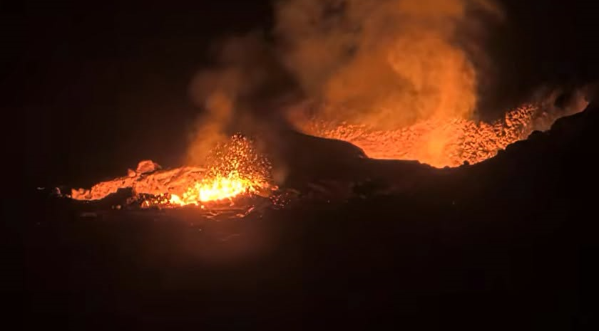
The Kīlauea summit eruption within Halema’uma’u is currently paused after episode 56 fountaining ended on November 5. The summit has been steadily reinflating since the end of episode 56, and rare spatter was visible overnight from the southwest vent. Another fountaining episode remains likely and the current forecast window for episode 57 fountaining is November 18-22.
Summit Observations:
Summit webcams recorded moderate to strong glow from both the north and southwest vents overnight. V1cam views overnight showed rare spatter and flames coming from the southwest vent.
Seismic tremor remains elevated during the eruption pause. One small earthquake was located at the summit in the past day.
The Uēkahuna tiltmeter (UWD) has recorded nearly continuous summit inflation following the end of episode 56 lava fountaining. This morning, UWD has recovered a total of about 13 microradians of inflationary tilt since the end of episode 56.
The average sulfur dioxide (SO2) emission rate recorded by the summit gas monitoring array yesterday, November 14, was about 2,000 tonnes per day. Trade winds this morning are carrying volcanic gases to the southwest.
On November 13th, geologists with the USGS Hawaiian Volcano Observatory surveyed the puʻu that has formed on the rim of the summit crater in the months since the eruption began in December 2024. The puʻu is made of tephra that was erupted from the vents during the many high lava fountaining episodes.
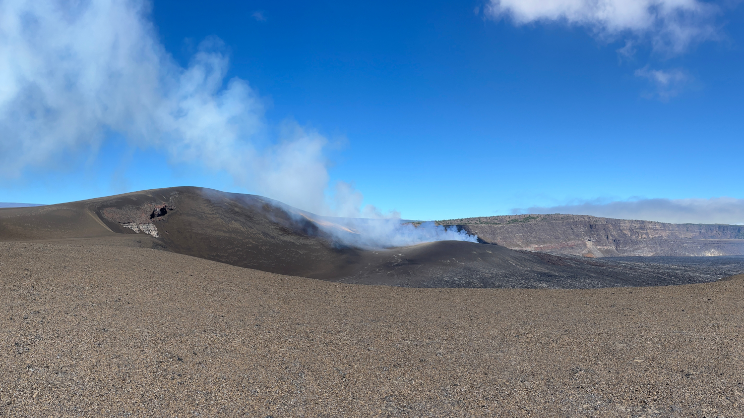
This photo was taken south of the southwest corner of Halema‘uma‘u at the summit of Kīlauea, and is looking to the north-northeast. The degassing plume from north and southwest vents is visible as it rises up over the cone. Mauna Loa can be seen in the background on the left.
Rift Zone Observations:
Rates of seismicity and ground deformation remain low in the East Rift Zone and Southwest Rift Zone. SO2 emissions from the East Rift Zone remain below the detection limit.
Photos : USGS , USGS / N. Deligne.
Indonesia , Ibu :
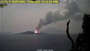
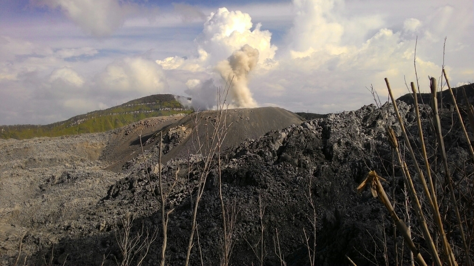
An eruption of Mount Ibu occurred on Tuesday, November 17, 2026, at 15:50 WIT; an ash column was observed, reaching approximately 500 meters above the summit (about 1,825 meters above sea level). The dense, gray-colored ash column drifted toward the west. This eruption was recorded by a seismograph, with a maximum amplitude of 28 mm and a duration of 69 seconds.
Seismic observations:
123 eruption-related earthquakes, with an amplitude of 15–28 mm and a duration of 33–78 seconds.
4 rockfall-related earthquakes, with an amplitude of 3–28 mm and a duration of 41–55 seconds.
3 gas or steam emission-related earthquakes, with an amplitude of 8–10 mm and a duration of 25–30 seconds.
18 harmonic tremors, with an amplitude of 4–28 mm and a duration of 38–77 seconds.
126 low-frequency earthquakes, with an amplitude of 2–15 mm and a duration of 17–29 seconds.
174 shallow volcanic earthquakes, with an amplitude of 2–8 mm and a duration of 9–21 seconds.
3 deep volcanic earthquakes, with an amplitude of 2–8 mm and a duration of 16–20 seconds.
1 local tectonic earthquake, with an amplitude of 2 mm and a duration of 21 seconds.
32 distant tectonic earthquakes, with an amplitude of 2–28 mm and a duration of 35–157 seconds.
Recommendations
1. Communities living in the vicinity of Mount Ibu, as well as visitors and tourists, are advised to refrain from any activity within a 2 km radius—extending to 3.5 km in the direction of the crater opening located to the north of Mount Ibu’s active crater.
2. In the event of ashfall, individuals who are outdoors are advised to protect their nose and mouth (using masks) and their eyes (using protective eyewear).
Source : PVMBG.
Photo : J Massolo. ( archive).
Guatemala , Santiaguito :
Atmospheric conditions: Clear sky
Wind: From the northeast
Precipitation: 0.5 mm
Volcanic activity:
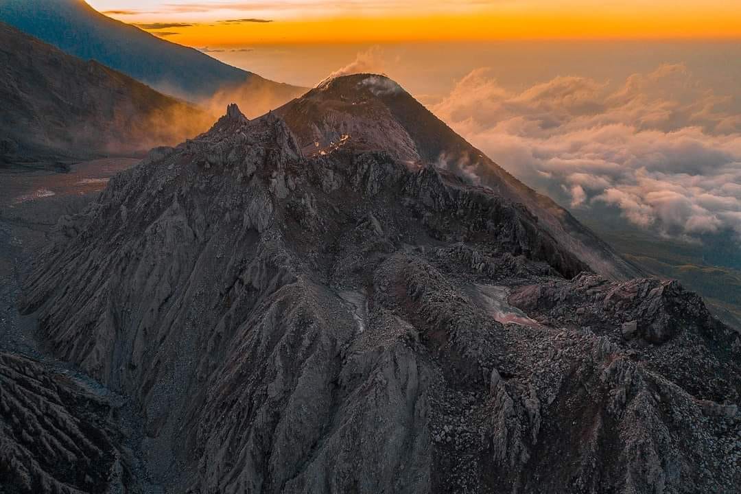
Constant degassing is observed above the « Caliente » dome, reaching a height of 400 meters and dispersing toward the west and southwest. Explosions of low to moderate intensity have been recorded, generating a column of gas and ash that rises up to 800 meters above the dome and disperses toward the west and southwest. During the night and early morning hours, incandescence is visible at the summit of the dome as well as on its western and southwestern flanks, a result of recurring avalanches descending these slopes.
The formation of pyroclastic density currents cannot be ruled out; therefore, the recommendations provided in special bulletin BESAN-002-2026 should be followed.
In the event of precipitation within the volcanic zone, low- to moderate-intensity lahars (volcanic mudflows) could occur in the riverbeds on the southern flank (specifically the Nimá I, Tambor, and Cabello de Angel); it is therefore necessary to adhere to the recommendations set out in special bulletin BESAN-016-2026.
Source : Insivumeh.
Photo : Noticias Caballo Blanco.
Philippines , Kanlaon :
MANILA, Philippines — Kanlaon Volcano on Negros Island emitted ash on Monday morning, the Philippine Institute of Volcanology and Seismology (Phivolcs) reported.
According to Phivolcs, the ash emission was observed from 6:35 a.m. to 7:55 a.m.
“The event generated grayish plumes that rose up to 350 meters above the summit crater before drifting southwest, as captured by the Kanlaon Volcano Observatory – Canlaon City IP camera,” Phivolcs said.
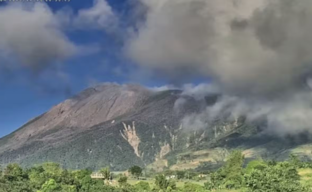
An ash emission was observed over the summit crater of Kanlaon Volcano on Negros Island on Monday morning, November 16, 2026. (Photo: Phivolcs)
On Sunday, state seismologists recorded four ash emissions over the volcano, triggering ashfall in parts of La Carlota City and La Castellana in Negros Occidental.
Kanlaon remains under Alert Level 2, indicating a “moderate level of volcanic unrest.”
Phivolcs reminded the public that entering the volcano’s permanent danger zone is prohibited.
Source : Inquirer . Net
Photo : Phivolcs .
Peru , Sabancaya :
Local date and time: 16/11/2026 – 13:48, Bulletin analysis period: November 9 to 15, 2026
Volcanic Alert Level
Orange alert level: The volcano is experiencing a significant increase in eruptive activity. There is an intensification of seismic activity, frequent explosions, and the emission of ash and ballistic blocks.
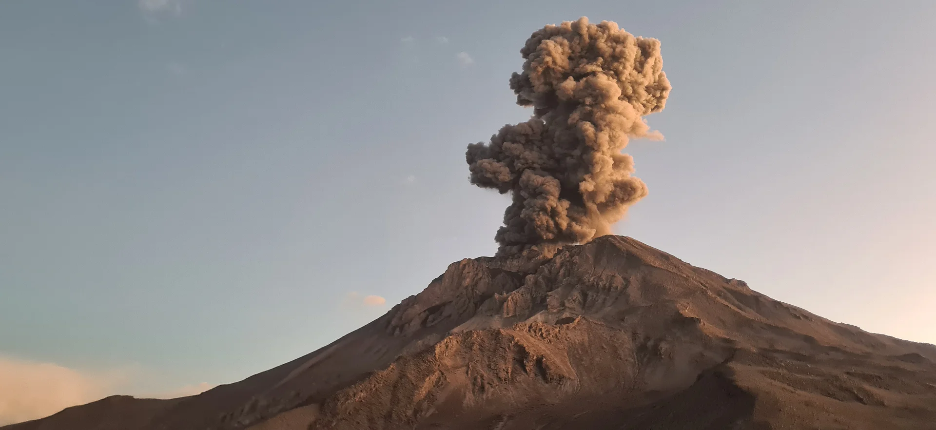
Conclusions
The IGP reports that the eruptive process at the Sabancaya volcano is ongoing, with activity remaining low and stable. No volcanic explosions have been recorded; only emissions of water vapor and gas, reaching up to 100 m above the summit, have been observed. Monitoring parameters remain stable. Consequently, the volcanic alert level is maintained at orange.
Recommendations
It is advised to stay consistently informed about volcanic activity at Sabancaya by consulting the reports and bulletins published by the IGP.
Outlook
Although volcanic activity remains at a low level, the possibility of future explosions persists. Such events could produce eruptive columns exceeding 2 km in height and lead to the dispersal of ash toward the Colca Valley and surrounding areas; for this reason, the volcanic alert level is maintained at orange.
Source et photo : Cenvul.