November 15 , 2026.
Alaska , Katmai :
AVO/USGS Volcanic Activity Notice
Current Volcano Alert Level: NORMAL
Current Aviation Color Code: GREEN
Issued: Saturday, November 14, 2026, 9:48 AM AKST
Source: Alaska Volcano Observatory
Notice Number: 2026/A843
Location: N 58 deg 16 min W 154 deg 57 min
Elevation: 6716 ft (2047 m)
Area: Alaska Peninsula
Summary:
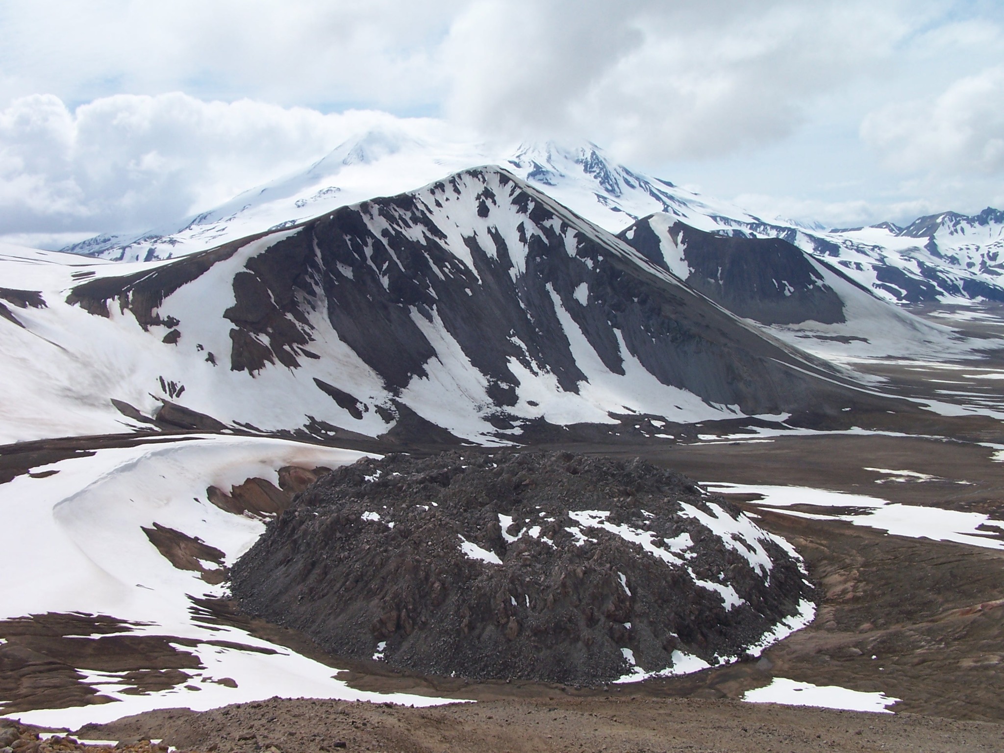
Resuspended ash observed from 1912 eruption. Aviation color code and alert level remain at GREEN/NORMAL.
Volcanic Activity:
Strong northwesterly winds in the vicinity of Katmai and the Valley of Ten Thousand Smokes have picked up loose volcanic ash erupted during the 1912 Novarupta-Katmai eruption and are carrying it to the southeast. The National Weather Service has issued a SIGMET for this low-level event and suggests that the maximum cloud height is about 6,000 ft (1.8 km) above sea level.
This phenomenon is not the result of recent volcanic activity and occurs during times of high winds and dry snow-free conditions in the Katmai area and other young volcanic areas of Alaska. No eruption is in progress. All of the volcanoes of the Katmai area (Griggs, Katmai, Novarupta, Mageik, Martin, Snowy and Trident) remain at Aviation Color Code GREEN and Alert Level NORMAL. Resuspended volcanic ash should be considered hazardous and could be damaging to aircraft and health.
Source : AVO.
Photo : P. Izbekov, AVO/UAF-GI. USGS, DGGS .
Costa Rica , Rincon de la Vieja :
OVSICORI-UNA Weekly Volcanic Monitoring Bulletin, November 13, 2026
Latitude: 10.83° N;
Longitude: 85.34° W;
Elevation: 1,916 m above sea level.
During this week, 12 small eruptions were recorded; none exceeded an acoustic magnitude of 4 (moderate), and all had a magnitude of less than 3. Additionally, 9 acoustic pulses—associated with emissions of water vapor and volcanic gases (small eruptions)—were detected. Background tremor is dominated by sequences of low-frequency (1–3 Hz) « banded tremors »; when visibility conditions allow, these sequences are observed to coincide with more intense emissions of water vapor and volcanic gases. These banded tremor sequences exhibit variations in amplitude, duration, and the intervals between episodes. Since October 25, an increase in the seismic amplitude of these events has been observed, accompanied by longer intervals between tremor episodes. Most of these events are accompanied by acoustic tremor. Continuous, high-frequency (3.5–6 Hz) background tremor is also present, with a stable amplitude, though it has shown a slight decrease compared to the previous week.
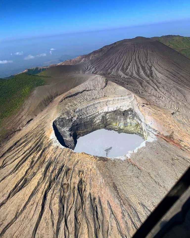
A slight increase in the frequency of long-period (LP) seismic signals has been recorded. The frequency of « tornillo » (screw-type) signals also shows a slight rise. Over the past week, 3 distal volcano-tectonic earthquakes and 3 proximal earthquakes (near the crater) were recorded. In the medium term (six months), a slight expansion of the volcano’s base has been detected, with no associated uplift. In the short term, no significant deformation has been observed. Overall, the monitoring stations do not show any significant pattern of vertical deformation. The MultiGAS station did not record a CO2/SO2 ratio this week, as SO2 concentrations were not high enough to allow for this calculation. The average SO2 flux this week was 278 ± 144 tonnes per day (t/d), with a maximum value of 1614 t/d; this average is higher than that of the previous week, which was 174 ± 92 t/d, with a maximum value of 1282 t/d. This increase is attributed to more favorable wind conditions for taking these measurements this week. The most recent detection of atmospheric SO2 by the SENTINEL satellite occurred on October 1, 2026, with a mass of 68 tonnes.
Source : Ovsicori.
Photo : Christopher Allen
Indonesia , Dukono :
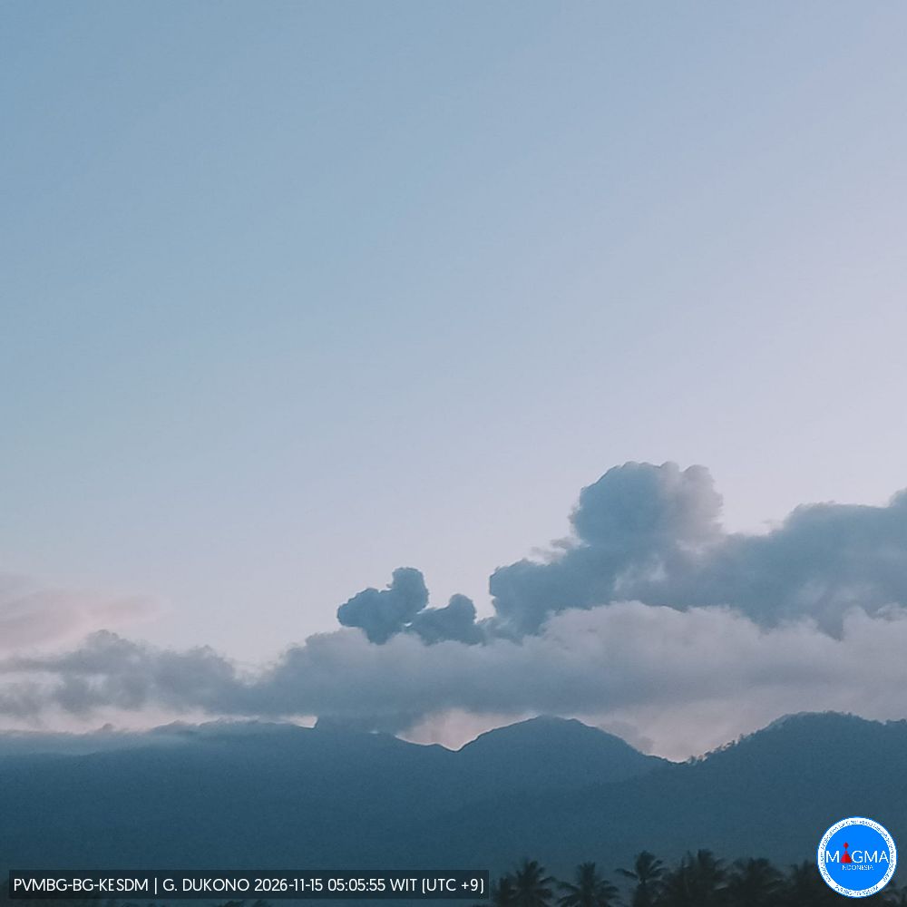
Eruption with volcanic ash cloud at 0330 UTC (1230 local). Best estimate of ash-cloud top is around 4438 FT (1387 M) above sea level or 960 FT (300 M) above summit. May be higher than what can be observed clearly. Source of height data: ground observer. Ash cloud moving to west. Volcanic ash is observed to be gray to dark. The intensity of volcanic ash is observed to be thick..
Seismic Observations
5 eruption-related earthquakes, with amplitudes ranging from 6 to 27 mm and durations between 37.56 and 52.72 seconds.
13 low-frequency earthquakes, with amplitudes ranging from 3 to 4 mm and durations between 25.92 and 31.92 seconds.
1 distant tectonic earthquake, with an amplitude of 10 mm and a duration of 75.92 seconds.
1 continuous tremor, with an amplitude ranging from 1 to 4 mm (dominant amplitude: 2 mm).
Recommendations
(1) Populations living in the vicinity of Mount Dukono, as well as visitors and tourists, are advised to refrain from any activities—including hiking—and to avoid approaching the Malupang Warirang crater within a 4 km radius.
(2) Given that eruptions producing volcanic ash occur periodically—and that the dispersion of this ash depends on wind direction and speed, meaning the affected areas may vary—individuals living around Mount Dukono are advised to keep masks or other forms of nose and mouth protection readily available. These should be used as necessary to protect the respiratory system from the risks posed by volcanic ash.
Source et photo : PVMBG.
Ecuador , El Reventador :
DAILY STATUS REPORT FOR REVENTADOR VOLCANO, Saturday, November 14, 2026.
Information from the Geophysical Institute – EPN.
Surface activity level: Moderate; Surface trend: Unchanged
Internal activity level: Moderate; Internal trend: Unchanged
From November 13, 2026, 11:00 AM to November 14, 2026, 11:00 AM:
Seismicity:
Explosions (EXP): 80
Long-period (LP) events: 16
Emission tremors (TREMI): 13
Harmonic tremors (TRARM): 2
Rainfall / Lahars:
At the time of writing this report, no precipitation has been recorded in the vicinity of the volcano. **In the event of heavy rainfall, accumulated materials could be remobilized, generating mud and debris flows that would descend the volcano’s flanks and reach adjacent rivers.**
Emission Column / Ash:
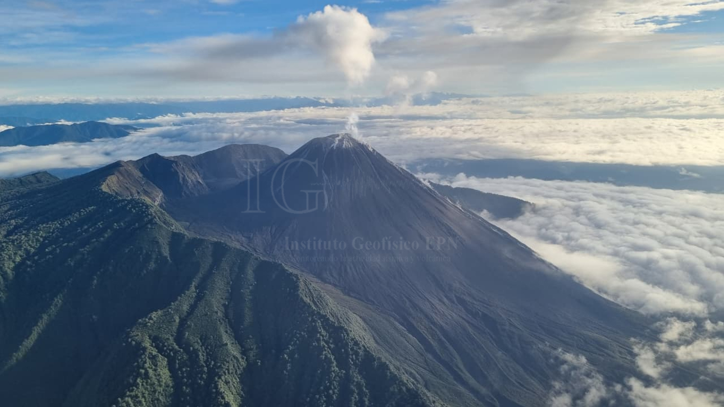
Since yesterday afternoon and up to the time of this report, the surveillance camera system has recorded several gas and ash emissions, reaching heights of up to 600 meters above the crater rim, moving toward the northwest and west. Furthermore, the Washington VAAC has not issued any reports regarding the volcano’s activity.
Other Monitoring Parameters:
The MIROVA VIIRS 375 system detected a thermal anomaly over the last 24 hours.
Observation:
Throughout last night and into the early morning, several episodes of incandescence were observed via the surveillance camera system, extending down to approximately 1,200 meters below the crater rim. At the time of writing, the volcano is obscured by clouds.
Alert Level – SGR: Orange
Source et photo : IGEPN.
Philippines , Kanlaon :
Kanlaon Volcano emits 900-meter ash plume; Alert Level 2 remains in effect
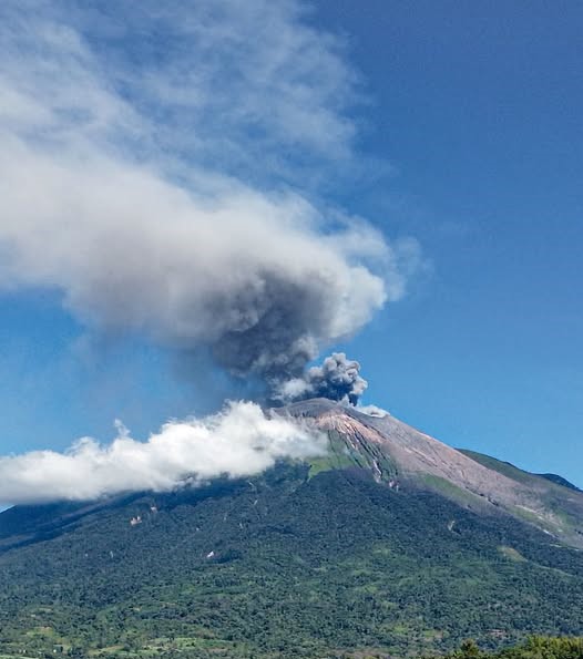
A 900-meter ash plume rose above the summit of Kanlaon Volcano on Negros Island on Sunday morning, according to sped-up camera footage released by the Philippine Institute of Volcanology and Seismology (PHIVOLCS).
In a post on X, PHIVOLCS said the ash emission was observed at 9:08 a.m., generating a grayish plume that rose above the summit crater before drifting southwest.
Kanlaon Volcano remains under Alert Level 2, indicating the possibility of sudden steam-driven or phreatic eruptions and precursory magmatic activity.
On Saturday evening, Kanlaon Volcano also emitted a 600-meter ash plume from 9:30 p.m. to 9:32 p.m.
Other Stories
PHIVOLCS’ monitoring on Nov. 14 recorded one volcanic earthquake, while ground deformation continued to indicate inflation of the volcano’s edifice.
The agency continues to prohibit entry into the volcano’s 4-kilometer-radius Permanent Danger Zone (PDZ) and flying aircraft close to its summit.
Source : GMA news , Lyjah Tiffany Bonzo .
Photo : Miss Ching Lagawing.