November 14 , 2026.
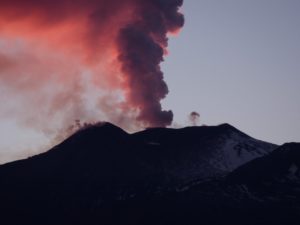
Chile / Argentina , Nevados de Chillan :
SPECIAL REPORT ON VOLCANIC ACTIVITY, November 12, 2026
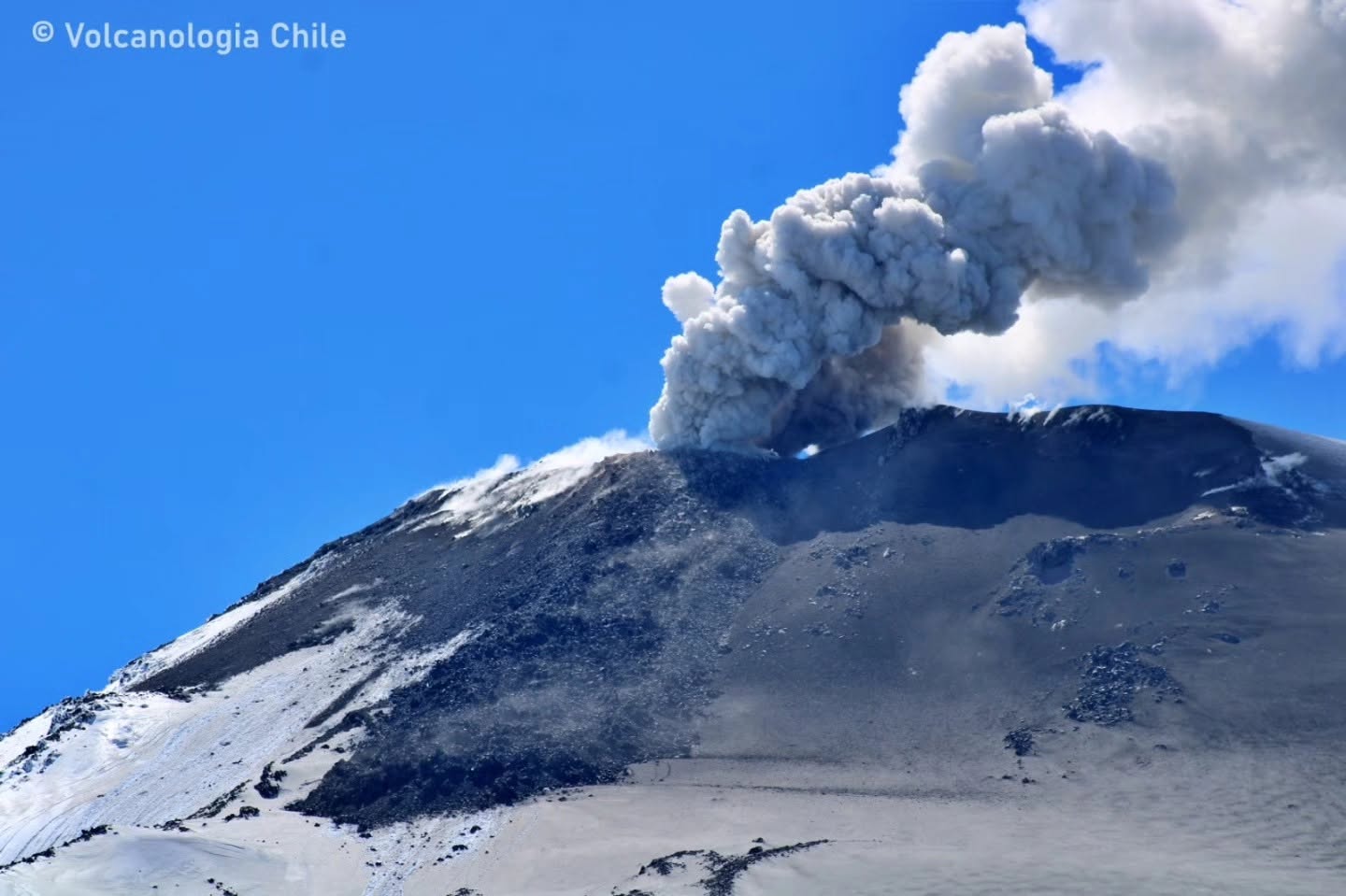
The Argentine Geological and Mining Service (SEGEMAR), through its Argentine Volcanic Monitoring Observatory (OAVV), reports that today, Thursday, November 12, 2026, at 5:03 PM local time (8:03 PM UTC), volcanic monitoring stations installed in the vicinity of the Nevados de Chillán volcanic complex (belonging to OVDAS) recorded an eruptive pulse accompanied by a short-range pyroclastic flow. This flow extended up to 500 meters from the emission center of the active lava flow. The column of gas and pyroclasts reached a height of 400 meters above the crater rim. This event was associated with a « Long-Period » (LP) volcanic earthquake—linked to the movement of fluids within the volcano—with a reduced displacement (RD) of 139 cm².
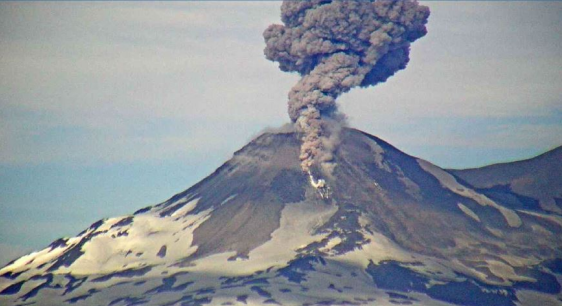
A pyroclastic flow was detected by the surveillance cameras of the Nevados de Chillán volcanic complex (operated by OVDAS), recorded at 17:03 local time (20:03 UTC).
Information regarding the recorded event:
Reduced displacement: 139 cm²
Column height: 400 m above the crater rim.
OBSERVATIONS:
At the time of this report’s publication, recurring explosive activity continues at the volcano’s active crater. The occurrence of similar events—potentially even of greater intensity—cannot be ruled out. Based on available information, the recorded events have remained confined to areas in the immediate vicinity of the active craters; no populations within Argentine territory have been affected thus far.
CONCLUSIONS
The technical alert level remains in place, and monitoring of the volcano will continue, in constant communication with Chile’s Southern Andes Volcanological Observatory (OVDAS); any developments will be reported.
Source : Segemar.
Photos : Segemar , Volcanologia Chile .
Philippines , Bulusan :
BULUSAN VOLCANO ADVISORY , 14 November 2026 , 02:00 PM
This is a notice of increased seismic activity at Bulusan Volcano.
A total of two hundred five (205) volcanic earthquakes have been recorded by the Bulusan Volcano Network (BVN) since 12:00 AM, 13 November 2026. Almost all of these were volcano-tectonic earthquakes that are associated with rock fracturing at depths of <20 kilometers beneath the Bulusan Volcano edifice. Degassing activity from the active vents has been weak to moderate, while volcanic sulfur dioxide emission was measured at 527 tonnes/day on 9 November 2026. These parameters likely indicate active shallow hydrothermal or tectonic processes beneath the volcano, which could lead to steam-driven or phreatic eruptions at any of its summit vents.
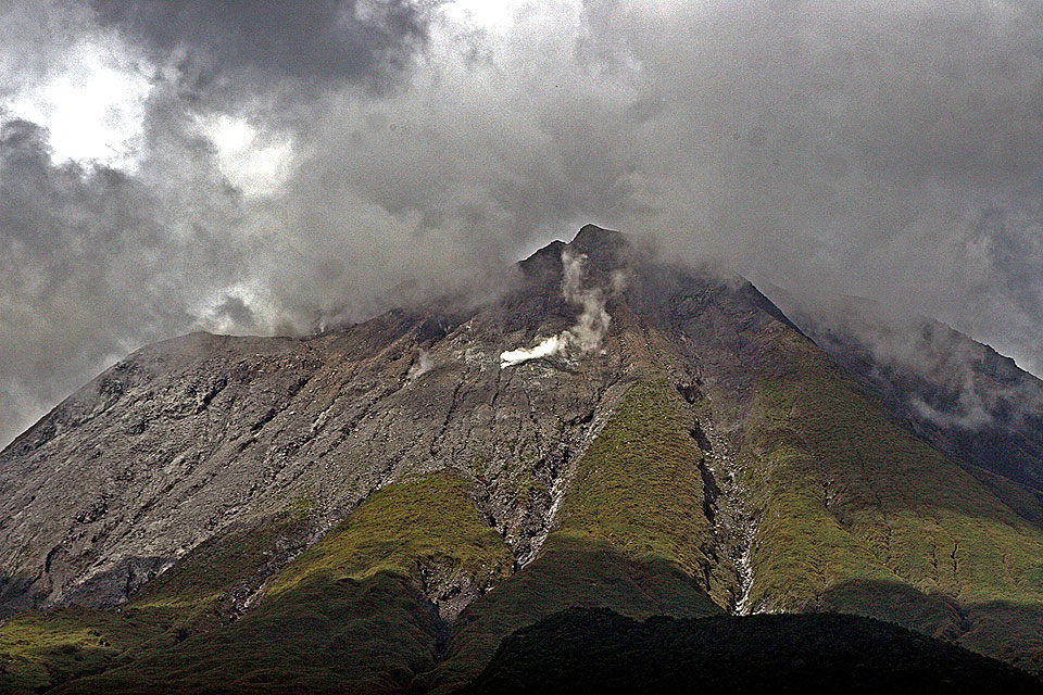
The public is reminded that Alert Level 1 (low-level unrest) prevails over Bulusan Volcano, and increased seismicity warns of increased chances of phreatic eruptions from any of its summit vents. Local government units are advised to strictly prohibit entry into the 4-kilometer radius Permanent Danger Zone (PDZ) and exercise vigilance in the 2-kilometer Extended Danger Zone (EDZ) on the southeast sector due to the possible impacts of volcanic hazards such as pyroclastic density currents or PDCs, ballistic projectiles, rockfall, avalanches, ashfall and others on these danger areas. Communities south and downwind of the volcano are also advised to prepare for ashfall in case phreatic eruption occurs, paying special attention to vulnerable members of the community including the elderly, expecting mothers, infants, and those with medical conditions. Civil aviation authorities must also advise pilots to avoid flying close to the volcano’s summit as ash from any sudden phreatic eruption can be hazardous to aircraft. Furthermore, people living within valleys and along river/stream channels, especially on the western sectors of the edifice should be vigilant against sediment-laden stream flows and lahars in the event of heavy and prolonged rainfall should phreatic eruption occur.
DOST-PHIVOLCS is closely monitoring Bulusan Volcano’s condition and any new development will be relayed to all concerned.
Source et photo : Phivolcs.
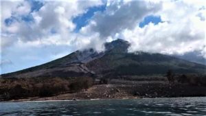
Martinique , Mount Pelée :
Weekly Report, Institut de Physique du Globe de Paris / Martinique Volcanological and Seismological Observatory (OVSM)
Saint-Pierre, November 13, 2026, at 14:30 local time (GMT-4)
Volcanic seismic activity
Between November 6, 2026, at 16:00 (UTC) and November 13, 2026, at 16:00 (UTC), the OVSM recorded 479 earthquakes of volcanic origin:
• 476 volcano-tectonic earthquakes. 10 of these had a magnitude (local magnitude Mlv or duration magnitude Md) greater than 1. The largest had a magnitude of Mlv = 1.66; the others were of lower energy. These earthquakes were located at depths ranging from 0.9 to 1.3 km below the volcano’s summit.
• 3 deep long-period earthquakes. Only one could be located; it was situated southeast of Mount Pelée at a depth of approximately 35 km, with a magnitude of Mlv = 0.4. The others were of lower energy.
No earthquakes were reported as felt by the population.
During the previous week, the OVSM recorded 339 earthquakes of volcanic origin. As of November 13, 2026, and over the past four weeks, the OVSM has observed a total of 1,073 volcanic earthquakes, representing an average of 268 to 269 earthquakes per week.
Deformations of Mount Pelée
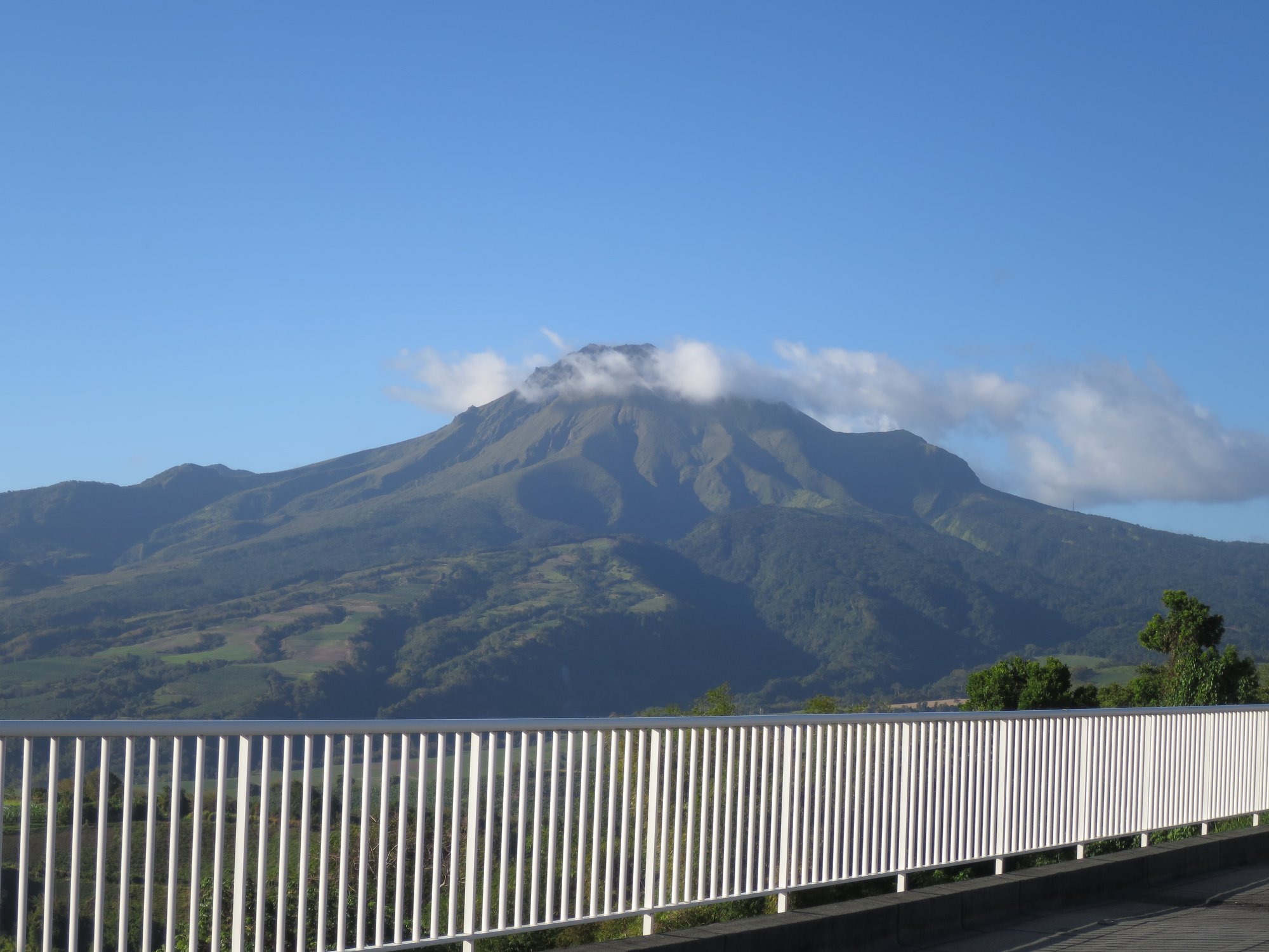
The ground displacements of several centimeters that had been observed in the summit area of Mount Pelée over the last few months have decreased significantly. In the deformation zones near the summit, the maximum elongation recorded over the past four weeks is 0.4 cm (along a 610-meter-long profile). These displacements remain consistent with a deformation of the volcanic edifice caused by an inflating pressure source, though this source can no longer be precisely localized.
The probability of eruptive activity in the short term remains low. However, based on observations gathered over the last few months and years, an evolution of the situation in the medium term (weeks to months) cannot be ruled out.
The volcanic alert level, in accordance with the provisions established by the authorities, is currently YELLOW: vigilance.
Source et photo : OVSM-IPGP
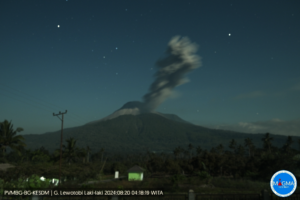
Indonesia , Gamkonora :
The Pusat Vulkanologi dan Mitigasi Bencana Geologi (PVMBG) reported increased seismicity at Gamkonora during October-November. According to a news article seismicity during the month of October was characterized by 129 tornillo earthquakes, five low-frequency earthquakes, 28 shallow volcanic earthquakes, and 79 deep volcanic earthquakes; there were increases in the daily average of shallow volcanic earthquakes from less than two to nine per day and in the daily average of deep volcanic earthquakes from less than four to five per day. During 1-5 November the seismic network recorded 13 tornillo earthquakes, three low-frequency earthquakes, one shallow volcanic earthquake, and eight deep volcanic earthquakes. PVMBG raised the Alert Level to 2 (on a scale of 1-4) at 1600 on 6 November due to the increased seismicity and warned the public to stay 2 km away from the summit. The volcano was closed to climbers.
The shifting of eruption centers on Gamkonora, the highest peak of Halmahera, has produced an elongated series of summit craters along a N-S trending rift. Youthful-looking lava flows originate near the cones of Gunung Alon and Popolojo, south of Gamkonora. Since its first recorded eruption in the 16th century, typical activity has been small-to-moderate explosive eruptions. Its largest recorded eruption, in 1673, was accompanied by tsunamis that inundated villages.
Sources: Pusat Vulkanologi dan Mitigasi Bencana Geologi (PVMBG, also known as CVGHM), Antara News , GVP.
Photo : Bruce Gemmell, University of Tasmania.
Colombia , Nevado del Ruiz :
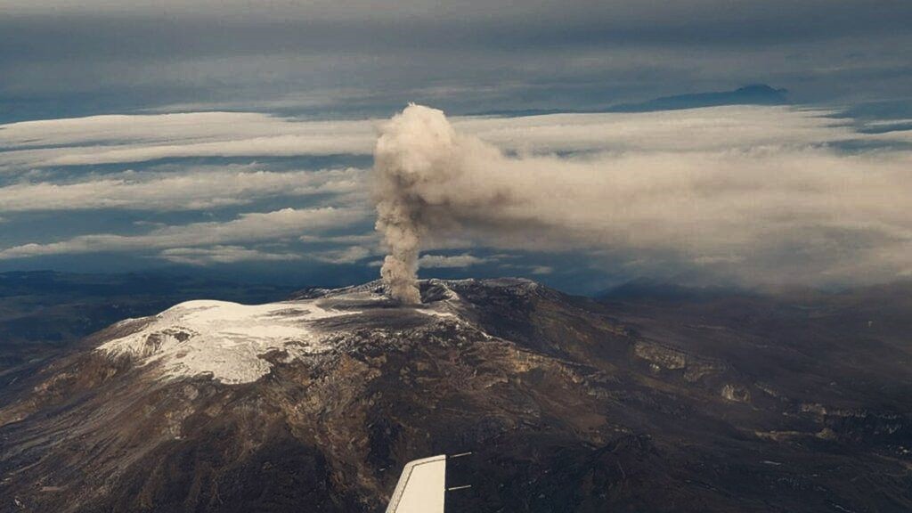
Regarding the monitoring of activity at the Nevado del Ruiz volcano, the Colombian Geological Service (SGC)—an agency affiliated with the Ministry of Mines and Energy—reports the following:
During the week of November 3 to 9, 2026, the volcano continued to exhibit unstable behavior. Compared to the previous week, the primary variations in the monitored parameters were as follows:
– Seismic activity associated with rock fracturing within the volcanic edifice showed a decrease in the number of recorded earthquakes, but an increase in the total seismic energy released. The earthquakes were primarily localized near the Arenas crater and in two distinct areas: the north-northeast flank (within 4 km of the crater) and the northeast flank (at a distance of 9 to 11 km from the crater). The latter area saw the week’s highest-magnitude earthquakes: one on November 8 at 8:44 PM (magnitude 2.5) and another on November 9 at 9:14 AM (magnitude 2.0), both occurring at a depth of 3 km. In general, the depths of the other seismic events ranged from less than 1 km to 7 km below the volcano’s summit.
– Seismicity linked to fluid dynamics within the volcanic conduits remained at levels comparable to the previous period in terms of the number of recorded earthquakes, while the seismic energy released decreased. These events were short-lived and characterized by low energy levels.
– The emission of water vapor and volcanic gases—primarily sulfur dioxide (SO₂)—from the Arenas crater into the atmosphere continued. The estimated SO₂ flux increased compared to the previous week. Furthermore, satellite monitoring indicated higher levels of this gas than in the preceding month. The vertical height of the gas and water vapor plume ranged from 300 m to 1,100 m above the volcano’s summit, with a predominant height of 300 m. The maximum height of 1,100 m was recorded on November 8. The plume’s dispersion direction varied, with a tendency toward the southwest sector and, to a lesser extent, toward the northwest and west-northwest sectors of the volcano.
– Monitoring of thermal anomalies at the base of the Arenas crater via satellite platforms was limited by cloud cover in the area. Nevertheless, a few low-energy anomalies were recorded.
Source et photo : SGC.