November 11 , 2026.
Italy / Sicily , Etna :
WEEKLY BULLETIN, from November 2, 2026, to November 8, 2026 (date of issue: November 10, 2026)
SUMMARY OF ACTIVITY STATUS
Based on monitoring data, the following is noted:
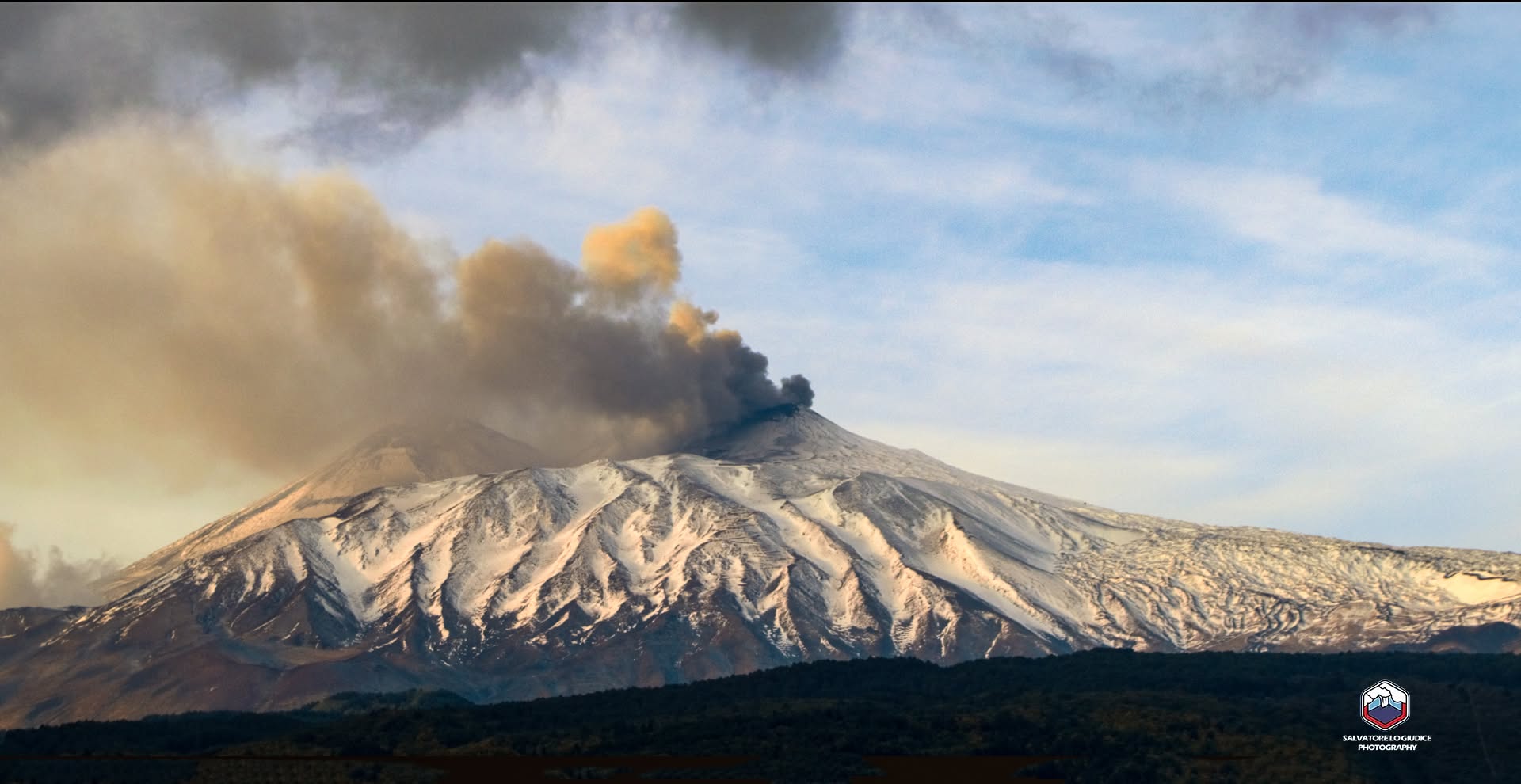
1) VOLCANOLOGICAL OBSERVATIONS: Variable degassing activity at the summit craters, with occasional ash emissions from the Northeast Crater.
2) SEISMOLOGY: Absence of seismic activity related to rock fracturing (Ml ≥ 2.0). Tremor amplitude at a moderate level.
3) INFRASOUND: Low-energy infrasonic activity, with a frequency of occurrence varying between low and moderate levels, localized at the Northeast Crater.
4) GROUND DEFORMATION: Inclinometer stations located in the summit area recorded minor variations on November 2.
5) GEOCHEMISTRY: SO2 flux at a moderate level.
CO2 flux from the ground (Etnagas): moderately high values.
Helium (He) isotope ratio at peripheral sites: no updates available.
6) SATELLITE OBSERVATIONS: Thermal activity in the summit area, as observed by satellite, remained generally low, with a few isolated, moderate-level anomalies.
7) OTHER OBSERVATIONS: During the period from November 2 to 8, 2026, soil radon emissions remained generally low, with the exception of two spikes that reached very high levels on November 5 and 6.
VOLCANOLOGICAL OBSERVATIONS
During the week under review, volcanic activity at Mount Etna was monitored by analyzing images from the surveillance camera network of the INGV – Etna Observatory (INGV-OE). Poor weather conditions—including cloud cover and strong winds—significantly limited observations throughout the week.
Activity at Etna’s summit craters showed no significant changes compared to the previous weeks; degassing was observed from the BN1 vent, along with fumarolic emissions along the rims and flanks of the Voragine and Southeast craters.
At the Northeast Crater, degassing from the vent continued, periodically accompanied by emissions of brown ash—a phenomenon frequently observed in previous weeks, most notably on November 4.
Source : INGV
Photo : Salvatore Lo Giudice
Italy , Stromboli :
WEEKLY BULLETIN, November 2, 2026, to November 8, 2026 (date of issue: November 10, 2026)
SUMMARY OF ACTIVITY STATUS
Based on monitoring data, the following observations are noted:
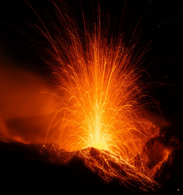
1) VOLCANOLOGICAL OBSERVATIONS: Typical Strombolian eruptive activity is occurring at both crater zones, accompanied by lava spattering in the North crater zone. The overall frequency of explosive activity—across both the North and Central-South crater zones—is at a moderate level; the intensity of explosions is moderate in the North crater zone and low in the Central-South zone. A lava overflow occurred from the North crater zone on November 2 and 3.
2) SEISMOLOGY: Monitored seismic parameters show no significant variations.
3) GROUND DEFORMATION: The SELI clinometer, installed at Pizzo, recorded a slight variation during the lava overflow on November 2.
4) GEOCHEMISTRY: SO2 flux is at a moderate to high level.
Soil CO2 flux (Pizzo area – STR02): no new data available.
C/S ratio in the plume: no new data available.
Helium isotopic ratio (R/Ra): high to very high values.
Soil CO2 flux in the San Bartolo area: high values.
Soil CO2 flux in the Scari area: moderate degassing values. 5) SATELLITE OBSERVATIONS: Thermal activity observed by satellite in the summit area was of low to moderate intensity during the lava overflow episode that began on November 2 and ended on November 3, 2026.
VOLCANOLOGICAL OBSERVATIONS
Observations of explosive activity recorded by surveillance cameras
During the observation week, Stromboli’s eruptive activity was analyzed using images recorded by INGV-OE surveillance cameras, located at an altitude of 190 m above sea level and at Punta dei Corvi (designated SCT-SCV and SPCT, respectively). Explosions in the north crater area (Zone N) primarily produced coarse material (bombs and lapilli), while explosions in the central-south crater area (Zone CS) generated mostly fine material, mixed with some coarse material.
The mean frequency of explosions in Zone N was within an average range, and the intensity remained generally low to moderate. In Zone CS, the mean explosion frequency remained low, while the intensity of the explosive activity was generally moderate. The total daily mean hourly frequency of explosions (Zone N + Zone CS) remained at a moderate level, except on the 3rd, when it reached moderate to high values.
NON-ROUTINE ACTIVITY
Effusive activity via lava overflow
Between November 2 and 3, 2026, an episode of lava emission via overflow occurred from the north crater area. This episode fed a lava flow, with its front located on the upper part of the Sciara del Fuoco; the event was accompanied by the rolling of blocks down the slope.
Source : INGV
Photo : Stromboli stati d’animo / Sebastiano Cannavo.
Hawaii , Kilauea :
HAWAIIAN VOLCANO OBSERVATORY DAILY UPDATE , U.S. Geological Survey
Tuesday, November 10, 2026, 9:08 AM HST (Tuesday, November 10, 2026, 19:08 UTC)
19°25’16 » N 155°17’13 » W,
Summit Elevation 4091 ft (1247 m)
Current Volcano Alert Level: ADVISORY
Current Aviation Color Code: YELLOW
Summary:
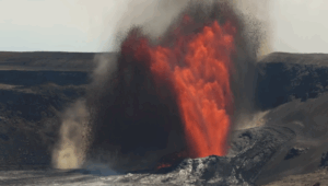
The Halema’uma’u eruption of Kīlauea is currently paused after episode 56 fountaining ended on November 5. The summit is reinflating and the next episode of lava fountaining is likely more than a week away.
Overview:
The Halema’uma’u eruption of Kīlauea is currently paused after episode 56 fountaining ended on November 5. The summit has been reinflating since the end of the fountaining episode, and the next lava fountaining episode is likely more than a week away.
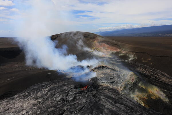
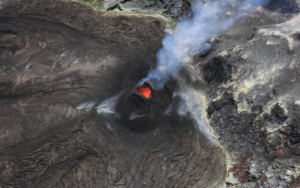
This overview photo of western Halema‘uma‘u crater at the summit of Kīlauea was captured during the USGS Hawaiian Volcano Observatory Overflight on November 4. The north vent lava pond is visible in the lower center of the frame, with the southwest vent sitting behind, somewhat obscured. The hill of tephra accumulated from past lava fountaining episodes—since early 2025—looms over both eruptive vents, perched on the former crater wall that is now almost completely buried.
Summit Observations:
Summit webcams recorded moderate glow at both the north and southwest vents overnight.
This morning, seismic tremor remains elevated. One small earthquake was located at the summit in the past day.
The Uēkahuna tiltmeter (UWD) has recorded continued summit inflation following the end of episode 56 lava fountaining. This morning UWD has recovered a total of 8.4 microradians of inflationary tilt since the end of episode 56.
During the eruptive pauses between fountaining episodes, the sulfur dioxide (SO2) emission rate from the summit is typically several thousand tonnes per day. Trade winds this morning are carrying volcanic gases southwest toward Kaʻū.
Rift Zone Observations:
Rates of seismicity and ground deformation remain low in the East Rift Zone and Southwest Rift Zone. SO2 emissions from the East Rift Zone remain below the detection limit.
Source : HVO.
Photo : USGS / M. Zoeller.
Chile / Argentina , Nevados de Chillan :
SPECIAL REPORT ON VOLCANIC ACTIVITY, November 10, 2026
The Argentine Geological and Mining Service (SEGEMAR), through its Argentine Volcanic Monitoring Observatory (OAVV), reports that today, Tuesday, November 10, 2026, at 18:54 local time (21:54 UTC) and 19:36 local time (22:36 UTC), volcanic monitoring stations installed in the vicinity of the Nevados de Chillán volcanic complex—under the purview of OVDAS—recorded at least two (2) eruptive pulses characterized by the presence of pyroclastic material, reaching heights of 2,340 m and 2,400 m above the crater level.
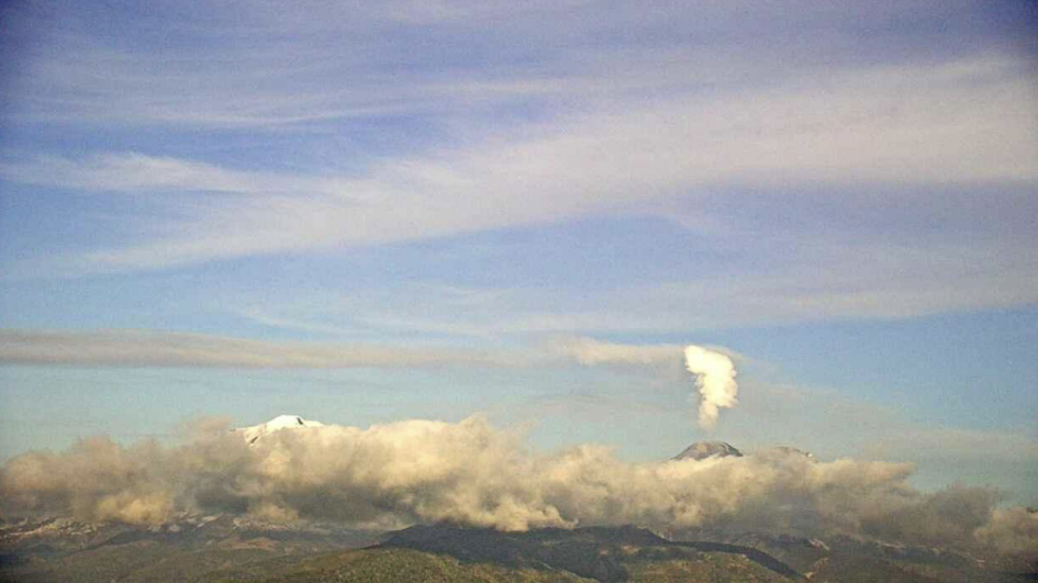
Eruption plume recorded by surveillance cameras at the Nevados de Chillán volcanic complex (managed by OVDAS) at 19:36 local time (22:36 UTC).
Information regarding the second recorded event:
Reduced displacement: 170 cm²
Plume height: 2,400 m above the crater rim
OBSERVATIONS:
At the time of this report, recurring explosive activity continues at the volcano’s active crater. The occurrence of similar events—potentially even of greater intensity—cannot be ruled out. Based on available information, the recorded events have remained localized near the active craters; to date, no impact has been observed on populations in Argentine territory.
CONCLUSIONS:
The technical alert level remains in effect, and monitoring of the volcano continues in constant coordination with the Southern Andes Volcanological Observatory (OVDAS) in Chile. Any further developments in the situation will be communicated accordingly.
Source : Segemar
Photo : OVDAS
Indonesia , Karangetang :
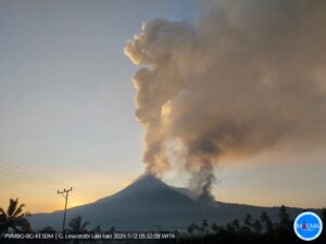
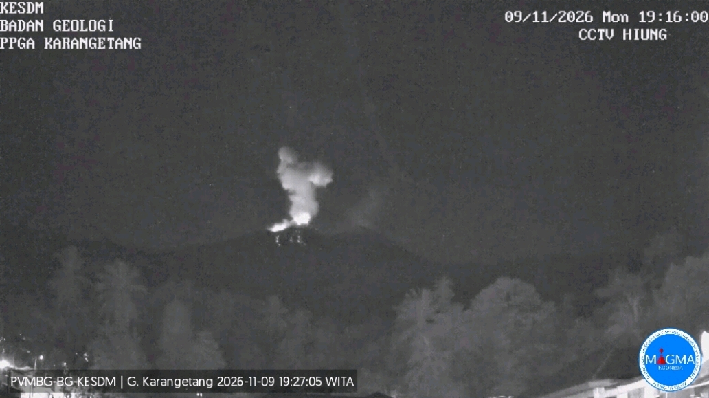
An eruption of Mount Karangetang occurred on Monday, November 9, 2026, at 7:14 PM (Central Indonesian Time, WITA). A dense, white-to-gray ash column was observed, reaching approximately 1,000 meters above the summit (about 2,784 meters above sea level) and drifting toward the northwest. The eruption was recorded by a seismograph, showing a maximum amplitude of 50 mm and a duration of 107 seconds.
Seismic Observations
22 rockfall-related seismic events, with amplitudes of 3–33 mm and durations of 23–90 seconds.
197 emission-related seismic events, with amplitudes of 6–50 mm and durations of 13–100 seconds.
63 harmonic tremors, with amplitudes of 4–50 mm and durations of 34–481 seconds.
20 non-harmonic tremors, with amplitudes of 7–50 mm and durations of 30–210 seconds.
1 shallow volcanic earthquake, with an amplitude of 16 mm and a duration of 8 seconds.
1 deep volcanic earthquake, with an amplitude of 50 mm and a duration of 12 seconds.
2 local tectonic earthquakes, with amplitudes of 12–50 mm and durations of 18–29 seconds.
7 distant tectonic earthquakes, with amplitudes of 12–50 mm and durations of 40–123 seconds.
Recommendations
(1) The public, including visitors and tourists, must not approach, hike in, or engage in any activity whatsoever within the designated danger zone—a 1.5 km radius around Kawah Dua (North crater) and the main crater (to the south), as well as a 2.5 km sectoral extension toward the south-southwest. (2) It is advisable to remain vigilant regarding the risks of lava-block rockfalls and pyroclastic flows, which may occur at any time due to the instability of previously accumulated volcanic material—particularly in the southern, south-eastern, western, and south-western sectors—as these deposits remain prone to collapse.
Source et photo : PVMBG.