November 9 , 2026.
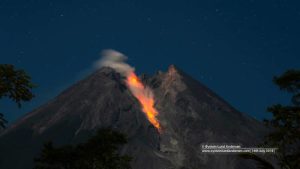
Kamchatka , Sheveluch :
KVERT VOLCANIC ACTIVITY NOTICE (VAN)
Issued: November 8 , 2026
Volcano: Sheveluch (CAVW #300270)
Current aviation colour code: ORANGE
Previous aviation colour code: orange
Source: KVERT
Notice Number: 2026-115
Volcano Location: N 56 deg 38 min E 161 deg 19 min
Area: Kamchatka, Russia
Summit Elevation: 3283 m (10768.24 ft), the dome elevation ~2500 m (8200 ft)
Volcanic Activity Summary:
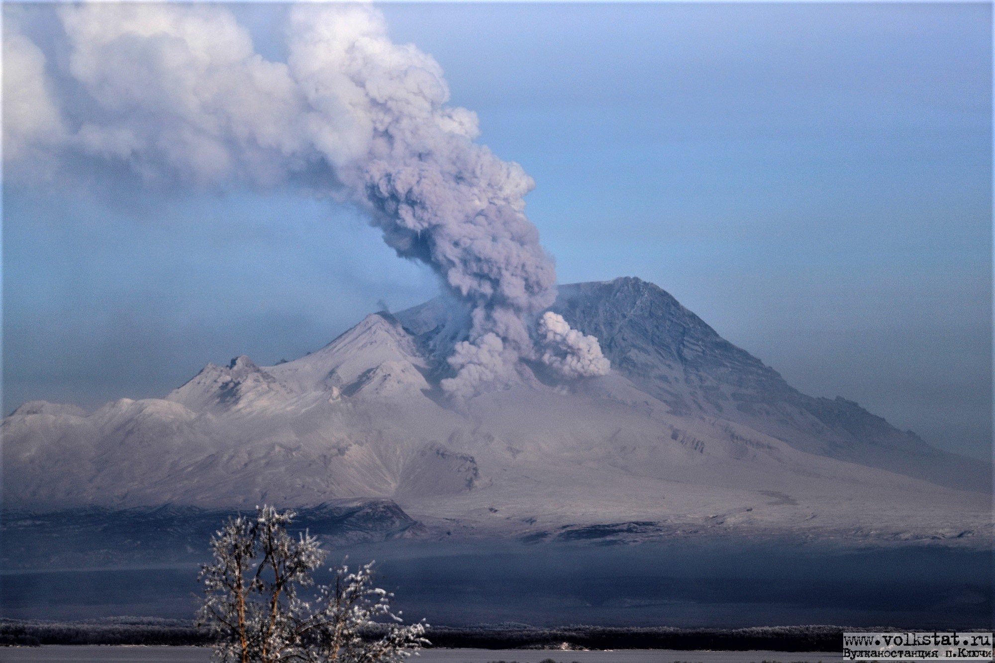
Satellite data by KVERT show a strong wind lifts ash from the eastern slopes of Sheveluch volcano, and a plume of resuspended ash is extending about 120 km to the east-southeast of the volcano.
There is NO eruption, but an resuspended ash. Ongoing activity could affect low-flying aircraft.
Volcanic cloud height:
5000 m (16400 ft) AMSL Time and method of ash plume/cloud height determination: 20261108/0330Z – Himawari-9 14m15
Other volcanic cloud information:
Distance of ash plume/cloud of the volcano: 120 km (75 mi)
Direction of drift of ash plume/cloud of the volcano: ESE / azimuth 98 deg
Time and method of ash plume/cloud determination: 20261108/0440Z – Himawari-9 14m15
Source : Kvert .
Photo : Yu. Demyanchuk ( archive).
Indonesia , Dukono :
Eruption accompanied by a volcanic ash cloud at 08:02 UTC (17:02 local time). According to the best estimates, the top of the ash cloud is approximately 9,878 feet (3,087 m) above sea level, or 6,400 feet (2,000 m) above the volcano’s summit. The actual altitude may be higher than what can be accurately observed. Source of the altitude estimate: ground-based observer. The ash cloud is moving northward. The observed volcanic ash is white to gray in color. The density of the volcanic ash is considered significant.
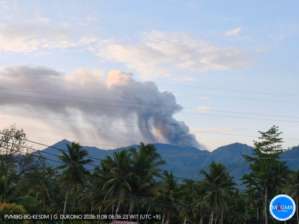
Seismic Observations
4 eruption-related earthquakes, with amplitudes ranging from 18 to 34 mm and durations between 30.62 and 51.4 seconds.
1 low-frequency earthquake, with an amplitude of 3 mm and a duration of 23.77 seconds.
2 local tectonic earthquakes, with an amplitude of 34 mm and durations between 37.15 and 40.13 seconds.
2 distant tectonic earthquakes, with amplitudes ranging from 5 to 19 mm and durations between 46.22 and 70.09 seconds.
1 continuous tremor, with an amplitude of 1 to 6 mm (predominantly 4 mm).
Recommendations
(1) Communities living near Mount Dukono, as well as visitors and tourists, are advised to refrain from any activities, hiking, or approaching the Malupang Warirang crater within a 4 km radius.
(2) Given that eruptions producing volcanic ash occur periodically—and because the dispersion of this ash depends on wind direction and speed, causing the affected area to vary—individuals living in the vicinity of Mount Dukono are advised to keep masks (or nose and mouth coverings) on hand to protect against respiratory health risks associated with volcanic ash.
Source et photo : PVMBG.
Ecuador , Sangay :
DAILY STATUS REPORT FOR SANGAY VOLCANO, Sunday, November 8, 2026.
Information from the Geophysical Institute – EPN.
Surface activity level: Moderate; Surface trend: Unchanged
Internal activity level: Low; Internal trend: Unchanged
Seismicity: From November 7, 2026, 11:00 AM to November 8, 2026, 11:00 AM:
Seismicity:
The following is the count of seismic events recorded at the reference station:
Explosion (EXP): 10
Emission tremor (TREMI): 8
Rainfall / Lahars:
No precipitation has been recorded in the vicinity of the volcano over the past 24 hours. **Heavy rainfall could remobilize accumulated materials, triggering mud and debris flows that would descend the volcano’s flanks and reach adjacent watercourses.**
Emission Plume / Ash:
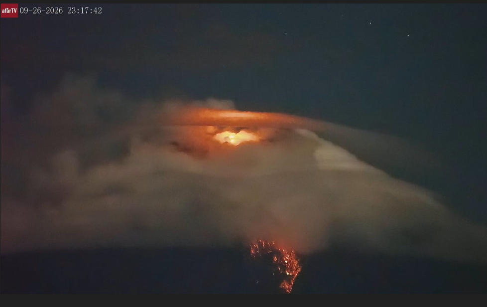
Due to heavy cloud cover in the area, only two gas emissions—containing small amounts of ash—were observed via surveillance cameras. These moved toward the northwest, reaching heights of 100 to 200 meters above the crater. Furthermore, the Washington VAAC reported no visible activity at the volcano.
Gas:
The MOUNTS satellite system detected 177.4 tonnes of sulfur dioxide (SO2) yesterday at 13:43 (local time).
Observation:
Since yesterday afternoon, and up until the time this report was finalized, the volcano has remained entirely obscured by clouds.
Sources : Instituto Geofísico-Escuela Politécnica Nacional (IG-EPN), Secretaría de Gestión de Riesgos (SGR) .
Photo : AFAR TV
Hawaii , Kilauea :
HAWAIIAN VOLCANO OBSERVATORY DAILY UPDATE , U.S. Geological Survey
Sunday, November 8, 2026, 9:29 AM HST (Sunday, November 8, 2026, 19:29 UTC)
19°25’16 » N 155°17’13 » W,
Summit Elevation 4091 ft (1247 m)
Current Volcano Alert Level: ADVISORY
Current Aviation Color Code: YELLOW
Summary:
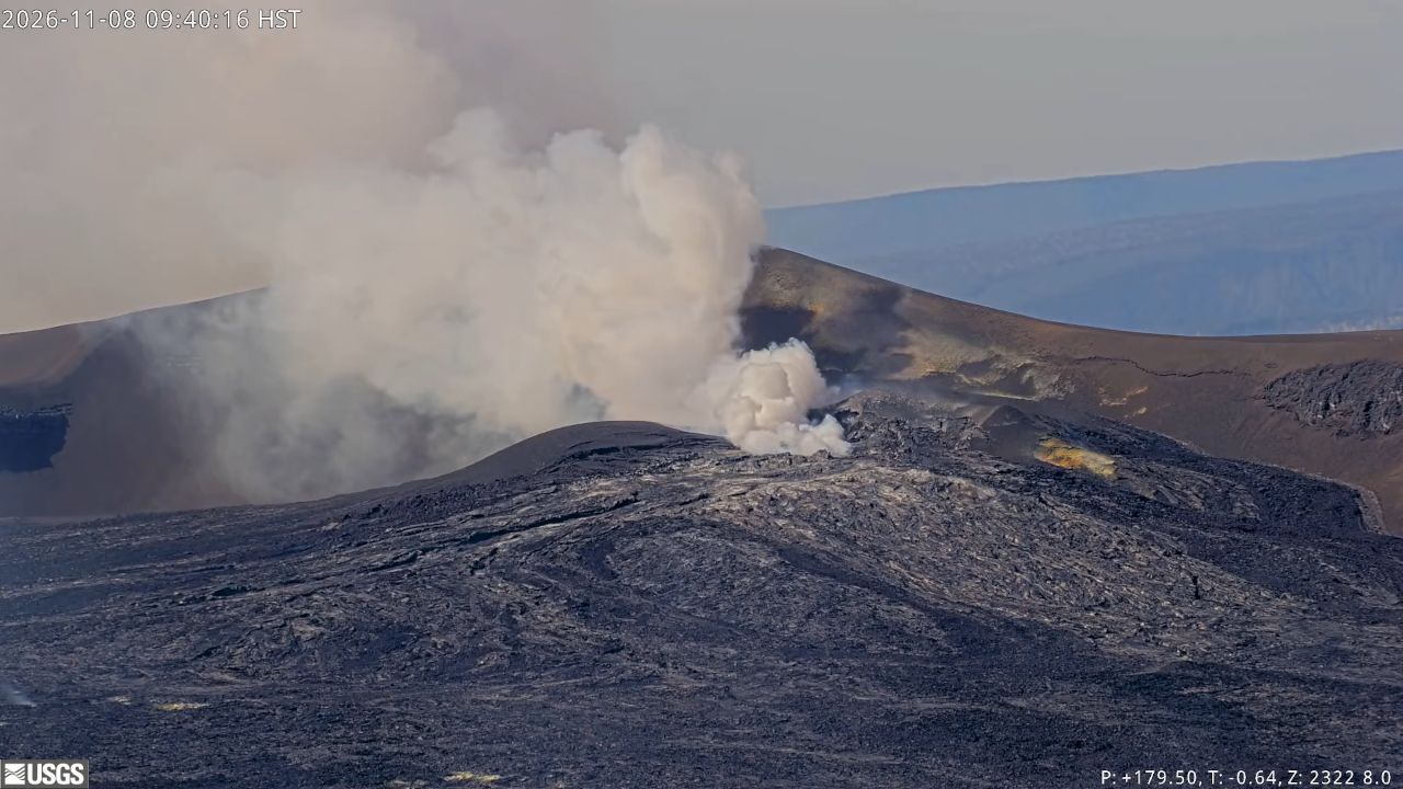
The Halema’uma’u eruption of Kīlauea is currently paused after episode 56 fountaining ended on November 5. The summit is reinflating and the next episode of lava fountaining is likely several weeks away.
Overview:
The Halema’uma’u eruption of Kīlauea is currently paused after episode 56 fountaining ended on November 5. The summit has been reinflating since the end of the fountaining episode, and the next lava fountaining episode is likely several weeks away.
Summit Observations:
Summit webcams recorded weak to moderate glow at both the north and southwest vents overnight.
This morning, seismic tremor remains elevated. One small earthquake was located at the summit in the past day.
The Uēkahuna tiltmeter (UWD) recorded continued summit inflation following the end of episode 56 lava fountaining. This morning UWD has recovered a total of 6.5 microradians of inflationary tilt since the end of episode 56.
During the eruptive pauses between fountaining episodes, the sulfur dioxide (SO2) emission rate from the summit is typically several thousand tonnes per day. Trade winds this morning are carrying volcanic gases southwest toward Kaʻū.
Rift Zone Observations:
Rates of seismicity and ground deformation remain low in the East Rift Zone and Southwest Rift Zone. SO2 emissions from the East Rift Zone remain below the detection limit.
Source et photo : HVO.
Mexico , Popocatepetl :
Monitoring of the Popocatépetl volcano, today, November 8, 2026
« The volcanic alert level for Popocatépetl is currently at YELLOW PHASE 2. » Cenapred urges people NOT TO APPROACH the volcano—and especially not the crater—due to the danger posed by falling incandescent fragments.
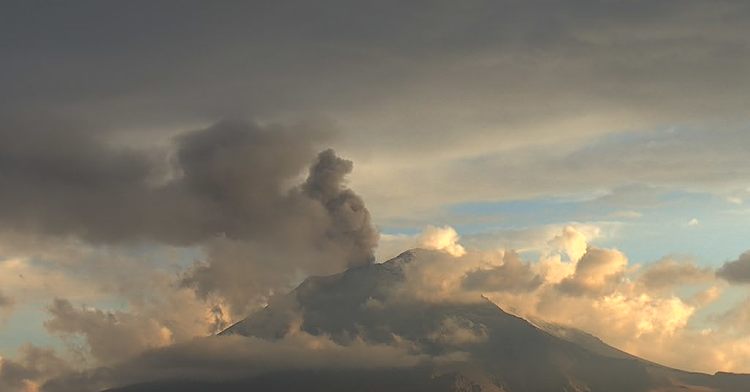
Activity over the last 24 hours
94 exhalations and 94 minutes of tremor were detected.
The volcanic alert level for Popocatépetl is currently Yellow Phase 2.
Cenapred strongly advises against attempting to climb the volcano, as explosions can occur and eject incandescent fragments—as has been observed recently. Please respect the 12-kilometer exclusion zone around the crater; entering this area is dangerous. In the event of heavy rain, stay away from the bottoms of ravines due to the risk of mudflows and debris flows.
Source et photo : Cenapred.