October 22 , 2026.
Hawaii , Kilauea :
HAWAIIAN VOLCANO OBSERVATORY DAILY UPDATE , U.S. Geological Survey
Wednesday, October 21, 2026, 9:25 AM HST (Wednesday, October 21, 2026, 19:25 UTC)
19°25’16 » N 155°17’13 » W,
Summit Elevation 4091 ft (1247 m)
Current Volcano Alert Level: ADVISORY
Current Aviation Color Code: YELLOW
Summary:
The Halema’uma’u eruption of Kīlauea is currently paused after episode 55 fountaining ended on October 17. Summit reinflation continues today and the preliminary forecast for episode 56 fountaining is between October 28 and November 5, 2026.
Overview:
The summit eruption of Kīlauea in Halemaʻumaʻu is paused following lava fountaining in episode 55 on October 17, 2026. Summit tiltmeter data showed re-inflation began immediately following the end of episode 55 and steady inflation continued until this morning when tilt leveled out. Presuming fountaining behavior returns to the patterns established in the past, the preliminary forecast for episode 56 fountaining to occur is between October 28 and November 5, 2026.
Summit Observations:
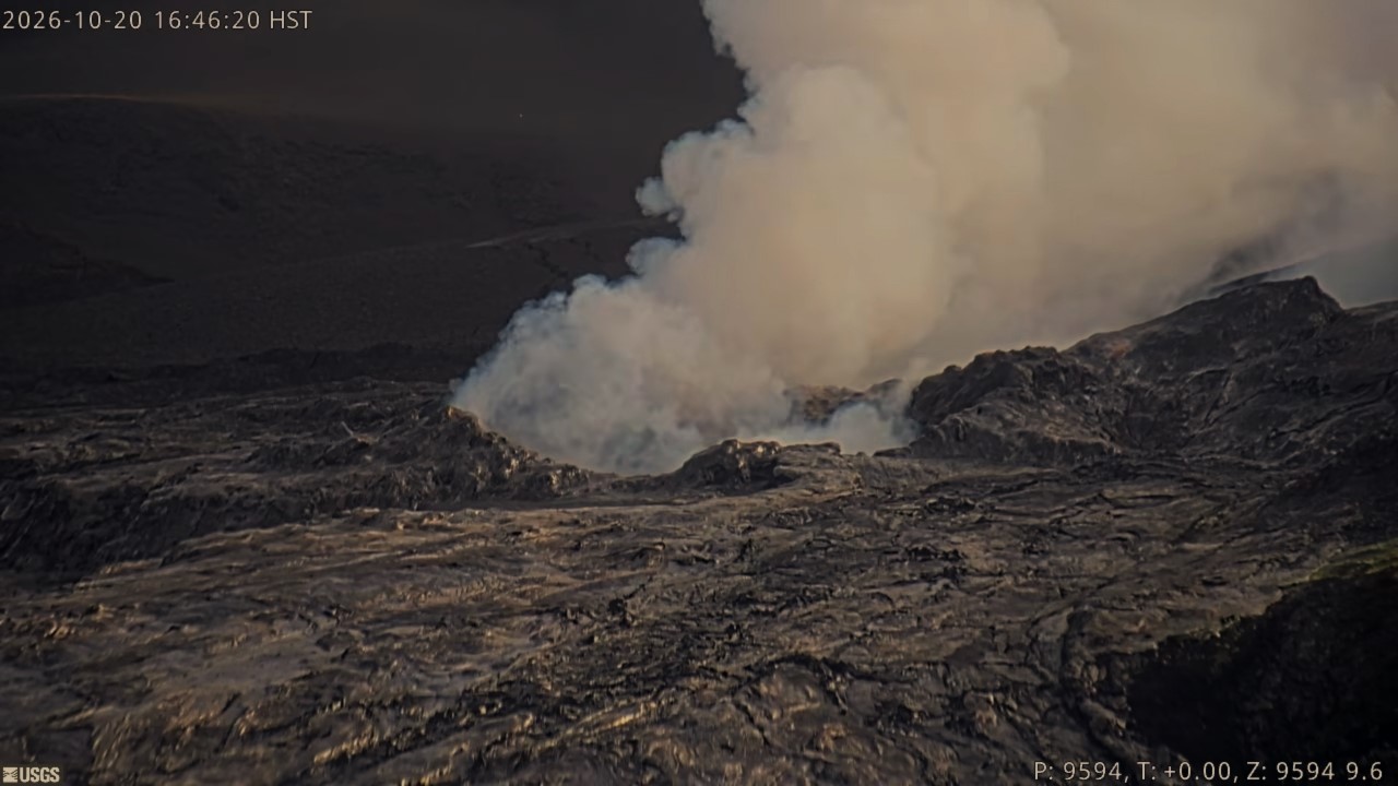
Continuous glow was again observed overnight from the north and west vents in Halema’uma’u. No glow was visible from the south vent, which was covered in a layer of tephra during episode 55.
Continuous, low-level seismic tremor has been present over the past day, which is typical during inter-episode pauses. Two earthquakes were recorded in the summit area in the past 24 hours.
Steady inflationary tilt continued until this morning when tilt leveled out. The UWD tiltmeter has recovered at total of 9.8 microradians of inflationary tilt since the end of episode 55. Deflationary tilt measured at a summit tiltmeter at Uēkahuna (UWD) totaled 21 microradians during episode 55. Post-fountaining tilt patterns have been similar to those seen prior to episode 54.
During inter-episode pauses, the sulfur dioxide (SO2) emission rate from the summit typically varies between 1,000 to 5,000 tonnes per day. Winds are forecast from the northeast, which are pushing the gas plume to the southwest over the Kaʻū Desert this morning.
Rift Zone Observations:
Rates of seismicity and ground deformation remain low in the East Rift Zone and Southwest Rift Zone. SO2 emissions from the East Rift Zone remain below the detection limit. No significant ground deformation was recorded in either rift zone.
Source et photo : USGS.
Colombia , Nevado del Ruiz :
Manizales, October 20, 2026, 5:30 PM
As part of the ongoing monitoring of the Nevado del Ruiz volcano, the Colombian Geological Service (SGC)—an agency affiliated with the Ministry of Mines and Energy—reports the following:
During the week of October 13 to 19, 2026, the volcano continued to exhibit unstable behavior. Compared to the previous week, the primary variations in the monitored parameters were as follows:
– Seismic activity associated with rock-fracturing processes within the volcanic edifice decreased—both in terms of the number of recorded earthquakes and the total seismic energy released—relative to the preceding week. The earthquakes were primarily located along the volcano’s northeast, north-northeast, and western flanks, as well as within the Arenas crater, at distances of up to 19 km from the crater. The depths of these events ranged from 1 km to 9 km below the volcano’s summit. The earthquake with the highest magnitude was recorded on October 13 at 6:03 AM (local time); it had a magnitude of 1.9, was located 11 km northeast of the crater, and was duly noted in the previous weekly bulletin.
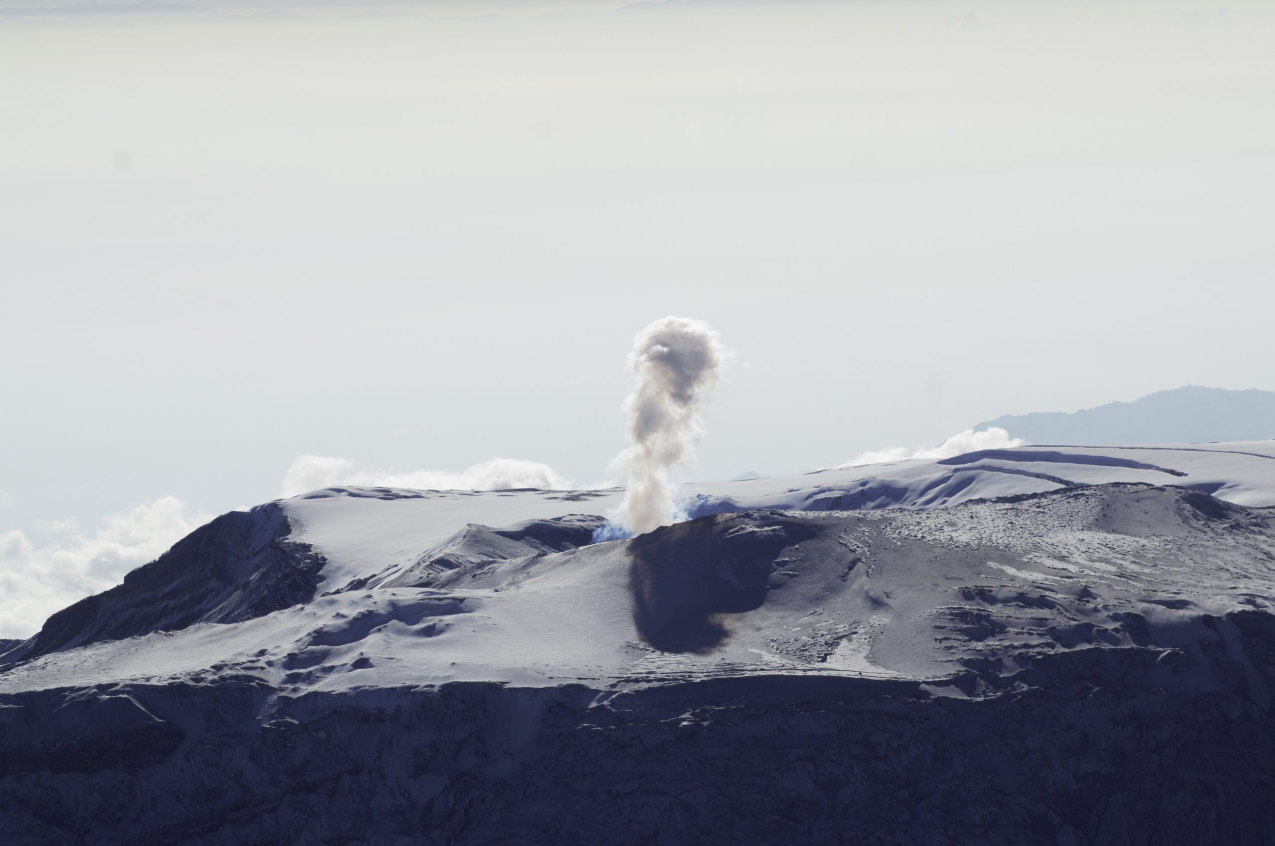
– Seismicity associated with fluid dynamics within the volcanic conduits has shown a slight decrease, both in the number of earthquakes and in the seismic energy released. This seismic activity was characterized by short-duration signals, with energy levels remaining low. As in previous weeks, no ash emissions or changes in the apparent temperature of the gas column were recorded.
– At the volcano, the emission of water vapor and volcanic gases—primarily sulfur dioxide (SO₂)—into the atmosphere continued from the Arenas crater. The estimated SO₂ flux, linked to degassing processes, showed a slight increase compared to the previous week. Additional observations, conducted via satellite platforms, confirmed the persistence of low-level SO₂ emissions.
– The vertical height of the gas and water vapor column reached a maximum of 900 m above the volcano’s summit, though it generally remained below 700 m. The dispersion direction of the column was variable, with a tendency toward the northwest and southeast flanks of the volcano.
– Monitoring of thermal anomalies at the bottom of the Arenas crater, carried out via satellite platforms, was limited by cloud cover in the area. Nevertheless, a few low-energy anomalies were recorded.
Source et photo : SGC.
Indonesia , Karangetang :
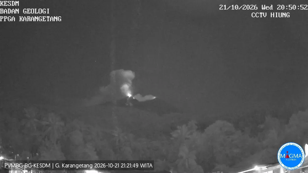
An eruption of Mount Karangetang, in North Sulawesi, occurred on Wednesday, October 21, 2026, at 8:47 p.m. (Central Indonesian Time, WITA). A column of ash was observed, reaching a height of approximately 800 meters above the summit (about 2,584.0 meters above sea level). This dense, white-to-gray column drifted toward the north and northeast. The eruption was recorded on a seismogram with a maximum amplitude of 50.0 mm and an initial duration of approximately 175.0 seconds. At the time this report was written, the eruption was still ongoing.
Seismic data
27 harmonic tremors, with an amplitude of 4.0 to 50.0 mm and a duration of 30.0 to 309.0 seconds.
22 rockfall-related seismic events, with an amplitude of 3.0 to 10.0 mm and a duration of 30.0 to 106.0 seconds.
5 distant tectonic earthquakes, with an amplitude of 5.0 to 50.0 mm and a duration of 55.0 to 114.0 seconds.
8 deep volcanic earthquakes, with an amplitude of 4.0 to 50.0 mm and a duration of 8.0 to 23.0 seconds.
1 eruption-related seismic event, with an amplitude of 50.0 mm and a duration of 39.0 seconds.
47 non-harmonic tremors, with an amplitude of 2.0 to 50.0 mm and a duration of 28.0 to 231.0 seconds.
4 shallow volcanic earthquakes, with an amplitude of 2.0 to 13.0 mm and a duration of 6.0 to 11.0 seconds.
3 local tectonic earthquakes, with an amplitude of 4.0 to 50.0 mm and a duration of 30.0 to 40.0 seconds.
92 emission-related seismic events, with an amplitude of 5.0 to 50.0 mm and a duration of 23.0 to 117.0 seconds.
Recommendations
(1) The public, as well as visitors and tourists, are advised not to approach, hike in, or engage in any activities within the designated danger zone—defined as a 1.5 km radius around the summits of Kawah Dua (the northern crater) and the main crater (to the south), as well as an extended sectoral zone reaching 2.5 km in a south-southwesterly direction.
Source et photo : PVMBG.
Guatemala , Fuego :
Atmospheric conditions: Clear sky
Wind: From the southeast
Precipitation: 3.3 mm
Activity
During the night and early morning hours, low- to moderate-intensity degassing was recorded; fumaroles reached approximately 200 meters above the crater and dispersed toward the northwest. Explosive activity continued at a rate of 4 to 8 explosions (of low to moderate intensity) per hour, generating ash plumes that rose between 4,300 and 4,800 meters above sea level and drifted toward the west and northwest. This activity resulted in fine ashfall in Yepocapa and surrounding localities.
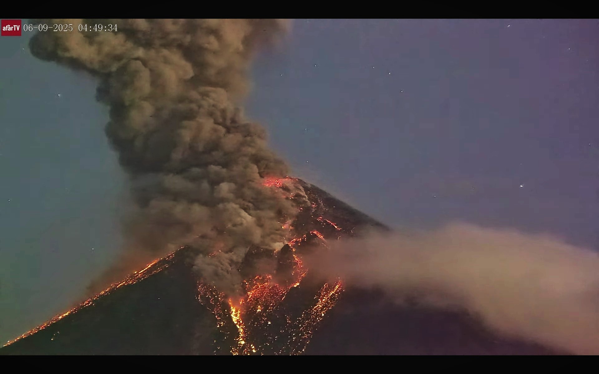
Incandescent material was observed being ejected up to 200 meters above the crater, accompanied by minor avalanches. Furthermore, incandescent debris fell around the crater and channeled into the Ceniza, Taniluyá, Seca, Santa Teresa, Trinidad, and Las Lajas ravines, in some instances reaching the edge of the vegetation zone.
Due to the rainy season and the accumulation of material within the ravines, the risk of lahars persists, particularly during the afternoon and evening. It is advised to stay away from the areas surrounding the volcano’s ravines and to follow the instructions provided in special bulletin BEFG0-013-2026.
Source : Insivumeh.
Photo : Afar tv.
Alaska , Great Sitkin :
Lava continues to erupt slowly within the summit crater of Great Sitkin Volcano. A few small earthquakes were detected in the past day. No activity observed in partly cloudy satellite and webcam views over the past day.
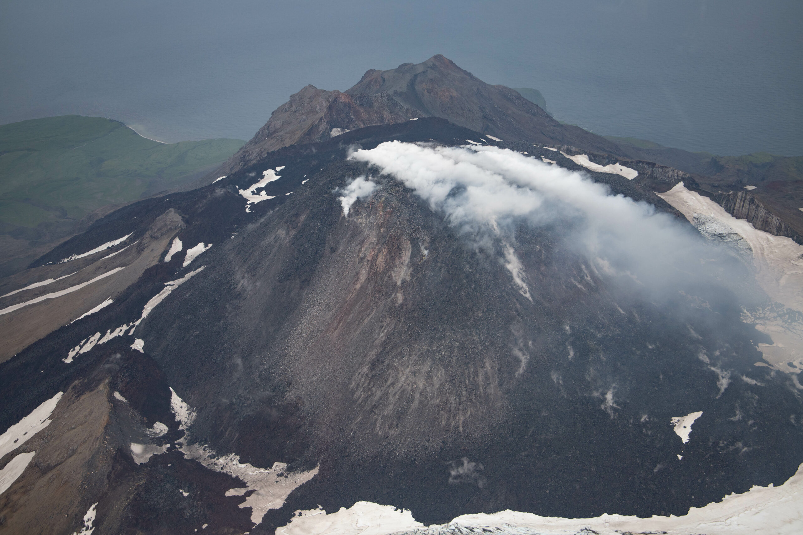
The current eruption began in July 2021. Since then, lava flows have filled most of the summit crater and advanced into valleys below. There have been no explosions at Great Sitkin Volcano since an event in May 2021. The volcano is monitored using local seismic and infrasound sensors, satellite data, webcams, and regional infrasound and lightning networks.
Source : AVO.
Photo : Hannah Dietterich / AVO/USGS .