October 19 , 2026.
Hawaii , Kilauea :
HAWAIIAN VOLCANO OBSERVATORY DAILY UPDATE , U.S. Geological Survey
Saturday, October 17, 2026, 9:50 AM HST (Saturday, October 17, 2026, 19:50 UTC)
19°25’16 » N 155°17’13 » W,
Summit Elevation 4091 ft (1247 m)
Current Volcano Alert Level: WATCH
Current Aviation Color Code: ORANGE
Summary:
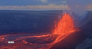
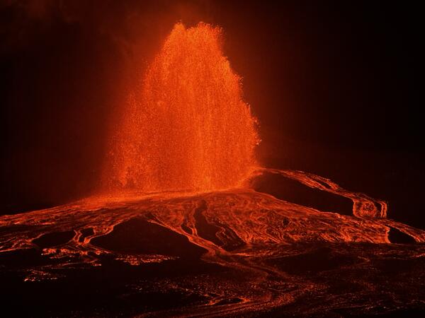
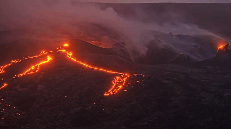
Episode 55 fountaining began from the north vent at 3:19 a.m. HST this morning and ended at 9:03 a.m. HST. Fountains reached a maximum height of 720 feet (220 m) around 5 a.m. HST.
Summit Observations:
Lava fountain episode 55 in Halemaʻumaʻu at the summit of Kīlauea began at 3:19 a.m. HST October 17, 2026, and ended at 9:03 a.m. HST on October 17, 2026, after about 6 hours of continuous fountaining from the north vent.
The onset of episode 55 fountain began at 3:19 a.m. HST as fountains from the north vent began to rapidly increase in height. Maximum fountain heights of 720 feet (220 m) were recorded between 4:50 and 5:10 a.m. HST with the plume cloud reaching up to 25,000 feet (7500 m) above sea level (a.s.l.) during that time. The fountain dropped quickly back to 650 feet and then to 500 feet by 7:00 a.m. HST this morning and was down to about 300 feet (100 m) high by 8:00 a.m. HST. Likewise, the plume cloud dropped to under 13,000 feet (4000 m) a.s.l. by 7:30 a.m. HST. Waning behavior was noted at around 8:50 a.m. and by 9:03 a.m. fountaining had ended. This was accompanied by a return of inflationary tilt patterns and a decrease in summit RSAM. The instantaneous effusion rate peaked at about 1000 cubic yards (770 cubic meters) per second at approximately 5:00 a.m. HST, with an average effusion rate of 380 cubic yards (290 cubic meters) per second for the entire fountaining episode. Preliminary estimates indicate about 9 million cubic yards (7 million cubic meters) of lava erupted during this episode. The repose period leading up to episode 55 was the longest and most complex since the eruption began on December 23, 2024. Initial precursory flows erupted on September 7 preceding episode 55 fountains by 39 days. The next longest period of precursory activity was 6 days. The repose period prior to episode 55 included a series of new vents opening up on September 14-16 along the base of the cliffs on the west side of Halemʻamaʻu as well as an intrusion beneath the northwestern part of Kaluapele September 30 to October 1.
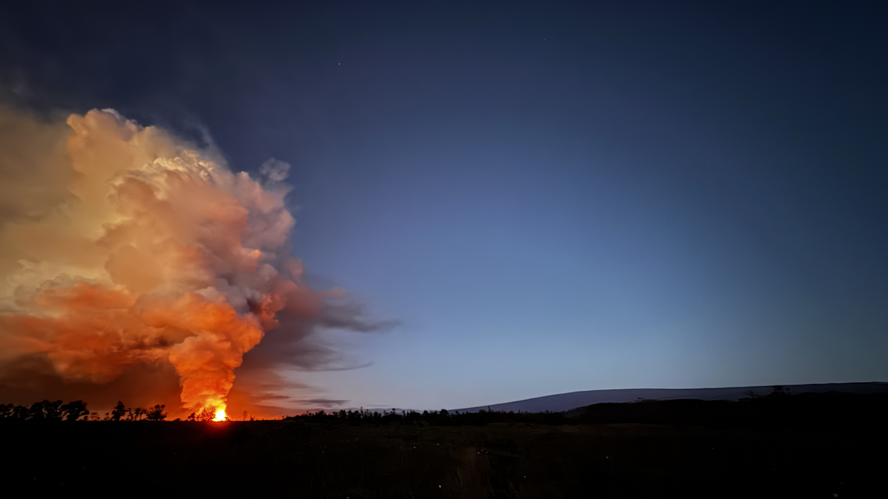
Lava flows flooded the western part of Halema’uma’u crater and by 8:30 a.m. HST were covering 75% of the crater floor. Fountaining was preceded by continuous overflows from the south vent that began at 5:56 a.m. HST on October 16 and continued until the start of fountaining from the north vent early this morning. Intermittent overflows began from the north vent at 6:11 p.m. HST on October 16 and after 6 small flows started to erupt continuously at 11:35 p.m. last night. Rare overflows from the west vent began at 10:49 p.m. HST last night, with three small overflows preceding the onset of continuous eruption of lava at 2:23 a.m. HST. The north vent fountains doubled in size right around 3:19 a.m. HST at the onset of episode 55, while the south and west vents had small dome fountains that continued to feed flows. The south vent overflows ended at 3:55 a.m. HST while the west vent fountains and overflows were drowned by the north vent at 4:13 a.m. HST.
Tremor had been continuous and steady throughout most of yesterday but began to increase around 2:45 a.m. HST this morning. By 3:19 a.m. HST background tremor measured by RSAM indicate that the intensity of tremor had doubled at the same time rapid deflationary tilt started at the summit. This along with the doubling of the north vent fountain height defined the onset of episode 55 fountaining even though the fountain was less than 100 feet (30 m) high at the time. Tremor rapidly increased to about 10 times background by 4:30 a.m. HST about 20 minutes prior to the fountain reaching its maximum height of 720 feet. Tremor slowly dropped since that time, until the end of fountaining at 9:03 a.m., when it decreased to lower values typical of the immediate post-fountaining period. There were 22 small earthquakes beneath the summit region in the last 24 hours, but only 3 of those occurred in the last 8 hours.
The Uēkahuna (UWD) tiltmeter recorded gradual inflationary tilt throughout the day yesterday until it plateaued around midnight. The tiltmeter recorded minor deflationary tilt beginning around 1:30 a.m. HST. Rapid deflationary tilt began at 3:19 a.m. when the summit magma chamber began to rapidly deflate at the onset of episode 55 fountaining. This quickly turned to inflationary tilt once again with the end of fountaining at 9:03 a.m., as is typically observed following fountaining episodes.
During fountain episodes, the sulfur dioxide (SO2) emission rate from the summit typically 100,000 tonnes per day. Plumes of volcanic gas and tephra reached as high as 25,000 feet (7000 m) above sea level but dropped rapidly to under 20,000 feet above sea level. Winds below 20,000 feet were out of the northeast, pushing the plume to the southwest. Most tephra fall is expected to occur southwest of the vent area within the closed area of Hawaiʻī Volcanoes National Park, but traces of fine ash and Peleʻs hair in Pāhala and possibly other communities to the southwest in Kaʻū. Sulfur dioxide (SO2) emission rates from the summit are expected to drop back to 1,000-5,000 tonnes per day.
Source : HVO.
Photos : USGS / K Mulliken ,
Italy , Stromboli :
Statement on Stromboli activity, October 18, 2026, 16:11 (14:11 UTC).
The National Institute of Geophysics and Volcanology (INGV), Osservatorio Etneo, reports that at 13:24 UTC, a partial collapse of a volcanic cone was observed in the area of the northern craters, triggering a moderate landslide of hot material. The rockfall was channeled along the Sciara del Fuoco and was accompanied by the falling of volcanic blocks.
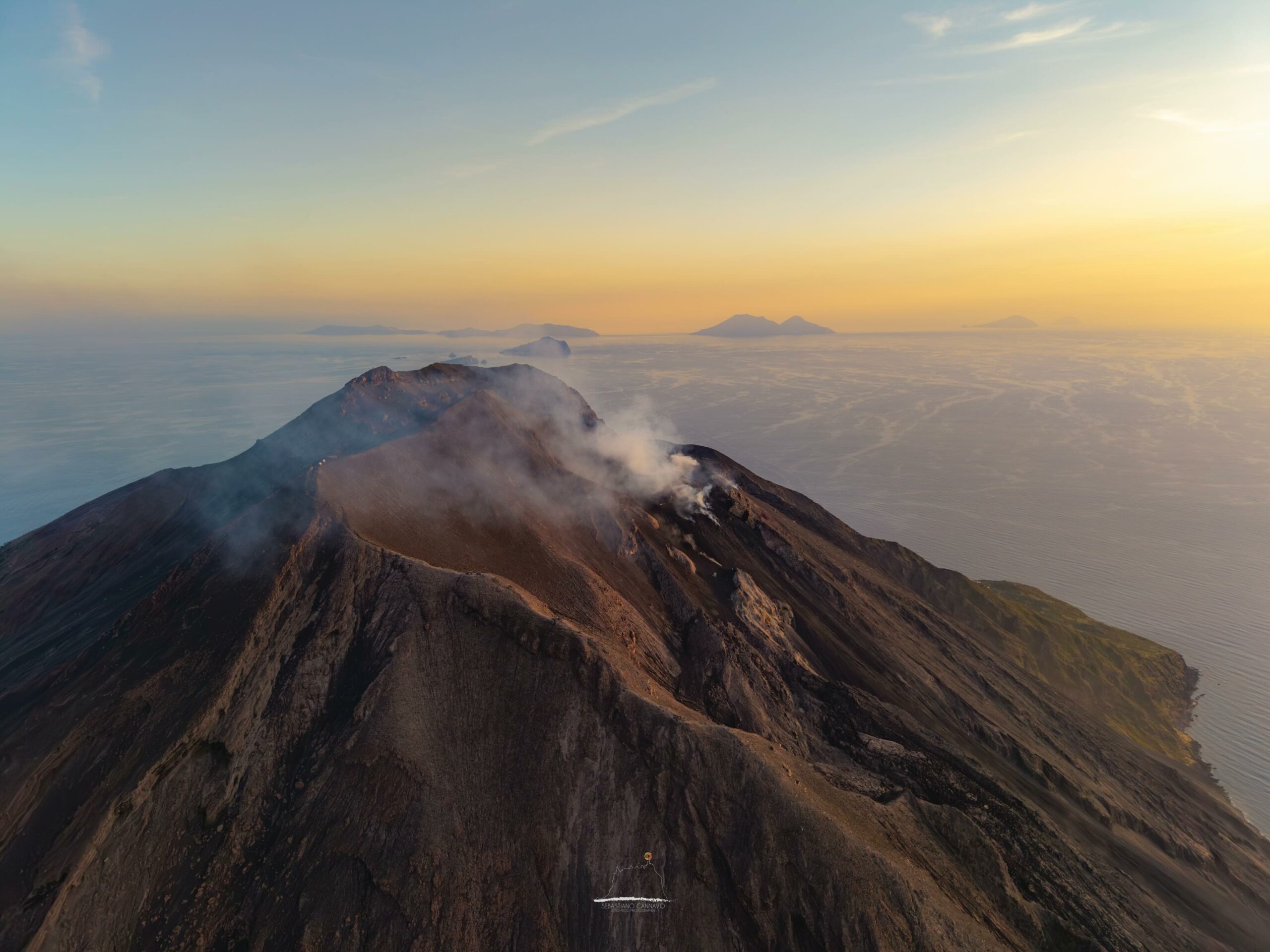
From a seismic perspective, a signal lasting approximately two minutes was recorded starting at 13:24 UTC, corresponding to this event. Volcanic tremor showed no significant variation. Regarding explosion-related earthquakes (« explosion quakes »), no changes were observed compared to previous hours.
Ground deformation monitoring networks (high-frequency GNSS and tiltmeter) show no significant variations.
Further updates will be provided as soon as possible.
Source : INGV.
Photo : Stromboli stati d’animo / Sebastiano Cannavo.
New Zealand , White Island :
Emission of weak steam and gas plumes with minor volcanic ash continues at Whakaari/White Island. Volcanic Alert Level remains at 2 and Aviation Colour Code remains at Yellow.
Published: Mon Oct 19 2026 4:00 PM
During the past few days, Whakaari/White Island volcano has continued to produce intermittent low-altitude plumes of steam and gas, with minor amounts of volcanic ash. The Volcanic Alert Level remains at 2 and the Aviation Colour Code remains at Yellow.
The emission of steam and gas plumes from Whakaari/White Island, discussed in our October 14th Volcanic Activity Bulletin, has continued and has been visible on GeoNet webcams and from the Bay of Plenty coast. Throughout Saturday and Sunday plumes were clearly seen, and on those days, minor amounts of volcanic ash were present in the steam-rich cloud. Ash was detected by satellite imagery, but volcanic sulphur dioxide gas has not been detected since mid-last week.
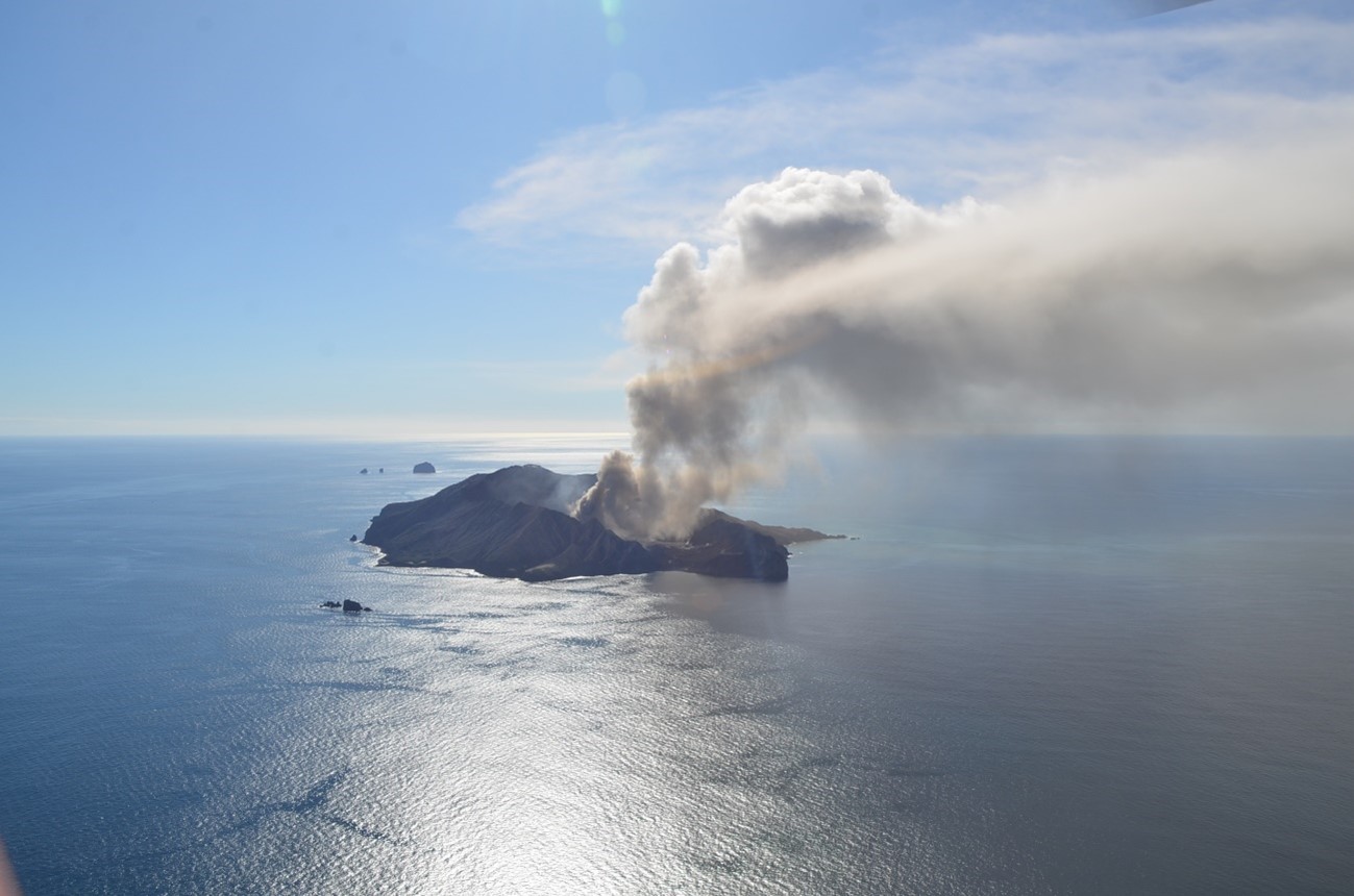
Today, light wind and hazy conditions partly obscure the views from our Whakatane and Te Kaha sites, but high plumes are still being observed. Satellite images confirm that steam and gas discharge has been intermittent and contained minor amounts of volcanic ash. While the emissions appear to have declined since the weekend, more may occur from time to time in the coming days.
The unrest state of Whakaari/White Island has been reviewed and will remain at Volcanic Alert Level 2 and Aviation Colour Code Yellow. Minor ashfall is likely occurring on and near the island, and is not affecting the mainland. People might smell the sulphur gases, during onshore winds.
Volcanic activity could escalate with little or no warning – sudden, more explosive events could affect the Main Crater floor and immediate vicinity of Whakaari/White Island.
Earth Sciences New Zealand’s Volcano Monitoring Group and the National Geohazards Monitoring Centre will continue to closely monitor Whakaari/White Island for any changes in activity. We will provide further updates when information becomes available or the status changes.
Source : Geonet / Michael Rosenberg / Duty Volcanologist
Photo : Bradd Scott / Geonet ( archive).
Indonesia , Ibu :
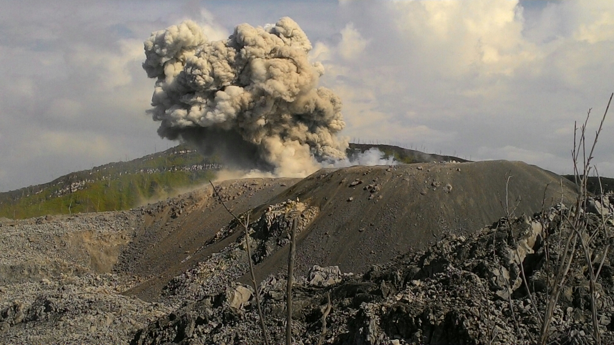
An eruption of Mount Ibu occurred on Monday, October 19, 2026, at 09:06 WIT (Eastern Indonesian Time). The observed ash column reached a height of approximately 600 meters above the summit (about 1,925 meters above sea level). This gray-colored, moderately intense column drifted toward the northwest. The eruption was recorded by a seismograph, showing a maximum amplitude of 28 mm and a duration of 44 seconds.
Seismic observations:
101 eruption earthquakes, with an amplitude of 15–28 mm and a duration of 31–69 seconds.
1 rockfall earthquake, with an amplitude of 3 mm and a duration of 43 seconds.
3 emission earthquakes, with an amplitude of 4–7 mm and a duration of 32–41 seconds.
8 harmonic tremors, with an amplitude of 2–12 mm and a duration of 41–76 seconds.
134 low-frequency earthquakes, with an amplitude of 2 to 10 mm and a duration of 17 to 29 seconds.
167 shallow volcanic earthquakes, with an amplitude of 2 to 6 mm and a duration of 7 to 21 seconds.
2 deep volcanic earthquakes, with an amplitude of 2 to 28 mm and a duration of 42 to 119 seconds.
1 local tectonic earthquake, with an amplitude of 2 mm and a duration of 32 seconds.
12 distant tectonic earthquakes, with an amplitude of 2 to 28 mm and a duration of 42 to 103 seconds.
Recommendations
1. Populations living in the vicinity of Mount Ibu, as well as visitors and tourists, are advised to refrain from any activity within a 2 km radius of the active crater—a distance that extends to 3.5 km in the direction of the crater opening.
2. In the event of ashfall, individuals who are outdoors are advised to protect their nose and mouth (using masks) and their eyes (using protective eyewear).
Source : PVMBG.
Photo : J. Massolo.( archive).
Ecuador , Sangay :
DAILY STATUS REPORT FOR SANGAY VOLCANO, Sunday, October 18, 2026.
Information from the Geophysical Institute – EPN.
Surface activity level: Moderate; Surface trend: Unchanged
Internal activity level: Low; Internal trend: Unchanged
Seismicity: From October 17, 2026, 11:00 AM to October 18, 2026, 11:00 AM:
Seismicity:
The following is the count of seismic events recorded at the reference station:
Explosion (EXP): 5
Long-period (LP): 4
Emission tremor (TREMI): 7
Rainfall / Lahars:
No precipitation has been recorded in the vicinity of the volcano. **In the event of heavy rainfall, accumulated materials could be remobilized, generating mud and debris flows that would descend the volcano’s flanks and reach adjacent watercourses.**
Emission Plume / Ash:
The surveillance camera system captured several gas and ash emissions; the plumes reached heights ranging from 500 to 2,000 meters above the crater, moving toward the west. In connection with this activity, the Washington VAAC issued three reports regarding emissions with plumes rising between 500 and 1,500 meters above the crater, drifting toward the west and northwest.
Gas:
The MOUNTS satellite system detected 192.8 tonnes of sulfur dioxide (SO2), measured yesterday at 13:37 (local time).
Other Monitoring Parameters:
The VIIRS 750 satellite system recorded 3 thermal anomalies, the VIIRS 375 system recorded 4, and the MODIS system detected 1; additionally, the FIRMS satellite system recorded 17 thermal anomalies.
Observation:
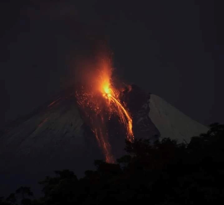
Throughout the afternoon and overnight, the surveillance camera system observed the descent of incandescent material. At the time this report was written, the volcano is obscured by clouds.
Sources : Instituto Geofísico-Escuela Politécnica Nacional (IG-EPN), Secretaría de Gestión de Riesgos (SGR) .
Photo : Diego Cárdenas