October 18 , 2026.
Hawaii , Kilauea :
HVO/USGS Volcanic Activity Notice
Current Volcano Alert Level: WATCH
Current Aviation Color Code: ORANGE
Issued: Saturday, October 17, 2026, 3:43 AM HST
Source: Hawaiian Volcano Observatory
Notice Number: 2026/H488
Location: N 19 deg 25 min W 155 deg 17 min
Elevation: 4091 ft (1247 m)
Area: Hawaii
Summary:
Episode 55 of the ongoing Halemaʻumaʻu eruption began at 3:19 AM HST on October 17, 2026.
Volcanic Activity:
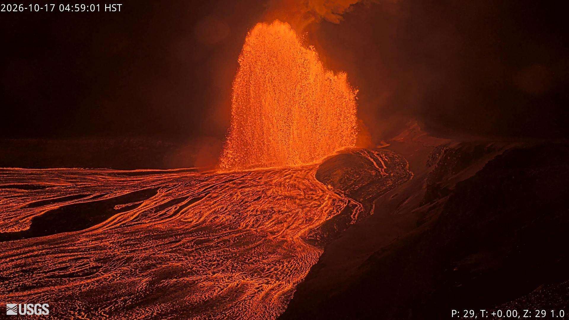
Episode 55 of lava fountaining in Halemaʻumaʻu began at the summit of Kīlauea began at 3:19 AM HST on October 17, 2026.
Fountain heights are relatively low at about 100-150 feet (30-45 m), and it is not clear whether this episode will evolve to the same heights as previous episodes. Continuous overflows from the vents began yesterday, October 16, just before 6 a.m. HST and transitioned into episode 55 fountains at 3:19 a.m. HST this morning. The current forecast is for winds are blowing from the north-northeast direction, which suggests that volcanic gas emissions and volcanic material may be distributed to the south-southwest direction from Halemaʻumaʻu.
Issued: Saturday, October 17, 2026, 9:11 AM HST
Source: Hawaiian Volcano Observatory
Notice Number: 2026/H489
Location: N 19 deg 25 min W 155 deg 17 min
Elevation: 4091 ft (1247 m)
Area: Hawaii
Summary:
Episode 55 of the ongoing Halemaʻumaʻu eruption ended abruptly at 9:03 a.m. HST on October 17, 2026.
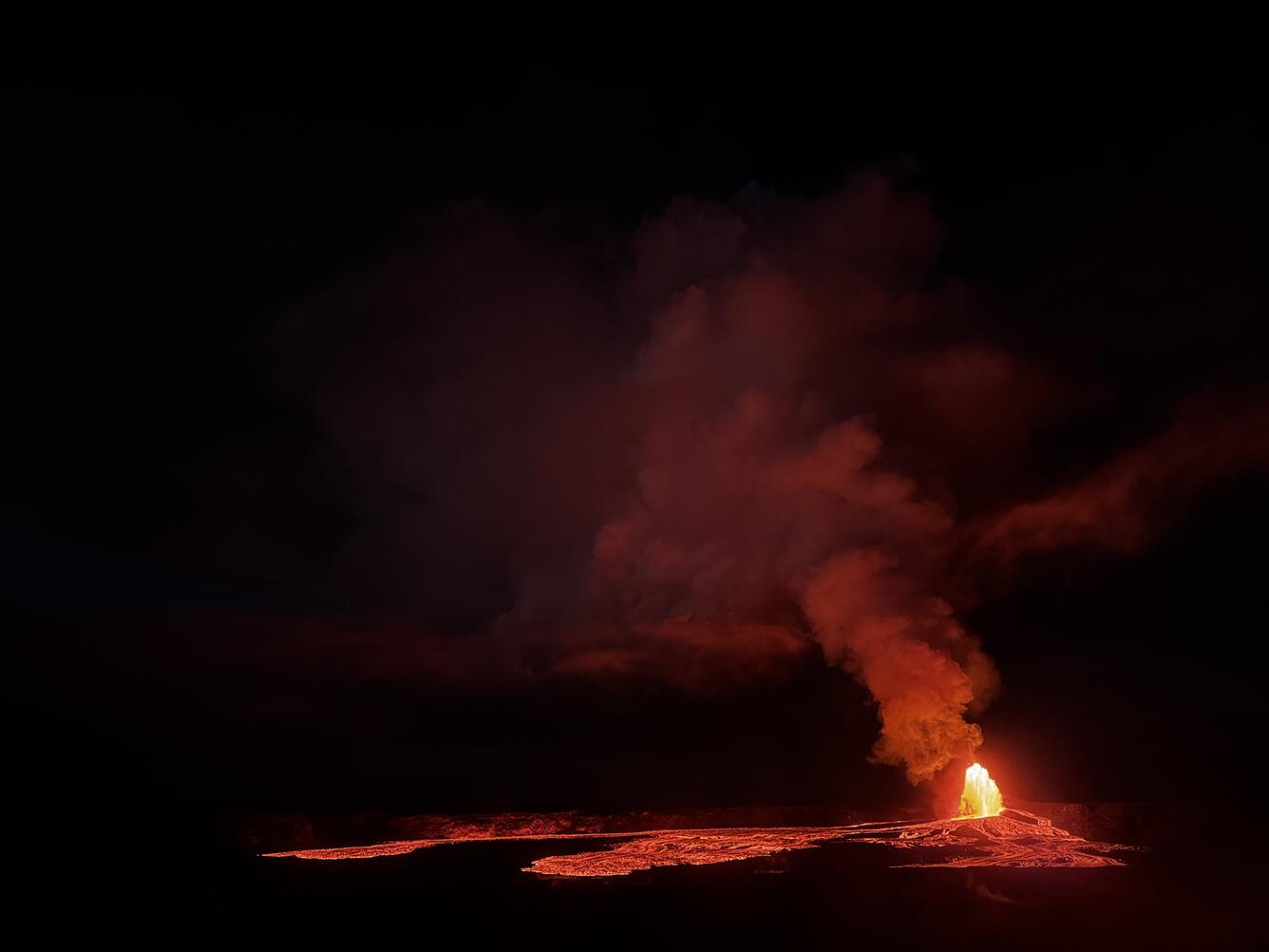
After nearly two months since episode 54 of lava fountaining (Aug. 25, 2026), episode 55 of Kīlauea summit lava fountaining began at 3:19 a.m. HST on October 17, 2026. This is the 55th lava fountaining episode in the Kīlauea summit caldera eruption in Hawai‘i Volcanoes National Park that began on December 23, 2024. It occurs following weeks of intermittent spatter, low-dome fountains, and lava flows from the eruptive vent complex.
Volcanic Activity:
Episode 55 of the ongoing Halemaʻumaʻu eruption ended abruptly at 9:03 a.m. HST on October 17, 2026 after about 6 hours of continuous lava fountaining. Additional details on this eruptive episode will be provided in the next official report.
All eruptive vents and lava flows are confined to Halemaʻumaʻu crater within Hawaiʻi Volcanoes National Park. Tephra fall from volcanic ash clouds is greatest within 3 miles (5 km) of the vents, lighter ash and Pele’s Hair may stay suspended for large distances from the vents.
Source : HVO.
Photos : USGS , USGS / K. Mulliken.
Martinique , Mount Pelée :
Weekly Report, Institut de Physique du Globe de Paris / Martinique Volcanological and Seismological Observatory
Saint-Pierre, October 16, 2026, at 14:30 local time (GMT-4)
Volcanic seismic activity
Between October 9, 2026, at 16:00 (UTC) and October 16, 2026, at 16:00 (UTC), the OVSM recorded 62 earthquakes of volcanic origin:
– 59 volcano-tectonic earthquakes. 3 of these earthquakes had a magnitude (local magnitude Mlv or duration magnitude Md) greater than 1. The largest had a magnitude of Mlv = 1.34; the others were of lower energy. These earthquakes were located at depths between 0.8 and 2 km below the volcano’s summit.
– 3 hybrid-type earthquakes. These were located at a depth of 0.9 km below the volcano’s summit. The largest had a magnitude of Mlv = 0.88; the others were of lower energy.
No earthquakes were reported as felt by the population.
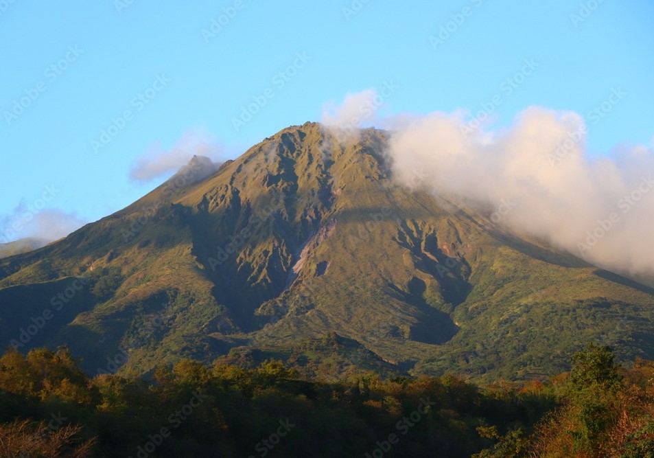
During the previous week, the OVSM recorded 145 volcanic earthquakes. As of October 16, 2026, and over the past four weeks, the OVSM has observed a total of 631 volcanic earthquakes—an average of 157 to 158 per week.
Deformations of Mount Pelée
Since May 2026, the OVSM has been recording ground displacements of several centimeters in the summit area of Mount Pelée. In the deformation zones near the summit, the maximum elongation recorded over the last four weeks is 0.7 cm (along an 880-meter-long profile). These displacements are consistent with a deformation of the volcanic edifice caused by an inflating pressure source located at a depth of approximately 1 km beneath the summit.
The probability of eruptive activity in the short term remains low. However, given the observations gathered over recent months and years, an evolution of the situation in the medium term (weeks to months) cannot be ruled out.
The volcanic alert level, in accordance with the protocols established by the authorities, is currently YELLOW: vigilance.
Source et photo : OVSM-IPGP
Indonesia , Anak Krakatau :
VOLCANO OBSERVATORY NOTICE FOR AVIATION – VONA
Issued : October 18 , 2026
Volcano : Anak Krakatau (262000)
Current Aviation Colour Code : ORANGE
Previous Aviation Colour Code : orange
Source : Anak Krakatau Volcano Observatory
Notice Number : 2026KRA034
Volcano Location : S 06 deg 06 min 07 sec E 105 deg 25 min 23 sec
Area : Lampung, Indonesia
Summit Elevation : 502 FT (157 M)
Volcanic Activity Summary :
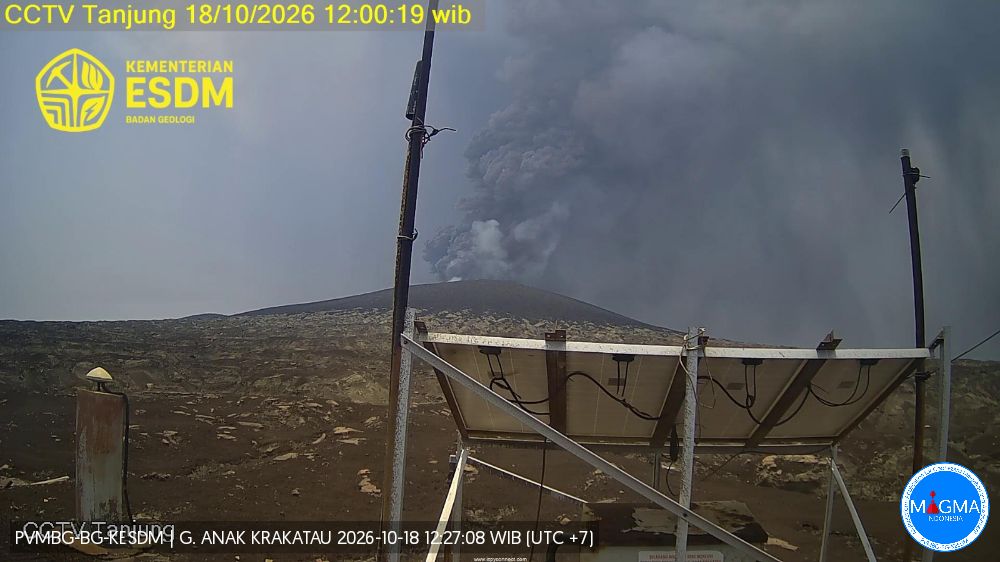
Eruption with volcanic ash cloud at 05h03 UTC (12h03 local).
Volcanic Cloud Height :
Best estimate of ash-cloud top is around 2102 FT (657 M) above sea level or 1600 FT (500 M) above summit. May be higher than what can be observed clearly. Source of height data: ground observer.
Other Volcanic Cloud Information :
Ash cloud moving to north. Volcanic ash is observed to be dark. The intensity of volcanic ash is observed to be thick.
Remarks :
Eruption and ash emission is continuing. Eruption recorded on seismogram with maximum amplitude 55 mm. Tremor recorded on seismogram with maximum amplitude 20 mm.
Seismic observations
5 eruption-related earthquakes, with amplitudes ranging from 48 to 56 mm and durations from 23 to 674 seconds.
6 emission-related earthquakes, with amplitudes ranging from 13 to 48 mm and durations from 20 to 49 seconds.
12 hybrid/polyphase earthquakes, with amplitudes ranging from 4 to 30 mm and durations from 5 to 15 seconds.
3 shallow volcanic earthquakes, with amplitudes ranging from 9 to 42 mm and durations from 7 to 10 seconds.
5 deep volcanic earthquakes, with amplitudes ranging from 41 to 55 mm and durations from 11 to 23 seconds.
1 continuous tremor, with an amplitude ranging from 0.5 to 15 mm (dominant amplitude: 2 mm).
Recommendations
1. Populations living in the vicinity of the Anak Krakatau volcano, as well as visitors, tourists, and hikers, are prohibited from entering or conducting any activities within a 5 km radius of the Anak Krakatau eruptive center.
2. Populations living in the vicinity of the Anak Krakatau volcano, as well as visitors and tourists, are prohibited from entering or conducting any activities within a 1 km radius of the new islands located in the northwest and southeast sectors of the Anak Krakatau volcano.
Source et photo : PVMBG.
Costa Rica , Poas :
Latitude: 10.20° N;
Longitude: 84.23° W;
Elevation: 2,687 m above sea level
Current activity level: Warning
No eruptions were recorded this week. In general, tremor amplitude remains moderate, with little variation. No volcano-tectonic earthquakes were recorded this week. The number of long-period events remains stable, despite a temporary increase over the last few hours. No significant deformation has been observed.
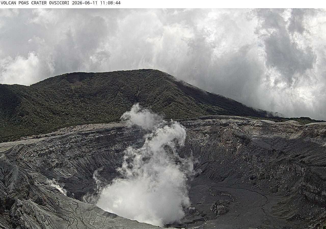
The Multi-GAS stations recorded an average SO2/CO2 ratio of 1.1 ± 0.5, a value comparable to that of the previous week (1.0 ± 0.4). The H2S/SO2 ratio remains below 0.1. The NOVAC stations recorded 110 ± 75 tonnes of SO2 per day, with a maximum of 664 t/day. This flux is higher than that of the previous week (46 ± 31 tonnes of SO2 per day, with a maximum of 531 t/day); however, this apparent increase could be linked to wind directions that were more favorable for these measurements during the week.
The SENTINEL satellite continues to detect the SO2 plume almost daily, with an average value of approximately 50 tonnes and a peak of 191 tonnes of SO2 in the atmosphere on October 9. The level of the hyperacidic lake shows slight variations but remains generally stable. Similarly, precipitation can be heavy, though it remains sporadic.
Source et photo : Ovsicori.
Ecuador , El Reventador :
DAILY STATUS REPORT FOR REVENTADOR VOLCANO, Saturday, October 17, 2026.
Information from the Geophysical Institute – EPN.
Surface activity level: High; Surface trend: Unchanged
Internal activity level: Moderate; Internal trend: Unchanged
From October 16, 2026, 11:00 AM to October 17, 2026, 11:00 AM:
Seismicity:
Explosions (EXP): 88
Long-period (LP) events: 5
Emission tremors (TREMI): 7
Harmonic tremors (TRARM): 4
Precipitation / Lahars:
No precipitation has been recorded in the area. **Heavy rainfall could remobilize accumulated materials and trigger debris-laden mudflows (lahars) that may descend the volcano’s flanks and flow into adjacent rivers.**
Emission plumes / ash:
The surveillance camera system captured several gas and ash emissions. The plumes reached heights ranging from 300 to 800 meters above the crater, drifting toward the west and west-southwest. In connection with this activity, the Washington VAAC issued three reports regarding these emissions; in each instance, the plume reached a height of 1,000 meters above the crater, with a trajectory toward the west and west-northwest.
Observation:
From yesterday afternoon until the time this report was written, the volcano remained largely clear. Throughout last night and early this morning, cameras captured incandescence at the crater, as well as the descent of incandescent material reaching as far as 1,100 meters below the crater.
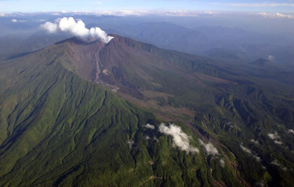
Alert Level – SGR: Orange
Source et photo : IGEPN.