October 11 , 2026.
Philippines , Kanlaon :
Mount Kanlaon erupts, spewing a massive ash column in the Philippines!
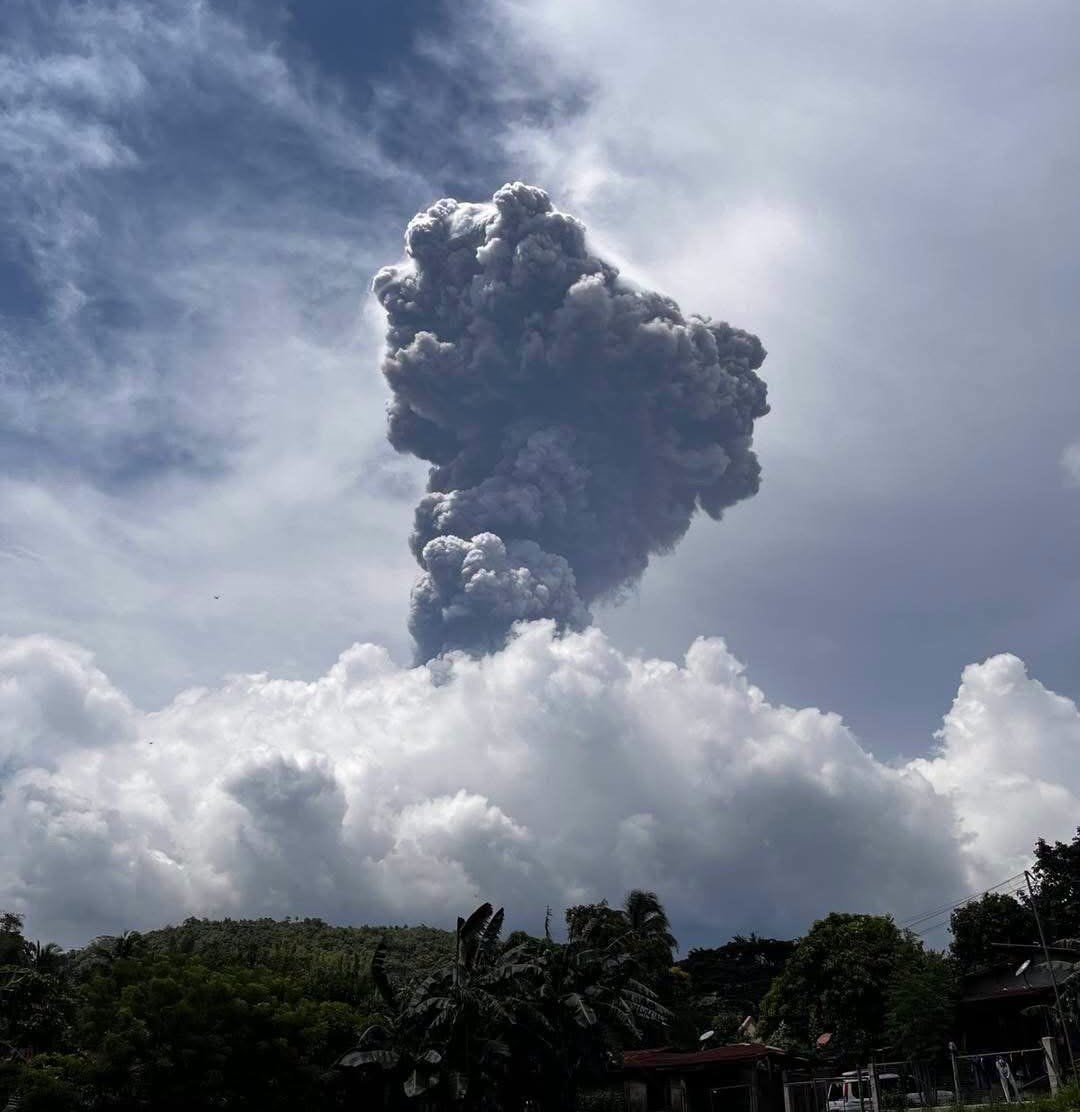
A new eruption has rocked Mount Kanlaon on Negros Island in the Philippines. The event occurred on October 10, 2026, generating an ash column that reached a height of 5 to 6 kilometers above the crater, while volcanic fallout began to affect surrounding areas.
The explosion lasted about two minutes, but ash emissions continued after the initial event. This particle fallout can hinder breathing, irritate the eyes, and reduce visibility in communities near the volcano.
Kanlaon remains at alert level 2, and authorities are maintaining access restrictions to hazardous areas. The public is advised to stay away from the volcano and to take precautions against ashfall.
Although no major eruption has been confirmed, specialists continue to monitor activity due to the possibility of further episodes.
Sources : Alerta mundial / FB.
Photo : Balisong Channel.
Colombia , Nevado del Ruiz :
Manizales, October 6, 2026, 5:30 PM.
As part of the monitoring of activity at the Nevado del Ruiz volcano, the Colombian Geological Service (SGC)—an agency affiliated with the Ministry of Mines and Energy—reports the following:
During the week of September 29 to October 5, 2026, the volcano continued to exhibit unstable behavior. Compared to the previous week, the main variations in the monitored parameters were as follows:
– Seismicity associated with fluid dynamics within the volcanic conduits showed an increase in the number of earthquakes, while the level of released seismic energy remained similar. This seismic activity was characterized by short-duration, low-energy signals. As in previous weeks, no long-duration seismic signals were recorded, and no ash emissions or changes in the apparent temperature of the gas column were confirmed.
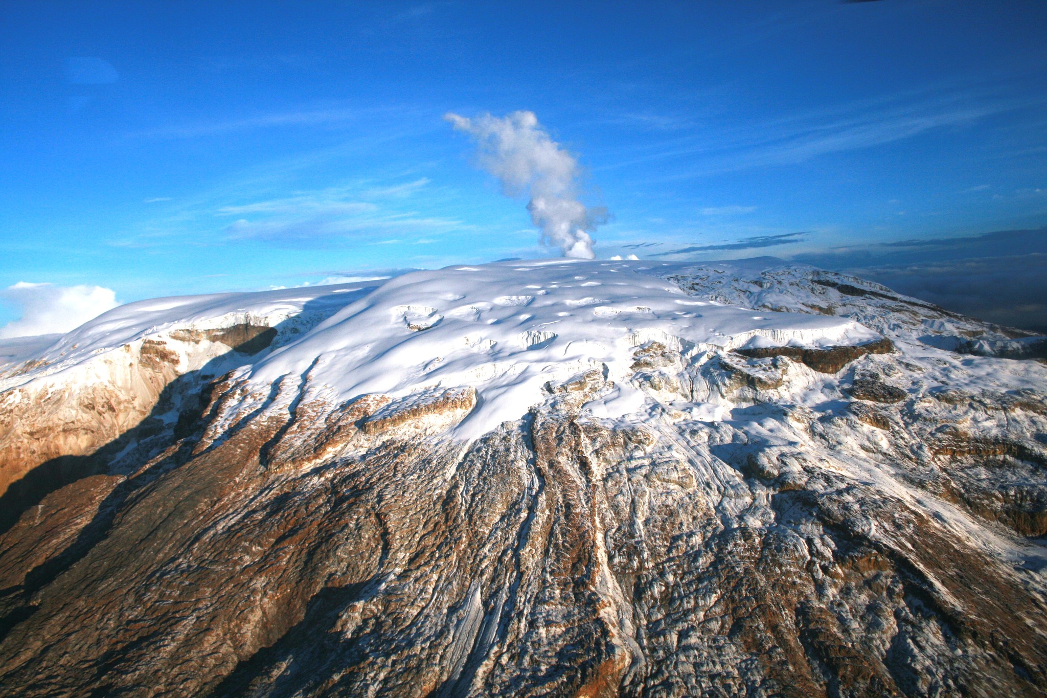
– Seismic activity associated with rock-fracturing processes within the volcanic edifice decreased—in terms of both the number of recorded earthquakes and released seismic energy—compared to the previous week. Earthquakes were located primarily within the Arenas crater and on the south-southwest, south, and southeast flanks, within 3 km of the crater. To a lesser extent and in a scattered pattern, earthquakes were recorded in other sectors, up to 12 km from the crater. Event depths ranged from less than 1 km to 6 km below the volcano’s summit. The recorded events showed low energy levels (magnitudes below 1.0). – Emissions of water vapor and volcanic gases—primarily sulfur dioxide (SO₂)—into the atmosphere continued from the Arenas crater. The estimated SO₂ flux associated with degassing processes decreased compared to the previous week. Supplementary monitoring using satellite data platforms continued to show low levels of SO₂ emissions.
– The vertical height of the gas and water vapor plume reached a maximum of 900 m above the volcano’s summit, though it generally remained below 600 m. The plume’s dispersion direction varied, with a prevailing trend toward the volcano’s southwest and northwest flanks.
– Monitoring of thermal anomalies at the bottom of the Arenas crater via satellite platforms was limited on some days by cloud cover. Nevertheless, low-energy anomalies were recorded.
Source et photo : SGC.
Costa Rica , Rincón de la Vieja :
OVSICORI-UNA Weekly Volcanic Monitoring Bulletin
October 9, 2026
Latitude: 10.83° N;
Longitude: 85.34° W;
Elevation: 1,916 m above sea level.
Current activity level: Caution.
During this week, 12 eruptions were recorded; only one exceeded an acoustic magnitude of 4 (moderate). Most of these eruptions were of low magnitude. The eruption on October 4 at 9:20 a.m. registered the highest acoustic magnitude of the week and did not trigger associated lahars. Frequent acoustic pulses associated with emissions of water vapor and volcanic gases (small eruptions) continued to be observed this week. A total of 130 very low-magnitude acoustic pulses were recorded. This activity is declining in terms of both amplitude and frequency.
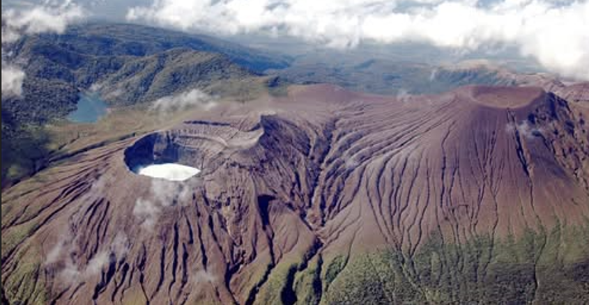
Twelve proximal and ten distal volcano-tectonic earthquakes (relative to the crater) were recorded. The proximal volcano-tectonic earthquakes are located at a depth of 1.5 km, according to data confirmed by OSIVAM-ICE. Background tremor is dominated by « banded tremor » sequences; it sometimes appears continuous. Amplitudes vary. The banded tremor sequences show variations in amplitude, duration, and the interval between tremors. The occurrence rate of long-period (LP) and « tornillo »-type seismic signals remains stable. The frequency of « tornillo »-type signals has increased over the past two weeks. In general, eruptions tend to occur when a significant decrease in low-frequency tremor amplitude is observed; this suggests the presence of a plug accumulating volatiles, the rupture of which ultimately triggers the eruption.
In the medium term (the last six months), a trend of subsidence has been observed at both the base and the summit of the volcano, accompanied by extension of the summit area and the base. The rapid summit uplift detected in September, as well as the associated contraction, have ceased. The MultiGAS station is recording a CO2/SO2 ratio of 2.6, a value comparable to the 2.1 recorded the previous week. The average SO2 flux for this week is 133 ± 77 t/d, with a maximum value of 1,694 t/d. These values are comparable to those of the previous week, when the average flux was 191 ± 130 t/d, with a maximum value of 139 t/d. However, it should be noted that these measurements are influenced by unfavorable wind directions. This week’s values remain above the volcano’s baseline level.
The most recent atmospheric SO2 detection by the Sentinel satellite dates back to October 1, 2026, with a mass of 68 tonnes.
Source et photo : Ovsicori .
Indonesia , Ibu :
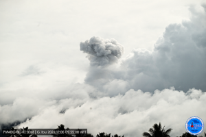
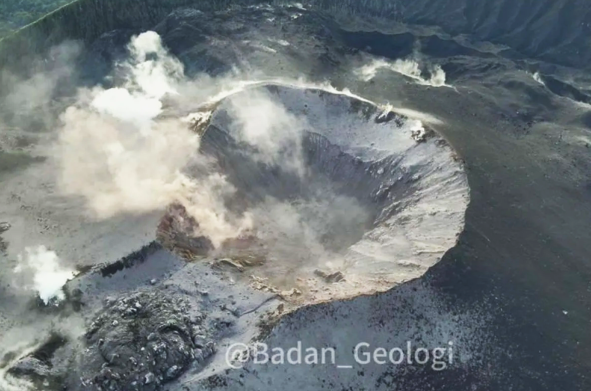
An eruption of Mount Ibu occurred on Sunday, October 11, 2026, at 07:32 WIT; the observed ash column reached a height of approximately 800 m above the summit (or about 2,125 m above sea level). This gray, moderately intense ash column drifted northward. The eruption was recorded by the seismograph with a maximum amplitude of 28 mm and a duration of 46.88 seconds.
Seismic observations
97 eruption-related earthquakes, with amplitudes of 10–28 mm and durations of 30–141 seconds.
1 rockfall-related earthquake, with an amplitude of 20 mm and a duration of 146 seconds.
3 emission-related earthquakes, with amplitudes of 4–15 mm and durations of 31–35 seconds.
23 episodes of harmonic tremor, with amplitudes of 2–28 mm and durations of 38–168 seconds.
106 low-frequency earthquakes, with amplitudes of 2–10 mm and durations of 17–29 seconds.
134 shallow volcanic earthquakes, with amplitudes of 2–6 mm and durations of 7–21 seconds.
4 deep volcanic earthquakes, with amplitudes of 2–4 mm and durations of 10–15 seconds.
18 distant tectonic earthquakes, with amplitudes of 2–28 mm and durations of 32–138 seconds.
Recommendations
1. Communities living near Mount Ibu, as well as visitors and tourists, are advised not to conduct any activities within a 2 km radius, nor within the 3.5 km sectoral extension zone stretching toward the crater opening on the northern flank of Mount Ibu’s active crater.
2. In the event of ashfall, individuals outdoors are advised to protect their nose and mouth (using masks) and their eyes (using protective eyewear).
Source et photo : PVMBG.
Ecuador , El Reventador :
DAILY STATUS REPORT FOR REVENTADOR VOLCANO, Saturday, October 10, 2026.
Information from the Geophysical Institute – EPN.
Surface activity level: High; Surface trend: Unchanged
Internal activity level: Moderate; Internal trend: Unchanged
From October 9, 2026, 11:00 AM to October 10, 2026, 11:00 AM:
Seismicity:
Explosions (EXP): 80
Long-period events (LP): 5
Emission tremor (TREMI): 11
Harmonic tremor (TRARM): 2
Precipitation / Lahars:
No precipitation was recorded in the area. **Heavy rains could remobilize accumulated material and generate debris-laden mudflows (lahars) capable of descending the volcano’s flanks and flowing into adjacent rivers.**
Emission plume / ash:
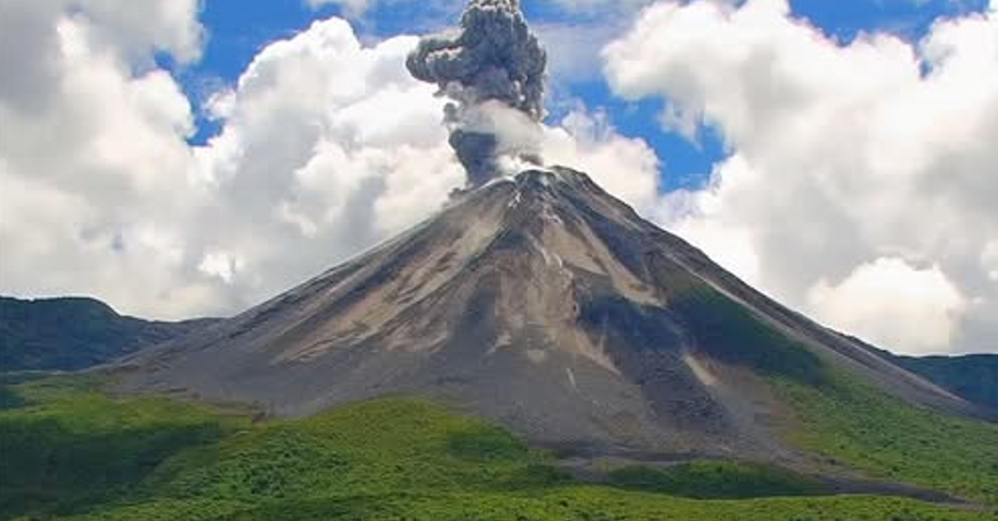
Surveillance cameras captured several gas and ash emissions, with plumes reaching heights of 300 to 1,000 meters above the crater rim, drifting westward. In connection with this activity, the Washington VAAC issued four reports noting ash plumes reaching heights of 700 to 1,000 meters above the crater, drifting northwest and west-northwest.
Other monitoring parameters:
The MIROVA VIIRS satellite system detected four thermal anomalies, while the FIRMS satellite system reported six thermal anomalies.
Observation:
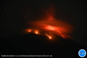
During the night and early morning hours, the camera system observed several episodes of crater incandescence as well as material descending up to 1,100 meters below the summit. At the time of this report, the volcano remained largely clear of clouds.
Alert Level – SGR: Orange
Source : IGEPN.
Photo : Afar tv.