October 3 , 2026.
Indonesia , Merapi :
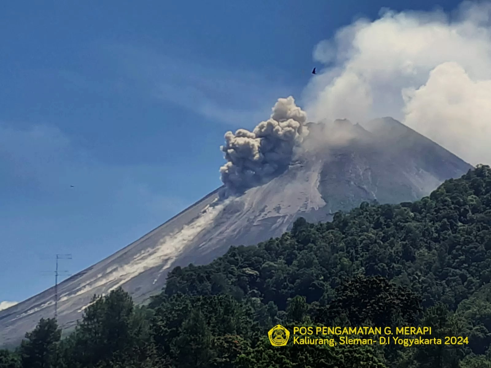
The Pusat Vulkanologi dan Mitigasi Bencana Geologi (PVMBG) reported that the eruption at Merapi (on Java) continued during 24-30 September with lava avalanches produced by the active lava dome on the upper SW flank. The seismic network recorded up to three lava avalanches per day that traveled as far as 2.5 km down the Sat/Putih drainage on the SW flank and the Boyong drainage on the S flank. The Alert Level remained at 3 (on a scale of 1-4), and the public was warned to stay 3-7 km away from the summit, based on location.
Seismic observations
11 earthquakes associated with rockfalls, with amplitudes of 2–20 mm and durations of 50.21–144.7 seconds.
21 hybrid/multiphase earthquakes, with amplitudes of 2–34 mm and durations of 12.57–32.01 seconds.
Recommendations
1. Current potential hazards include block avalanches and pyroclastic density currents (PDCs) in the south-southwest sector, extending up to 5 km along the Boyong River and up to 7 km along the Bedog, Krasak, and Bebeng rivers. In the southeast sector, hazards extend up to 3 km along the Woro River and 5 km along the Gendol River. Furthermore, in the event of an explosive eruption, volcanic material could be ejected within a 3 km radius of the summit.
2. Monitoring data indicate a continuous supply of magma, likely to trigger pyroclastic density currents resulting from dome collapse within the potential hazard zone.
Sources: Pusat Vulkanologi dan Mitigasi Bencana Geologi (PVMBG, also known as CVGHM), GVP.
Photo : BPPTKG.
Costa Rica , Rincon de la Vieja :
OVSICORI-UNA Weekly Volcanic Monitoring Bulletin, October 2, 2026
Latitude: 10.83° N;
Longitude: 85.34° W;
Elevation: 1,916 m above sea level.
Current activity level: Caution.
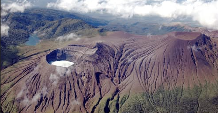
During this week, 9 eruptions were recorded; only one exceeded an acoustic magnitude of 4 (moderate). Most of these eruptions were of low magnitude. The eruption on September 26 at 10:26 PM exhibited the highest acoustic magnitude of the week and did not result in associated mudflows (lahars). The week was marked by persistent, frequent acoustic pulses linked to emissions of water vapor and volcanic gases (small eruptions). A total of 192 acoustic pulses were recorded, albeit of very low magnitude. An increase in seismic activity related to rock fracturing was observed—both at a distance from the crater and in its immediate vicinity—with the majority of these earthquakes occurring on September 26, 27, and 28. Distal earthquakes, located south of the volcano (Las Pailas), predominated, with 134 events recorded this week. The proximal earthquakes (8 events) are of low magnitude and located beneath the crater, at a depth corresponding to sea level. Low-frequency (0.5–3 Hz) background tremor showed variations: a decrease until September 26, followed by an increase in amplitude on the 27th. From September 28 up to the date of this report, a sequence of « banded tremors » has been recorded, with slight variations in amplitude and duration between events. This sequence began following the occurrence of volcano-tectonic earthquakes distal to the crater. The occurrence rate of long-period (LP) and « tornillo »-type seismic signals remains stable. However, the frequency of « tornillo »-type signals has increased over the past two weeks.
In general, eruptions tend to occur during a significant drop in the amplitude of background tremor. Over the medium term (the last six months), a trend of subsidence has been observed at both the base and the summit of the volcano, accompanied by extension in the summit area. However, in the short term, rapid summit uplift has been detected, amounting to 17 ± 5 mm between August 18 and September 30. Contraction is observed in the horizontal component. The MultiGAS station has recorded a gradual decrease in CO2/SO2 and H2S/SO2 ratios since July 2026. This week, ratios of 3 for CO2/SO2 and 0.1 for H2S/SO2 were recorded. The average SO2 flux for the week is 191 ± 130 t/d, with a maximum value of 139 t/d. These figures indicate an apparent drop in SO2 emissions compared to the previous week, when the average flux was 259 ± 196 t/d, with a maximum value of 2104 t/d. However, this week’s values may have been influenced by unfavorable wind direction, which would explain the apparent decrease. Current values remain above the volcano’s baseline level.
For the first time in a year, the SENTINEL satellite detected the SO2 plume this week. The plume was detected five times in seven days, with a peak of 68 tonnes of SO2 in the atmosphere on October 1. The water chemistry of the Santuarium thermal spring, located approximately 4 km north of the active Rincón crater, reveals a gradual change in its oxidation-reduction potential (ORP) from April 2019 to the present, shifting from chemically reducing waters (H2S-rich fluids) to more oxidizing waters (SO2-richer fluids).
Source et photo : Ovsicori .
Colombia , Chiles / Cerro Negro :
San Juan de Pasto, September 29, 2026, 6:00 PM
Regarding the monitoring of activity at the Chiles-Cerro Negro volcanic complex (CVCCN), the Colombian Geological Service (SGC)—an agency attached to the Ministry of Mines and Energy— reports the following:
For the period from September 22 to September 28, 2026, the main variations in monitored parameters compared to the previous week were as follows:
● Amidst the fluctuating behavior of this volcanic complex, seismic activity showed a slight increase in both earthquake frequency and energy levels.
The most frequent events during the week were those linked to fluid dynamics from a persistent source, followed by events associated with rock fracturing processes.
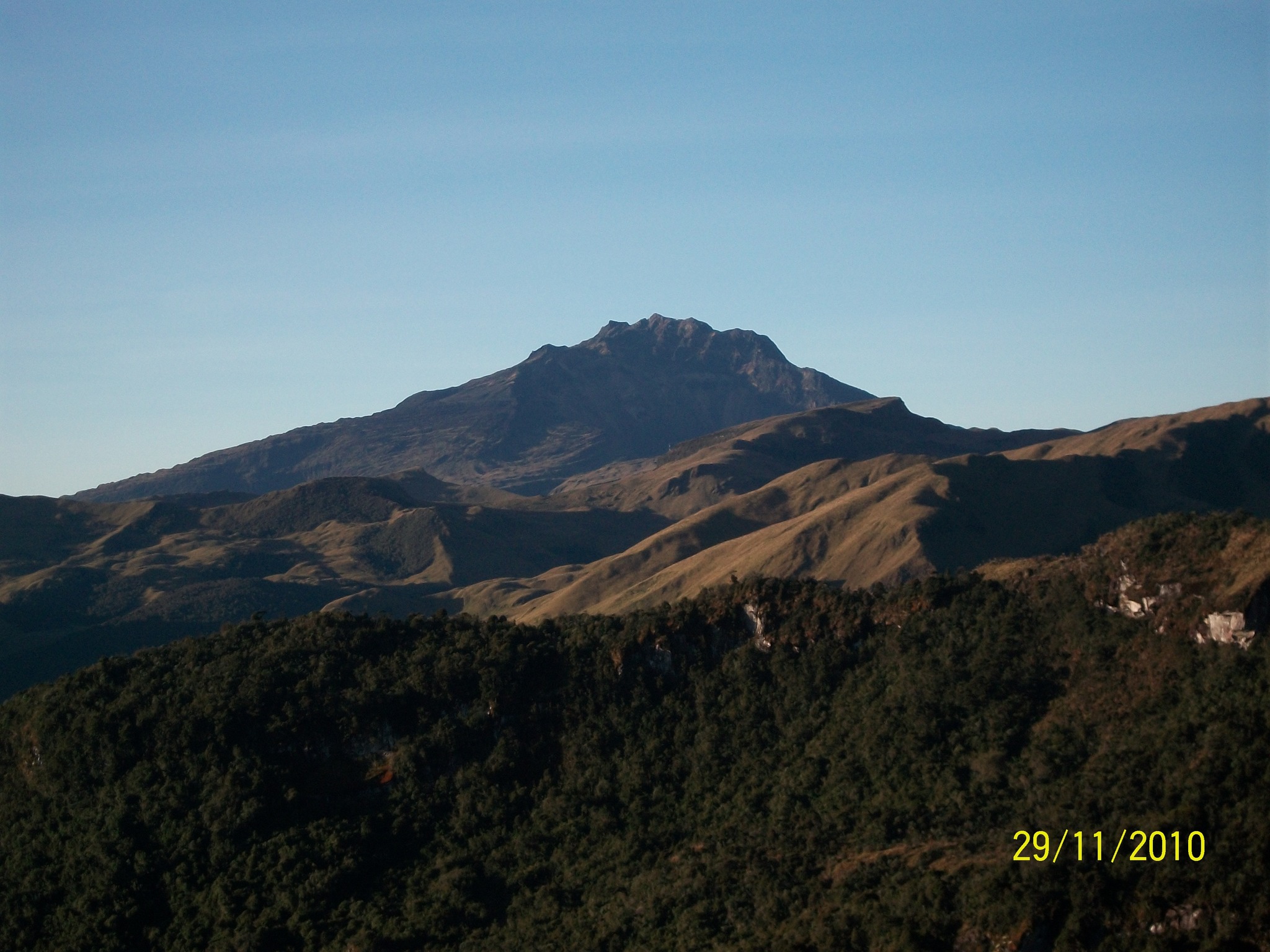
● During this period, seismicity was scattered; earthquakes located south of the Chiles volcano predominated, occurring at distances of up to 14.7 km from the volcano
and at depths ranging from 2 to 10 km below its summit (4,700 m above sea level). Notably, two earthquakes with magnitudes of 2.1
and 2.6 were recorded on September 22 and 25, respectively; neither was reported as felt.
● Analysis of data from satellite sensors and ground stations continued to reveal variations associated with deformation processes
in the volcanic zone.
Based on the assessment and correlation of monitored parameters, the SGC recommends closely tracking their evolution via weekly bulletins and other information released through official channels, as well as adhering to instructions from local and departmental authorities and the National Unit for Disaster Risk Management (UNGRD).
Volcanic activity remains at the yellow alert level: an active volcano exhibiting behavioral changes relative to the baseline of monitored parameters, along with other manifestations.
Source et photo : SGC.
Chile / Argentina , Nevados de Chillán :
SPECIAL REPORT ON VOLCANIC ACTIVITY – October 1, 2026
The Argentine Geological and Mining Service (SEGEMAR), through its Argentine Volcanic Monitoring Observatory (OAVV), reports that today, Thursday, October 1, 2026, volcanic monitoring cameras installed near the Nevados de Chillán volcanic complex (operated by OVDAS) recorded persistent incandescence at the active crater, as well as low-altitude plumes (100 meters) during the night. At daybreak, an emission of particles was observed reaching 500 meters above the crater rim, dispersing first towards the northeast (NE) and subsequently towards the southeast (SE). Furthermore, since September 29, a topographic change has been observed from the southwest (SW), indicating a new morphology in the active crater area.
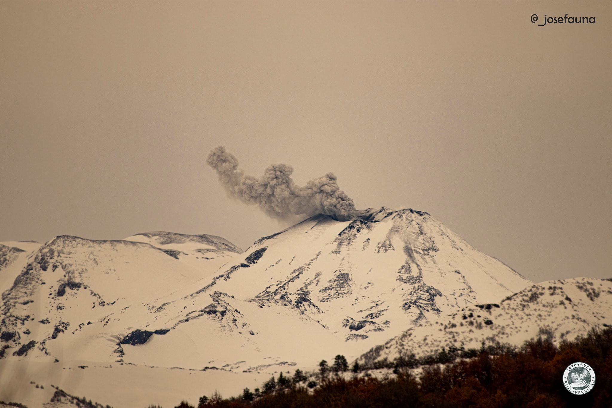
Furthermore, analysis of Sentinel-2 L2A satellite imagery has detected radiance anomalies in the area where previous explosions were recorded. The Mirova platform indicates thermal anomalies for today, with a peak radiative power of 7.28 MW. Both parameters point to an increase in the volcanic system’s surface temperature.
Additionally, since September 22, a change in seismic patterns has been observed, characterized by an increased frequency of long-period (LP) earthquakes and tremor (TR) events—all linked to fluid dynamics within the volcano—which is consistent with the observed surface activity.
This activity indicates the presence of an effusive body at the surface. Explosive activity is also ongoing at the time of writing. However, it should be noted that the activity recorded to date has not affected Argentine territory.
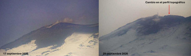
Topographic changes observed by surveillance cameras at the Nevados de Chillán volcanic complex (managed by OVDAS) between September 17 and 29.
OBSERVATIONS:
Given the circumstances, the occurrence of future events of a similar or higher energy level cannot be ruled out. Based on available information, the recorded events remained localized near the active craters; no impact on populations in Argentine territory has been observed to date.
CONCLUSIONS
The technical alert level remains in effect, and volcano monitoring will continue in constant coordination with Chile’s Southern Andes Volcanological Observatory (OVDAS); any developments in the situation will be communicated.
Source : Segemar.
Photos : Josefauna ( archive ) Segemar.
Ecuador , Sangay :
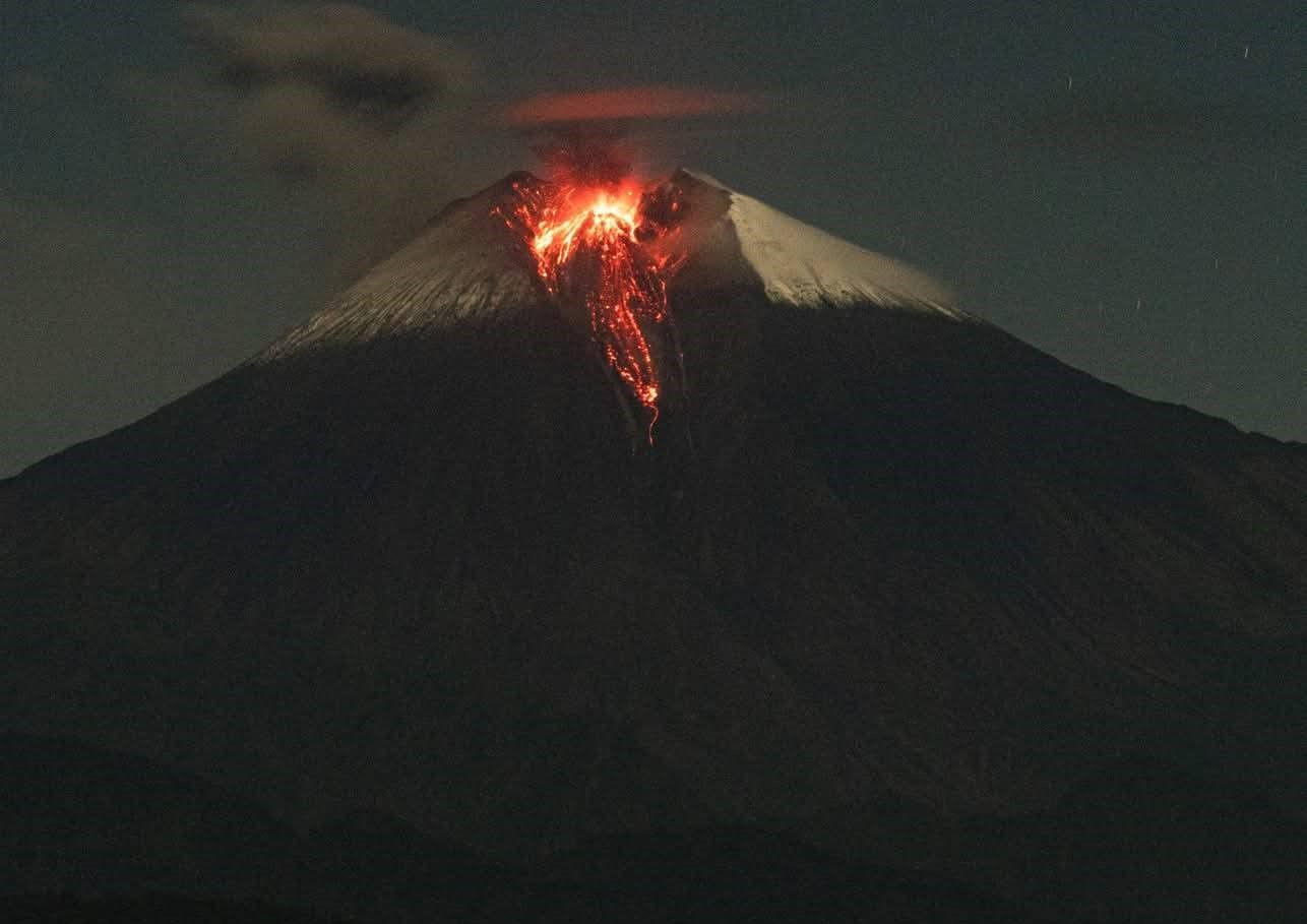
The Instituto Geofísico-Escuela Politécnica Nacional (IG-EPN) reported that volcanic activity at Sangay continued during 23-30 September. The seismic network recorded 1-14 daily explosions, a few long-period earthquakes, a period of harmonic tremor, and 0-6 daily signals indicating emissions. Daily ash-and-gas plumes visible in webcam views and satellite images, and those reported by the Washington Volcanic Ash Advisory Center, rose as high as 1.5 km above the crater rim and drifted in multiple directions, though mainly NW and W. During dark hours incandescence at the summit was visible along with the occasional descent of incandescent material as far as 400 m down the flank; weather clouds sometimes prevented visual observations. Several ejections of incandescent material at the summit were visible in webcam images during 29-30 September. The Secretaría de Gestión de Riesgos (SGR) maintained the Alert Level at Yellow (the second highest level on a four-color scale). The Secretaría de Gestión de Riesgos (SGR) maintained the Alert Level at Yellow (the second highest level on a four-color scale).
DAILY STATUS REPORT FOR SANGAY VOLCANO, Friday, October 2, 2026.
Information from the Geophysical Institute – EPN.
Surface activity level: Moderate; Surface trend: Unchanged
Internal activity level: Low; Internal trend: Unchanged
Seismicity: From October 1, 2026, 11:00 AM to October 2, 2026, 11:00 AM:
Seismicity:
Here is the count of seismic events recorded at the reference station:
Explosion (EXP): 0
Emission tremor (TREMI): 1
Rainfall / Lahars:
No precipitation was recorded in the volcano area. Heavy rainfall could remobilize accumulated material, generating mud and debris flows that would descend the volcano’s flanks into adjacent rivers.
Emission plume / ash:
Surveillance cameras captured three gas emissions with low ash content; the plumes reached heights of 300 to 1,400 meters above the crater, drifting south-southwest, southwest, and west-southwest. In connection with this activity, the Washington VAAC issued two reports regarding emissions with plumes rising 850 and 1,200 meters above the crater, both drifting southwest.
Other monitoring parameters:
Over the past 24 hours, the MIROVA MODIS satellite system recorded one thermal anomaly, while the MIROVA VIIRS system detected two. Additionally, the FIRMS system reported six thermal anomalies.
Observation:
From yesterday afternoon until the time of this report, the volcano remained largely obscured by clouds. However, incandescence at the crater was observed via the surveillance camera network during the night and early this morning.
Alert level: Yellow
Sources : Instituto Geofísico-Escuela Politécnica Nacional (IG-EPN), Secretaría de Gestión de Riesgos (SGR) , GVP.
Photo : Cristopher Cárdenas .