September 21 , 2026.
Indonesia , Ili Lewotolok :
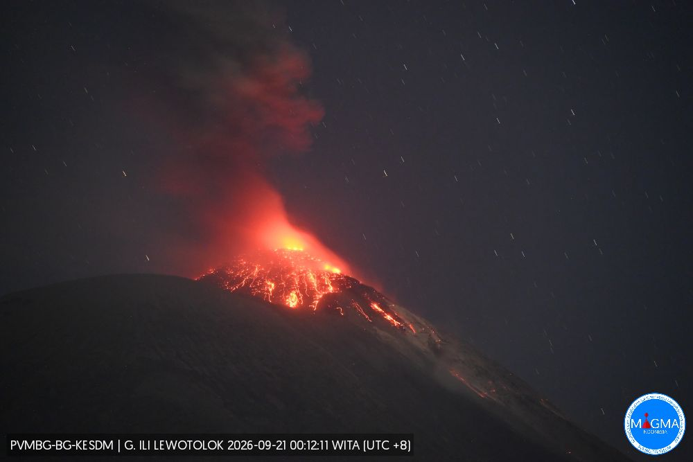
An eruption of Mount Ili Lewotolok occurred on Sunday, September 20, 2026, at 6:29 p.m. (WITA), with an ash column reaching a height of approximately 300 m above the summit (or about 1,723 m above sea level). This dense, white-to-gray column drifted westward. The eruption was recorded by the seismograph with a maximum amplitude of 40 mm and a duration of 60 seconds.
Seismic observations
277 eruptive earthquakes (amplitudes: 8.8–40 mm; durations: 35–114 seconds).
2 avalanche earthquakes (amplitudes: 4.4–11.1 mm; durations: 41–70 seconds).
112 emission earthquakes (amplitudes: 0.6–27.6 mm; durations: 24–60 seconds).
3 harmonic tremors (amplitudes: 2.2–11.1 mm; durations: 90–221 seconds).
2 non-harmonic tremors (amplitudes: 16.6–22.1 mm; durations: 88–121 seconds).
1 distant tectonic earthquake (amplitude: 40 mm; duration: 153 seconds).
Recommendations
1. Communities living near Mount Ili Lewotolok, as well as visitors, climbers, and tourists, must not enter or conduct activities within a 2 km radius—extending to 3 km in the southern and southeastern sectors—of the Mount Ili Lewotolok activity center.
2. Remain vigilant regarding potential risks of lava avalanches and pyroclastic flows in the southern, southeastern, western, and northeastern sectors of Mount Ili Lewotolok.
Source et photo : PVMBG.
Chile / Argentina , Nevados de Chillán :
SPECIAL REPORT ON VOLCANIC ACTIVITY, September 18, 2026
The Argentine Geological and Mining Service (SEGEMAR), through its Argentine Volcanic Monitoring Observatory (OAVV), reports that on Friday, September 18, 2026, starting at 14:11 local time (17:11 UTC), volcanic monitoring stations installed near the Nevados de Chillán volcanic complex (operated by OVDAS) recorded an earthquake associated with fluid dynamics within the volcanic system (a « Long-Period » event). This phenomenon was accompanied by a particle emission plume reaching a height of 380 m above the crater rim and dispersing in a south-southeast (SSE) direction.
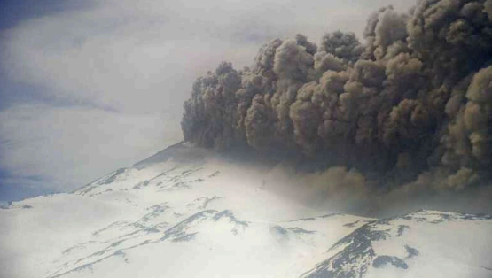
Particle emission pulse recorded by surveillance cameras at the Nevados de Chillán volcanic complex (operated by OVDAS).
Event details
Time of origin: 14:11 local time (17:11 UTC).
Reduced displacement: 72.9 cm².
Column height: 380 m above the crater rim.
Dispersion direction: South-southeast (SSE).
OBSERVATIONS:
At the time of writing, the emission of low-altitude pyroclastic material is continuing, albeit with reduced intensity. No significant changes have been observed in other monitoring parameters associated with this event.
It should be noted that no airborne volcanic ash has been detected at the Argentina-Chile border; no populations in Argentine territory are currently affected.
CONCLUSIONS
The technical alert level remains unchanged, and volcano monitoring will continue in constant communication with the Southern Andes Volcanological Observatory (OVDAS) in Chile; any developments will be reported.
Source : Segemar .
Colombia , Puracé – Los Coconucos volcanic chain :
Popayán, September 20, 2026, 3:15 PM.
Based on monitoring of the Los Coconucos volcanic chain, the Colombian Geological Service (SGC)—an agency attached to the Ministry of Mines and Energy—reports the following:
Since the last bulletin, seismic activity has remained dominated by phenomena linked to fluid dynamics within the volcanic conduits—primarily « long-period » (LP) events located beneath the Puracé volcano crater at depths of less than 0.5 km. However, a significant decrease in the frequency of these events has been observed.
Seismicity associated with rock fracturing (volcano-tectonic, or VT, events) has been located largely about 15 km northeast of the Puracé volcano, at depths
ranging from 8 to 10 km. The maximum magnitude recorded during the period under review was 1.7 Ml.
Slow ground deformation continues in the area between the Puracé, Piocollo, and Curiquinga volcanoes. Regarding gas monitoring, sulfur dioxide (SO2) emissions
persist, although a decrease in levels has been noted. Conversely, ground-level carbon dioxide (CO2) concentrations continue to rise.
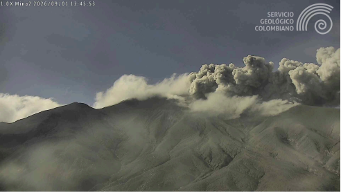
At 1:41 a.m. today, an ash emission was recorded; the ash dispersed toward the northwest of the volcanic edifice, following the prevailing wind direction. During the
period under review, weather conditions—characterized by persistent, dense cloud cover over the volcano’s summit—significantly limited direct observation of the crater area
on several occasions.
According to data from satellite monitoring platforms, no thermal anomalies were detected at the crater floor.
Overall, based on various volcanic monitoring methods, readings from instruments on the volcano over the past few weeks have remained above baseline levels; this indicates a significant change in volcanic activity, which is why the volcano remains at an orange alert level.
The public is advised to stay away from the crater areas of the Puracé, Piocollo, and Curiquinga volcanoes, as well as the headwaters of the rivers originating there, since sudden emissions of gas and ash—accompanied by the ejection of rock fragments—may occur. Furthermore, the accumulation of ash and erupted material could trigger localized mudflows.
Source et photo : SGC.
Guatemala , Fuego :
Weather conditions: Partly cloudy
Wind: Northwest
Precipitation: 83.1 mm
Activity
During the night and early morning hours, light-gray degassing was observed at an altitude of 4,300 m above sea level. Between 5 and 8 explosions per hour were recorded—ranging from low to moderate intensity—propelling gas and ash plumes to altitudes between 4,300 and 4,800 m (14,107–15,748 ft); these plumes are drifting toward the east and southeast.
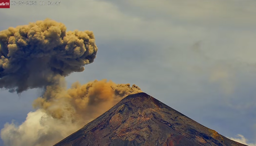
Some explosions are accompanied by noise, rumbling, and weak shockwaves. Incandescent bursts are observed at night, causing hot material to fall around the crater; this material flows into the Seca, Taniluya, Ceniza, Las Lajas, and Honda ravines (among others), sometimes reaching the edge of the vegetation zone. Additionally, fine ashfall is possible in areas southeast of the volcano. Rainfall during the day may trigger torrential flows and/or lahars; it is advised not to stop within or near these ravines when rain is affecting the volcanic edifice.
Source : Insivumeh.
Photo : Afar TV.
Philippines , Mayon :
The Philippine Institute of Volcanology and Seismology (PHIVOLCS) reported ongoing ash emissions and unrest at Mayon during 9-16 September. Each day the seismic network recorded 2-38 volcanic earthquakes; one rockfall was detected on 6 September. Sulfur dioxide emissions (SO₂) generally averaged 500-5,363 tonnes per day (t/d). Emissions rose 100-750 m above the crater and drifted in different directions on 12, 13, 15, and 16 September.
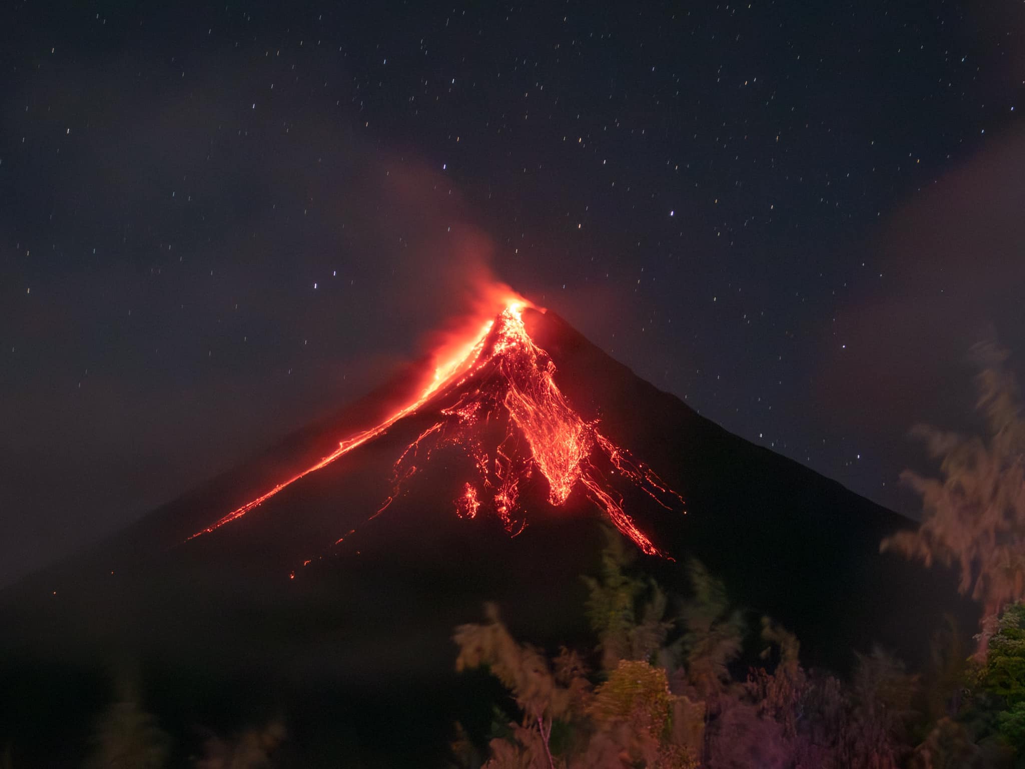
A total of three ash emissions, each lasting one minute long, were recorded on 14 and 15 September. One ash emission, lasting 46 seconds, was reported on 16 September. The Alert Level remained at 2 (on a 0-5 scale) and the public was reminded to stay away from the 6-km-radius Permanent Danger Zone (PDZ). PHIVOLCS recommended that civil aviation authorities advise pilots to avoid flying close to the summit.
Sources : Philippine Institute of Volcanology and Seismology (PHIVOLCS), GVP.
Photo : Rick Estillomo ( archive )