August 21 , 2026.
Italy / Sicily , Etna :
Statement on Etna’s activity, August 20, 2026, 14:39 (12:39 UTC).
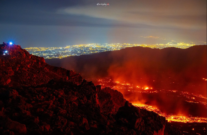
The National Institute of Geophysics and Volcanology (INGV) – Etna Observatory (Osservatorio Etneo) reports that, based on observations and thermal measurements conducted this morning by INGV-OE personnel, the lava flow originating from the vent at an elevation of 1,900 meters is being fed at a low rate and is advancing via rolling motion. The flow front is currently located at an elevation of approximately 1,500 meters, near Rocca Musarra (Valle del Bove). Furthermore, during the field inspection, no explosive activity was observed at the Voragine crater; only sporadic emissions of dilute ash were noted, dispersing across the summit area.
Seismically, the average amplitude of volcanic tremor has gradually decreased over the past 24 hours, reaching a low range of values. Currently, the tremor exhibits slight fluctuations between low and moderate levels. Tremor source centroids are primarily located in the Northeast Crater area, at elevations between 1,500 and 2,500 meters above sea level.
Infrasonic activity, which had reached a high level yesterday, has stabilized at moderate values since the start of the day. Infrasonic events are located in the Northeast Crater area and show low to moderate amplitudes.
Regarding ground deformation, the GNSS network currently shows no significant variation. As previously noted, since approximately 03:30 UTC on August 19, the « Cratere del Piano » tiltmeter station has been recording a slight inflation phase, with a cumulative change of about 0.5 microradians.
Further information will be provided as soon as possible.
Source : INGV.
Photo : Giovinsky Aetnensis
Indonesia , Semeru :
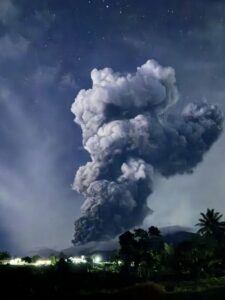
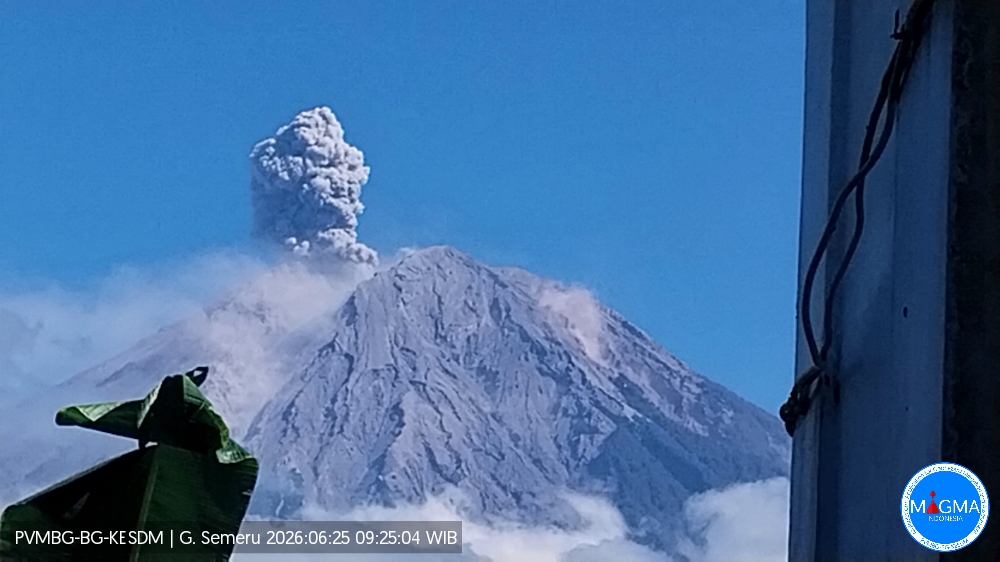
An eruption of Mount Semeru occurred on Thursday, August 20, 2026, at 09:17 WIB; the observed ash column reached a height of approximately 1,100 m above the summit (or about 4,776 m above sea level). The ash column, of moderate intensity, ranged in color from white to gray and drifted northward. At the time of writing, the eruption was still ongoing.
Seismic observations
25 eruption earthquakes, with amplitudes of 11–22 mm and durations of 67–138 seconds.
1 avalanche earthquake, with an amplitude of 5 mm and a duration of 91 seconds.
7 emission earthquakes, with amplitudes of 3–9 mm and durations of 47–51 seconds.
Recommendations
1. Do not conduct any activities in the southeast sector along the Besuk Kobokan River within a 13 km radius of the summit (eruption center). Beyond this distance, the public must not conduct activities within 500 meters of the banks of the Besuk Kobokan, due to the risk of pyroclastic flows and lahars extending up to 17 km from the summit.
Source et photo : PVMBG.
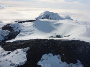
Chile / Argentina , Nevados de Chillan :
During the period under review, volcano-tectonic (VT) seismic activity—linked to rock fracturing within the volcano—continued to be recorded, showing an increase in energy release levels compared to the previous period. The most energetic VT event recorded had a local magnitude (ML) of 2.8.
The dominant seismic activity was associated with fluid movements within the volcano, manifesting as long-period (LP) events and tremors (TR). LP events were the most frequent, although they showed a decrease in energy release, with a maximum reduced displacement (RD) of 11 cm².
In addition, tremor-type seismicity was detected, persisting continuously for up to two days, with a maximum reduced displacement (RD) value of 7 cm². Towards the end of this two-week period, « tornillo » (screw-shaped) and hybrid seismicity were recorded to a lesser extent.
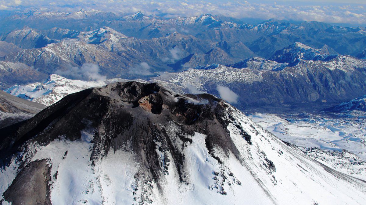
Analysis of images from OVDAS surveillance cameras—when weather conditions permitted—revealed low-magnitude surface activity,
with degassing plumes reaching a maximum height of 120 m above the crater rim. No energetic explosive events were recorded during this period.
However, on August 12, a low-altitude, low-energy passive ash emission was observed, dispersing southward (S) from the active craters. No
incandescence was observed during the period. No thermal anomalies were detected during the analyzed period based on satellite image processing. Analysis of high-resolution satellite imagery (PlanetScope and Sentinel-2 L2A) identified a pyroclastic fallout deposit extending 230 m to the south (S), associated with the pulse emitted on August 12.
Source : Segemar.
Photo : Sernageomin.
Colombia , Puracé – Los Coconucos volcanic chain :
Popayán, August 20, 2026, 2:00 PM.
Based on monitoring of the Los Coconucos volcanic chain’s activity, the Colombian Geological Service (SGC)—an agency affiliated with the Ministry of Mines and Energy—reports the following information:
Since the last bulletin, seismic signals associated with fluid dynamics within the volcanic conduits (circulation of gases and liquids derived from magma and their interaction with the hydrothermal system) have remained predominant. Within this seismic activity, « tremor » (TR) signals continue to prevail; they show a decrease in energy and remain localized beneath the Puracé volcano crater, at depths of less than 2 km. Concurrently, seismicity associated with rock-fracturing processes (VT)—located approximately 1 km beneath the crater—has remained at a low level, in terms of both the number of events and magnitude. Likewise, a slow deformation process persists in the area between the Puracé, Piocollo, and Curiquinga volcanoes.
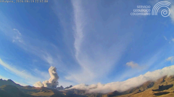
Webcam image from El Púlpito—located 5.8 km south of Puracé volcano—showing an ash emission on August 19, 2026, at 17:32.
Three ash emissions were recorded; only one was visually confirmed by monitoring webcams, reaching a maximum height of 1,100 m above the summit of Puracé volcano. Regarding these emissions, numerous reports of ashfall and strong volcanic gas odors were received from residents and local observers in the rural areas (*veredas*) of Paletará, La Josefina, El Depósito, Jigual, Loma Linda, Cristales, Alto de Anambío, El Crucero, Campamento, La Palma, Tabio, Chapío Alto, Hispala, Hato Viejo, 20 de Julio, and Pululó—all located within the municipality of Puracé. Although a decrease in the number of earthquakes and atmospheric ash emissions has been observed, gas monitoring indicates that recorded sulfur dioxide (SO2) levels remain above the volcano’s established average, and elevated ground-level carbon dioxide (CO2) concentrations persist. Measurements of atmospheric sulfur dioxide (SO2) emissions indicate a value of 3,230 tonnes per day (t/d), with the plume dispersing toward the northwest of the volcano. No thermal anomalies associated with the crater floor have been reported, according to data published on the MIROVA satellite platform.
Values recorded by instruments at the volcano in recent days have reached peaks well above usual baseline levels; this indicates a major shift in the volcano’s dynamics, which therefore remains at the orange alert level. We urge the public not to disseminate information regarding volcanic activity unless it originates from the Colombian Geological Service (SGC) or entities within the National Disaster Risk Management System.
In light of the above, the SGC recommends closely monitoring the situation via daily bulletins and other information released through our official channels, as well as adhering to the instructions of local and departmental authorities and the National Unit for Disaster Risk Management (UNGRD).
The alert level for volcanic activity remains at Orange: Volcano showing significant changes in monitored parameters.
Source et photo : SGC.
Costa Rica , Rincón de la Vieja / Poas :
Daily volcano status report. OVSICORI-UNA, Date: August 20, 2026. Update time: 12:48:00.
Volcano: Rincón de la Vieja
Latitude: 10.83
Longitude: -85.324
Elevation: 1,916 m above sea level
Observed activity:
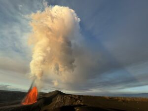
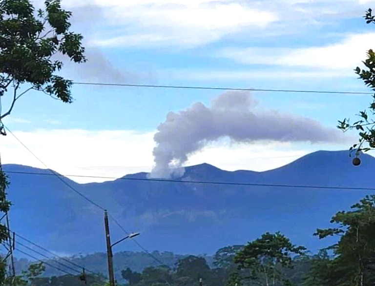
A low-energy phreatic eruption lasting approximately one minute was recorded by seismographs and infrasound sensors today, August 20, 2026, at 02:11 (local time). No ashfall has been reported so far.
Rincón de la Vieja volcano has frequently experienced phreatic eruptions throughout the year, particularly since July. Several eruptions in July and August triggered primary and secondary lahars, loading the watercourses in the watersheds north of the volcano with sediment, mud, soil, rocks, and debris torn from the volcano’s pristine forests. The public is strongly urged not to take risks, to avoid climbing the volcano, and to stay a safe distance away from riverbeds and bridges.
Environmental conditions:
The Rincón de la Vieja volcano area remains very cloudy.
Activity level: Vigilance (3)
Volcano: Poás
Latitude: 10.200
Longitude: -84.233
Elevation: 2,687 m above sea level
Observed activity:
Seismographs and infrasound sensors did not record any eruptions but detected volcanic tremor with frequencies around 2.5 Hz over the past 24 hours. The MultiGAS instrument is recording an SO2 flux of approximately 200 tonnes/day. The European SENTINEL satellite detected an SO2 mass of 62 tonnes on August 19, 2026. Fumaroles at the bottom of the crater continue to emit water vapor, magmatic gases, and aerosols.
Environmental conditions:
Skies over Poás remain partly cloudy.
Activity level: Alert (2)
Source : Ovsicori .
Photo : Rincon / Ovsicori.