July 22 , 2026.
Hawaii , Kilauea :
HAWAIIAN VOLCANO OBSERVATORY DAILY UPDATE , U.S. Geological Survey
Tuesday, July 21, 2026, 9:42 AM HST (Tuesday, July 21, 2026, 19:42 UTC)
19°25’16 » N 155°17’13 » W,
Summit Elevation 4091 ft (1247 m)
Current Volcano Alert Level: ADVISORY
Current Aviation Color Code: YELLOW
Summary:
The Halemaʻumaʻu eruption is paused. The next fountain episode is likely between July 25 and July 29.
Overview:
The summit eruption of Kīlauea in Halemaʻumaʻu is paused after the end of episode 51 on July 15. Summit inflation and glow from both vents continued over the past 24 hours but the rate of inflation and brightness of the glow diminished overnight. Updated models indicate that the forecast time window for episode 52 fountains is now between July 25 and July 29 due to the current slowdown in summit inflation.
No significant activity has been noted along Kīlauea’s East Rift Zone or Southwest Rift Zone.
Summit Observations:
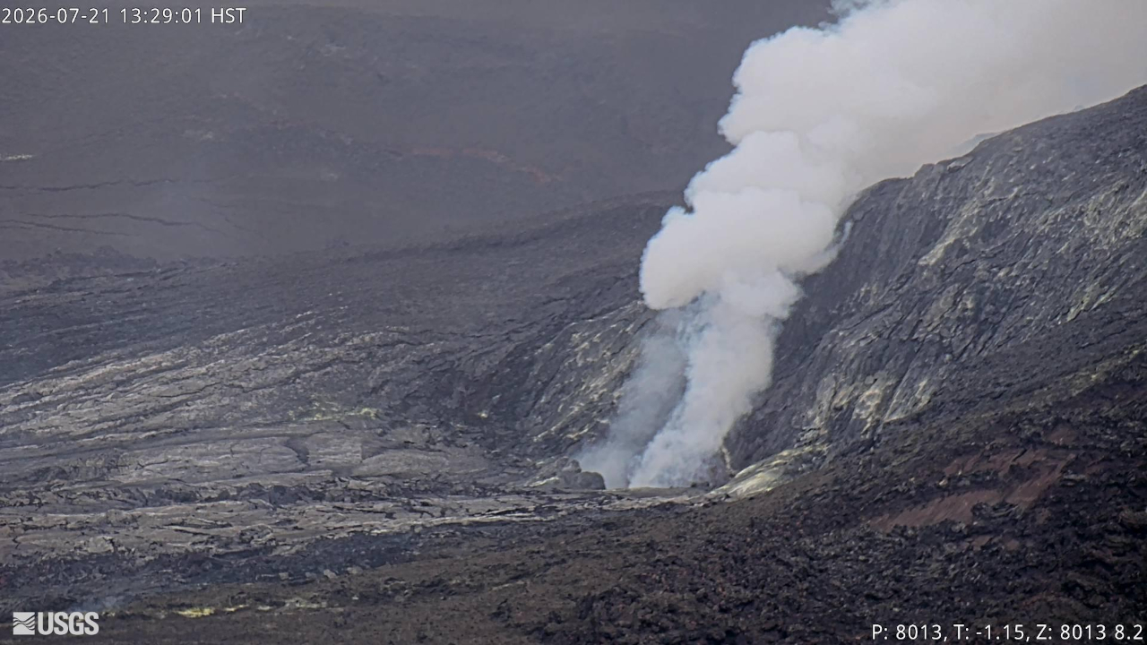
Bright glow with periodic flames was visible overnight from the south vent, but the glow was not as bright or as continuous as previous nights, becoming less strong and more intermittent after midnight. Glow from the north vent was weaker than the south vent, and gradually dimmed further between midnight and 3 a.m.
Tremor remains continuous but still has occasional small, ragged tremor bursts. No earthquakes were located beneath the summit of Kīlauea summit in the past 24 hours.
Since episode 51 ended, inflation resumed and has recovered 9 microradians of tilt at the summit tiltmeter at Uēkahuna (UWD). Kīlauea summit deflation totaled 14.7 microradians during episode 51. The rate of summit inflation varied over the past 24 hours and has been relatively flat since before midnight. Reduced vent glow brightness seemed to correlate with lower inflation rates.
The sulfur dioxide (SO2) emission rate from the summit is likely now varying within a typical range of 1,000 to 5,000 tonnes per day. Degassing plumes from both vents are being blown toward the southwest this morning.
Rift Zone Observations:
Rates of seismicity and ground deformation remain low in the East Rift Zone and Southwest Rift Zone. SO2 emissions from the East Rift Zone remain below the detection limit.
Source et photo : HVO.
Colombia , Puracé – Los Coconucos volcanic chain :
Popayán, July 21, 2026, 3:00 PM.
Based on monitoring of the Puracé volcano—part of the Los Coconucos volcanic chain (CVLC)—the Colombian Geological Service (SGC), an agency attached to the Ministry of Mines and Energy, reports the following information:
During the week of July 14 to 20, 2026, an increase in CVLC activity was recorded. Seismic activity linked to fluid movements (magmatic gases and liquids, their interaction with the hydrothermal system, and atmospheric ash emissions) showed an intensification of continuous tremor and a rise in associated seismic energy; this activity remains localized beneath the Puracé volcano crater, at depths of less than 3 km. The number of daily ash emissions remains stable, although an increase in the height of the associated plumes was noted, reaching up to 2,200 m above the volcano’s summit. The plumes dispersed toward the northwest and west; ashfall was reported in the rural localities (*veredas*) of Cristales, 20 de Julio, Río Negro, Hato Viejo, and Alto Anambío (in the municipality of Puracé), as well as in the city of Popayán, on July 18, 19, and 20.
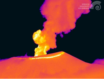
Ash emission at Puracé volcano on July 20, 2026, at 8:07 PM. Recording from the Mina thermal camera, located 2.2 km northwest of Puracé volcano.
Seismicity associated with rock fracturing (VT) remained at levels comparable to the previous week, in terms of both the number of events and the seismic energy released. These earthquakes were primarily located between Puracé and Piocollo volcanoes, at depths ranging from 1 to 3 km, with magnitudes below 1.6. Webcam imagery (visible and infrared spectra) continued to show thermal anomalies at the fumarole field on the outer rim of the Puracé volcano crater, as well as intense degassing processes within the craters of Puracé and Curiquinga volcanoes. Additionally, an increase in atmospheric sulfur dioxide (SO2) emissions was recorded. The slow deformation process previously observed in the area between Puracé, Piocollo, and Curiquinga volcanoes is ongoing.
In conclusion, the variations observed at Puracé volcano indicate that the system continues to evolve; further ash emissions and fallout are possible, with dispersion determined by prevailing wind directions. Furthermore, the possibility of additional changes in volcanic activity—potentially leading to more energetic surface manifestations—cannot be ruled out. The public is advised to avoid high-altitude areas of the volcanic chain and to stay informed via official SGC reports.
The volcanic alert level remains at « Yellow »: an active volcano showing changes in the baseline behavior of monitored parameters, alongside other manifestations.
Source et photo : SGC.
Indonesia , Lewotobi Laki-laki :
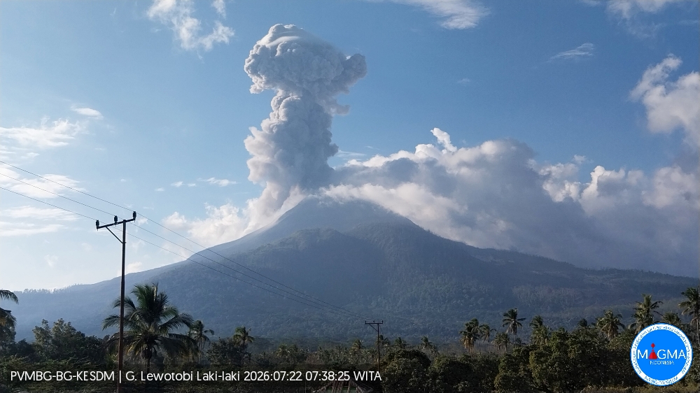
An eruption of Mount Lewotobi Laki-laki occurred on Wednesday, July 22, 2026, at 07:35 WITA, with an ash column reaching a height of approximately 1,500 m above the summit (or about 3,084 m above sea level). The observed ash column was dense and gray, drifting towards the north and northeast. The eruption was recorded by the seismograph with a maximum amplitude of 47.3 mm and a duration of 288 seconds.
Seismic observations
2 eruption-related earthquakes, with amplitudes of 29.6–47.3 mm and durations of 181–288 seconds.
1 emission-related earthquake, with an amplitude of 22.2 mm and a duration of 36 seconds.
8 episodes of non-harmonic tremor, with amplitudes of 4.4–7.4 mm and durations of 84–176 seconds.
Recommendations
1. Communities near Mount Lewotobi Laki-laki, as well as visitors and tourists, must not conduct any activities within a 5 km radius of the Mount Lewotobi Laki-laki eruption center.
2. The public is advised to remain calm, follow instructions from local authorities, and disregard information from unverified sources.
Source et photo : PVMBG.
Alaska , Atka volcanic complex :
AVO/USGS Volcanic Activity Notice
Current Volcano Alert Level: NORMAL
Previous Volcano Alert Level: ADVISORY
Current Aviation Color Code: GREEN
Previous Aviation Color Code: YELLOW
Issued: Tuesday, July 21, 2026, 12:08 PM AKDT
Source: Alaska Volcano Observatory
Notice Number: 2026/A543
Location: N 52 deg 19 min W 174 deg 8 min
Elevation: 5030 ft (1533 m)
Area: Aleutians
Summary:
Unrest has declined. Color Code and Alert Level Level lowered to GREEN/NORMAL.
Volcanic Activity:
A small explosion from Korovin Volcano within the Atka Volcanic complex was detected in seismic and infrasound data on July 16, 2026. Since then, unrest has declined. As a result, the Aviation Color Code and Alert Level are being lowered to GREEN/NORMAL.
Remarks:
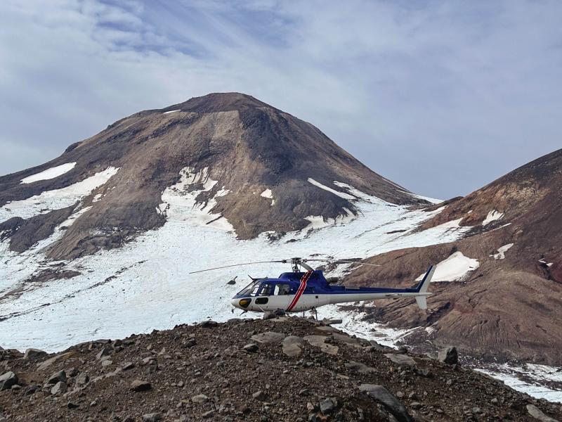
The Atka volcanic complex forms the northern part of Atka Island, located about 16 km north of the community of Atka and 1,761 km southwest of Anchorage. The Atka volcanic complex includes a possible older caldera and several younger vents, including Korovin Volcano, Mount Kliuchef, and Sarichef Volcano. Korovin Volcano, a 1553-m-high (5030 ft) stratovolcano, has been the site of most historical volcanic activity, and has a small, roiling crater lake that occasionally produces energetic steam emissions. Korovin has erupted several times in the past 200 years, including 1973, 1987, and 1998, and has likely had small ash emissions as recently as 2005. Typical recent Korovin eruptions produce minor amounts of ash and occasional but small lava flows. Reports of the height of the ash plume produced by the 1998 eruption ranged as high as 10,600 m (35,000 feet) above sea level. Mount Kliuchef is composed of a series of five vents aligned northeast–southwest. The two main summit vents of Kliuchef appear relatively young and the easternmost was probably the source of an 1812 eruption that is sometimes attributed to Sarichef.
Source : AVO
Photo : Coombs, Michelle / AVO / USGS.
Kamchatka , Sheveluch :
KVERT VOLCANIC ACTIVITY NOTICE (VAN)
Issued: July 22 , 2026
Volcano: Sheveluch (CAVW #300270)
Current aviation colour code: ORANGE
Previous aviation colour code: red
Source: KVERT
Notice Number: 2026-78
Volcano Location: N 56 deg 38 min E 161 deg 19 min
Area: Kamchatka, Russia
Summit Elevation: 3283 m (10768.24 ft), the dome elevation ~2500 m (8200 ft)
Volcanic Activity Summary:
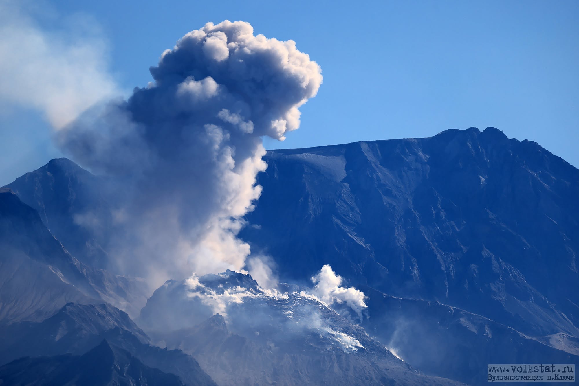
No new ash explosions have been observing on the volcano at now, but an ash cloud 380×70 km in size is located 380 km to the east of volcano (from ash explosions up to 8,6 km a.s.l. at 21:10 UTC on 21 July).
The explosive-extrusive eruption of the volcano continues. Ash explosions up to 12 km (39,400 ft) a.s.l. could occur at any time. Ongoing activity could affect international and low-flying aircraft.
Volcanic cloud height: NO ASH CLOUD PRODUCED
Other volcanic cloud information: NO ASH CLOUD PRODUCED
Source : Kvert.
Photo : volkstat ru.