April 26 , 2026.
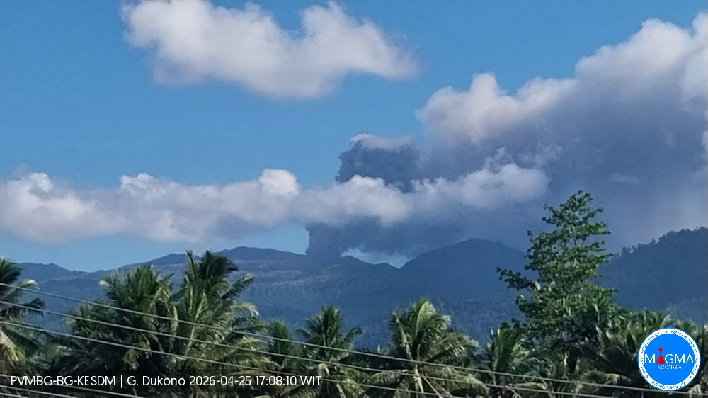
Indonesia , Dukono :
An eruption of Mount Dukono occurred on Sunday, April 26, 2026, at 1:50 PM WIT, with an observed ash column reaching a height of approximately 800 meters above the summit (approximately 1,887 meters above sea level). This gray-black column was highly intense and moving northwest. At the time of writing, the eruption was still ongoing.
Seismic Observations
103 eruption earthquakes with amplitudes ranging from 6 to 34 mm and durations from 38.68 to 63.94 seconds.
Two tectonic earthquakes, each 20 mm apart, with durations from 54.53 to 68.56 seconds.
Continuous seismic tremor with amplitudes ranging from 1 to 5 mm, primarily 3 mm.
Recommendations
(1) Communities living near Mount Dukono and visitors/tourists are advised to refrain from any activity, climbing, or approaching the Malupang Warirang crater within a 4 km radius.
(2) Since eruptions with volcanic ash occur periodically and the distribution of ash follows the direction and speed of the wind, making the ash cover area unstable, communities around Mount Dukono are advised to always have masks/face coverings and mouth coverings available to use as needed to avoid the dangers of volcanic ash to the respiratory system.
Source et photo : PVMBG.
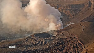
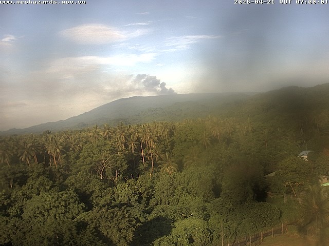
Vanuatu Archipelago , Ambae :
LATEST UPDATE ON AMBAE VOLCANO ACTIVITY
New data analysis shows that Ambae volcano activity continues at the level of a minor eruption and that activity is occurring within Lake Voui. The volcano alert level is at its highest.
Seismic data indicates a decrease in volcanic activity at Ambae, with ongoing volcanic shaking and volcano-seismic events.
Satellite images of ash and/or steam clouds escaping from the active crater of the volcano show that ash is continuously being ejected and is following the wind direction.
At night, residents of Ambae and neighboring islands may observe flames on the volcano’s flank.
Notice to Ambae residents, local authorities, tourism agencies, and the public regarding current volcanic activity:
• The danger zone remains in Zone B, a radius of approximately 3 km around the volcano’s crater, due to rocks, mudflows, and volcanic ash.
• Acid rain and volcanic ash may fall on areas around the volcano, nearby villages, and islands close to Ambae, depending on wind direction and strength.
• Danger also exists in areas with streams during heavy rainfall, as ash deposits near the volcano can trigger mudflows.
• Residents of Ambae and neighboring islands can also expect to observe volcanic glow at night and volcanic clouds at the summit of Ambae.
• It is advisable to cover water sources due to the ongoing volcanic ash and gases escaping from the volcano.
Source et photo : Vanuatu Meteorology and Geo-hazards Department.
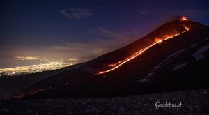
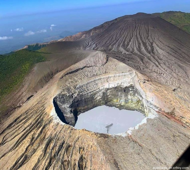
Colombia , Puracé – Los Coconucos volcanic Chain:
Popayán, April 21, 2026, 3:00 PM
Regarding the monitoring of activity at the Puracé volcano and the Los Coconucos volcanic chain, the Colombian Geological Survey (SGC), an agency under the Ministry of Mines and Energy, reports the following:
During the week of April 14-20, 2026, seismicity related to fluid movements within the volcanic edifice continued to be recorded. This seismicity consisted of long-period (LP) earthquakes and tremor pulses.
These earthquakes, located below the crater of the Puracé volcano, at a depth of less than one kilometer, were linked to the circulation and release of volcanic gases into the atmosphere. These gases dispersed according to the wind direction, reaching a maximum altitude of 793 meters above the summit of the volcano. A continuous tremor persists beneath the crater of the Piocollo volcano at depths of less than 2 km, linked to the fluid dynamics within the volcanic system.

The increased fracture seismicity observed the previous week continued, associated with events located on the northeast flank of Puracé volcano, at distances of 2 to 6 km and depths of 3 to 8 km, with magnitudes below 1.4. Low sulfur dioxide (SO₂) emissions were recorded, and gas emissions continue to be released from fissures in the craters of Curiquinga and Piocollo volcanoes. Furthermore, the slow deformation process continues between Puracé, Piocollo, and Curiquinga volcanoes, detected after the eruptive episode of Curiquinga volcano on January 20, 2025.
In conclusion, the variations observed in the Puracé-Los Coconucos volcanic chain indicate that the system continues to evolve and that further ash emissions and fallout are possible, depending on the prevailing wind direction. The public is advised to avoid the upper reaches of the volcanic chain and to closely monitor official bulletins from the Colombian Geological Survey (SGC).
The alert level for volcanic activity remains yellow: active volcano showing changes in monitored parameters and other signs of activity.
Source et photo ( archive) : SGC.
Costa Rica , Rincon de la Vieja :
Latitude: 10.83°N;
Longitude: 85.34°W;
Altitude: 1916 m
Current Activity Level: Alert.
Three small eruptions were recorded this week, a decrease in the number of events compared to last week. None of these eruptions generated lahars. Background tremor remains variable in amplitude and high in frequency (2.5 to 6 Hz). Most of these eruptions occur after a decrease in background tremor. Short tremors of varying amplitude and duration are also recorded, with a lower frequency (1-3 Hz) than the background tremor. Long-period, tornillo-type events of stable magnitude continue to occur. Their number is decreasing compared to last week. The dominant frequency of tornillos continues to decrease this week. Two distal volcano-tectonic earthquakes and one proximal earthquake at the crater were recorded this week.
The geodetic network is not recording any significant deformation. The MultiGAS station continues to record low SO₂ concentrations. This week, DOAS stations recorded an average SO₂ flux of 153 ± 76 t/d, significantly lower than the previous week’s (370 ± 308 t/d). The last detection of SO₂ in the atmosphere by the SENTINEL satellite, emitted by the Rincón de la Vieja volcano, dates back to October 14, 2025 (3 tonnes).
The absence of a convection cell in the lake was observed on April 17, before the eruption at 12:07 PM. Its surface temperature was 33.8 °C, and the fumaroles were close to their boiling point.
Source : Ovsicori.
Photo : crhoy( archive).
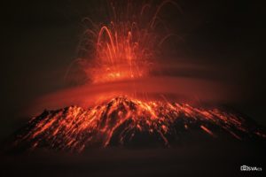
Alaska , Great Sitkin :
Friday, April 24, 2026, 12:04 PM AKDT (Friday, April 24, 2026, 20:04 UTC)
52°4’35 » N 176°6’39 » W,
Summit Elevation 5709 ft (1740 m)
Current Volcano Alert Level: WATCH
Current Aviation Color Code: ORANGE
Lava continues to slowly erupt within the summit crater at Great Sitkin Volcano. Minor lava dome growth and rockfalls down the east and south sides of the lava field continue. Satellite and webcam views were cloudy throughout the week. Seismic activity remains low, with occasional small volcanic earthquakes and seismic signals from small rockfalls within the crater.
The current lava eruption began in July 2021 and has filled most of the summit crater and advanced into the valleys below. There have been no explosions at Great Sitkin Volcano since an event in May 2021. The volcano is monitored using local seismic and infrasound sensors, satellite data, and web cameras, and regional infrasound and lightning networks.
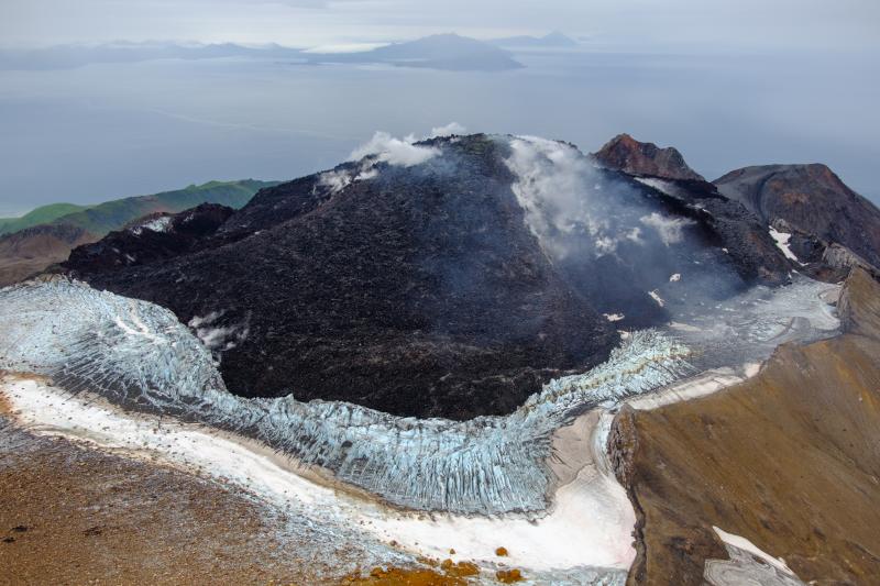
Great Sitkin Volcano on September 3, 2023, during helicopter approach for sampling efforts by AVO geologists. Image is looking west, with Adak and Kanaga Islands visible on the horizon.
Great Sitkin Volcano is a basaltic andesite volcano that occupies most of the northern half of Great Sitkin Island, a member of the Andreanof Islands group in the central Aleutian Islands. It is located 26 miles (42 km) east of the community of Adak. The volcano is a composite structure consisting of an older dissected volcano and a younger parasitic cone with a ~1 mile (1.6 km)-diameter summit crater. A steep-sided lava dome, emplaced in the crater during an eruption in 1974, has been mostly buried by the ongoing eruption. The 1974 eruption produced at least one ash cloud that likely exceeded an altitude of 25,000 ft (7.6 km) above sea level. A poorly documented eruption also occurred in 1945, producing a lava dome that was partially destroyed in the 1974 eruption. Within the past 280 years a large explosive eruption produced pyroclastic flows that partially filled the Glacier Creek valley on the southwest flank.
Source : AVO.
Photo : Loewen, Matthew / Alaska Volcano Observatory / U.S. Geological Survey.