February 9 , 2026.
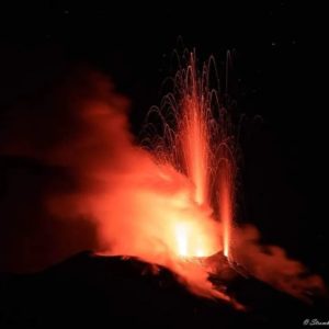
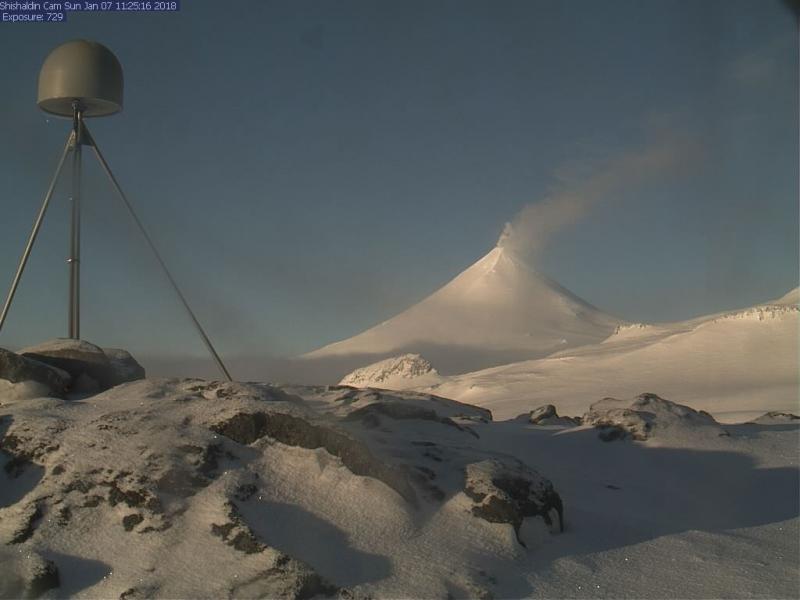
Alaska , Shishaldin :
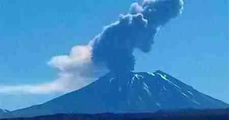
Shishaldin Volcano continues to experience unrest. Over the past day, seismic activity has been slightly elevated, with numerous small earthquakes, volcanic tremor, and infrasound detections. Webcam views of the volcano showed steaming at the summit when conditions were clear. Satellite imagery from the past day showed slightly elevated surface temperatures, probably associated with hot gas emissions in the crater.
Local seismic and infrasound sensors, web cameras, and a geodetic network are used to monitor Shishaldin Volcano. In addition to the local monitoring network, AVO uses nearby geophysical networks, regional infrasound and lightning data, and satellite images to detect eruptions.
Source : AVO
Photo : Archive webcam
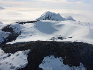
Chile , Lascar :
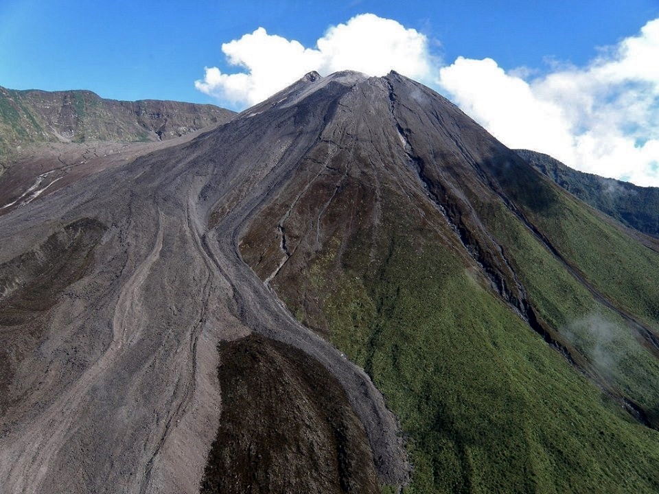
Activity at Láscar Volcano: Strong Seismicity and Ash Column Over One Kilometer High
For SENAPRED, the presence of a dense and visible fumarole and the detection of low-magnitude tremors are typical indicators of surface or phreatomagmatic activity, but do not necessarily signify an imminent eruption. SENAPRED is nevertheless maintaining continuous monitoring, in coordination with ONEMI, SERNAGEOMIN, and other technical services, to assess the evolving situation.
The National Service for Disaster Prevention and Response (SENAPRED) has activated continuous monitoring of a fumarole rising more than one kilometer above the crater of Láscar Volcano, located in the Antofagasta region, following an increase in seismic activity associated with the volcano. This measure follows observations made in recent hours and aims to anticipate any changes in the volcano’s behavior.
Authorities have indicated that, to date, no seismic activity or ground deformation warrants an eruption alert. However, they warned that significant fumaroles and associated activity are phenomena requiring constant attention, particularly due to tourism and air traffic in the north of the country.
Lascar Volcano, one of Chile’s most active, has experienced eruptive episodes in recent decades and is therefore under continuous monitoring. The work of specialized agencies includes installing sensors, interpreting geophysical signals, and regularly communicating information to the public to keep residents and visitors informed.
SENAPRED reiterated its appeal to the public to follow official instructions and not speculate on observed phenomena, emphasizing that scientific monitoring continues and that alerts will be adjusted based on the real-time evolution of volcanic activity.
Source et photo : Madero CL /Solange Veliz Smith.
Indonesia , Ili Lewotolok :
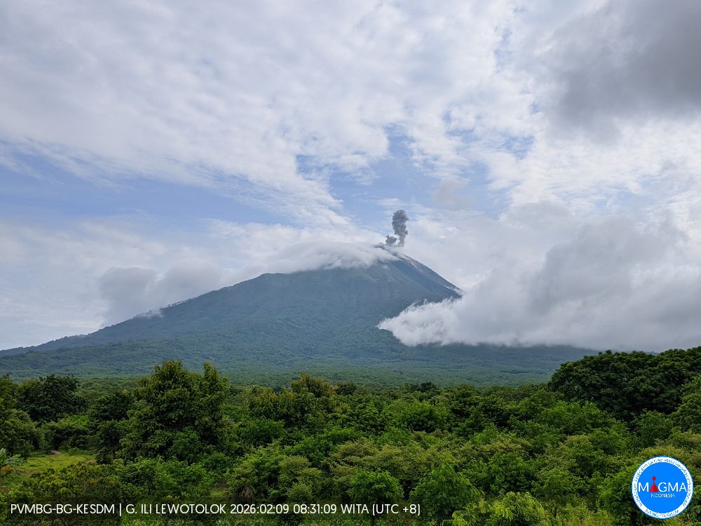
An eruption of Mount Ili Lewotolok occurred on Monday, February 9, 2026, at 08:58 WITA. The observed ash column rose approximately 200 meters above the summit (about 1,623 meters above sea level). White to gray in color, the ash column was thicker and oriented towards the east. This eruption was recorded by a seismograph, with a maximum amplitude of 18.7 mm and a duration of 49 seconds.
Seismic Observations
42 eruption earthquakes with amplitudes between 7.8 and 34 mm and durations of 35 to 68 seconds.
78 emission earthquakes with amplitudes between 2 and 6.2 mm and durations of 26 to 30 seconds.
Recommendations
1. Residents near Mount Ili Lewotolok, as well as visitors, climbers, and tourists, are advised to refrain from all activity within a 3 km radius of the Mount Ili Lewotolok activity center.
2. Be vigilant for the risk of lava avalanches and pyroclastic flows in the south, southeast, west, and northeast sectors of Mount Ili Lewotolok.
Source et photo : Magma Indonésie .
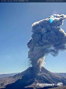
Ecuador , El Reventador :
REVENTADOR VOLCANO DAILY STATE REPORT, Sunday, February 8, 2026.
Information Geophysical Institute – EPN.
Surface Activity Level: High, Surface Trend: No Change
Internal Activity Level: Moderate, Internal Trend: No Change
From February 7, 2026, 11:00 AM to February 8, 2026, 11:00 AM:
Seismicity:
The table below shows the number of seismic events recorded at the reference station:
Explosion (EXP) 67
Long Period (LP) 8
Emission Tremor (TREMI) 3
Harmonic Tremor (TRARM) 3
Rainfall/Lahars:
No rainfall has been recorded in the volcano area. **Heavy rains could remobilize accumulated material, generating mudflows and debris flows that would cascade down the volcano’s flanks and into nearby rivers.**
Emission Column/Ash:
Since yesterday afternoon, several gas and ash emissions have been detected by the GOES-19 satellite system. These emissions are drifting southwest and reaching an altitude of less than 1,200 meters above the crater. The Washington VAAC has issued three reports concerning ash clouds drifting southwest, reaching altitudes of 700 and 1,100 meters above the crater.
Other monitoring parameters:
Over the past 24 hours, the FIRMS, MIROVA-MODIS, MIROVA-VIIRS 375, and MIROVA-VIIRS 750 satellite systems each recorded a thermal anomaly.
Observation:
From yesterday afternoon until the time of writing this report, the volcano remained shrouded in clouds.
Alert level – SGR: Orange
Source et photo : IGEPN.
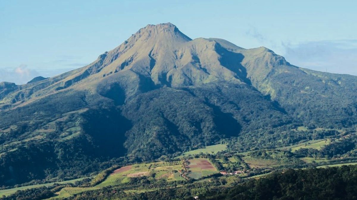
La Martinique Island , Mount Pelée :
Weekly Report, Paris Institute of Earth Physics / Martinique Volcanological and Seismological Observatory
Saint-Pierre, February 6, 2026, 5:30 p.m. local time (GMT-4)
Volcanic activity remained low this week with 10 volcanic earthquakes observed.
Between January 30, 2026, 4:00 p.m. UTC and February 6, 2026, 4:00 p.m. UTC, the Martinique Volcanological and Seismological Observatory recorded:
• 10 shallow, low-energy volcano-tectonic earthquakes. These earthquakes originated from the well-known seismically active zones of Mount Pelée, located between 1.0 and 1.4 km below the volcano’s summit. Shallow volcano-tectonic seismicity is associated with microfracturing in the volcanic edifice, linked to the overall reactivation of the volcano observed since 2019.
No earthquakes have been felt by the population.
The previous week, the OVSM (Swiss Volcanic Observatory) recorded 8 volcanic earthquakes. As of February 6, 2026, and over the past four weeks, the OVSM has therefore observed a total of 47 volcanic earthquakes, an average of 11 to 12 earthquakes per week.
During periods of volcanic reactivation in volcanoes similar to Mount Pelée, seismic activity of varying intensity and frequency is common. The probability of a short-term eruptive activity remains low. However, considering all the observations collected since the end of 2018 and their nature, and based on recent observations from the OVSM-IPGP (Paris Institute of Earth Observatory), we cannot rule out a change in the situation in the medium term (weeks, months).
For more details on observations and interpretations of volcanic activity over the longer term, please refer to the OVSM’s monthly bulletins.
The volcanic alert level, in accordance with the measures implemented by the authorities, is currently YELLOW: vigilance.
Source : Direction de l’OVSM-IPGP.
Photo : OVSM.