February 1 , 2026 .
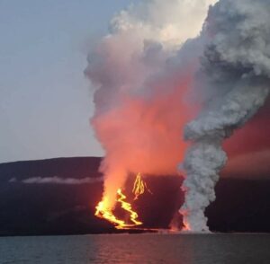
Hawaii , Kilauea :
HAWAIIAN VOLCANO OBSERVATORY DAILY UPDATE , U.S. Geological Survey
Saturday, January 31, 2026, 9:23 AM HST (Saturday, January 31, 2026, 19:23 UTC)
19°25’16 » N 155°17’13 » W,
Summit Elevation 4091 ft (1247 m)
Current Volcano Alert Level: WATCH
Current Aviation Color Code: ORANGE
Activity Summary:
The Halemaʻumaʻu eruption of Kīlauea is paused. Intermittent glow was visible overnight from both vents. Summit inflation and seismic tremor continued over the past 24 hours. The forecast for the onset of episode 42 lava fountaining is between February 10 and 16 based on current rates of summit inflation. The forecast window will be refined as more data become available. No significant activity has been noted along Kīlauea’s East Rift Zone or Southwest Rift Zone.
Summit Observations:
Intermittent moderate glow from the south vent was visible on webcams overnight, similar to recent nights. Less glow was visible from the north vent compared to recent nights, but it did emit occasional flames including a large, bright flame at 10:37 p.m.
The Uēkahuna tiltmeter (UWD) has recorded 15.2 microradians of inflationary tilt since the end of episode 41, including 1.3 microradians of inflationary tilt in the past 24 hours.
Seismic tremor continued over the past 24 hours. Recurring pulses of increased tremor beneath the summit occurred several times per hour. Four earthquakes were located beneath Kīlaueaʻs summit over the past 24 hours.
The sulfur dioxide (SO2) emission rate from the summit was last measured on January 14 at 1,550 tonnes per day, which is within the typical range of 1,000 to 5,000 tonnes of SO2 per day observed during previous eruptive pauses. This is considerably lower than rates observed during lava fountaining episodes.
Rift Zone Observations:
Rates of seismicity and ground deformation remain very low in the East Rift Zone and Southwest Rift Zone. SO2 emissions from the East Rift Zone remain below the detection limit.
Source et photo : HVO.
Kamchatka , Sheveluch :
KVERT VOLCANIC ACTIVITY NOTICE (VAN)
Issued: January 31 , 2026
Volcano: Sheveluch (CAVW #300270)
Current aviation colour code: ORANGE
Previous aviation colour code: orange
Source: KVERT
Notice Number: 2026-11
Volcano Location: N 56 deg 38 min E 161 deg 19 min
Area: Kamchatka, Russia
Summit Elevation: 3283 m (10768.24 ft), the dome elevation ~2500 m (8200 ft)
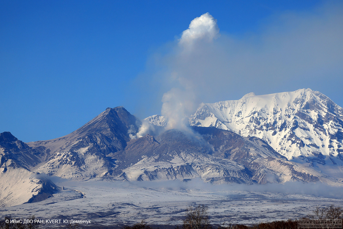
Volcanic Activity Summary:
An explosive-extrusive eruption of the volcano continues. A gas emission with ash continues, a plume extended for 70 km to the west-north-west of the volcano.
An explosive-extrusive eruption of the volcano continues. A danger of ash explosions up to 12 km (39,400 ft) a.s.l. remains. Ongoing activity could affect international and low-flying aircraft.
Volcanic cloud height:
6000 m (19680 ft) AMSL Time and method of ash plume/cloud height determination: 20260131/2110Z – Himawari-9 14m15
Other volcanic cloud information:
Distance of ash plume/cloud of the volcano: 70 km (43 mi)
Direction of drift of ash plume/cloud of the volcano: WNW / azimuth 301 deg
Time and method of ash plume/cloud determination: 20260131/2110Z – Himawari-9 14m15
Source : Kvert.
Photo : Yu. Demyanchuk, IVS FEB RAS, KVERT ( archive).
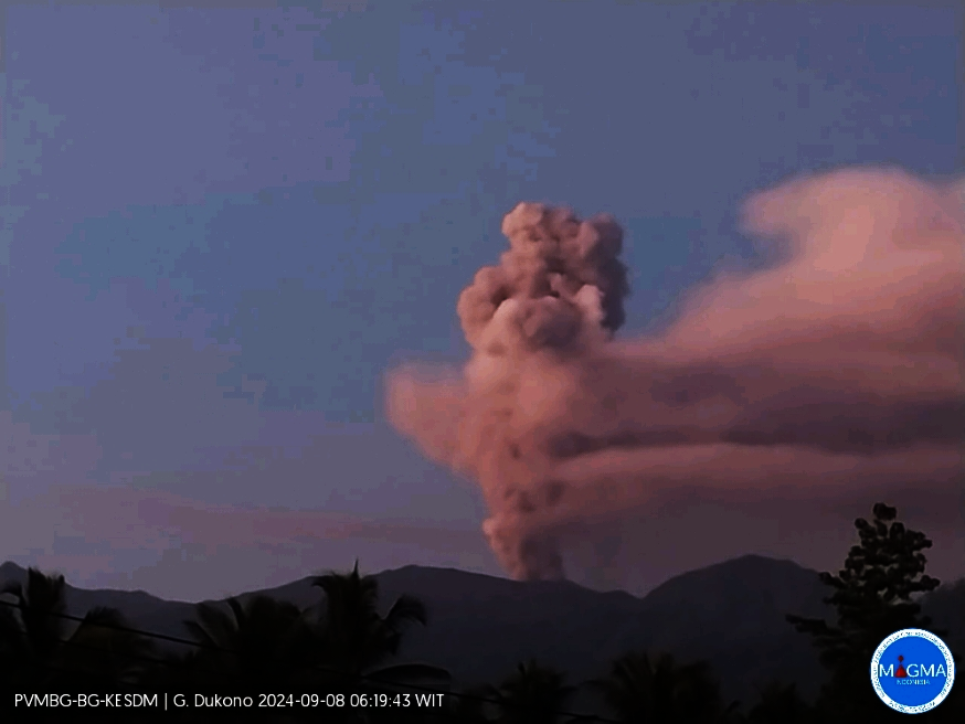
Indonesia , Dukono :
Mount Dukono erupted on Sunday, February 1, 2026, at 11:15 a.m. (local time). An ash column was observed approximately 300 meters above the summit (at an altitude of about 1,387 meters). This thick, white column extended southeastward. At the time of writing, the eruption was still ongoing.
Seismic Observations:
One eruption earthquake with an amplitude of 8 mm and a duration of 30.9 seconds.
Two tectonic earthquakes, separated by amplitudes between 10 and 12 mm and durations of 58.51 to 60.92 seconds.
Continuous seismic tremor with amplitudes between 1 and 4 mm, primarily 2 mm.
VOLCANO OBSERVATORY NOTICE FOR AVIATION – VONA
Issued : February 1 , 2026
Volcano : Dukono (268010)
Current Aviation Colour Code : YELLOW
Previous Aviation Colour Code : unassigned
Source : Dukono Volcano Observatory
Notice Number : 2026DUK006
Volcano Location : N 01 deg 41 min 35 sec E 127 deg 53 min 38 sec
Area : North Maluku, Indonesia
Summit Elevation : 3478 FT (1087 M)
Volcanic Activity Summary : Increasing in volcanic activity.
Volcanic Cloud Height :
Best estimate of ash-cloud top is around 4438 FT (1387 M) above sea level or 960 FT (300 M) above summit. May be higher than what can be observed clearly. Source of height data: ground observer.
Other Volcanic Cloud Information :
Ash cloud moving to southeast. Volcanic ash is observed to be white. The intensity of volcanic ash is observed to be thick.
Remarks :
Tremor recorded on seismogram with maximum amplitude 4 mm. The Surface of mount Dukono Volkano is Clearly, Visible Creater aktivitas, thick white Smoke, height approx 300 m. Weak pressure leaning to the southeast the weather is clody witd weak wins towards the southeast.
Source : Magma Indonésie.
Photo : Archive PVMBG.
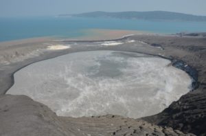
Ecuador , Sangay :
DAILY REPORT ON THE STATE OF SANGAY VOLCANO, Sunday, February 1, 2026.
Geophysical Information Institute – EPN.
Surface Activity Level: High, Surface Trend: No Change
Internal Activity Level: Moderate, Internal Trend: No Change
Seismicity: From January 31, 2026, 11:00 AM to February 1, 2026, 11:00 AM:
Seismicity:
The table below shows the number of seismic events recorded at the reference station:
Explosions (EXP): 179
Precipitation/Lahars:
No precipitation was recorded in the volcano area. **In the event of heavy rain, the accumulated materials could be remobilized, generating mud and debris flows that would cascade down the volcano’s flanks and flow into nearby rivers.**
Ash emissions:
No gas or ash emissions were observed by the monitoring camera system. However, several plumes of gas and ash were detected by the GOES-19 satellite system, reaching an altitude of less than 1,000 meters above the crater rim and drifting westward. In this regard, the VAAC agency in Washington issued three reports of ash emissions reaching an altitude of 1,100 meters above the crater rim and drifting southwest and west-southwest.
Other monitoring parameters:
Over the past 24 hours, the FIRMS satellite system recorded 13 thermal anomalies, the MIROVA-MODIS system 2 thermal anomalies, the MIROVA-VIIRS 375 system 1 thermal anomaly, and the MIROVA-VIIRS 750 system 2 thermal anomalies.
Note:
At the time of writing, the volcano remains completely obscured by clouds.
Alert level: Yellow
Source : IGEPN
Photo : Eqphos_fotografía
Chile / Argentina , Laguna del Maule :
SPECIAL REPORT ON VOLCANIC ACTIVITY, January 31, 2026
The Argentine Geological and Mining Service (SEGEMAR), through its Argentine Volcanic Monitoring Observatory (OAVV), reports that today, Saturday, January 31, 2026, at 8:34 PM local time (11:34 PM UTC), the volcanic monitoring stations located near the Laguna del Maule volcanic complex recorded a volcano-tectonic (VT) seismic event associated with rock fracturing within the volcanic system.
Event Information
Original Time: 8:34 PM local time (11:34 PM UTC)
Latitude: -36.117°
Longitude: -70.494°
Depth: 3.0 km
Local Magnitude: 3.5 (ML)
OBSERVATIONS:
At the time of writing, recurring volcano-tectonic activity continues, with events of low to moderate energy.
CONCLUSIONS:
The technical alert level remains in effect, and monitoring of the volcano continues in constant communication with the Southern Andes Volcanological Observatory (OVDAS) of Chile. Any changes will be reported.
Source et photo : Segemar.