December 8 , 2025.
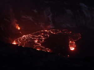
New Zealand , White Island :
No evidence of further explosive activity at Whakaari/White Island.
Published: Mon Dec 8 2025 2:00 PM
Based on observations from last week, including webcam, gas flight and satellite imagery, no further explosive activity has been recorded at Whakaari/White Island. The Volcanic Alert Level is lowered to 2 and the Aviation Colour Code to Yellow.
Since 30 October, Whakaari/White Island experienced a minor volcanic eruption. Ash emissions were primarily detected via satellite imagery and could occasionally be seen on webcams. Observations from last week’s gas flight, GeoNet cameras in the Bay of Plenty, and recent satellite imagery confirm that the explosive activity has ended, with no detectable ash emissions from the volcano.
Recent observations from our Whakatāne and Te Kaha cameras, along with last week’s gas flight, indicate a decrease in activity at the active vent area. No eruptive activity or ash emissions have been observed over the past week. Volcanic gases were detected, but the level of Sulphur Dioxide (SO₂) measured during the gas flight was lower than previous levels. During the same period, MetService has reported no volcanic ash in the plume based on satellite imagery.
Due to this lack of evidence of further eruptions and overall ash emission at Whakaari White Island over the past week, we lowered the Volcanic Alert Level to 2 (moderate-heightened unrest) and the Aviation Colour Code to Yellow. While eruptive activity has ceased for now, volcanic activity could re-escalate with little or no warning. Further sudden, more explosive events could therefore affect the crater floor area and immediate vicinity of the island.
Given our current lack of real-time monitoring data from the island we cannot distinguish between Volcanic Alert Level (VAL) 1 and 2. As a result, Whakaari/White Island will remain at minimum at VAL 2 until on-island monitoring gets reinstated.
Earth Sciences NZ Volcano Monitoring Group and National Geohazards Monitoring Centre will continue to closely monitor Whakaari/White Island for any changes in activity. Without sensors on the island, our monitoring continues to rely on remote cameras, satellite imagery, and periodic observation and gas flights to monitor Whakaari/White Island. We will provide further updates when information becomes available.
Source : Geonet /Agnes Mazot / Duty Volcanologist
Photo : Geonet.
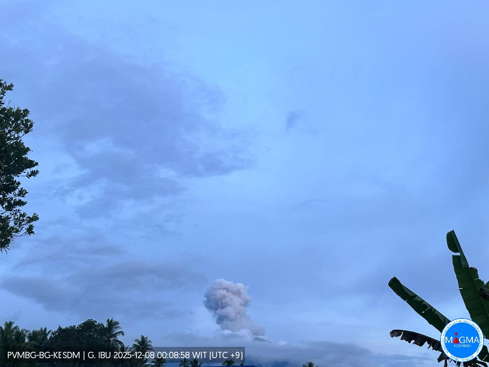
Indonesia , Ibu :
Mount Ibu erupted on Sunday, December 7, 2025, at 6:14 PM WIT. An ash column was observed approximately 600 meters above the summit (at an altitude of about 1,925 meters). This ash column, white to gray in color, was moderately to strongly intense and drifted northeast and east. The eruption was recorded by a seismograph, with a maximum amplitude of 28 mm and a duration of 61 seconds.
Seismicity Observations
108 eruption earthquakes with amplitudes of 15 to 28 mm and durations of 32 to 67 seconds.
2 emission earthquakes with amplitudes of 4 to 10 mm and durations of 37 seconds.
10 harmonic tremors with amplitudes of 2 to 15 mm and durations of 27 to 123 seconds.
116 low-frequency earthquakes with amplitudes of 2 to 10 mm and durations of 17 to 29 seconds.
126 shallow volcanic earthquakes with amplitudes of 2 to 6 mm and durations of 7 to 21 seconds.
1 deep volcanic earthquake with an amplitude of 8 mm and a duration of 20 seconds.
19 tectonic earthquakes, spaced apart, with amplitudes ranging from 2 to 28 mm and durations from 26 to 112 seconds.
Recommendations
1. Residents living around Mount Ibu and visitors/tourists are advised to refrain from all activities within a 2 km radius and a 3.5 km zone around the crater opening in the northern part of the active Mount Ibu crater.
2. In the event of ashfall, people engaging in outdoor activities are advised to wear a mask covering their nose, mouth, and eyes, as well as protective eyewear.
Source et photo : Magma Indonésie .
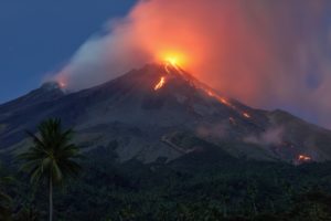
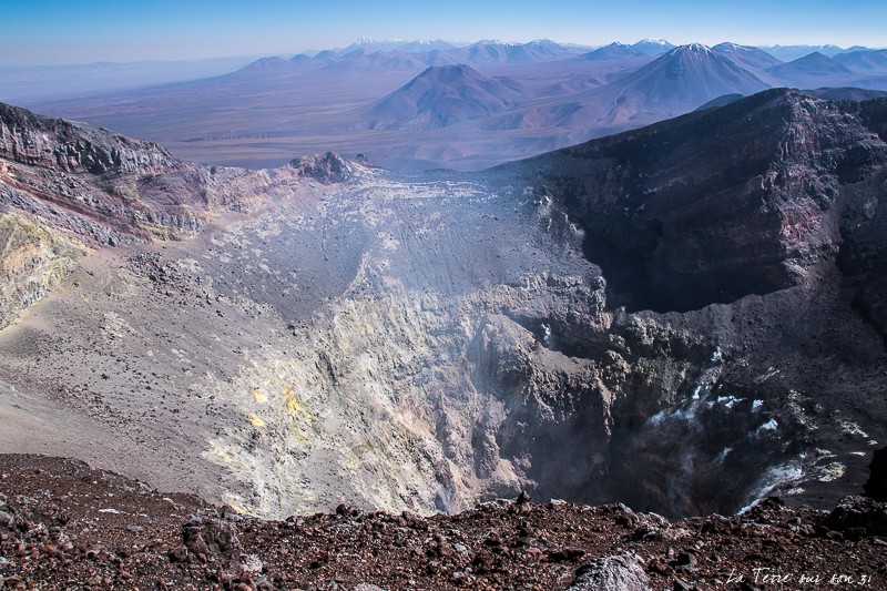
Chile , Lascar :
Seismology
The seismic activity of the period was characterized by the recording of:
4 VT-type seismic events, associated with rock fracturing (volcano-tectonics). The most powerful earthquake, with a local magnitude (ML) of 1.0, was located 0.6 km south-southeast of the volcanic edifice, at a depth of 4.8 km.
67 LP-type seismic events, associated with fluid dynamics within the volcanic system (long period). The amplitude of the largest earthquake, measured by the reduced displacement parameter (DR), was 5 cm².
Fluid Geochemistry
Sulfur dioxide (SO₂) emission data obtained by differential absorption spectroscopy (DOAS) at the Emu station, located 6 km east-southeast of the active crater, revealed an average SO₂ flux of 690 t/d for the study period, with a daily peak of 1,892 t/d on November 6.
Three anomalies in sulfur dioxide (SO₂) emissions into the atmosphere were observed near the volcano, according to data published by the German Aerospace Center (DLR) Earth Observation Center (EOC). The maximum mass of SO₂ emitted during this period reached 58 tonnes on November 27, calculated from Sentinel-5P image processing.
Satellite Thermal Anomalies
During the study period, 69 thermal alerts were recorded on the MIROVA platform in the volcanic zone. The maximum radiative power (PRV) was 1.4 MW for MODIS on November 1, 1.7 MW for VIIRS750 on the same day, and 2.6 MW for VIIRS375 on November 23, levels considered low. Analysis of Sentinel-2-L2A satellite images revealed five radiance anomalies, detected by false-color combinations on November 3, 11, 15, 18, 23, and 29. The NHI TOOLS tool did not identify any areas of high thermal intensity within the volcanic system.
Geodesy
Geodetic monitoring carried out during the period, using two GNSS stations and interferometric radar analysis (InSAR), yielded the following results:
– The GNSS stations recorded low rates of vertical displacement, less than 0.2 cm/month.
– Horizontal displacement rates at the GNSS stations remained below 0.2 cm/month, values considered low, with no significant trend over time suggesting deep pressurization.
The interferometric radar analysis (InSAR), performed on Sentinel-1A images acquired between December 10, 2024, and November 23, 2025, revealed no deformation near the volcano.
Surveillance Cameras
Images from fixed cameras installed near the volcano recorded degassing plumes. The plume reached its maximum height of 860 meters above the crater rim on November 24. Activity remained low, suggesting the volcano is stable.
The volcanic technical alert level remains: GREEN TECHNICAL ALERT: Active volcano with stable behavior – No immediate risk.
Source : Sernageomin
Photo : la terre sur son 31
Colombia , Puracé – Los Coconucos volcanic chain :
Popayán, December 7, 2025, 9:00 AM
Regarding the monitoring of activity in the Los Coconucos volcanic chain, the Colombian Geological Survey (SGC), an agency under the Ministry of Mines and Energy, reports the following:
Since the publication of yesterday’s extraordinary bulletin and up to the date of this announcement, earthquakes associated with fluid movements within the volcanic edifice continue to be recorded. These are long-period (LP) earthquakes and tremors (TR), with the occurrence of a persistent signal, called continuous tremor, being particularly noteworthy. This seismicity has been located primarily beneath the Puracé volcano crater and is linked to the sustained emission of gases into the atmosphere. Furthermore, low-magnitude signals associated with rock fracturing have been recorded southwest of the crater, at depths between 2 and 3 km.
Some tremor signals were accompanied by ash emissions, the dispersion of which depended on wind direction, primarily towards the Northeast. The 11:39 a.m. eruption was remarkable, with ash particles reaching over 700 meters above the volcano’s summit. In total, four (4) ash emissions were recorded at the Puracé volcano crater, triggering alerts to the Civil Aviation Authority.
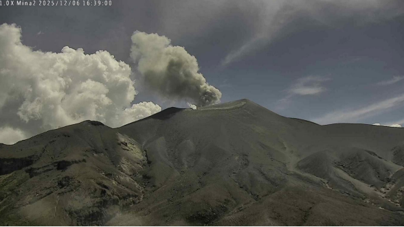
Image from the Mina camera, located 2.2 km north of the Purace volcano. Gas and ash plume recorded at 11:39 a.m. on December 6, 2025, at a height of over 700 m above the summit of the Purace volcano.
Sulfur dioxide (SO₂) emissions remain within the range observed in recent weeks. According to satellite image analysis, the sulfur dioxide dispersed primarily to the northeast within a 150 km radius of the volcano. Furthermore, a temperature increase continues to be detected in the crater area.
As long as the orange alert level remains in effect, temporary fluctuations in volcanic activity are possible, meaning that it may sometimes decrease compared to previous days or weeks. However, this does not necessarily mean that the volcano has returned to a stable level of activity. To return to a more stable level (yellow alert), a reasonable amount of time is needed to assess all monitored parameters and determine trends that may indicate reliable stabilization.
Given the above, the Geological Survey of Colombia (SGC) recommends staying away from the volcano’s crater and surrounding areas, closely monitoring the situation through special bulletins and information published on our official channels, and following the instructions of local and regional authorities and the National Unit for Disaster Risk Management (UNGRD).
The volcanic activity level remains at ORANGE alert: volcano exhibiting significant variations in monitored parameters.
Source et photo : SGC.
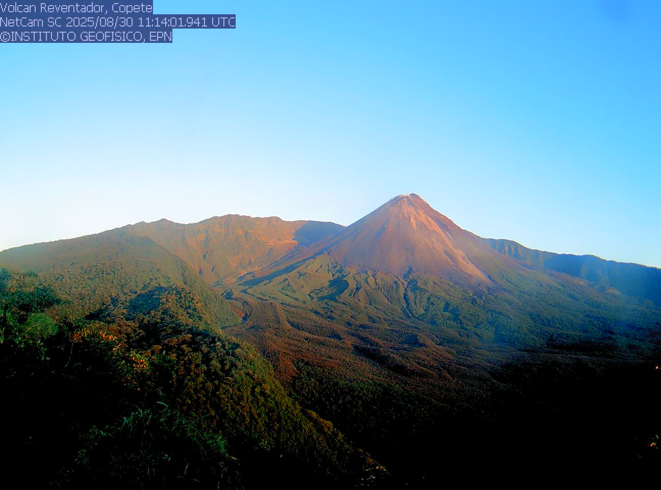
Ecuador , El Reventador :
REVENTADOR VOLCANO DAILY STATE REPORT, Sunday, December 7, 2025.
Geophysical Information Institute – EPN.
Surface Activity Level: High, Surface Trend: No Change
Internal Activity Level: Moderate, Internal Trend: No Change
From December 6, 2025, 11:00 AM to December 7, 2025, 11:00 AM:
Seismicity:
Below is the count of seismic events recorded at the reference station.
Explosion (EXP) 57
Long Period (LP) 7
Emission Tremor (TREMI) 4
Harmonic Tremor (TRARM) 3
Rainfall/Lahars:
No rainfall has been recorded in the volcano’s vicinity. **Heavy rainfall could remobilize accumulated material, generating mudflows and debris flows that would cascade down the volcano’s flanks and flow into nearby rivers.**
Emissions/Ash Plume:
Using the GOES-19 satellite system, several gas and ash emissions were detected at altitudes between 800 and 900 meters above the crater rim, drifting northeast.
Regarding this activity, the Washington VAAC agency issued two reports indicating ash clouds reaching 700 meters above the crater rim, drifting northeast and east.
Other Monitoring Parameters:
MIROVA MODIS recorded a thermal anomaly in the last 24 hours.
Alert level – SGR: Orange
Source et photo : IGEPN