October 3 , 2025.
Alaska , Great Sitkin :
Lava continues to erupt in the summit crater of Great Sitkin Volcano. Satellite data through September 30 showed continued slow advance of the lava from the vent, spreading to the southwest and southeast. Rockfalls from the step flow front continue and are traveling up to several hundred meters (~650 ft) down slope. Small earthquakes and rockfall signals were observed over the past day. Elevated surface temperatures continue to be observed. Webcam views were obscured by clouds over the past day.
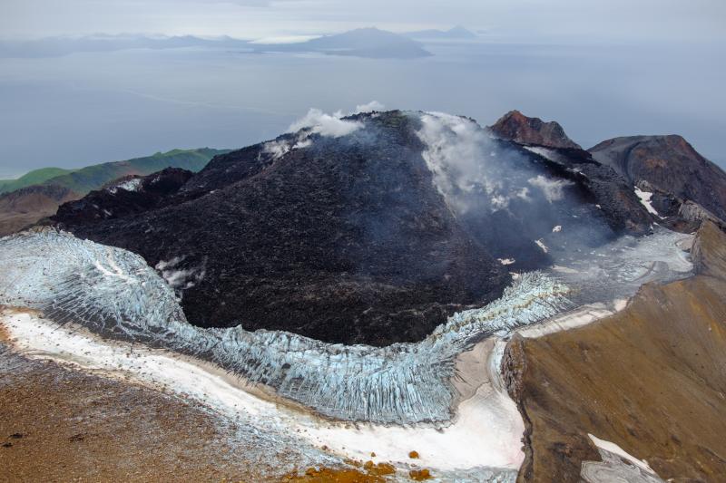
The current lava eruption began in July 2021 and since then has filled most of the summit crater and advanced into valleys below. There have been no explosions at Great Sitkin Volcano since an event in May 2021. The volcano is monitored using local seismic and infrasound sensors, satellite data and web cameras, and regional infrasound and lightning networks.
Source : AVO.
Photo : Loewen, Matt / AVO / U.S. Geological Survey.
Kamchatka , Krasheninnikov :
VOLCANO OBSERVATORY NOTICE FOR AVIATION (VONA)
Issued: October 3 , 2025
Volcano: Krasheninnikov (CAVW #300190)
Current aviation colour code: ORANGE
Previous aviation colour code: orange
Source: KVERT
Notice Number: 2025-102
Volcano Location: N 54 deg 35 min E 160 deg 16 min
Area: Kamchatka, Russia
Summit Elevation: 1856 m (6087.68 ft)
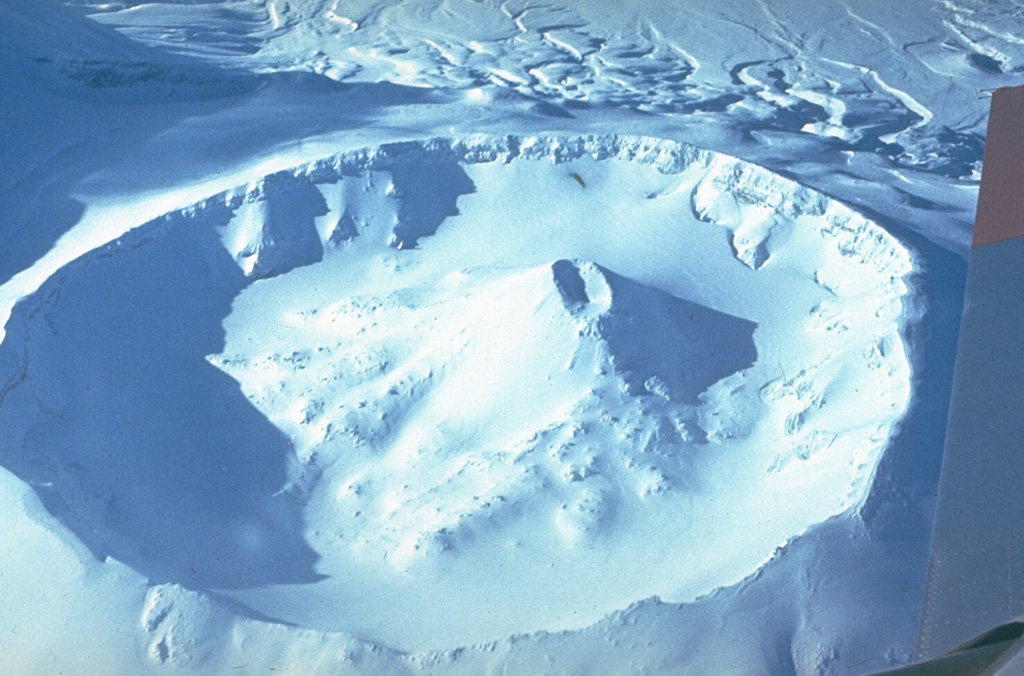
The 800-m-wide crater of the northern cone of Krasheninnikov is seen here looking west across the crater. An eruption 400 years ago formed the small Pauk cone within this crater, and also produced a lava flow from a vent on the upper SW flank of the southern cone (at left out of view).
Volcanic Activity Summary:
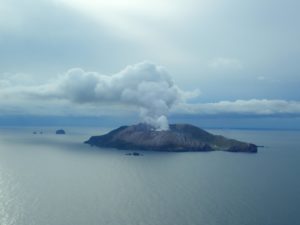
Satellite data by KVERT shows a strong wind lifts ash from the northern slopes of Krasheninnikov volcano, and a plume of resuspended ash is extending for about 75 km to the southeast of the volcano.
There is NO eruption, but an resuspended ash. Ongoing activity could affect low-flying aircraft.
Volcanic cloud height:
2500-3000 m (8200-9840 ft) AMSL Time and method of ash plume/cloud height determination: 20251003/0200Z – Himawari-9 14m15
Other volcanic cloud information:
Distance of ash plume/cloud of the volcano: 75 km (47 mi)
Direction of drift of ash plume/cloud of the volcano: SE / azimuth 134 deg
Time and method of ash plume/cloud determination: 20251003/0200Z – Himawari-9 14m15
Remarks:
There is NO eruption, but an resuspended ash.
The first historical eruption of the volcano began on 02 August, 2025. The explosive-effusive eruption of the volcano continues. The previous effusive eruption of the volcano occurred 400-600 years ago.
Source : Kvert .
Photo : Yuri Doubik (Institute of Volcanology, Petropavlovsk), via GVP.
Indonesia , Lewotobi Laki-laki :
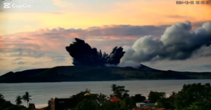
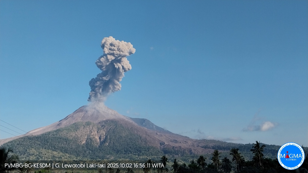
An eruption of Mount Lewotobi Laki-laki occurred on Thursday, October 2, 2025, at 4:54 PM WITA. An ash column was observed about 2,000 m above the summit (about 3,584 m above sea level). The ash column was gray and dense, oriented toward the west and northwest. This eruption was recorded by seismograph with a maximum amplitude of 29.6 mm and a duration of 208 seconds.
VOLCANO OBSERVATORY NOTICE FOR AVIATION – VONA
Issued : October 2 , 2025
Volcano : Lewotobi Laki-laki (264180)
Current Aviation Colour Code : ORANGE
Previous Aviation Colour Code : orange
Source : Lewotobi Laki-laki Volcano Observatory
Notice Number : 2025LWK476
Volcano Location : S 08 deg 32 min 20 sec E 122 deg 46 min 06 sec
Area : East Nusa Tenggara, Indonesia
Summit Elevation : 5069 FT (1584 M)
Volcanic Activity Summary :
Eruption with volcanic ash cloud at 08h54 UTC (16h54 local).
Volcanic Cloud Height :
Best estimate of ash-cloud top is around 11469 FT (3584 M) above sea level or 6400 FT (2000 M) above summit. May be higher than what can be observed clearly. Source of height data: ground observer.
Other Volcanic Cloud Information :
Ash cloud moving from west to northwest. Volcanic ash is observed to be gray. The intensity of volcanic ash is observed to be thick.
Remarks :
Eruption recorded on seismogram with maximum amplitude 29.6 mm and maximum duration 208 second.
Source et photo : Magma Indonésie .
La Réunion , Piton de la Fournaise :
Monthly Bulletin – September 2025, Piton de la Fournaise Volcanological Observatory – IPGP
Seismicity:
In September 2025, the OVPF-IPGP recorded a total of:
• 14 shallow volcano-tectonic earthquakes (0 to 2.5 km above sea level) beneath the summit craters;
• 2 deep earthquakes (below sea level);
• 2 long-period earthquakes;
• 63 rockfalls.
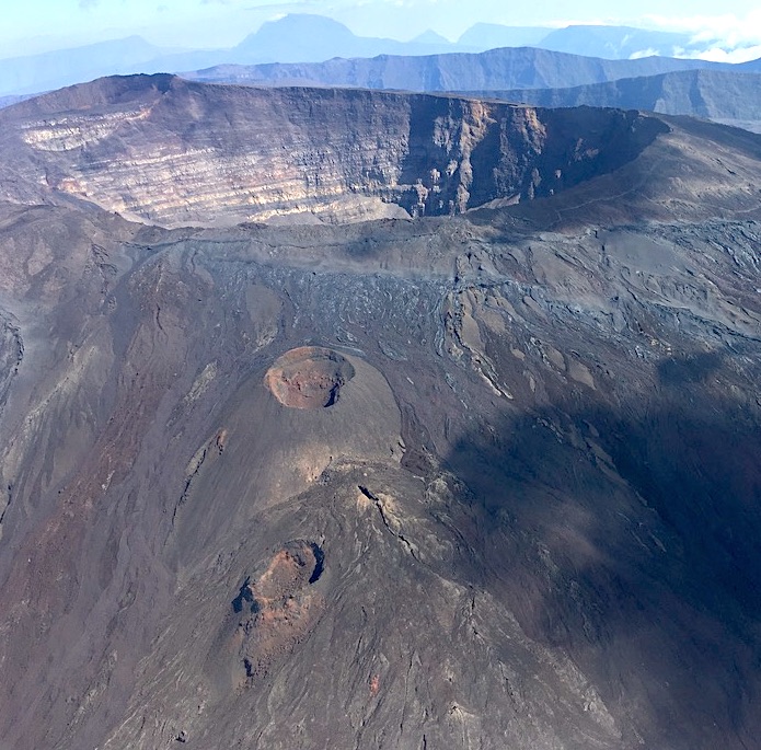
September 2025 was marked by low seismicity beneath Piton de la Fournaise, with only 14 shallow volcano-tectonic earthquakes and 2 deep earthquakes recorded. Only four shallow and two deep volcano-tectonic earthquakes could be located, respectively, beneath the Dolomieu crater and beneath the volcano’s eastern flank. The others, of lower magnitude, could not be located.
Numerous (63) landslides in the Dolomieu crater, at the ramparts of Enclos Fouqué, and at Cassé de la Rivière de l’Est were also recorded.
Deformation:
After resuming in February 2024, the edifice’s inflation stopped at the beginning of April 2024.
Since then, a slight deflation has been observed over the long term, particularly clearly visible at the summit stations. It should be noted that the two summit stations (DERG and DSRG) destroyed during Cyclone Garance on February 28, 2025, were reinstalled on September 24, 2025. The reinstallation of these two stations, which also serve as relays for the PVDG (Southeast of the terminal cone) and PRAG (Puys Ramond) stations, enabled the recovery of data from these two stations.
Summary
Since April 2024, magma replenishment and pressurization of the surface reservoir have ceased. In September 2025, seismicity remained low with only 14 shallow volcano-tectonic earthquakes and 2 deep earthquakes recorded. A slight summit deflation is still observed, and the September 2025 data confirm the general downward trend in CO2 emissions recorded since the last eruption of Piton de la Fournaise.
Source et photo : OVPF.
Mexico , Popocatepetl :
October 2, 11:00 a.m. (October 2, 5:00 p.m. GMT)
Activity in the last 24 hours
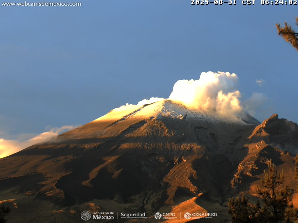
35 low-intensity exhalations were detected, accompanied by water vapor, volcanic gases, and occasionally small amounts of ash. In addition, 82 minutes of low-amplitude tremor were recorded, including 21 minutes of high-frequency tremor and 61 minutes of harmonic tremor.
During the morning, and sometimes masked by cloudy skies in the crater area, emissions of water vapor and volcanic gases were observed in a westerly direction.
The Popocatépetl volcano fire alert is at yellow phase 2.
The expected scenarios for this phase are as follows:
A few minor to moderate explosions
Occurrence of tremors of varying amplitude
Light to moderate ashfall in surrounding towns and some more distant towns
Expulsion of incandescent fragments within a 12-kilometer exclusion radius
Lahars descending into ravines are expected due to ash accumulation on the slopes and their interaction with the precipitation expected in the coming weeks
Possibility of pyroclastic flows not reaching towns
Source et photo : Cenapred .