August 23 , 2025.
Hawaii , Kilauea :
HVO/USGS Volcanic Activity Notice
Current Volcano Alert Level: WATCH
Current Aviation Color Code: ORANGE
Issued: Friday, August 22, 2025, 2:16 PM HST
Source: Hawaiian Volcano Observatory
Notice Number: 2025/H372
Location: N 19 deg 25 min W 155 deg 17 min
Elevation: 4091 ft (1247 m)
Area: Hawaii
Volcanic Activity Summary:
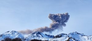
Episode 31 of the ongoing Halemaʻumaʻu eruption began at 2:04 p.m. HST on August 22 and is currently fountaining from the north vent. Past episodes have produced incandescent lava fountains over 1000 feet (300 meters) high that produce eruptive plumes up to 20,000 feet (6000 meters) above ground level. According to the National Weather Service, winds are blowing from the northeast at 15-20 miles per hour (8 meters per second), which suggests that volcanic gas emissions and volcanic material may be distributed to the south and southwest of the summit caldera.
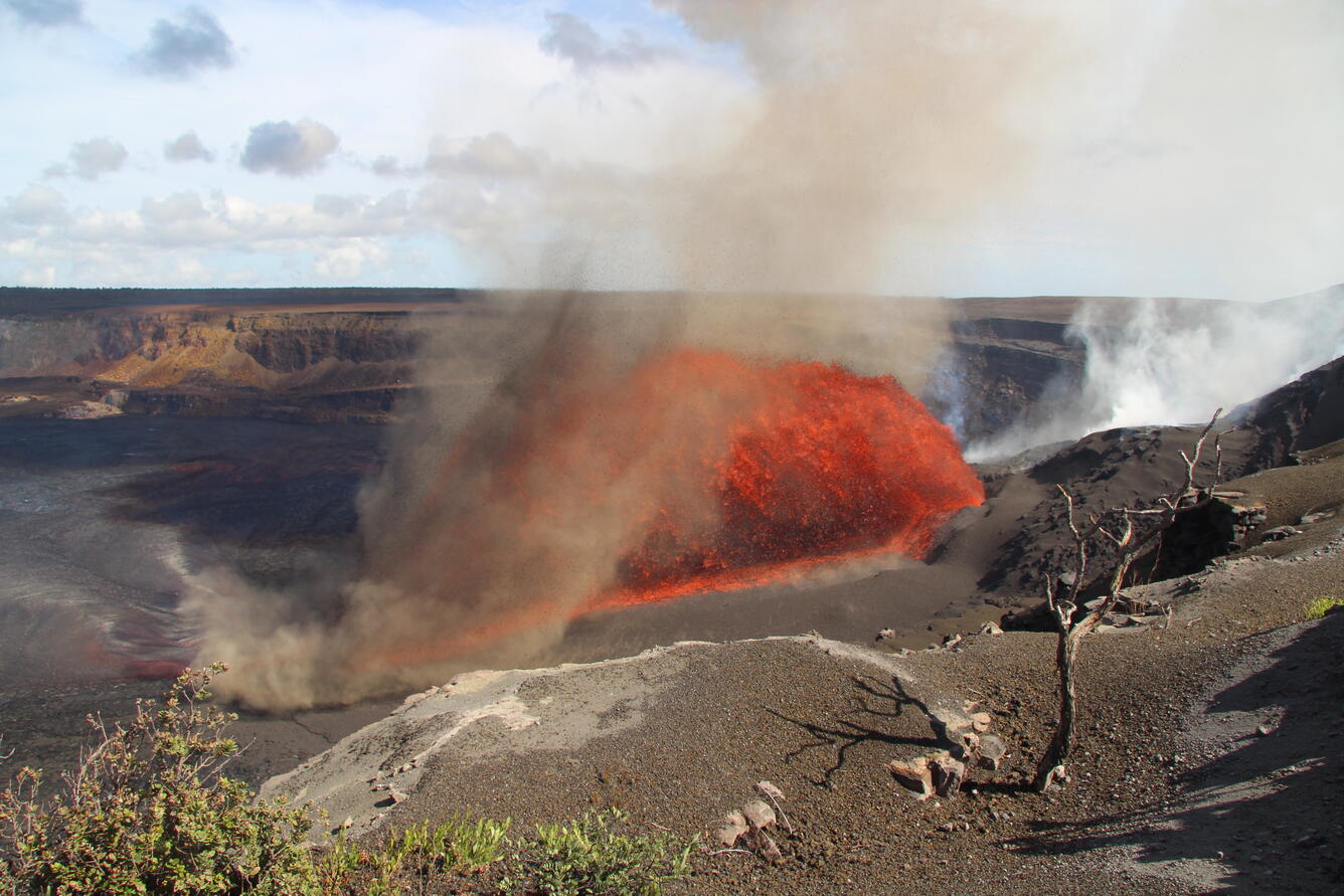
Inclined lava fountains from Kīlauea summit eruption episode 31 on August 22 have blanketed the Halemaʻumaʻu crater floor with tephra, in addition to feeding lava flows extending to the east.
All eruptive activity is confined to Halemaʻumaʻu crater within Hawaiʻi Volcanoes National Park; commercial airports in Hawaii County (KOA and ITO) will not be affected by this activity.
Episode 31 was preceded by continuous spatter in the north vent that began at approximately 8:30 a.m. and continued to increase in intensity until 11:45 a.m., when precursory lava overflows began. Fountaining the north vent began at 2:04 p.m. and and arcuate fountain approximately 100 feet (30 meters) high is feeding multiple lava streams at 2:15 p.m. HST.
Inflationary tilt reached just over 22 microradians since the end of the last episode. Seismic tremor began increasing and tilt at UWD switched from inflationary to deflationary at about 2:00 p.m. HST, about the same time lava flows began erupting onto the crater floor.
Most episodes of Halemaʻumaʻu lava fountaining since December 23, 2024, have continued for around a day or less and have been separated by pauses in eruptive activity lasting generally at least several days.
Source : HVO
Photo : USGS / M. Zoeller.
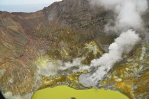
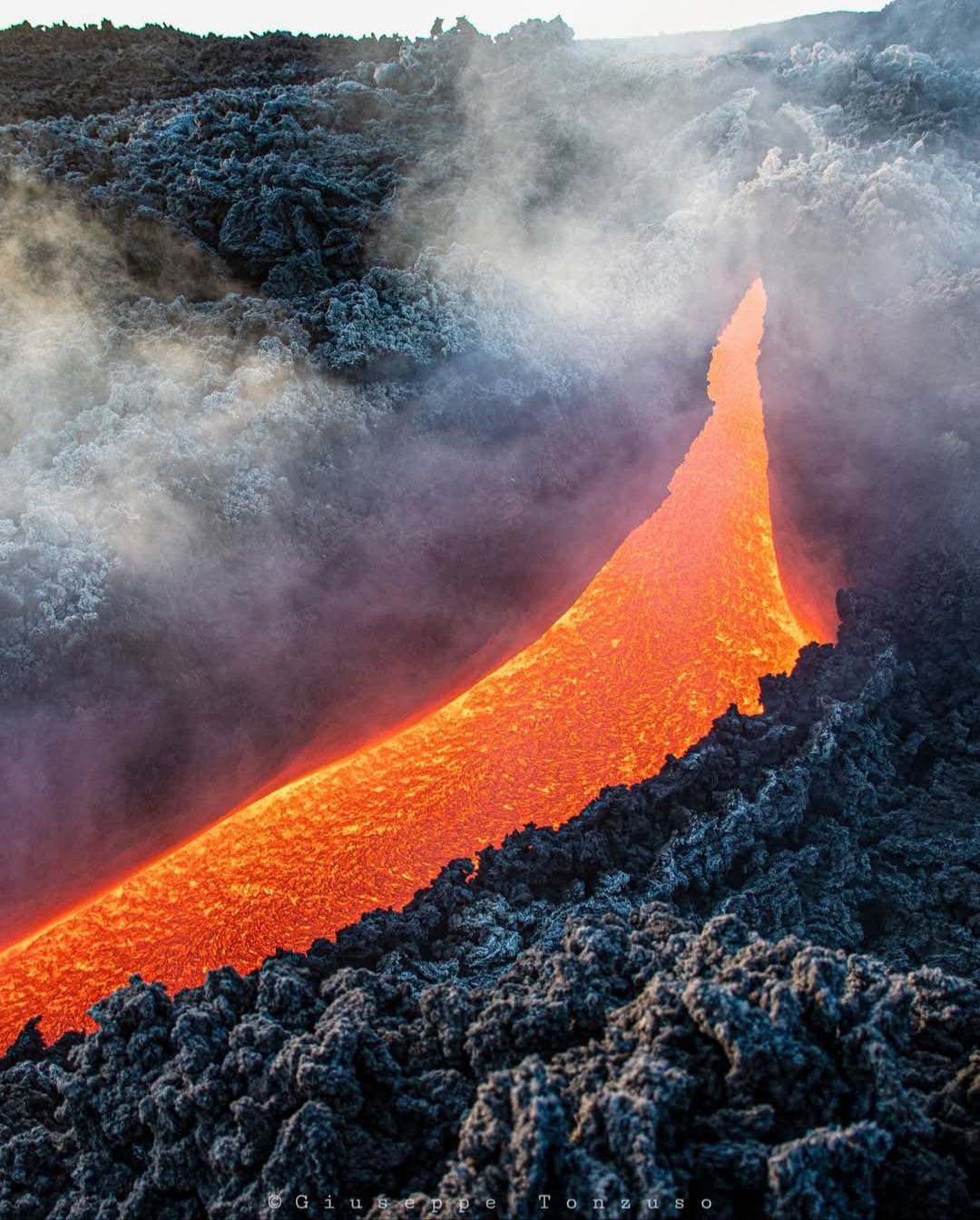
Italy / Sicily , Etna :
Etna Activity Report, August 22, 2025, 6:00 PM (4:00 PM UTC).
The Osservatorio Etneo, the National Institute of Geophysics and Volcanology, reports that, based on volcanological observations made by INGV personnel at the summit and analysis of images acquired by the video surveillance network, effusive activity is continuing at the vent located at an altitude of approximately 3,200 m, on the southern flank of the southeast crater, feeding a lava flow that is spreading southwestward. Effusive activity also continues at the weakly fed chimney located at 3,100 m altitude, whose most advanced front reached 3,050 m altitude this morning, as well as at the chimney located at 2,980 m altitude, whose most advanced front is estimated at approximately 2,500 m altitude. Strombolian activity also continues in the Southeast Crater, with ejections of pyroclastic products extending beyond the crater rim.
From a seismic perspective, over the past 24 hours, the average amplitude of volcanic tremor has remained high, with occasional strong fluctuations. The center of gravity of the tremor sources is located in the southeast crater area, at a depth of approximately 3,000 meters above mean sea level. The presence of strong summit winds has affected the automatic detection and localization of infrasound events. However, based on available locations and seismogram analysis, low-amplitude infrasound activity, located in the southeast crater, has been detected.
Ground deformation signals recorded by GNSS and inclinometer networks currently show no significant variation. The DRUV dilatometer station continues to show a slow variation in decompression, accumulating to date, since the beginning of the current effusive activity, a total of approximately -20 nanostrains.
Further information will be communicated shortly.
Source : INGV
Photo : Sicilia le sue bellezze e il cuore delle Madonie Piano Battaglia
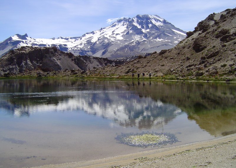
Chile , Descabezado Grande :
Special Report on Volcanic Activity (REAV), Del Maule region, Descabezado Grande volcanic complex, August 19, 2025, 8:10 PM local time (Continental Chile)
The National Geology and Mining Service of Chile (Sernageomin) announces the following preliminary information, obtained using the monitoring equipment of the National Volcanic Monitoring Network (RNVV), processed and analyzed at the Volcanological Observatory of the Southern Andes (OVDAS):
On Tuesday, August 19, 2025, at 7:53 PM local time (23:53 UTC), monitoring stations installed near the Descabezado Grande volcanic complex recorded an earthquake associated with rock fracturing within the volcanic system (VT volcano-tectonic type).
The earthquake characteristics after analysis are as follows:
TIME OF ORIGIN: 7:53 PM local time (11:53 PM UTC)
LATITUDE: 35.589°S
LONGITUDE: 70.762°W
DEPTH: 3.3 km
LOCAL MAGNITUDE: 3 (ML)
Observations:
No changes in the volcano’s seismic behavior were recorded after the event.
The Volcanic Technical Alert remains at Green.
Source : Sernageomin.
Photo : Wikiheinz
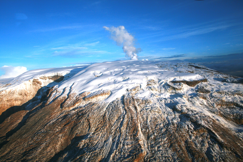
Colombia , Nevado del Ruiz :
Manizales, August 19, 2025, 5:20 p.m.
Regarding the monitoring of the activity of the Nevado del Ruiz volcano, the Colombian Geological Survey (SGC), an entity attached to the Ministry of Mines and Energy, reports that:
During the week of August 12 to 18, 2025, the volcano continued to exhibit unstable behavior. Compared to the previous week, the main variations in the monitored parameters were:
– Seismicity related to fluid dynamics in volcanic conduits decreased, with a decrease in the number of recorded earthquakes and the seismic energy released. The energy levels of these seismic signals were mostly low, sometimes moderate. No long-period signals were recorded during this week. Using cameras (conventional or thermographic) used to monitor the volcano, it was possible to confirm several pulsed ash emissions and variations in the apparent temperature of the emitted materials associated with this seismic activity.
The seismic activity associated with rock fracturing processes within the volcanic edifice decreased both in the number of recorded earthquakes and in the seismic energy released. The earthquakes were mainly located in the Arenas crater, at a depth of less than 3 km, measured from the volcano’s summit. To a lesser extent, seismic activity was recorded in the west-northwest, northeast, southeast, east, and south-southwest sectors, at distances of up to 10 km from the Arenas crater. The depth of the earthquakes ranged from less than 1 km to 9 km from the volcanic summit.
The strongest earthquakes of the week occurred on August 16 at 5:28 a.m. and on August 18 at 6:43 a.m. The first earthquake was located 10 km west-northwest of the Arenas Crater and at a depth of 8 km, and the second was located in the Arenas Crater, at a depth of 2 km. Both events had a magnitude of 1.4. Emissions of water vapor and gases, mainly sulfur dioxide (SO₂), into the atmosphere through the Arenas Crater varied throughout the week. Estimated values of the SO₂ flux associated with degassing increased slightly compared to those recorded the previous week.
The vertical height of the gas, water vapor, or ash column generally remained below 500 m above the volcano’s summit and reached a maximum height of 700 m. During the dispersal, the maximum height was estimated at 1,000 m, a value measured during the ash emission recorded on August 18 at 6:26 p.m. During the week, the direction of dispersal was oriented toward the northwest flank of the volcano.
During the monitoring of thermal anomalies at the floor of Arenas Crater using satellite monitoring platforms, detection continued on some days, limited by persistent atmospheric conditions of heavy cloud cover in the volcanic area. However, some low-energy anomalies were reported.
Source et photo : SGC.
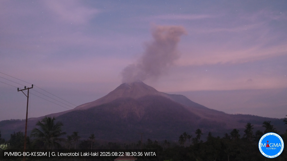
Indonesia , Lewotobi Laki-laki :
An eruption of Mount Lewotobi Laki-laki occurred on Friday, August 22, 2025, at 6:24 PM WITA. The observed ash column was ± 1,000 m above the summit (± 2,584 m above sea level). The ash column was gray, of low to moderate intensity, oriented southwest and west. This eruption was recorded by seismograph with a maximum amplitude of 10.5 mm and a duration of 115 seconds.
VOLCANO OBSERVATORY NOTICE FOR AVIATION – VONA
Issued : August 22 , 2025
Volcano : Lewotobi Laki-laki (264180)
Current Aviation Colour Code : ORANGE
Previous Aviation Colour Code : red
Source : Lewotobi Laki-laki Volcano Observatory
Notice Number : 2025LWK379
Volcano Location : S 08 deg 32 min 20 sec E 122 deg 46 min 06 sec
Area : East Nusa Tenggara, Indonesia
Summit Elevation : 5069 FT (1584 M)
Volcanic Activity Summary :
Eruption with volcanic ash cloud at 10h24 UTC (18h24 local).
Volcanic Cloud Height :
Best estimate of ash-cloud top is around 8269 FT (2584 M) above sea level or 3200 FT (1000 M) above summit. May be higher than what can be observed clearly. Source of height data: ground observer.
Other Volcanic Cloud Information :
Ash cloud moving from southwest to west. Volcanic ash is observed to be gray. The intensity of volcanic ash is observed from thin to medium.
Remarks :
Eruption recorded on seismogram with maximum amplitude 10.5 mm and maximum duration 115 second.
Source et photo : Magma Indonésia