June 16 , 2025.
Alaska , Iliamna :
ALASKA VOLCANO OBSERVATORY INFORMATION STATEMENT
U.S. Geological Survey
Sunday, June 15, 2025, 10:19 AM AKDT (Sunday, June 15, 2025, 18:19 UTC)
60°1’55 » N 153°5’30 » W,
Summit Elevation 10016 ft (3053 m)
Current Volcano Alert Level: UNASSIGNED
Current Aviation Color Code: UNASSIGNED
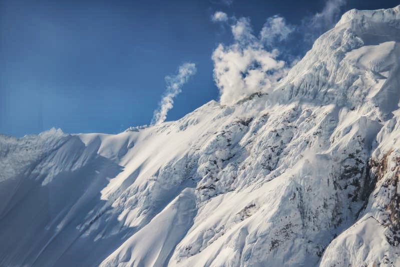
An increase in seismicity, marked by frequent small earthquakes, has been observed at Iliamna Volcano beginning at about 4:30 am AKDT (12:30 UTC), June 15, 2025. This activity is likely not caused by volcanic unrest. Initially, the earthquake rate was nearly continuous, with several earthquakes per minute, but this has since slowed to a rate of about one earthquake per minute. The seismic activity resembles that previously observed preceding large ice and rock avalanches at the volcano, although the outcome of the current activity remains uncertain. Large ice and rock avalanches at Iliamna Volcano in the past have often occurred around this time of year.
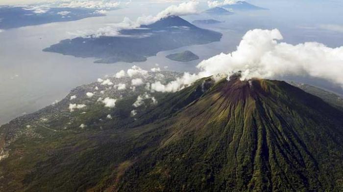
Iliamna volcano is located on the western side of lower Cook Inlet in Lake Clark National Park. It is a snow-covered stratovolcano which rises 3046 meters (9,993 feet) above sea level. Although steam plumes occur on its eastern flanks, there has been no historical volcanic activity at Iliamna. Iliamna is located 215 kilometers (130 miles) southwest of Anchorage and 100 kilometers (60 miles) northwest of Homer.
Source : AVO.
Photo : Mitchell, Mitch / USGS/AVO.
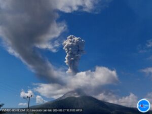
Indonesia , Gamalama :
Activity at Mount Gamalama, North Maluku, June 16, 2025
Mount Gamalama, located on Ternate Island in the North Maluku Islands, is one of Indonesia’s active volcanoes. Eruptions have been recorded since 1538. Its activity level has been at Level II, or WASPADA, since March 10, 2015. Eruptions typically occur in the central crater and are preceded by brief initial symptoms. The last eruption was recorded on October 4, 2018.
Visual observations revealed thin to moderate white smoke, ranging from 20 to 200 meters high, at the summit of Mount Gamalama’s main crater. At the same time, instrumental observations of seismicity are dominated by emission earthquakes, which have slowly increased since June 4, 2025. Four events were recorded, the most intense occurring on June 15, 2025: 29 emission earthquakes, with an amplitude of 8 to 38 mm and a duration of 22.08 to 49.06 seconds.
With the increase in seismic activity mentioned above and Mount Gamalama’s status still on Level II alert, Mount Gamalama continues to pose a potential risk of phreatic eruption. The current threat is an ejection of material from the main crater, affecting an area with a radius of 1.5 km around the eruption center. Light ash rain may occur, the distance and intensity of which depend on wind direction and speed. During the rainy season, residents living near rivers that originate at the summit of Mount Gamalama should systematically raise awareness of the potential secondary risks associated with lahars. Local authorities, including the Regional Disaster Management Agency (BPBD) of North Maluku Province and Ternate City, are encouraged to continue their active collaboration with the Gamalama Volcano Observation Post, located at Jalan Sabia Belakang, Sangaji Utara Village, North Ternate District, Ternate City, North Maluku.
The activity level of Mount Gamalama will be assessed periodically or at any time in the event of a significant change. The public is encouraged to remain calm, vigilant, and follow the authorities’ instructions for everyone’s safety.
Source : PVMBG.
Photo : KOMPAS/HERU SRI KUMORO
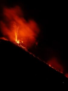
Ecuador , El Reventador :
DAILY STATUS REPORT OF REVENTADOR VOLCANO, Sunday, June 15, 2025.
Information Geophysical Institute – EPN.
Surface Activity Level: High, Surface Trend: No change
Internal Activity Level: Moderate, Internal Trend: No change
From June 14, 2025, 11:00 a.m. to June 15, 2025, 11:00 a.m.:
Seismicity:
Below is the count of seismic events recorded at the reference station.
Explosion (EXP) 94
Long Period (LP) 9
Emission Tremor (TREMI) 8
Harmonic Tremor (TRARM) 7
Rainfall/Lahars:
Precipitation was recorded in the volcanic area, but did not generate mudflows or debris flows. **Heavy rainfall could remobilize accumulated material, generating mudflows and debris flows that would cascade down the volcano’s flanks and flow into adjacent rivers.**
Emission/Ash Plume:
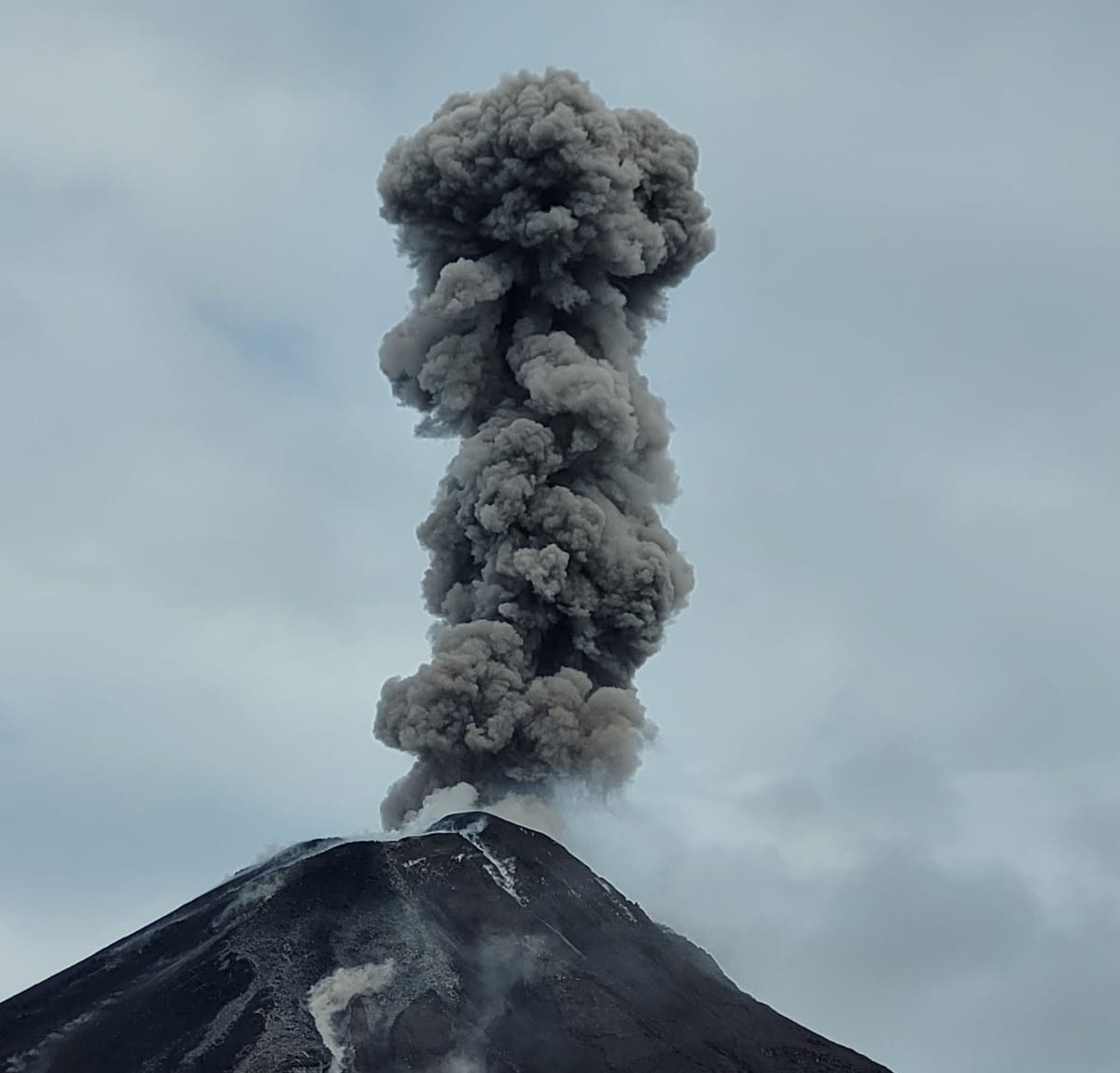
Since yesterday afternoon, several gas and ash emissions have been observed by surveillance cameras at altitudes between 700 and 1,000 meters above the crater level, in a southwesterly direction. Regarding this activity, the Washington-based VAAC agency has published five reports of ash emissions at altitudes between 700 and 1,000 meters above the crater level, in a westerly direction.
Other monitoring parameters:
The FIRMS satellite system detected six thermal anomalies, the MIROVA-VIIRS satellite system two thermal anomalies, and the MIROVA-MODIS satellite system one thermal anomaly.
Observation:
During the night and early morning, several episodes of incandescent material falling were observed on the volcano’s flanks, reaching 1,100 meters below the crater level. At the time of writing, the volcano remains entirely cloudy.
Alert Level – SGR: Orange
Source : IGEPN
Photo : GEPN via volcanes ecuador / FB
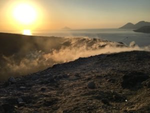
Costa Rica , Rincon de la Vieja :
Latitude: 10.83°N;
Longitude: 85.34°W;
Altitude: 1,916 m
Current activity level: Alert.
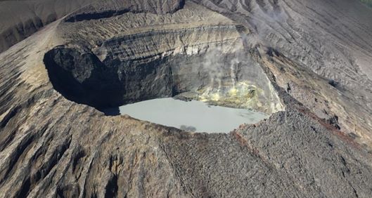
One eruption and two exhalations were recorded this week. The eruption occurred on Thursday, May 12, at 7:28 a.m.; however, it did not generate lahars or ash emissions. Tornillos-type earthquakes continue to occur. The dominant frequency of these earthquakes in 2025 remains generally stable, with a slight decreasing trend. Five low-magnitude volcano-tectonic events were recorded near the crater on June 7. Background volcanic tremor remains stable in the frequency range between 2 and 6 Hz. A slight decrease in tremor amplitude has been observed since June 9. Geodetic observations show a slight basal contraction without other significant deformation. The SO2 flux remains relatively low (weekly average of 140 ± 195 tons per day) with peaks (up to > 500 tons per day) associated with eruptions.
Source : Ovsicori .
Photo : Chris Allen de Sunquest Helitours
La Martinique , Mount Pelée :
Weekly report, Paris Institute of Earth Physics, Martinique Volcanological and Seismological Observatory.
Saint-Pierre, June 13, 2025, at 3:15 p.m. local time (GMT-4)
Volcanic activity decreased this week, with 43 earthquakes of volcanic origin observed.
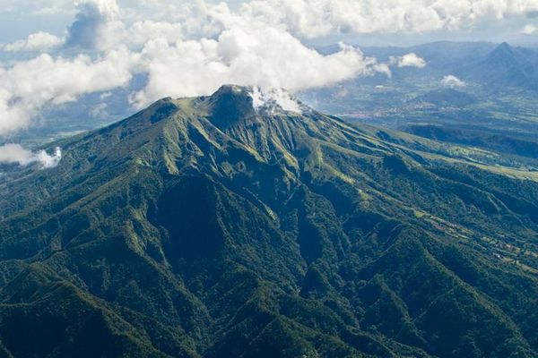
Between June 6, 2025, at 4:00 p.m. (UT) and June 13, 2025, at 4:00 p.m. (UT), the OVSM recorded 43 low-energy volcano-tectonic earthquakes. These earthquakes were clearly identified as originating from one of the well-known seismically active zones on Mount Pelée, located between 1.0 and 1.4 km deep below the volcano’s summit. The superficial volcano-tectonic seismicity is associated with micro-fracturing in the volcanic edifice linked to the global reactivation of the volcano observed since the end of 2018.
No earthquakes were felt by the population.
The previous week, the OVSM recorded 66 earthquakes of volcanic origin. As of June 13, 2025, and over the past four weeks, the OVSM has observed a total of 186 volcanic earthquakes, an average of 46 to 47 earthquakes per week.
During phases of volcanic reactivation in volcanoes similar to Mount Pelée, seismic activity of varying intensity and frequency is commonly observed.
For more details on observations and interpretations of volcanic activity over the longer term, refer to the OVSM’s monthly bulletins.
The alert level is currently YELLOW: vigilance.
Source : Direction de l’OVSM-IPGP.
Photo : Parc naturel Martinique