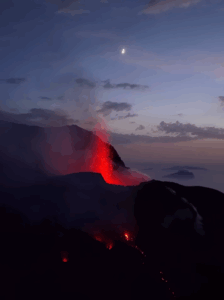
September 20 , 2022.
La Réunion , Piton de la Fournaise :
Press release of September 19, 2022 – 4:45 p.m. (local time) – 12:45 p.m. (UTC time)
Ongoing eruption
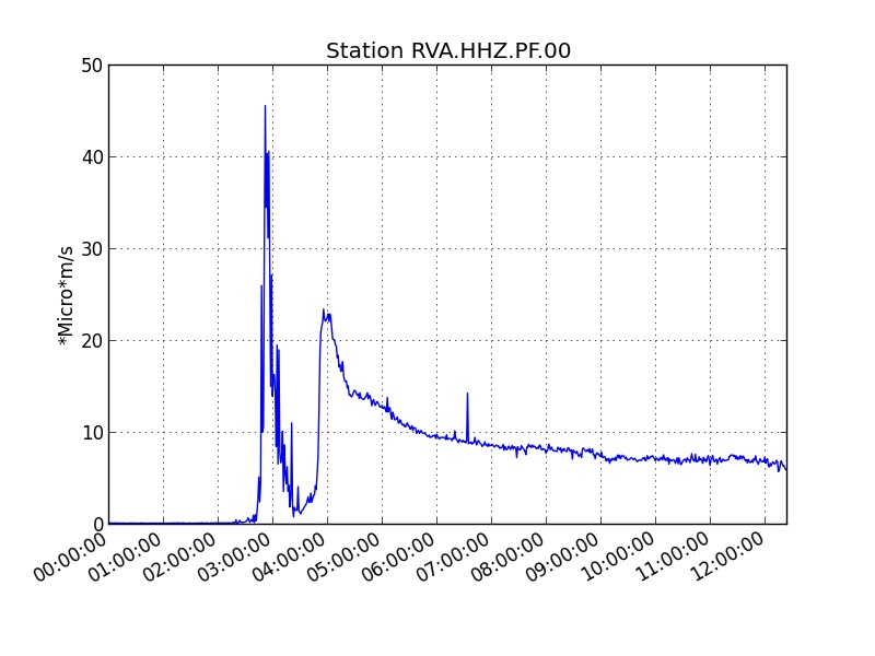
The eruption started today, 09/19/2022 around 7:48 a.m. local time continues. After a phase of increase at the start of the eruption, the intensity of the volcanic tremor (indicator of an emission of lava on the surface) has been gradually decreasing since around 8:00 a.m. (local time, 04:00 a.m. UT; Figure 1). This drop in tremor at the start of the eruption is usually observed at
beginning of each eruption at Piton de la Fournaise.
Figure 1: Evolution of the RSAM (indicator of a surface lava emission) since 09/19/2022 00:00 UTC time (04:00 local time) on the RVA seismological station located at the Rivals crater (© OVPF / IPGP).
The tremor location map made it possible to quickly locate the eruptive site at the south-southwest base of the terminal cone, in the Rivals crater sector (Figure 2).
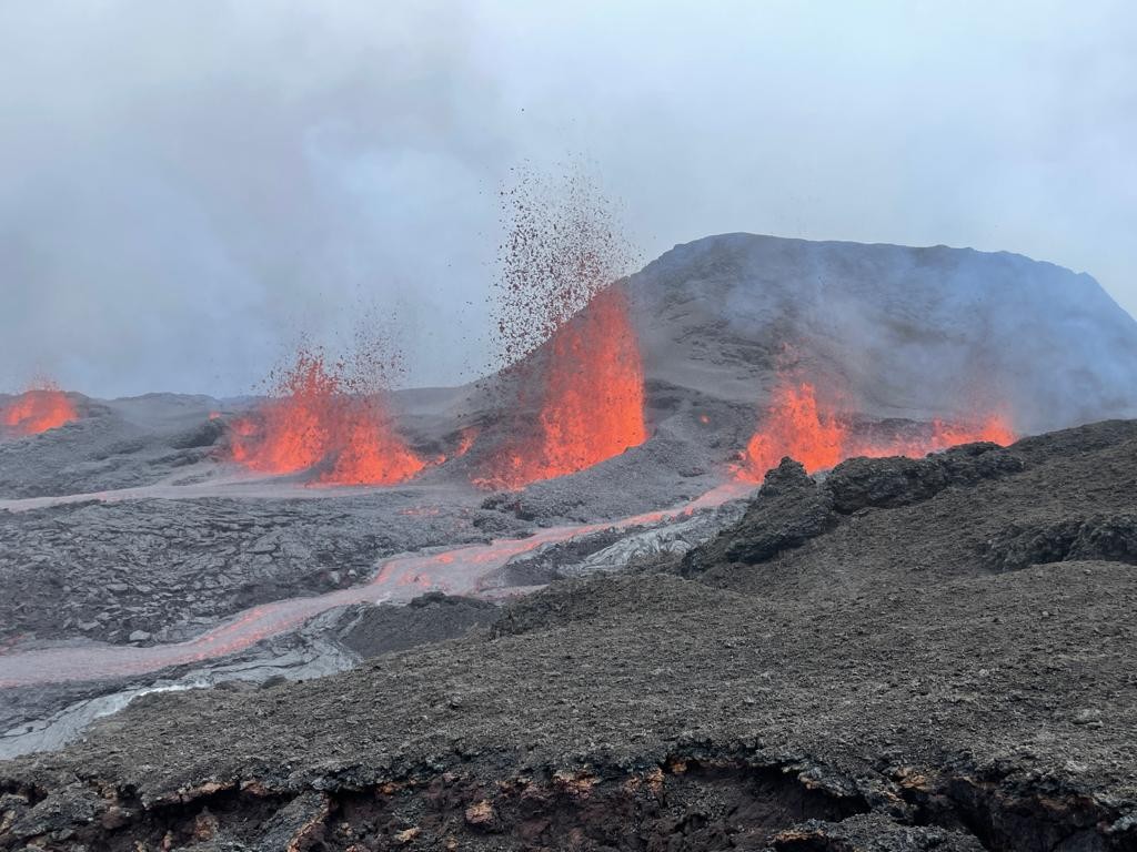
This location was confirmed by the PGHM teams on site to evacuate the Enclos , with the observatory of lava fountain activity (20-30 m high) located east of Piton Kala Pélé.
Seismic activity is still present below the summit; thus 72 volcano-tectonic earthquakes have been recorded since the start of the eruption. The majority of these earthquakes are located below the southern rim of the Dolomieu crater.
Due to the very bad weather conditions on site:
– no on-site reconnaissance could be carried out by the OVPF-IPGP teams, whether on foot or by air,
– and no lava flow estimate could be established by the HOTVOLC platform (OPGC – Clermont Auvergne University).
Alert level: Alert 2-1 (eruption in the Enclosure without any particular threat to the safety of people, property or the environment)
Source et photos : OVPF.
Russia / Kuril Islands , Alaid :
VOLCANO OBSERVATORY NOTICE FOR AVIATION (VONA)
Issued: September 18 , 2022
Volcano: Alaid (CAVW #290390)
Current aviation colour code: ORANGE
Previous aviation colour code: yellow
Source: KVERT
Notice Number: 2022-116
Volcano Location: N 50 deg 51 min E 155 deg 33 min
Area: Northern Kuriles, Russia
Summit Elevation: 2339 m (7671.92 ft)
Volcanic Activity Summary:
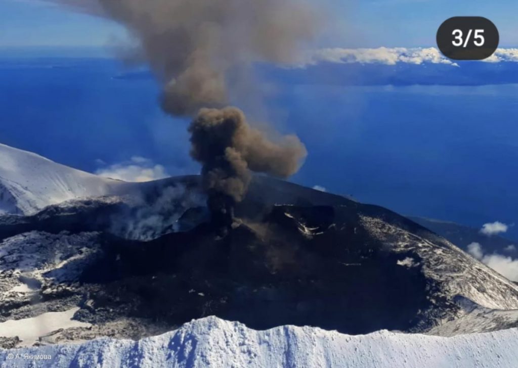
Probably the Strombolian explosive eruption of Alaid volcano began on 00:39 UTC on 15 September. A gas-steam plume containing some amount of ash is observing at present time: this plume extending to the east-southeast of the volcano. KVERT continues to monitor Alaid volcano.
Moderate eruptive activity of the volcano continues. Ash explosions up to 6 km (19,700 ft) a.s.l. could occur at any time. Ongoing activity could affect low-flying aircraft.
Volcanic cloud height:
2500-2600 m (8200-8528 ft) AMSL Time and method of ash plume/cloud height determination: 20220918/0008Z – NOAA-18 4m5
Other volcanic cloud information:
Distance of ash plume/cloud of the volcano: 32 km (20 mi)
Direction of drift of ash plume/cloud of the volcano: ESE / azimuth 109 deg
Time and method of ash plume/cloud determination: 20220918/0008Z – NOAA-18 4m5
Remarks:
Alaid – the volcano-Island, is situated at a distance 30 km north-west from Paramushir Island, and 70 km southwest from Kamchatka. Alaid exposes high potential hazard to the aircrafts flying over Kamchatka and the Kuriles because its eruptive plumes can rise up to 10-15 km a.s.l., and extend for hundreds of kilometers, and the duration of eruptions can exeed a few months. Last eruption of Alaid was in 2015-2016.
Source : Kvert.
Photo : A. Yakimova
New Zealand , Lac Taupo :
The Volcanic Alert Level for Taupō Volcano is raised to Volcanic Alert Level 1 (minor volcanic unrest). The minor volcanic unrest is causing the ongoing earthquakes and ground deformation at Taupō Volcano.
GNS Science, through the GeoNet programme, continually monitors Taupō volcano and our other active volcanoes for signs of activity. There has been an increase in earthquakes and deformation (ground movement) at Taupō since May 2022 indicating volcanic unrest is occurring. The Volcanic Alert Level (VAL) change this week has been informed by our ongoing analysis of monitoring data, increased knowledge of Taupō Volcano from research programmes and new knowledge of causes of past unrest at Taupō Volcano.
Figure 1: Earthquakes located by GeoNet in the Lake Taupō area from January 1 to September 18, 2022. Most earthquakes shown here were located between 4 and 13 km deep. There are almost 700 earthquakes shown within the dashed area of the map. There are also clusters of small earthquakes at geothermal fields in the Taupō area that are unrelated to the Taupō volcanic unrest.
Although this is the first time we have raised the VAL to 1, this is not the first volcanic unrest at Taupō. There have been 17 previous episodes of unrest over the past 150 years. Several of these were more severe than what we are currently observing at Taupō. None of these episodes, or the many other episodes which would have occurred over the past 1800 years before written records were kept, ended in an eruption. The last eruption at Taupō volcano was in 232 AD ± 10 years. The chance of an eruption at Taupō remains very low in any one year.
The earthquakes and deformation could continue for the coming weeks or months. While some of the earthquakes may be felt in areas around Lake Taupō, the deformation is currently only detectable by our sensitive monitoring instruments.
We have now located almost 700 earthquakes, mainly at a depth of 4 to 13 km beneath the lake (Figure 1).
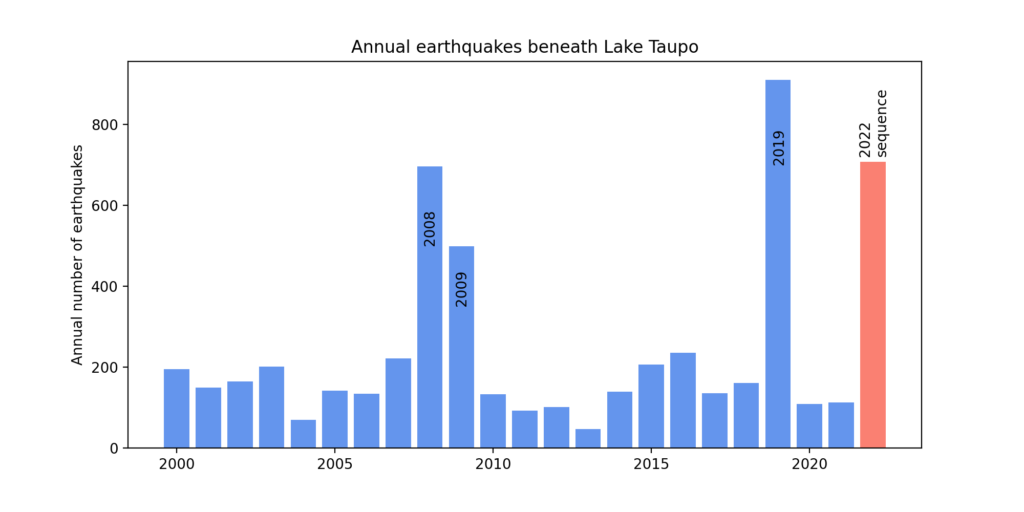
The earthquake locations in this year’s sequence are forming two clusters in the central part of the lake. There is a cluster beneath the central and eastern part of the lake and a smaller, western cluster centred just offshore from Karangahape. Shown in Figure 2 is the number of earthquakes detected and located each year since 2000 in the dashed area outlined in the map (Figure 1).
In addition to seismic activity, GeoNet continuously monitors ground deformation (land movement) about Lake Taupō. Our GNSS (GPS) instruments around the lake have observed uplift at a rate of 60 ± 20 mm per year since May 2022 at a site at Horomatangi Reef in the lake. Modelling of the GNSS data indicates that the area that is rising beneath the lake is in the same place as the main region of earthquake activity.
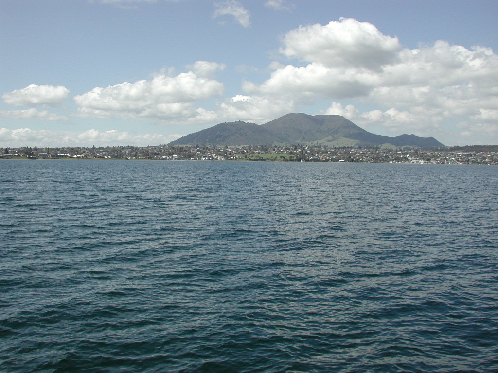
Mount Tauhara from Lake Taupo
We interpret the ground uplift and earthquake activity to be caused by the movement of magma and the hydrothermal fluids inside the volcano. We have also sampled springs and gas vents around the lake for changes in chemistry that may be related to the earthquake and ground uplift.
Source : Geonet.
Photos : Geonet , pseudopanax.
Chile , Laguna del Maule :
Special Report on Volcanic Activity (REAV), Del Maule region, Laguna del Maule volcanic complex, September 19, 2022, 10:58 a.m. local time (mainland Chile).
The National Service of Geology and Mines of Chile (Sernageomin) publishes the following PRELIMINARY information, obtained through the monitoring equipment of the National Volcanic Monitoring Network (RNVV), processed and analyzed at the Volcanological Observatory of the Southern Andes ( Ovdas):
On Monday September 19, 2022, at 09:24 local time (12:24 UTC), the monitoring stations installed near the Laguna del Maule volcanic complex recorded a swarm of earthquakes of 118 events associated with rock fracturing (volcano-tectonic type), located 8.4 km west – south-west of the center of the lagoon.
The characteristics of earthquakes after their analysis are as follows:
ORIGINAL TIME: 09:24 local time (12:24 UTC)
LATITUDE: 36.104°S
LONGITUDE: 70.584°W
DEPTH: 5.1km
LOCAL MAGNITUDE: 1.3ml
COMMENTS:
Continuation of the seismic swarm. At the time of this report, a decrease in seismic activity was recorded. The vast majority of events are considered low energy.
The volcanic technical alert remains at the Green level.
Sources : Sernageomin.
Photo : segemar.
Indonesia , Merapi :
Report on the activity of Mount Merapi from September 09, 2022 to September 15, 2022, Published on September 16, 2022
RESULTS OF OBSERVATIONS
Visual
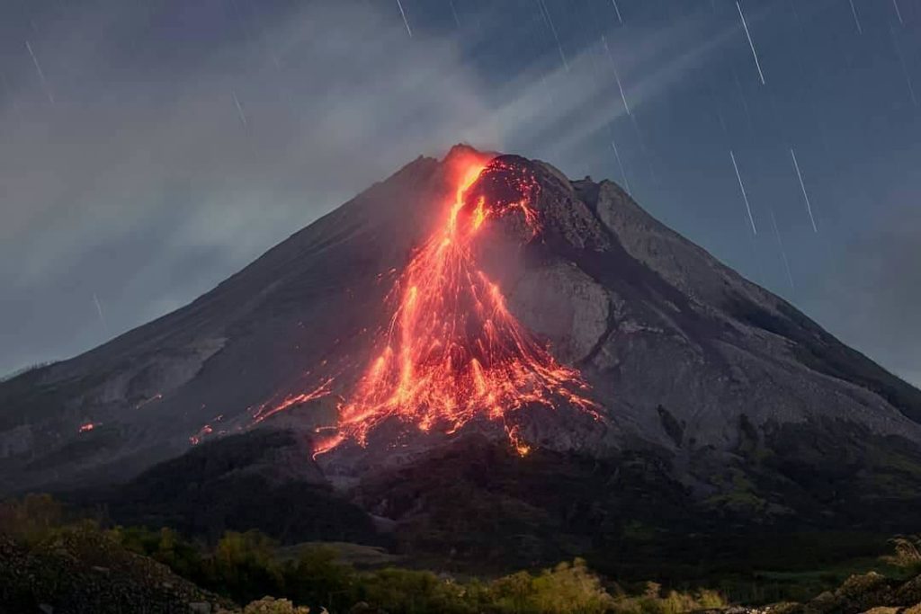
The weather around Mount Merapi is usually sunny in the morning and afternoon, while the evening is foggy. White smoke, thin to medium thickness, low pressure and 75 m high was observed from the Mount Merapi observation post of Babadan on September 15, 2022 at 06:13 WIB.
This week, 13 lava avalanches were observed in the Southwest, descending the Bebeng River with a maximum sliding distance of 1800 m.
On the Southwest dome, there is no change in the height of the dome. For the central dome, no significant morphological change was observed. Based on photo analysis, the volume of the dome is still calculated at 1,664,000 m3, and for the central dome it is 2,772,000 m3.
Seismicity
This week, the seismicity of Mount Merapi showed:
429 deep volcanic earthquakes (VTA),
71 shallow volcanic earthquakes (VTB),
519 multi-phase earthquakes (MP),
426 avalanche earthquakes (RF),
1 low frequency earthquake (LF)
37 emission earthquakes (DG),
15 tectonic earthquakes (TT).
The intensity of this week’s seismicity is still quite high.
Deformation
Mount Merapi’s deformation that was monitored using EDM and GPS this week showed a distance shortening rate of 0.7 cm/day.
Rain and lahars:
This week, no rain was reported at the Mount Merapi observation post. There have been no reports of lahars or additional flow in the rivers that originate from Mount Merapi.
Conclusion
Based on the results of visual and instrumental observations, it is concluded that:
The volcanic activity of Mount Merapi is still quite high in the form of effusive eruption activity. The state of the activity is defined at the « SIAGA » level.
Source : BPPTKG.
Photo : @ilhamm_ska

