February 20 , 2021
Italy / Sicily , Etna :
COMMUNICATION ON THE ACTIVITY OF ETNA [UPDATE n. 141]
The National Institute of Geophysics and Volcanology, Osservatorio Etneo, announces that lava fountain activity is underway which produces an eruptive cloud which disperses in the atmosphere towards the south. The flow noted in the previous press release is fed.
The average amplitude of the volcanic tremor reached high values with a tendency to increase further. The source of the tremor remains located under the Southeast Crater, at a depth of about 2700 m above sea level.
The infrasonic activity also shows high values of the rate of occurrence and the energy of infrasonic transients, with a tendency to increase.
COMMUNICATION ON THE ACTIVITY OF ETNA [UPDATE n. 142]
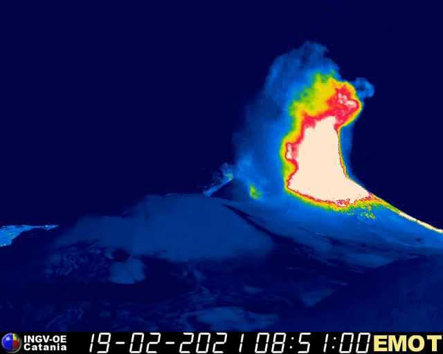
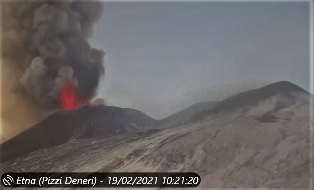
The National Institute of Geophysics and Volcanology, Osservatorio Etneo, announces that the intensity of the lava fountain produced by the Southeast Crater has increased, which produces an eruptive cloud that disperses in the atmosphere at an altitude of ‘approximately 6000 m in a South-East direction. The lava flow that propagates towards the Valle del Bove continues to be fed and the front is at an altitude of about 2700 m.
All seismic parameters remain at high values.
The deformation data of the GPS network did not record any significant variations, limited variations (0.1 – 1 microradians) of the inclinometric network are recorded.
Third paroxysmal episode. Many explosive interactions between lava and snow, sometimes sufficiently intense, cause small pyroclastic flows (if we can call them that, since the mechanism of fragmentation is rather ′ ′ hydroclastic ′ ′ or ′ ′ hydromagmatic ′ ′).
COMMUNICATION ON THE ACTIVITY OF ETNA [UPDATE n. 144]
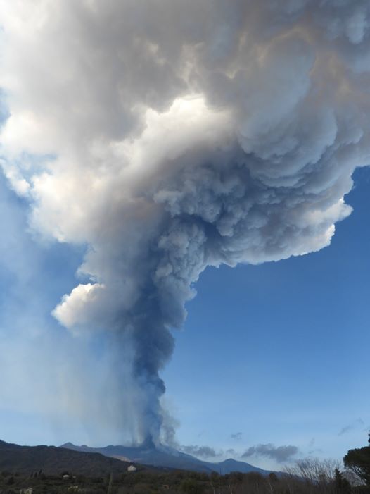
The National Institute of Geophysics and Volcanology, Osservatorio Etneo, announces that the lava fountain has ceased from around 09:50 UTC, the lava flows that extend over the Valle del Bove, are located at an altitude of approximately 2600 m above sea level, but not moving slowly but no longer supplied. The eruptive cloud produced by the explosive activity dispersed in an east-south-east direction at an altitude of about 10,000 m, causing ash and lapilli to fall on the inhabited areas on the east side of the volcano.
From around 9:30 UTC, the average amplitude of the volcanic tremor and infrasonic activity recorded a decrease in their intensity and are currently comparable to those that preceded the activity of the lava fountain.
The deformation data indicates a return of the variations recorded on the inclinometric network.
COMMUNICATION ON THE ACTIVITY OF ETNA [UPDATE n. 145]
The National Institute of Geophysics and Volcanology, Osservatorio Etneo, reports that the eruptive activity at the Southeast Crater has ended and that only a weak emission of dilute ash remains, which is quickly dispersed into the atmosphere. Several lava flows were emitted, mainly towards the East and the North-East, as during the paroxysmal episodes of February 16 and 18, 2021, in the direction of the Valle del Bove. Another lava overflow occurred from the vent on the southern flank of the Southeast Crater cone (also known as « Bocca della Sella »), hence at the top of the paroxysm , lava fountains were produced with those produced by the East vents. This lava flow extended southward towards the region of Torre del Filosofo and southwest, following a similar path to that of the lava flows of December 2020. The southwest arm has traveled approximately 1.5 at 2 km.
The lava flows are no longer fed, but the fluid parts are still moving and the lava fronts continue to advance slowly.
Throughout the activity of the lava fountain, the explosive activity inside the other summit craters continued unchanged. INGV staff is currently on site to check the state of the feed supply.
The average amplitude value of volcanic tremor is in the range of average values. The infrasonic activity is very moderate in the number and energy of infrasonic transients.
COMMUNICATION ON THE ACTIVITY OF ETNA [UPDATE n. 146]
The National Institute of Geophysics and Volcanology, Osservatorio Etneo, announces that the staff of the INGV-Etneo Observatory present on the ground reports that the two lava flows, directed towards the South-West and the East in the Valle del Bove, no longer seem to be fed. In particular, in correspondence with the lava flows directed towards the Valle del Bove, one observes the rolling of unstable blocks, as well as from the sides of the cone of the South-East crater, in particular from the South-East. No explosive activity is observed in the Southeast Crater, while eruptive activity continues inside the other summit craters.
The results of laboratory analyzes of the products emitted during the lava fountains of February 16 and 18, 2021, indicate that the composition of the magma emitted from December 2020 to February 2021 is among the most primitive of the paroxysmal activity produced by the Southwest crater. These findings, observed in the activity cycle of this crater since 2019, indicate that the composition of the magma has become progressively more primitive, suggesting that a deep magma recharge process is underway in the volcanic system.
The value of the mean amplitude of the volcanic tremor is in the range of the mean values, with a slight tendency to decrease. The source of the tremor affects the area of the summit craters at a depth of about 2800 m above sea level and is mainly located below the Southeast Crater. The infrasonic activity is very moderate in the number and energy of infrasonic transients; the latter coincide with the Southeast Crater.
The deformation data, after the return of the variations recorded on the inclinometric network during the lava fountain, do not show significant variations.
Further updates will be communicated shortly.
Source : INGV .
Photos : INGV , Webcam.
Vidéo : Gio Giusa .
Indonesia , Merapi :
Mount Merapi activity report from February 12 to 18, 2021.
OBSERVATION RESULT
Visual
The weather around Mount Merapi is generally sunny in the morning, while the afternoon until evening is foggy. There is white smoke, thin to thick with low pressure. A maximum smoke height of 500 m is observed from the Ngepos observation post on February 17, 2021 at 06:30 WIB.
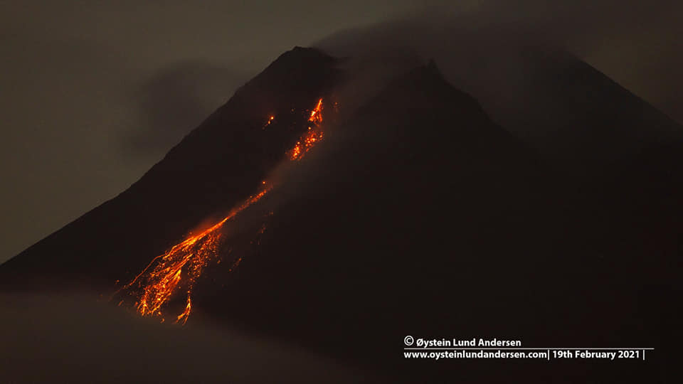
Morphological analysis of the peak area based on photos of the southwest sector from February 17 shows a change in the morphology of the peak area due to avalanche activity. From drone data dated February 17, 2021, 2 (two) lava domes were observed which are located in the Southwest (attached to the 1997 lava wall) and a dome in the middle of the crater. Based on the calculation of the aerial photographs, the Southwest dome has dimensions of 258 m long, 133 m wide, 30 meters high, and a volume of 397,500 m3 with a growth rate of 25,200 m3 / day. While the lava dome in the center of the crater has dimensions of 160 m long, 120 m wide, 50 meters high and a volume of 426,000 m3 with an average growth rate of 10,000 m3 / day.
Seismicity
This week, the seismicity of Mount Merapi recorded:
3 shallow volcanic earthquakes (VTB),
60 multi-phase earthquakes (MP),
943 avalanche earthquakes (RF),
17 emissions earthquakes (DG)
12 tectonic earthquakes (TT).
The seismic intensity this week is lower than last week.
Deformation
The deformation of Mount Merapi which was monitored using EDM and GPS this week showed no significant changes.
Rain and lahars
This week there was rain at Mount Merapi Observation Post with the highest rainfall intensity of 63mm / hour for 20 minutes at Kaliurang Post on February 15, 2021. It was reported that there was an increase in the flow of the Kali Boyong on February 16, 2021.
Conclusion
Based on the results of visual and instrumental observations, it is concluded that:
The volcanic activity of Mount Merapi is still quite high in the form of effusive eruption activity. The status of the activity is defined at the “SIAGA” level.
Source : BPPTKG
Photo : Oystein Lund Andersen .
Hawaii , Kilauea :
19°25’16 » N 155°17’13 » W,
Summit Elevation 4091 ft (1247 m)
Current Volcano Alert Level: WATCH
Current Aviation Color Code: ORANGE
Activity Summary:
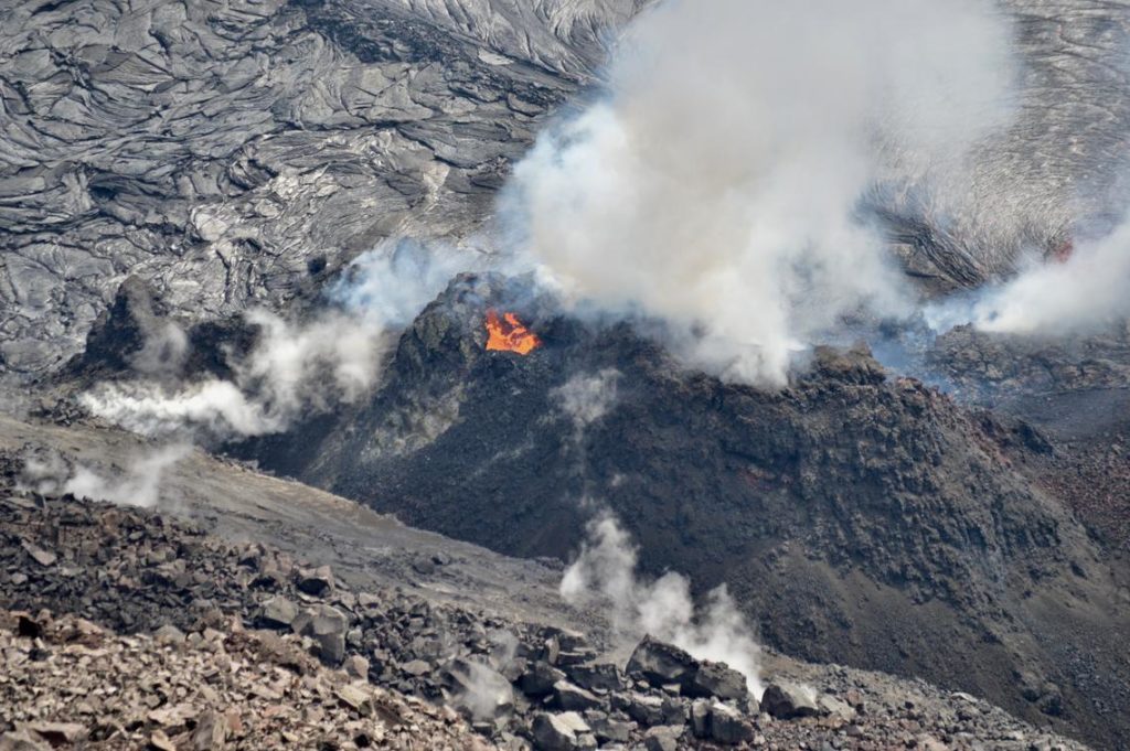
Kīlauea Volcano is erupting. Lava activity is confined to Halemaʻumaʻu with lava erupting from a vent on the northwest side of the crater. As of the morning of February 18, the lava in the western (active) portion of the lake in Halema‘uma‘u was 217 m (712 ft) deep with intermittent crustal foundering. The eastern portion of the lava lake has a stagnant and solidified surface crust. SO2 emission rates remain elevated at 1,200 t/day.
Lava continues to erupt from the west vent in Halema‘uma‘u, at the summit of Kīlauea. On Wednesday morning, February 17, small pieces of spatter were occasionally ejected from the vent, landing on the slope below. This type of activity has decreased significantly over the past several weeks. Lava from the west vent continues to enter the lava lake at an inlet near the base of the spatter cone.
Summit Observations:
The most recent sulfur dioxide emission rate measurements from February 16 are about 1,200 t/d—lower than the emission rates from the pre-2018 lava lake (around 5,000 t/d). The summit tiltmeters show steady ground change of slight inflation over the past 24 hours. Seismicity remains stable, with elevated tremor and no minor earthquakes.
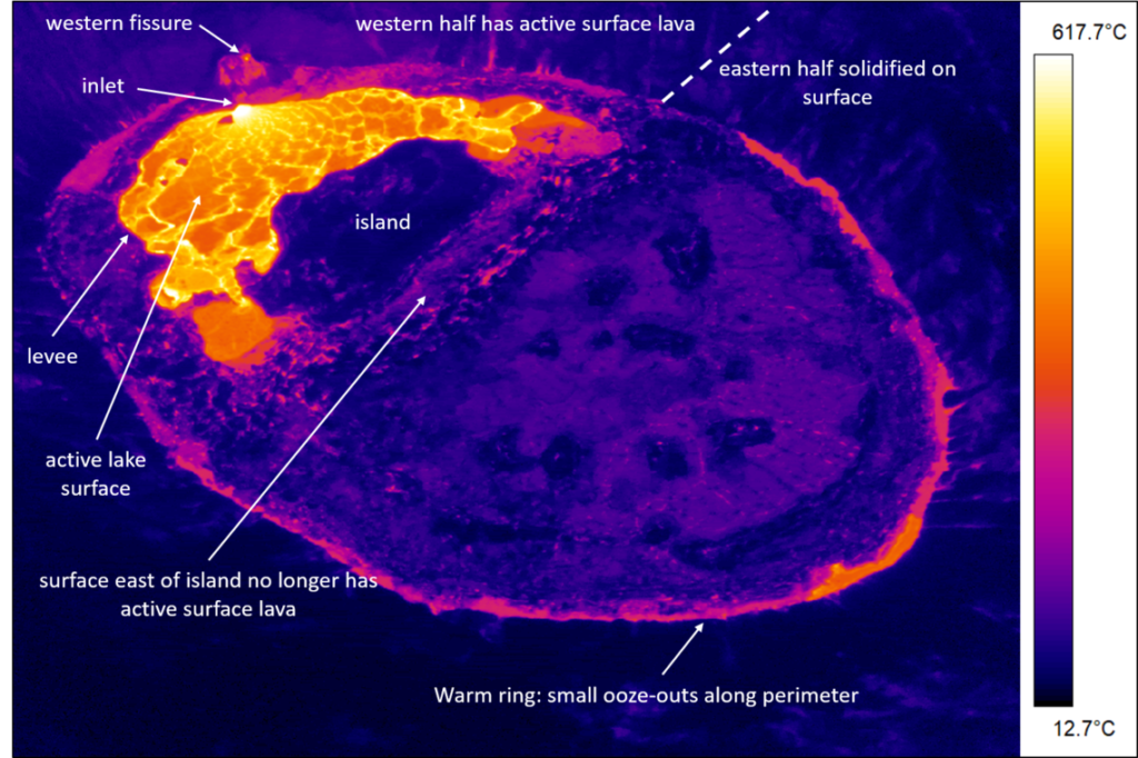
On the February 16 helicopter overflight, at approximately 9:20 a.m. HST, thermal imagery was collected of the ongoing eruption within Halema‘uma‘u crater, at the summit of Kīlauea Volcano. This annotated thermal image shows the western active lava surface is limited to an area on the north, south, and west sides of the largest island. Lava continues to enter the lava lake from the west vent through an inlet at the base of the spatter cone. The warm ring around the edge of the lake is caused by ooze-outs as the lake surface continues to rise. The temperature scale is in degrees Celsius.
Halemaʻumaʻu lava lake Observations:
Lava from the west vent continues to supply the lava lake within Halema‘uma‘u crater.
The active western half of the lava lake was approximately 217 m (712 ft) deep today on February 18, 2021. The small increase in depth since yesterday coincides with current effusion rates and slight inflationary trend.
Over the past day, lava effusion continued at the western fissure, with the lava rapidly developing a thin crust and flowing outwards towards the east. The eastern half of the lake crust is stagnant.
Source : HVO
Photos : USGS / B. Carr.
Guatemala , Pacaya :
Activity:
The Pacaya Volcano Observatory reports that, due to the weather conditions that have reigned in the places since last night, it has not been possible to observe the activity in the crater, nor to hear any type of sound. or perceive a rumble derived from explosive activity. Likewise, it is not possible to distinguish a degassing column. However, the PCG and PCG5 seismic stations record sporadic tremors and incremental pulses associated with the movement of magma inside the volcanic building.
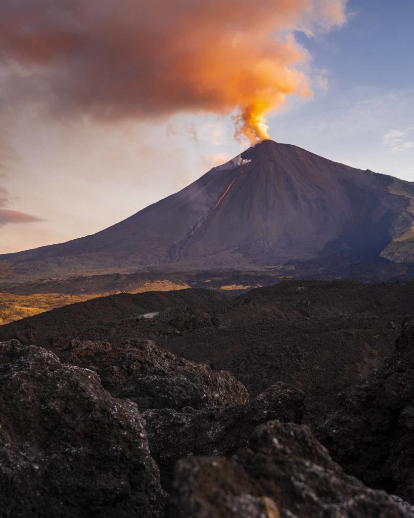
The lava flow on the South-Southwest flank has been observed without incandescence since last night, however, this area of lava flow still maintains very high temperatures and is likely to generate avalanches and ash columns due of its collapse. It is not excluded that new lava flows appear on other flanks or that the growth pulses continue or that ash emissions occur from the crater in the following hours or days.
The recommendations of the special BEPAC bulletin n ° 030-2021 remain valid.
Source : Insivumeh .
Photo : @diegorizzophoto

