February 7 , 2026.
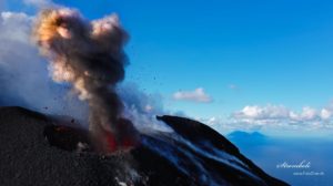
Alaska , Shishaldin :
Signs of volcanic unrest at Shishaldin Volcano continued this week. Low-level seismic activity, including frequent small earthquakes and volcanic tremor, was detected throughout the week. Infrasound signals, likely caused by gas bubbles bursting deep within the volcanic vent, were also detected occasionally this week. A steam and gas plume was observed in webcam views when the weather was clear. Sulfur dioxide plumes were detected several times during the week. These emissions originate from the degassing of shallow magma.
Shishaldin Volcano is monitored by local seismic and infrasound sensors, web cameras, and a telemetered geodetic network. In addition to the local monitoring network, the Alaska Volcano Observatory uses nearby geophysical networks, regional infrasound and lightning data, and satellite data to monitor the volcano.
Source : AVO.
Photo : AVO
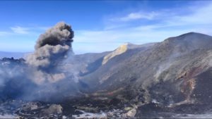
Kamchatka , Sheveluch :
KVERT VOLCANIC ACTIVITY NOTICE (VAN)
Issued: February 7 , 2026
Volcano: Sheveluch (CAVW #300270)
Current aviation colour code: ORANGE
Previous aviation colour code: red
Source: KVERT
Notice Number: 2026-22
Volcano Location: N 56 deg 38 min E 161 deg 19 min
Area: Kamchatka, Russia
Summit Elevation: 3283 m (10768.24 ft), the dome elevation ~2500 m (8200 ft)
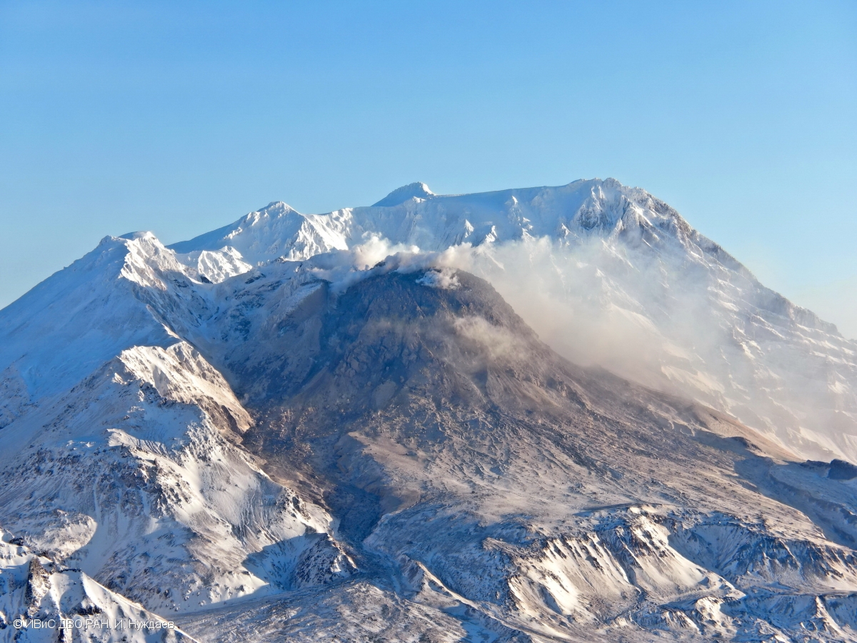
Volcanic Activity Summary:
No new ash explosions have been observed on the volcano Sheveluch at now, but an ash cloud at altitude of 9 km a.s.l. continues to move for 130 km to the north-west of the volcano.
An explosive-extrusive eruption of the volcano continues. Ash explosions up to 12 km (39,400 ft) a.s.l. could occur at any time. Ongoing activity could affect international and low-flying aircraft.
Volcanic cloud height: NO ASH CLOUD PRODUSED
Other volcanic cloud information: NO ASH CLOUD PRODUSED
Source : Kvert.
Photo : I. Nuzhdaev, IVS FEB RAS ( archive).
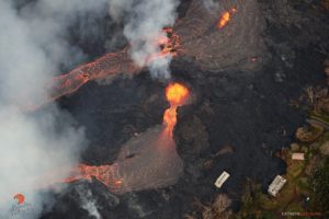
Hawaii , Kilauea :
HAWAIIAN VOLCANO OBSERVATORY DAILY UPDATE , U.S. Geological Survey
Friday, February 6, 2026, 9:17 AM HST (Friday, February 6, 2026, 19:17 UTC)
19°25’16 » N 155°17’13 » W,
Summit Elevation 4091 ft (1247 m)
Current Volcano Alert Level: WATCH
Current Aviation Color Code: ORANGE
Activity Summary:
The Halemaʻumaʻu eruption of Kīlauea is paused. Summit inflation continued over the past day at a steady rate. Weak glow at the south vent was visible in the webcams overnight. The forecast for the onset of episode 42 lava fountaining is between February 11 and 15 based on current rates of summit inflation.
No significant activity has been noted along Kīlauea’s East Rift Zone or Southwest Rift Zone.
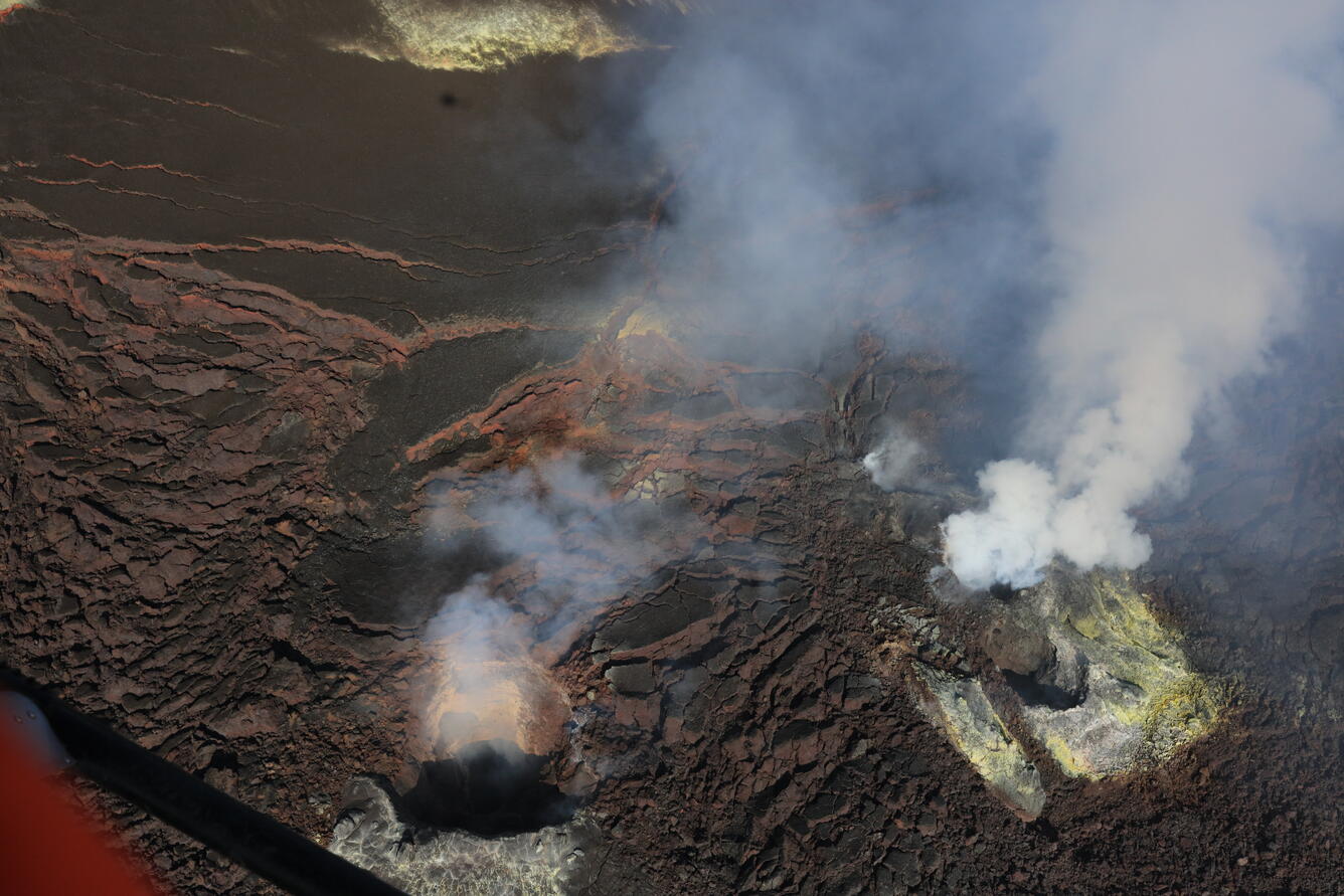
USGS Hawaiian Volcano Observatory geologists captured this view during a morning helicopter monitoring overflight of Kīlauea summit caldera, Kaluapele, on the morning of February 4, 2026. Despite glow present on the USGS livestream cameras overnight, no lava or incandescent material was visible in the north (right) and south (left) vents.
Summit Observations:
Weak glow at the south vent returned this morning at about 3:30 a.m., following an absence of glow the previous night. A brief burst of glow was also seen last night at the north vent around 9:38 p.m.
Seismic tremor continued over the past 24 hours. Recurring pulses of increased tremor have ceased over the past day, with seismic tremor relatively steady. Earthquake activity at Kīlaueaʻs summit was low over the past 24 hours.
The Uēkahuna tiltmeter (UWD) has recorded 23.2 microradians of inflationary tilt since the end of episode 41, including 1.8 microradians of inflationary tilt in the past 24 hours.
The sulfur dioxide (SO2) emission rate from the summit was last measured on February 2 at 5,172 tonnes per day, which is slightly higher than the typical range of 1,000 to 5,000 tonnes of SO2 per day observed during previous eruptive pauses. This is considerably lower than rates observed during lava fountaining episodes. Areas near Kīlauea summit including Hawai’i Volcanoes National Park and nearby communities have been experiencing higher than usual levels of vog (volcanic air pollution) due to ongoing light and variable winds. The National Weather Service forecast indicates south southwest winds today at 7-11 mph.
Rift Zone Observations:
Rates of seismicity and ground deformation remain very low in the East Rift Zone and Southwest Rift Zone. SO2 emissions from the East Rift Zone remain below the detection limit..
Source : USGS.
Photo : USGS / D. Downs.
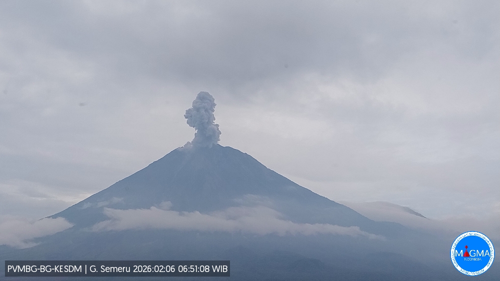
Indonesia , Semeru :
Mount Semeru erupted on Friday, February 6, 2026, at 6:49 a.m. West Indonesian Time. An ash column was observed approximately 700 meters above the summit (at an altitude of about 4,376 meters). This ash column, white to gray in color, was highly intense and drifted northeast. The eruption was recorded by a seismograph with a maximum amplitude of 22 mm and a duration of 125 seconds.
VOLCANO OBSERVATORY NOTICE FOR AVIATION – VONA
Issued : February 6 ,2026
Volcano : Semeru (263300)
Current Aviation Colour Code : ORANGE
Previous Aviation Colour Code : orange
Source : Semeru Volcano Observatory
Notice Number : 2026SMR271
Volcano Location : S 08 deg 06 min 29 sec E 112 deg 55 min 12 sec
Area : East java, Indonesia
Summit Elevation : 11763 FT (3676 M)
Volcanic Activity Summary :
Eruption with volcanic ash cloud at 23h49 UTC (06h49 local).
Volcanic Cloud Height :
Best estimate of ash-cloud top is around 14003 FT (4376 M) above sea level or 2240 FT (700 M) above summit. May be higher than what can be observed clearly. Source of height data: ground observer.
Other Volcanic Cloud Information :
Ash cloud moving to northeast. Volcanic ash is observed to be white to gray. The intensity of volcanic ash is observed to be thick.
Remarks :
Eruption recorded on seismogram with maximum amplitude 22 mm and maximum duration 125 second
Source et photo : Magma Indonésie .
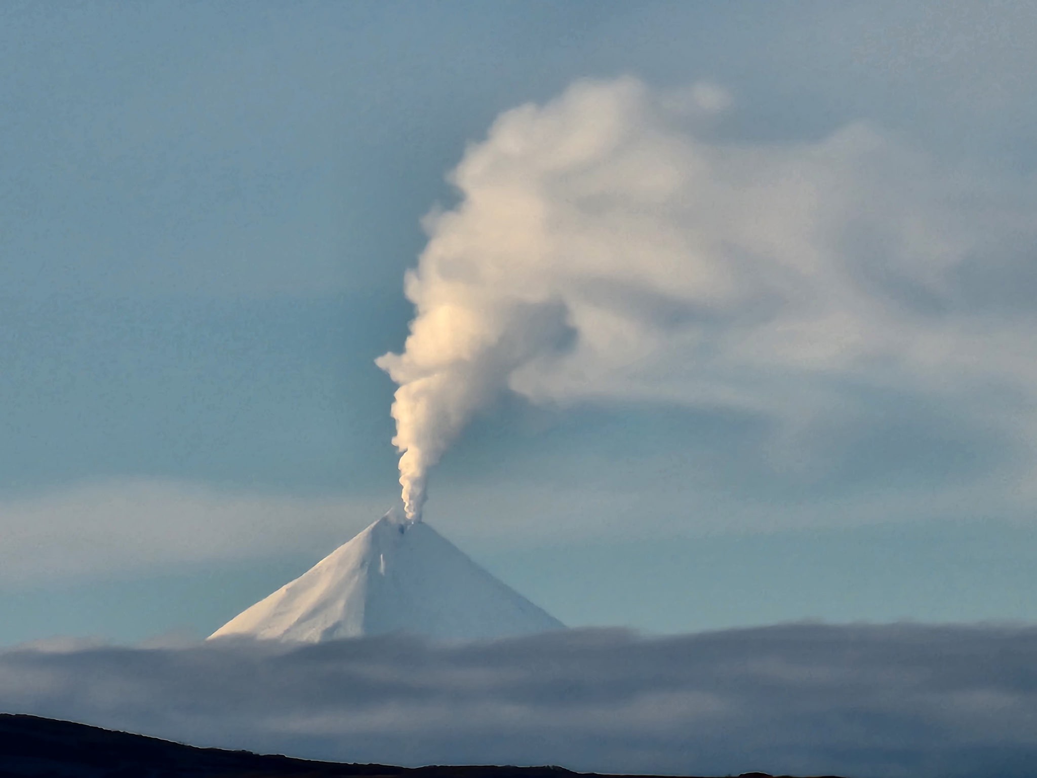
Colombia , Cumbal :
San Juan de Pasto, February 3, 2026, 4:30 PM
Regarding the monitoring of activity at the Cumbal Volcanic Complex (CVC), the Colombian Geological Survey (SGC), an agency under the Ministry of Mines and Energy, reports the following:
During the week of January 27 to February 2, 2026, the main variations in monitored parameters compared to the previous week were as follows:
● In a context of low volcanic activity, a decrease in the number of earthquakes and their energy release was recorded. The most significant seismic contribution corresponded to rock fracturing processes within the volcanic edifice.
Among the localized events, the maximum magnitude was 1.5.
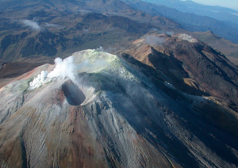
● Weak gas emissions were recorded at the Rastrojos, Boca Vieja, and El Verde fumaroles, with dispersion varying according to wind direction.
● All other volcanic monitoring parameters remained stable.
In light of the above, the Geological Survey of Colombia (SGC) recommends closely monitoring the situation through weekly bulletins and other information published via its official channels, as well as following the instructions of local and departmental authorities and the National Unit for Disaster Risk Management (UNGRD).
Volcanic activity remains at the yellow alert level: active volcano exhibiting changes in the reference behavior of monitored parameters and other manifestations.
Source et photo : SGC.