November 19 , 2026.
Hawaii , Kilauea :
HAWAIIAN VOLCANO OBSERVATORY DAILY UPDATE , U.S. Geological Survey
Wednesday, November 18, 2026, 8:45 AM HST (Wednesday, November 18, 2026, 18:45 UTC)
19°25’16 » N 155°17’13 » W,
Summit Elevation 4091 ft (1247 m)
Current Volcano Alert Level: ADVISORY
Current Aviation Color Code: YELLOW
Summary:
The Halema’uma’u eruption of Kīlauea remains paused following episode 56 fountaining on November 5. The summit is deflating slowly and the episode 57 forecast window is November 20-23.
Overview:
The summit has been slowly deflating since midnight and continuous glow remained visible overnight from both the north and southwest vents. Another fountaining episode remains likely and the current forecast window for episode 57 fountaining is November 20-23.
Summit Observations:
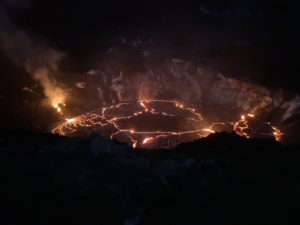
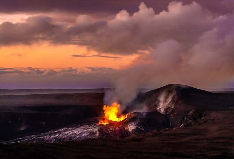
Summit webcams recorded strong glow from both the north and southwest vents overnight. Views from the V1cam livestream webcam overnight showed nearly continuous flames from the north vent along with rare spatter.
Seismic tremor remains elevated during the eruption pause. Two earthquakes were located beneath the summit in the past day.
The Uēkahuna tiltmeter (UWD) has recorded nearly continuous summit inflation since the end of episode 56 lava fountaining, however, tilt flattened yesterday and began slowly deflating around midnight, which is slowing inflation recovery. This morning, UWD has recovered a total of about 14.5 microradians of inflationary tilt since the end of episode 56.
The average sulfur dioxide (SO2) emission rate recorded by the summit gas monitoring array yesterday, November 17, was about 2,600 tonnes per day. Trade winds this morning are carrying volcanic gases to the southwest.
Rift Zone Observations:
Rates of seismicity and ground deformation remain low in the East Rift Zone and Southwest Rift Zone. SO2 emissions from the East Rift Zone remain below the detection limit.
Source : HVO.
Photo : J.Wei
Kamchatka , Sheveluch :
KVERT VOLCANIC ACTIVITY NOTICE (VAN)
Issued: November 18 , 2026
Volcano: Sheveluch (CAVW #300270)
Current aviation colour code: ORANGE
Previous aviation colour code: orange
Source: KVERT
Notice Number: 2026-117
Volcano Location: N 56 deg 38 min E 161 deg 19 min
Area: Kamchatka, Russia
Summit Elevation: 3283 m (10768.24 ft), the dome elevation ~2500 m (8200 ft)
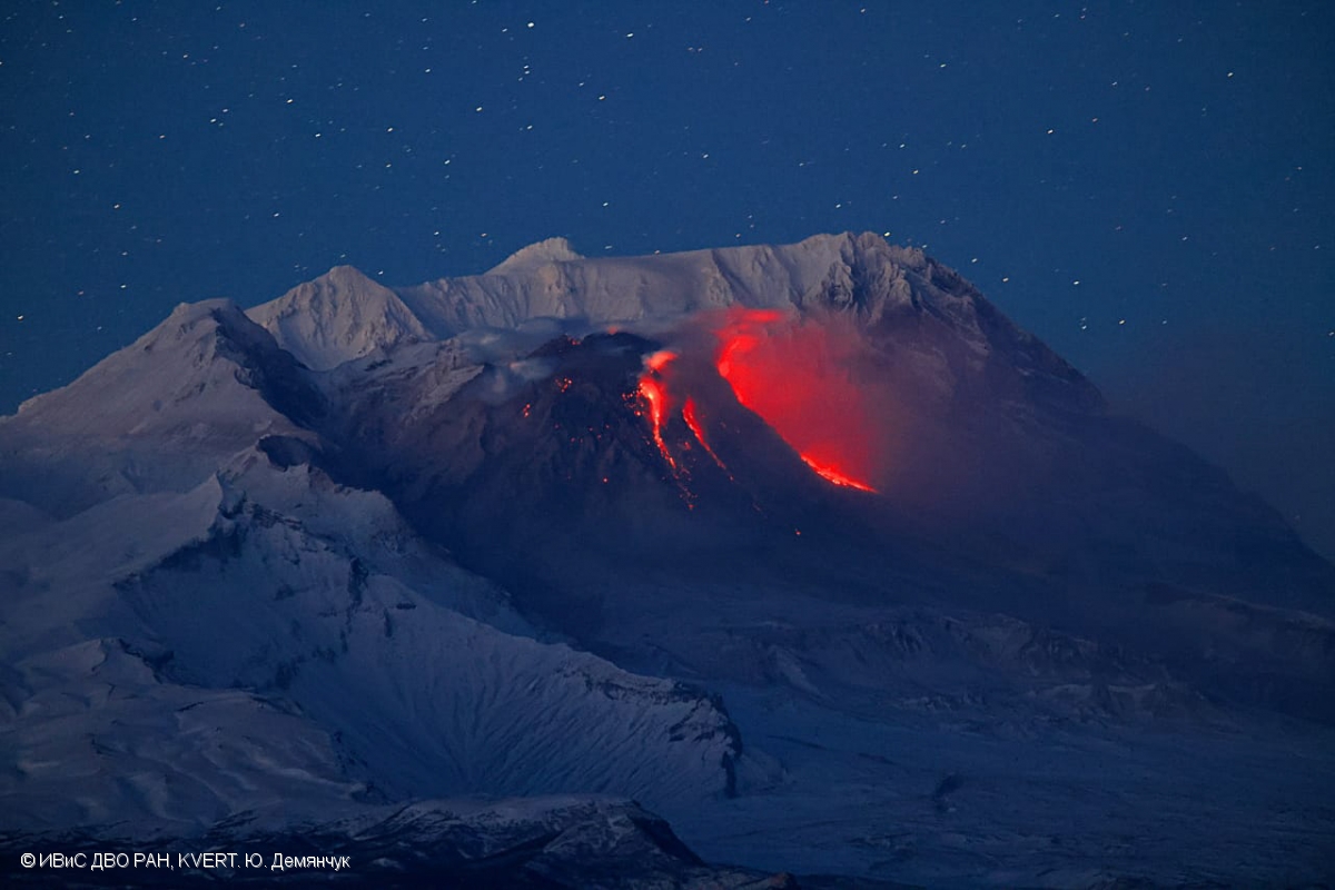
Volcanic Activity Summary:
An explosive-extrusive eruption of the volcano continues, accompanied by powerful gas-steam activity; a new block of lava continues to grow in the northern part of the lava dome. Explosion sent ash up to 6.6 km a.s.l., and ash cloud moved about 180 km to the east-south-east from the volcano on 20:50 UTC.
An explosive-extrusive eruption of the volcano continues. Ash explosions up to 12 km (39,400 ft) a.s.l. could occur at any time. Ongoing activity could affect international and low-flying aircraft.
Volcanic cloud height:
6600 m (21648 ft) AMSL Time and method of ash plume/cloud height determination: 20261118/1830Z – Himawari-9 14m15
Other volcanic cloud information:
Distance of ash plume/cloud of the volcano: 180 km (112 mi)
Direction of drift of ash plume/cloud of the volcano: ESE / azimuth 100 deg
Time and method of ash plume/cloud determination: 20261118/2050Z – Himawari-9 14m15
Start time of explosion and how determined: 20261118/1820Z – Satellite data
Duration of explosion: ~ 10 min
Source : Kvert.
Photo : Yu. Demyanchuk, IVS FEB RAS, KVERT
Indonesia , Semeru :
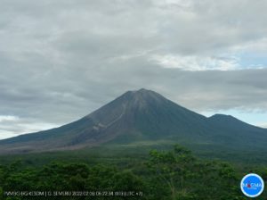
An eruption of Mount Semeru occurred on Thursday, November 19, 2026, at 05:33 WIB; an ash column was observed, reaching approximately 700 meters above the summit (about 4,376 meters above sea level). This ash column, of moderate intensity and white to gray in color, was moving toward the south. At the time this report was written, the eruption was still ongoing.
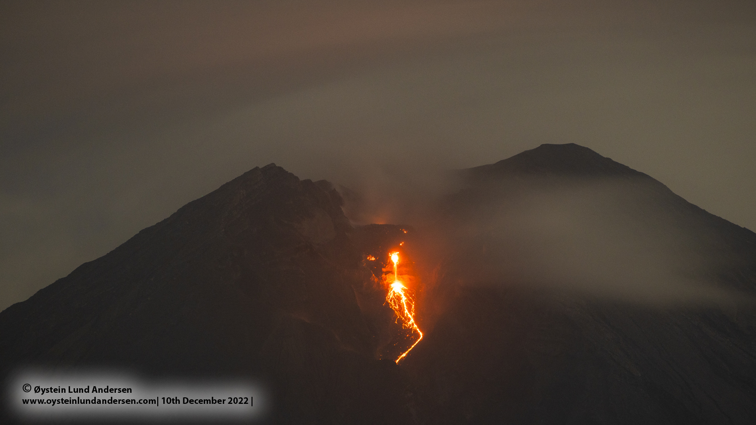
Seismic observations
18 eruption-related earthquakes, with amplitudes of 10–22 mm and durations of 63–139 seconds.
5 emission-related earthquakes (gas releases), with amplitudes of 4–6 mm and durations of 35–100 seconds.
2 distant tectonic earthquakes, with amplitudes of 15–35 mm and durations of 43–49 seconds.
Recommendations
1. Do not conduct any activities in the southeastern sector, along the Besuk Kobokan riverbed, within a 13 km radius of the summit (eruptive center). Beyond this distance, the public is advised to avoid any activity within 500 meters of the banks of the Besuk Kobokan; pyroclastic flows can reach a distance of 17 km from the summit, and lahars (volcanic mudflows) may also occur.
2. Do not conduct any activities within a 5 km radius of the crater/summit of Mount Semeru, as this area is exposed to the risk of falling rocks (incandescent projectiles).
Source : PVMBG.
Photo : Oystein lund Andersen ( archive).
Colombia , Puracé – Los Coconucos volcanic chain :
Popayán, November 17, 2026, 4:30 PM
As part of the ongoing monitoring of the Puracé volcano—part of the Los Coconucos volcanic chain (CVLC)—the Colombian Geological Service (SGC), an agency under the Ministry of Mines and Energy, reports the following:
During the week of November 10 to 16, 2026, seismicity associated with fluid movement (gases and liquids originating from magma and their interaction with the hydrothermal system) remained at levels comparable to those recorded in previous weeks, in terms of both the number of events and their energy output. These events continued to be localized beneath the Puracé and Piocollo volcanoes, at depths of less than 3 km.
Seismicity linked to rock-fracturing processes (VT events) was concentrated primarily in two areas. The first is located northeast of the Puracé volcano, at an average distance of 13 km and at depths ranging from 7 to 10 km, with a maximum magnitude of 2.0 ML. The second, characterized by low-magnitude events, is situated beneath the Puracé and Piocollo volcanoes, at depths between 1 and 3 km.
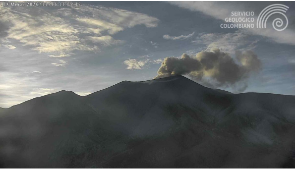
Ash emission at the Puracé volcano, November 16, 2026, at 06:05. Image from the « Mina » webcam, located 2.2 km northwest of the Puracé volcano.
A process of slow ground deformation continues in the area between the Puracé, Piocollo, and Curiquinga volcanoes. Significant levels of sulfur dioxide (SO₂) and carbon dioxide (CO₂) emissions into the atmosphere are also still being recorded. Satellite observations have identified low-energy thermal anomalies within the crater of the Puracé volcano. Furthermore, continuous degassing and 13 ash emissions have been recorded; some of these emissions reached heights of up to 1 km above the summit of the Puracé volcano, dispersing primarily toward the northwest.
In conclusion, the variations observed at the Puracé volcano indicate that the system remains unstable across several monitored parameters. Further ash emissions and fallout are possible, with their dispersion depending on the prevailing wind direction. Additionally, the occurrence of further changes in volcanic activity—potentially leading to more intense surface manifestations—cannot be ruled out.
The alert level for volcanic activity remains at « Yellow, » indicating an active volcano showing changes in the behavior of monitored parameters relative to their baseline levels, along with other manifestations.
Source et photo : SGC.
Guatemala , Fuego :
Atmospheric conditions: Clear sky
Wind: From the north-east
Precipitation: 0 mm
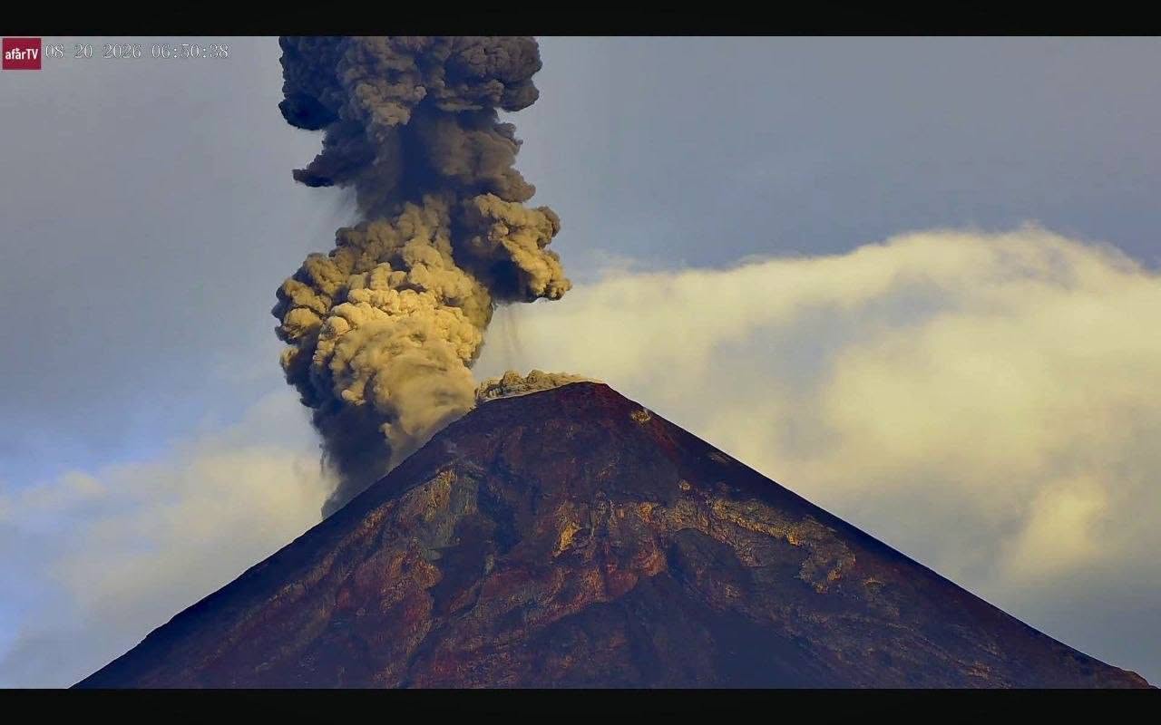
Activity
During the night and early morning hours, 1 to 3 explosions of low to moderate intensity were recorded, accompanied by ash plumes reaching altitudes between 4,200 and 4,500 m above sea level. These plumes dispersed toward the south and southwest of the volcanic complex, traveling a distance of approximately 40 kilometers. Additionally, avalanches have been observed on the western, southwestern, and southern flanks; some rock fragments have reached the vegetation zone.
Given the activity described, remaining on the plateau is dangerous due to the risk of falling ballistic debris.
Atmospheric conditions are resulting in low temperatures during the evening and throughout the night.
Source : Insivumeh.
Photo : Afar TV.