November 7 , 2026.
Kamchatka , Sheveluch :
KVERT VOLCANIC ACTIVITY NOTICE (VAN)
Issued: November 5 , 2026
Volcano: Sheveluch (CAVW #300270)
Current aviation colour code: ORANGE
Previous aviation colour code: orange
Source: KVERT
Notice Number: 2026-114
Volcano Location: N 56 deg 38 min E 161 deg 19 min
Area: Kamchatka, Russia
Summit Elevation: 3283 m (10768.24 ft), the dome elevation ~2500 m (8200 ft)
Volcanic Activity Summary:
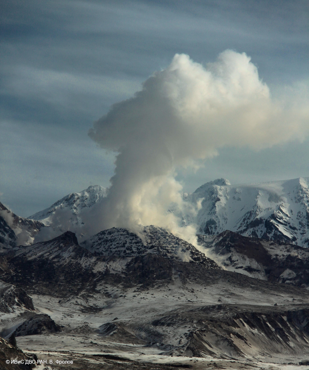
An explosive-extrusive eruption of the volcano continues, accompanied by powerful gas-steam activity; a new block of lava continues to grow in the northern part of the lava dome. Explosion sent ash up to 5.7 km a.s.l., and ash cloud moved about 46 km to the east-south-east from the volcano.
This explosive-extrusive eruption of the volcano continues. Ash explosions up to 12 km (39,400 ft) a.s.l. could occur at any time. Ongoing activity could affect international and low-flying aircraft.
Volcanic cloud height:
5700 m (18696 ft) AMSL Time and method of ash plume/cloud height determination: 20261105/2230Z – Himawari-9 14m15
Other volcanic cloud information:
Distance of ash plume/cloud of the volcano: 46 km (29 mi)
Direction of drift of ash plume/cloud of the volcano: ESE / azimuth 110 deg
Time and method of ash plume/cloud determination: 20261105/2230Z – Himawari-9 14m15
Start time of explosion and how determined: 20261105/2200Z – Satellite data
Duration of explosion: ~ 30 min
Source : KVERT
Photo : V. Frolov. IVS FEB RAS
Hawaii , Kilauea :
HAWAIIAN VOLCANO OBSERVATORY DAILY UPDATE , U.S. Geological Survey
Friday, November 6, 2026, 10:09 AM HST (Friday, November 6, 2026, 20:09 UTC)
19°25’16 » N 155°17’13 » W,
Summit Elevation 4091 ft (1247 m)
Current Volcano Alert Level: WATCH
Current Aviation Color Code: ORANGE
Summary:
Episode 56 lava fountaining occurred yesterday afternoon with fountains reaching 660 feet (200 meters), and the summit is now reinflating. The next episode of lava fountaining is likely several weeks away.
Overview:
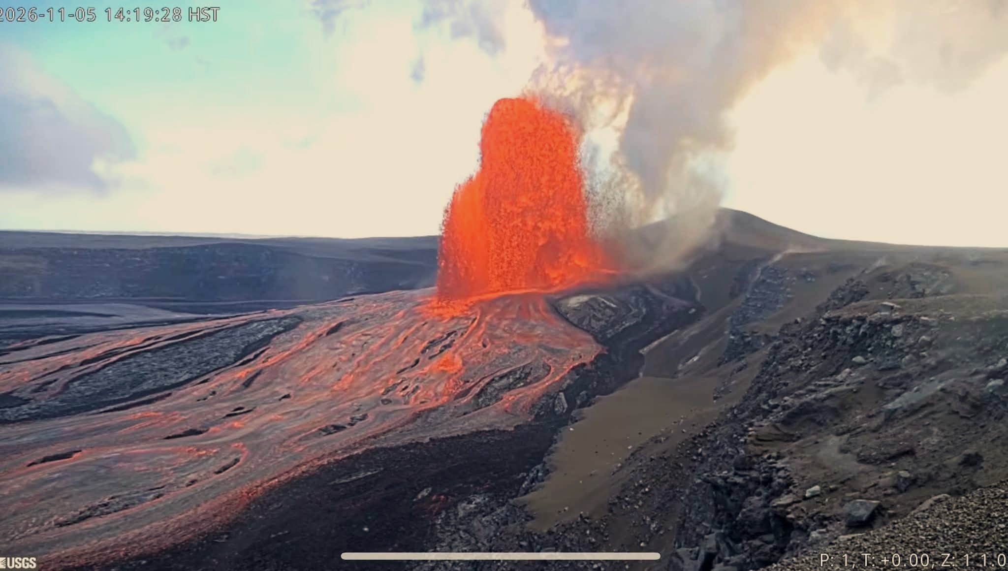
Episode 56 lava fountaining occurred yesterday between 12:10 p.m. and 6:01 p.m., with fountains reaching about 660 feet (200 meters). The summit began reinflating after the end of the fountaining episode, and the next lava fountaining episode is likely several weeks away.
Summit Observations:
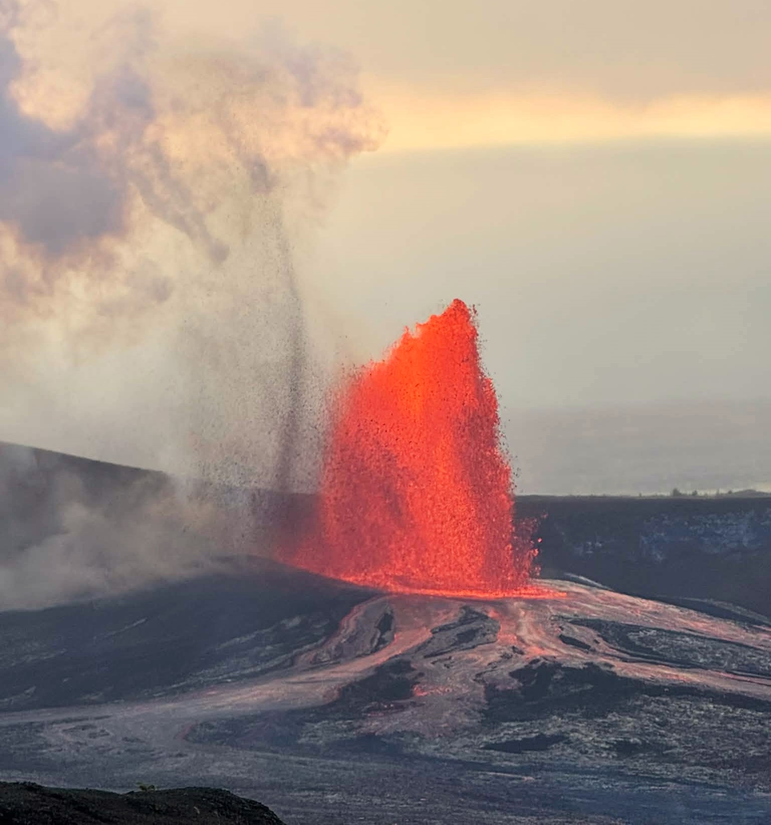
Precursory overflows from the north vent became more vigorous yesterday morning, building to a continuous low-level fountain in the late morning. This fountaining steadily intensified, and the onset of episode 56 was declared at 12:10 p.m. Fountain heights increased more rapidly after this time, peaking at about 660 feet (200 meters) between 1:30 and 2 p.m. The fountaining was limited to the north vent, with only some sporadic spattering seen in the southwest vent in the opening stages of the episode. Lava was carried from the north vent across the crater floor in several long channelized flows, as well as impressive sheet-like flows down the vent shield. Much of the western and northern portions of the crater floor were covered with new lava, with flows reaching into the eastern end of the crater. Fountain heights steadily decreased after 2 p.m. The fountain height fluctuated shortly before 6 p.m. and the fountain abruptly shut off at 6:01 p.m. Lava on the crater floor continued to flow over the next hour as the flows stagnated. Tiltmeter data indicate that episode 56 erupted approximately 8 million cubic yards (6 million cubic meters) of lava, with a peak effusion rate of about 690 cubic yards (530 cubic meters) per second, and an average effusion rate of 260 cubic yards (200 cubic meters) per second.
Strong surface level winds from the northeast carried tephra fallout to the southwest, primarily into the closed area of Hawai’i Volcanoes National Park. As the eruption plume rose, upper level winds from the east and southeast carried the higher-level plume northwest towards Mauna Loa summit. National Weather Service radar showed the plume reached 18,000 feet (5,500 meters) above sea level. HVO geologists reported trace fallout of Pele’s hair west of the summit on Highway 11 and the town of Pāhala.
Seismic tremor increased rapidly during the lava fountaining episode, and abruptly dropped with the termination of fountaining. This morning, tremor remains elevated, with sporadic spikes that suggest gas pistoning cycles in the conduit. Only one small earthquake was located at the summit in the past day.
Summit tiltmeters showed gradual deflationary tilt starting at about 8 a.m. Rapid deflationary tilt then accompanied the onset of fountaining. The Uēkahuna tiltmeter (UWD) recorded a total of 17 microradians of deflationary tilt during episode 56. Inflationary tilt resumed with the end of lava fountaining at 6:01 p.m. This morning UWD has recovered a total of 3 microradians of inflationary tilt since the end of episode 56.
During fountain episodes, the sulfur dioxide (SO2) emission rate from the summit is typically 100,000 tonnes per day. Trade winds this morning are carrying volcanic gases southwest toward Kaʻū.
Rift Zone Observations:
Rates of seismicity and ground deformation remain low in the East Rift Zone and Southwest Rift Zone. SO2 emissions from the East Rift Zone remain below the detection limit.
Source et photos : HVO.
Indonesia , Dukono :
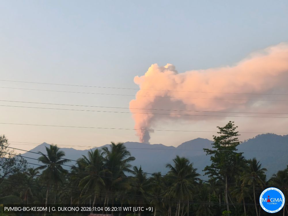
An eruption of Mount Dukono occurred on Saturday, November 7, 2026, at 12:09 PM WIT; an ash column was observed, reaching approximately 1,000 meters above the summit (about 2,087 meters above sea level). The ash column, which appeared dense and ranged in color from white to gray, drifted toward the west and northwest. The eruption was recorded by a seismograph, with a maximum amplitude of 18 mm and a duration of 34.48 seconds.
Seismic observations:
2 eruption-related earthquakes, with an amplitude of 9–14 mm and a duration of 36.72–41.81 seconds.
11 low-frequency earthquakes, with an amplitude of 3–4 mm and a duration of 23.72–30.02 seconds.
1 deep volcanic earthquake, with an amplitude of 6 mm and a duration of 11.82 seconds.
5 distant tectonic earthquakes, with an amplitude of 4–8 mm and a duration of 66.63–153.61 seconds.
1 continuous tremor, with an amplitude of 1–4 mm (predominantly 2 mm).
Recommendations
(1) Communities living near Mount Dukono, as well as visitors and tourists, are advised to refrain from any activities—including hiking—and to avoid approaching the Malupang Warirang crater within a 4 km radius.
(2) Given that eruptions producing volcanic ash occur periodically—and that the dispersion of this ash depends on wind direction and speed, meaning the affected areas may vary—those living in the vicinity of Mount Dukono are advised to keep masks (or other forms of nose and mouth protection) on hand, so that they may be used if necessary to limit respiratory health risks associated with volcanic ash.
Source et photo : PVMBG.
Costa Rica , Rincon de la Vieja :
OVSICORI-UNA Weekly Volcanic Monitoring Bulletin, November 6, 2026
Latitude: 10.83° N;
Longitude: 85.34° W;
Elevation: 1,916 m above sea level.
Current activity level: Warning.
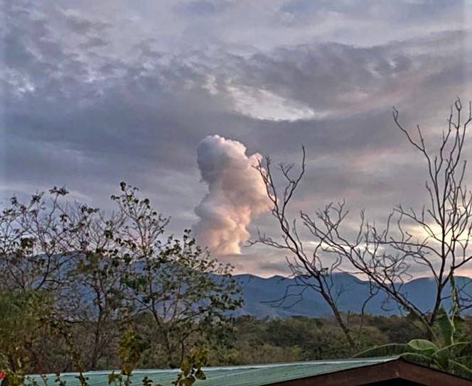
Over the past week, 10 small eruptions were recorded; none exceeded an acoustic magnitude of 4 (moderate), and all had a magnitude of less than 3. Compared to the previous week, there has been a decrease in eruptive activity and in the number of acoustic pulses (only 4). Background tremor is dominated by « banded » tremor sequences (intermittent sequences) which, when visibility conditions allow, are associated with more intense emissions of water vapor and volcanic gases. These sequences show variations in amplitude, tremor duration, and the intervals between episodes. Since October 25, an increase in the seismic amplitude of these events has been observed, accompanied by longer intervals between the tremor episodes. Most of these events are accompanied by an acoustic signal. Long-period (LP) seismic signals and « tornillo » (screw-shaped) signals continue to be present. The frequency of « tornillo » signals showed a slight increase, followed by a decrease.
During this week, 8 distal volcano-tectonic earthquakes and 2 proximal volcano-tectonic earthquakes (near the crater) were recorded. The distal volcano-tectonic earthquakes are located to the northeast of the volcano, at a depth of between 4 and 8 km. In the medium term (six months), slight extension at the base of the volcano has been detected. In the short term, extension is observed at the summit relative to the station located to the north (VRFI). Overall, the stations do not show any significant pattern of vertical deformation. The MultiGAS station recorded a CO2/SO2 ratio of approximately 20—a higher value than that of the previous week, when a figure of 5.8 ± 2.2 was noted. A gradual increase in this ratio has been observed since the beginning of October, suggesting a decrease in the SO2 supply relative to CO2. The average SO2 flux for this week is 194 ± 82 tonnes per day (t/d), with a maximum value of 1282 t/d; this average is lower than that of the previous week, when the mean flux was 328 ± 95 t/d, with a maximum of 2531 t/d. The most recent detection of atmospheric SO2 by the SENTINEL satellite dates back to October 1, 2026, with a mass of 68 tonnes.
Source et photo : Ovsicori.
Martinique , Mount Pelée :
Weekly Report, Institut de Physique du Globe de Paris / Martinique Volcanological and Seismological Observatory (OVSM)
Saint-Pierre, November 6, 2026, at 16:30 local time (GMT-4)
Volcanic seismic activity
Between October 30, 2026, at 16:00 (UTC) and November 6, 2026, at 16:00 (UTC), the OVSM recorded 339 earthquakes of volcanic origin:
• 339 volcano-tectonic earthquakes. Five of these earthquakes had a magnitude (local magnitude Mlv or duration magnitude Md) greater than 1. The largest had a magnitude of Mlv = 1.94; the others were of lower energy. The vast majority of these earthquakes were located at depths between 0.6 and 1.2 km below the volcano’s summit. One low-energy earthquake was located at a depth of approximately 3.0 km below sea level.
No earthquakes were reported as felt by the population.
During the previous week, the OVSM recorded 115 earthquakes of volcanic origin. As of November 6, 2026, and over the past four weeks, the OVSM has observed a total of 656 volcanic earthquakes, representing an average of 164 earthquakes per week.
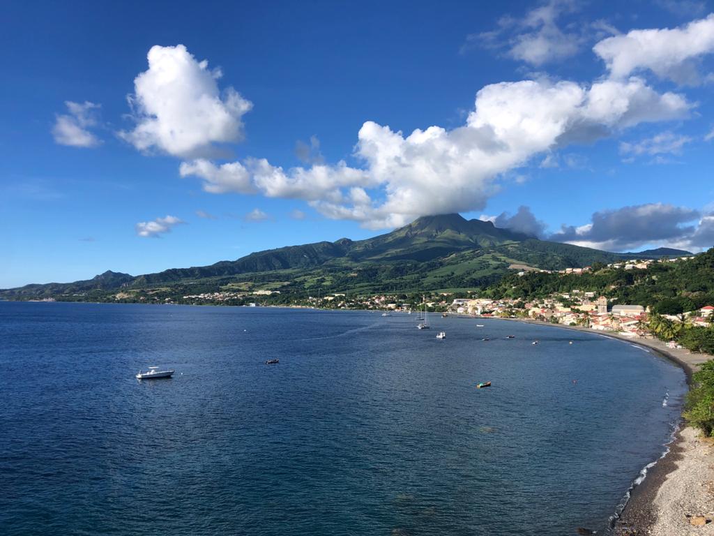
Deformations of Mount Pelée
The ground displacements of several centimeters observed in the summit area of Mount Pelée over the last few months have decreased significantly. In the deformation zones near the summit, the maximum elongation recorded over the past four weeks is 0.4 cm (along a 610-meter-long profile). These displacements remain consistent with a deformation of the volcanic edifice caused by an inflating pressure source, though this source can no longer be precisely located.
The probability of eruptive activity in the short term remains low. However, based on observations gathered over the last few months and years, an evolution of the situation in the medium term (weeks to months) cannot be ruled out.
The volcanic alert level, in accordance with the protocols established by the authorities, is currently YELLOW: vigilance.
Source et photo : OVSM-IPGP