November 5 , 2026.
Hawaii , Kilauea :
HAWAIIAN VOLCANO OBSERVATORY DAILY UPDATE , U.S. Geological Survey
Wednesday, November 4, 2026, 10:03 AM HST (Wednesday, November 4, 2026, 20:03 UTC)
19°25’16 » N 155°17’13 » W,
Summit Elevation 4091 ft (1247 m)
Current Volcano Alert Level: WATCH
Current Aviation Color Code: ORANGE
Summary:
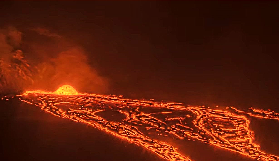
Intermittent lava flows have continued from the north vent over the past day. High fountaining remains a possibility today or anytime within the next few days.
Overview:
Lava flows have occurred intermittently over the past day from the north vent. Summit inflation that continued through most of yesterday shifted to deflation around 3 a.m. this morning. Seismic tremor at the summit is elevated with fluctuations in tremor associated with the beginning and end of lava overflows. SO2 emission rates are elevated. Episode 56 high fountaining remains a possibility today or anytime through November 8 based upon prior behavior once precursory flows have begun.
Summit Observations:
Intermittent overflows continued from the north vent over the past day. Overflows were typically around 15-20 minutes in duration, and this morning 2-3 per hour were occurring. Strong glow could be seen from the southwest vent overnight, along with occasional spatter and flames.
Background seismic tremor began increasing around 6 a.m. and remains elevated as of this morning. Periodic strong tremor bursts associated with the vigorous drain back of lava marking the end of each overflow picked up this morning. Six small earthquakes were located at the summit in the past day, with most beneath the south caldera region.
This morning the Uēkahuna tiltmeter (UWD) had recovered a total of 17.6 microradians of tilt since the end of episode 55. Inflationary tilt that continued through yesterday and early this morning switched to deflationary tilt around 3 a.m., with deflationary tilt continuing this morning.
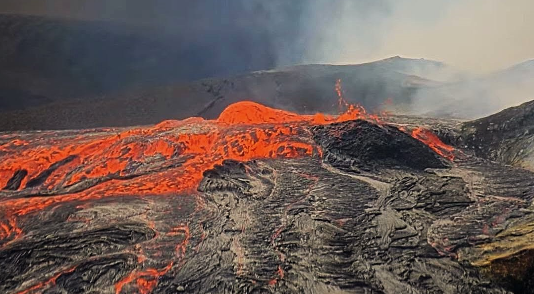
Sulfur dioxide (SO2) emission rates averaged 4000 tonnes per day (t/d) after overflows began on November 2. Strong trade winds this morning are carrying volcanic gases southwest toward Kaʻū.
Rift Zone Observations:
Rates of seismicity and ground deformation remain low in the East Rift Zone and Southwest Rift Zone. SO2 emissions from the East Rift Zone remain below the detection limit.
Source et photo : HVO
Indonesia , Ili Lewotolok :
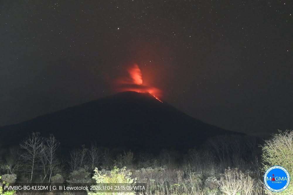
An eruption of Mount Ili Lewotolok occurred on Wednesday, November 4, 2026, at 11:15 p.m. WITA (Central Indonesian Time); an ash column was observed, reaching approximately 500 meters above the summit (about 1,923 meters above sea level). This dense, white-to-gray ash column drifted toward the west. The eruption was recorded by a seismograph, showing a maximum amplitude of 40 mm and a duration of 45 seconds.
Seismic observations
98 eruption-related earthquakes, with amplitudes ranging from 15.6 to 40 mm and durations of 30 to 82 seconds.
3 rockfall-related earthquakes, with an amplitude of 3.9 mm and durations of 60 to 88 seconds.
132 emission-related earthquakes (gas releases), with amplitudes ranging from 5.8 to 38 mm and durations of 18 to 52 seconds.
3 harmonic tremors, with amplitudes ranging from 3.9 to 11.7 mm and durations of 92 to 152 seconds.
9 non-harmonic tremors, with amplitudes ranging from 7.8 to 19.5 mm and durations of 86 to 356 seconds.
7 deep volcanic earthquakes, with amplitudes ranging from 5.8 to 40 mm and durations of 13 to 22 seconds.
1 local tectonic earthquake, with an amplitude of 15.6 mm and a duration of 22 seconds.
1 distant tectonic earthquake, with an amplitude of 11.7 mm and a duration of 51 seconds.
Recommendations
1. Communities living in the vicinity of Mount Ili Lewotolok, as well as visitors, hikers, and tourists, are advised not to enter or conduct any activities within a 2 km radius—extending to 3 km in the southern and southeastern sectors—of the active crater of Mount Ili Lewotolok.
2. It is necessary to remain vigilant regarding the potential risks of lava avalanches, rockfalls, and pyroclastic flows in the southern, southeastern, western, and northeastern sectors of Mount Ili Lewotolok.
Source et photo : PVMBG.
Colombia , Puracé – Los Coconucos volcanic chain :
Popayán, November 3, 2026, 4:00 PM
As part of the ongoing monitoring of the Puracé volcano—part of the Los Coconucos volcanic chain (CVLC)—the Colombian Geological Service (SGC), an agency under the Ministry of Mines and Energy, reports the following:
During the week of October 27 to November 2, 2026, seismicity associated with fluid movement (gases and liquids originating from magma and their interaction with the hydrothermal system) remained at levels comparable to those of the previous week. These events continued to be localized beneath the Puracé and Piocollo volcanoes, at depths of less than 3 km.
Seismicity associated with rock fracturing (volcano-tectonic, or VT, events) was concentrated primarily in two areas:
one to the northeast of the Puracé volcano, at a distance of 12 to 18 km and at depths ranging from 7 to 12 km, with a maximum magnitude of 1.8; and another in the area between the Puracé and Piocollo volcanoes, where low-magnitude events were recorded at depths between 1 and 4 km.
A process of slow ground deformation continues in the sector encompassing the Puracé, Piocollo, and Curiquinga volcanoes. Significant levels of sulfur dioxide (SO₂) and carbon dioxide (CO₂) emissions into the atmosphere are also continuing to be recorded.
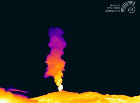
Ash emission at the Puracé volcano, October 27, 2026, at 19:08. Recorded by the Pulpito thermal camera, located 5.5 km southwest of the Puracé volcano.
Satellite observations identified low-energy thermal anomalies within the crater of the Puracé volcano during this period.
Continuous degassing was observed, accompanied by 23 ash emissions; some of these reached heights of up to 2 km above the summit of the Puracé volcano,
with dispersion primarily toward the northwest.
In conclusion, the variations observed at the Puracé volcano indicate that the system remains unstable across several monitored parameters; further ash emissions
and ashfall—dispersed according to the prevailing wind direction—remain possible. Furthermore, the occurrence of additional changes
in volcanic activity cannot be ruled out, which could potentially lead to more intense surface manifestations.
The volcanic alert level remains at « Yellow »: indicating an active volcano showing changes in the behavior of monitored parameters relative to their baseline levels, along with other manifestations.
Source et photo : SGC
Guatemala , Santiaguito :
Atmospheric conditions: Clear sky
Wind: From the northeast
Precipitation: 0.0 mm
Volcanic activity
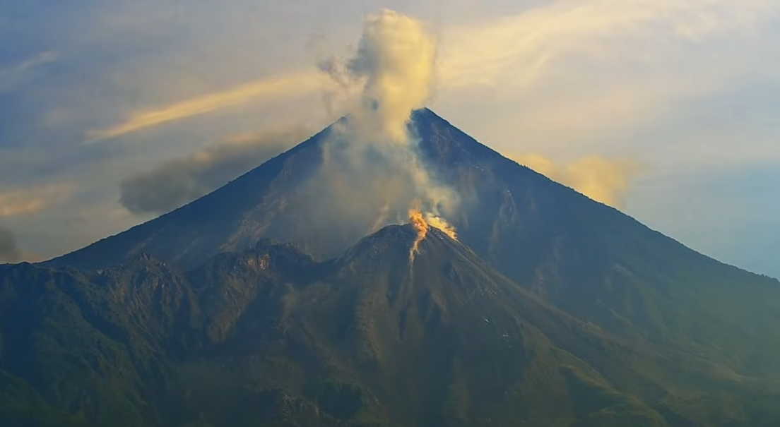
Constant degassing is observed above the « Caliente » dome; the plume reaches a height of 400 meters and disperses toward the west and southwest. Explosions of low to moderate intensity have been recorded, generating a column of gas and ash that rises up to 800 meters above the dome, dispersing toward the west and southwest. During the night and early morning hours, incandescence is visible at the summit of the dome as well as on its western and southwestern flanks, a result of recurring avalanches descending these slopes.
The formation of pyroclastic density currents cannot be ruled out; therefore, the recommendations provided in special bulletin BESAN-002-2026 should be followed.
In the event of precipitation within the volcanic zone, low- to moderate-intensity lahars (volcanic mudflows) could occur in the riverbeds on the southern flank (specifically the Nimá I, Tambor, and Cabello de Angel rivers); it is, therefore, necessary to adhere to the recommendations set out in special bulletin BESAN-016-2026.
Source : Insivumeh
Photo : Afar tv
Peru , Sabancaya :
Date and local time: November 2, 2026 – 15:37
Period covered by the bulletin: October 26 to November 1, 2026
Volcanic Alert Level
Orange alert level: The volcano is experiencing a significant increase in eruptive activity. An intensification of seismic activity, frequent explosions, and the emission of ash and ballistic blocks are being observed.
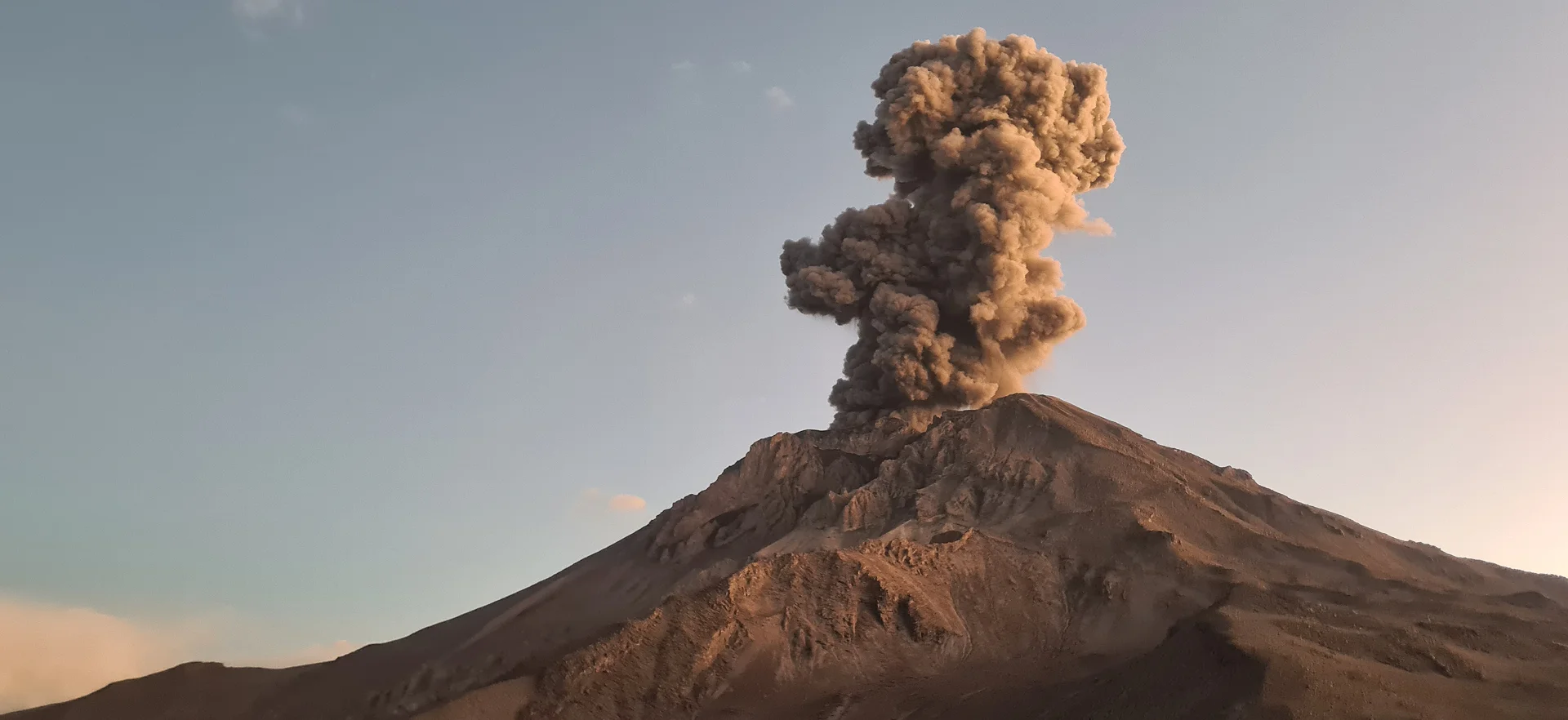
Conclusions
The IGP indicates that the eruptive process at the Sabancaya volcano is ongoing. During this period, no volcanic explosions were recorded; observations were limited to emissions of water vapor, ash, and gas reaching up to 800 m above the volcano’s summit, accompanied by seismic activity linked to the movement of magmatic fluids and internal fracturing. Consequently, the volcanic alert level remains at orange.
Recommendations
It is advised to stay consistently informed about the activity of the Sabancaya volcano by consulting the reports and bulletins published by the IGP.
Outlook
The occurrence of volcanic explosions producing eruptive columns exceeding 2 km in height is considered probable. Such events could affect districts located in the Colca Valley as well as surrounding areas due to the dispersal of volcanic ash; therefore, the volcanic alert level remains at orange.
Source et photo : Cenvul.