November 4 , 2026.
Hawaii , Kilauea :
HAWAIIAN VOLCANO OBSERVATORY DAILY UPDATE , U.S. Geological Survey
Tuesday, November 3, 2026, 10:35 AM HST (Tuesday, November 3, 2026, 20:35 UTC)
19°25’16 » N 155°17’13 » W,
Summit Elevation 4091 ft (1247 m)
Current Volcano Alert Level: WATCH
Current Aviation Color Code: ORANGE
Summary:
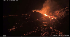
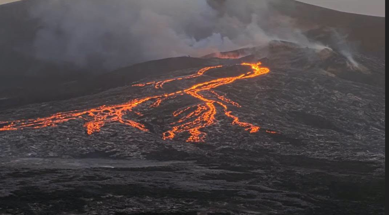
Lava flows began erupting from the north vent within Halema’uma’u yesterday, November 2, and are continuing this morning. High fountaining remains a possibility today or anytime within the next few days.
Overview:
Lava flows began yesterday, November 2, from the north vent in Halemaʻumaʻu and are continuing this morning. Minor deflation that began just around 1:00 p.m. yesterday has slowed and may be turning back to inflation. Seismic tremor at the summit is elevated with fluctuations in tremor associated with the beginning and end of lava overflows. SO2 emission rates are elevated. Episode 56 high fountaining remains a possibility today or anytime through November 8 based upon prior behavior once precursory flows have begun.
Summit Observations:
Voluminous overflows of lava began erupting from the north vent yesterday at 11:43 a.m. HST. The first two flows lasted over an hour and were highly degassed. The third overflow began at 3:35 p.m. and lasted approximately 40 minutes, forming a small but active dome fountain, which signaled the arrival of more gas-rich magma. Subsequent overflows produced dome fountains approximately 6-7 meters (20-23 feet) high. These typically lasted about 15-20 minutes with breaks of 5-15 minutes in between when lava drained back but remained visible near the top of the vent. After 29 overflows, dome fountains began decreasing around 4:00 a.m. The last few overflows this morning did not produce dome fountains, and lava appears to be retreating further into the vent, disappearing from view between overflows. There have been 42 overflows from the north vent since the start of activity yesterday. One small overflow escaped from the combined southwest vent yesterday at 4:22 p.m. and lasted less than two minutes. Strong glow could be seen from the southwest vent overnight, along with occasional spatter and flames.
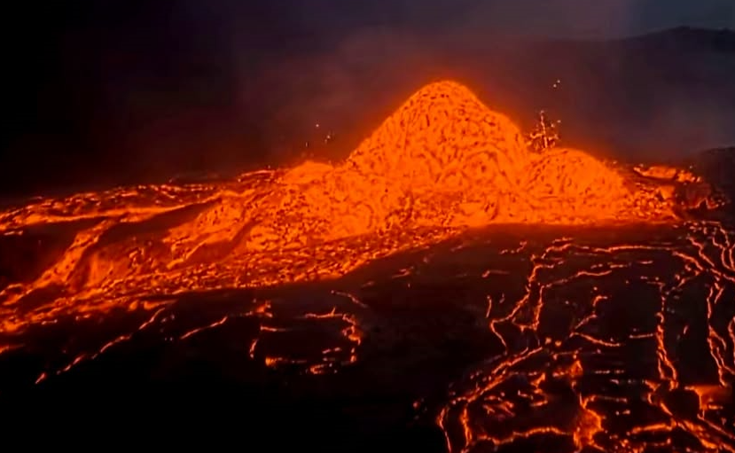
Background seismic tremor increased yesterday around 3:30 p.m. and remains elevated as of this morning. Periodic strong tremor bursts associated with the vigorous drain back of lava marking the end of each overflow have diminished since around 3 a.m. HST. Deformation reversed from deflationary tilt to slow inflationary tilt at that time and dome fountains began to drop in size until they were no longer present during overflows this morning.
The Uēkahuna tiltmeter (UWD) had recovered a total of 18.1 microradians of tilt since the end of episode 55 by approximately 12:30 p.m. yesterday. Minor deflation began around 1:00 p.m. yesterday and continued until about 3:00 a.m. this morning. In that time, the UWD tiltmeter recorded a little over one microradian of deflationary tilt. Slow inflationary tilt has occurred since then, though this trend could change at any time.
Sulfur dioxide (SO2) emission rates averaged 2200 tonnes per day (t/d) yesterday morning. Around 1:00 p.m. they began to increase, and by about 2:30 p.m. average SO2 emission rates reached approximately 4000 t/d. SO2 emissions remain elevated this morning, and strong trade winds are carrying volcanic gases southwest toward Kaʻū.
Rift Zone Observations:
Rates of seismicity and ground deformation remain low in the East Rift Zone and Southwest Rift Zone. SO2 emissions from the East Rift Zone remain below the detection limit.
Source et photo : HVO
Italy / Sicily , Etna :
WEEKLY BULLETIN, from October 26, 2026, to November 1, 2026. (Date of issue: November 3, 2026)
SUMMARY OF ACTIVITY STATUS
Based on monitoring data, the following observations are noted:
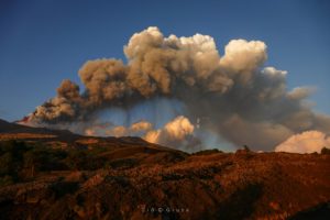
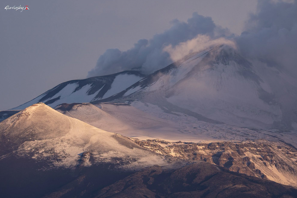
1) VOLCANOLOGICAL OBSERVATIONS: Variable degassing activity at the summit craters, with occasional ash emissions from the Northeast Crater.
2) SEISMOLOGY: Low seismic activity related to rock fracturing. The amplitude of the volcanic tremor is characterized by significant fluctuations between low and medium levels.
3) INFRASOUND: Infrasonic activity is generally low.
4) GROUND DEFORMATION: Time series from ground deformation monitoring stations show no significant variations.
5) GEOCHEMISTRY: SO2 flux is at a medium level.
CO2 flux from the ground (Etnagas): medium values.
Partial pressure of CO2 dissolved in groundwater (EtnaAcque network): no updates available.
Helium (He) isotope ratio at peripheral sites: the latest data, from October 26, 2026, indicate high values.
6) SATELLITE OBSERVATIONS: Thermal activity observed by satellite in the summit area remained, overall, at a low level.
7) OTHER OBSERVATIONS: Analysis of volcanic ash samples emitted by the Northeast Crater reveals an essentially lithic composition and fine grain size. During the period from October 26 to November 1, 2026, soil radon emissions remained generally low, though with a few spikes reaching very high levels on October 31 and November 1.
VOLCANOLOGICAL OBSERVATIONS
Throughout the week, volcanic activity at Mount Etna was monitored via the analysis of images from the surveillance camera network of the INGV – Osservatorio Etneo (INGV-OE).
However, cloud cover and strong winds in the summit area limited observations during part of the period in question.
Activity at Etna’s summit craters showed no significant variations compared to what was observed the previous week and reported in the prior bulletin (Report No. 44/2026 ETNA). Overall, during the period under review, activity was characterized by degassing of varying intensity and patterns at the summit craters, accompanied by episodic ash emissions from the Northeast Crater.
Source : INGV
Photo : Giovinsky Aetnensis
Italy, Stromboli :
WEEKLY BULLETIN, from October 26, 2026, to November 1, 2026. (Date of issue: November 3, 2026)
SUMMARY OF ACTIVITY STATUS
Based on monitoring data, the following observations are noted:
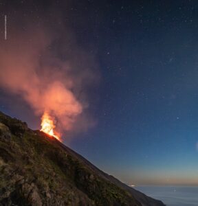
1) VOLCANOLOGICAL OBSERVATIONS: Typical Strombolian eruptive activity is occurring across both crater zones. The overall frequency of explosive activity—encompassing both the North crater zone and the Central-South crater zone—is at a moderate level, with the intensity of explosions in both areas also being predominantly moderate.
2) SEISMOLOGY: Monitored seismic parameters show no significant variations.
3) GROUND DEFORMATION: No significant variations have been detected in the time series from ground deformation monitoring stations.
4) GEOCHEMISTRY: SO2 flux is at a moderate to high level.
Soil CO2 flux (Pizzo zone – STR02): preliminary data (due to technical issues).
C/S ratio in the plume: no data available.
Helium isotopic ratio (R/Ra): no data available.
Soil CO2 flux in the San Bartolo zone: moderate values.
Soil CO2 flux in the Scari zone: preliminary data.
5) SATELLITE OBSERVATIONS: Thermal activity in the summit area, as observed via satellite, has been at a low to moderate level.

VOLCANOLOGICAL OBSERVATIONS
Observations of explosive activity captured by surveillance cameras
During the observation week, Stromboli’s eruptive activity was characterized through the analysis of images recorded by INGV-OE surveillance cameras, located at an altitude of 190 m above sea level and at Punta dei Corvi (designated as SCT-SCV and SPCT, respectively). Explosions in the North crater area (Zone N) produced primarily coarse material (bombs and lapilli), while explosions in the Central-South crater area (Zone CS) generated mostly fine material, mixed with some coarse material. The mean frequency of explosions from Zone N was at an average level, while the intensity remained generally low. In Zone CS, the mean explosion frequency remained low, and the intensity of the explosive activity stayed, overall, at a low level. The total daily mean hourly frequency of explosions (Zone N + Zone CS) was at an average level.
Source : INGV
Photo : Stromboli stati d’animo / Sebastiano Cannavo
Kamchatka , Sheveluch :
KVERT VOLCANIC ACTIVITY NOTICE (VAN)
Issued: November 4 , 2026
Volcano: Sheveluch (CAVW #300270)
Current aviation colour code: RED
Previous aviation colour code: orange
Source: KVERT
Notice Number: 2026-112
Volcano Location: N 56 deg 38 min E 161 deg 19 min
Area: Kamchatka, Russia
Summit Elevation: 3283 m (10768.24 ft), the dome elevation ~2500 m (8200 ft)
Volcanic Activity Summary:
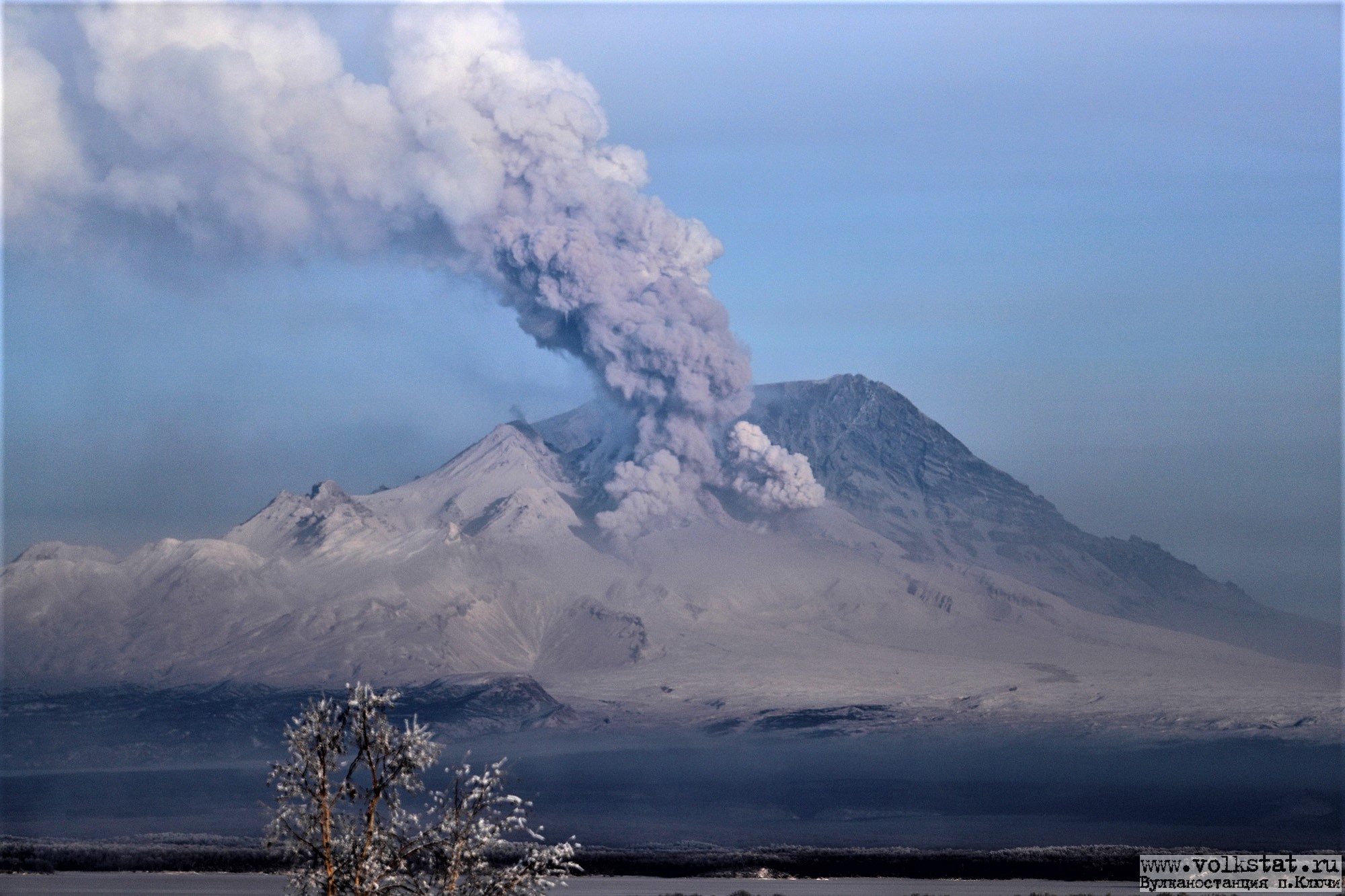
An explosive-extrusive eruption of the volcano continues, accompanied by powerful gas-steam activity; a new block of lava continues to grow in the northern part of the lava dome. Explosion sent ash up to 9.1 km a.s.l., and ash cloud moved about 54 km to the east-north-east from the volcano.
This explosive-extrusive eruption of the volcano continues. Ash explosions up to 12 km (39,400 ft) a.s.l. could occur at any time. Ongoing activity could affect international and low-flying aircraft.
Volcanic cloud height:
9100 m (29848 ft) AMSL Time and method of ash plume/cloud height determination: 20261104/0020Z – Himawari-9 14m15
Other volcanic cloud information:
Distance of ash plume/cloud of the volcano: 54 km (34 mi)
Direction of drift of ash plume/cloud of the volcano: ENE / azimuth 71 deg
Time and method of ash plume/cloud determination: 20261104/0040Z – Himawari-9 14m15
Start time of explosion and how determined: 20261104/0010Z – Satellite data
Duration of explosion: ~ 10 min
Source : Kvert
Photo : Yu. Demyanchuk ( archive)
United – States , Yellowstone :
YELLOWSTONE VOLCANO OBSERVATORY MONTHLY UPDATE , U.S. Geological Survey
Monday, November 2, 2026, 9:09 AM MST (Monday, November 2, 2026, 16:09 UTC)
44°25’48 » N 110°40’12 » W,
Summit Elevation 9203 ft (2805 m)
Current Volcano Alert Level: NORMAL
Current Aviation Color Code: GREEN
Summary:
YVO Monthly Update: background seismicity and deformation
Yellowstone Caldera activity remains at background levels, with 66 located earthquakes in October (largest = M2.0). Deformation measurements indicate no significant uplift or subsidence of the caldera or north caldera rim for the past several months. Giant Geyser, in Upper Geyser Basin, erupted three times in October.
Recent Work and News
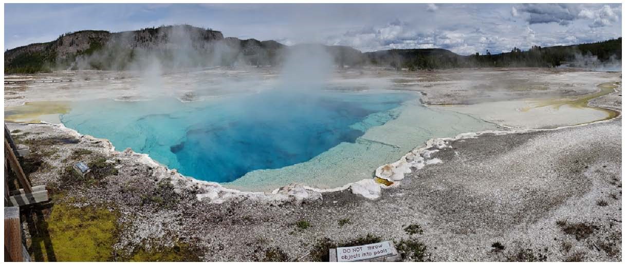
Hydrothermal activity in Yellowstone National Park during the month of October included an eruption of Echinus Geyser (Norris Geyser Basin) on October 26. Giant Geyser (Upper Geyser Basin)—the second tallest geyser in the park—erupted on October 5, 13, and 22. In addition, the small pool of hot water that formed via collapse in Biscuit Basin after the June 13, 2026, hydrothermal explosion had at least two small eruptions. Steamboat Geyser, in Norris Geyser Basin, was characterized by minor eruptions and has only had one major eruption thus far in 2026.
Seismicity
During October 2026, the University of Utah Seismograph Stations, responsible for the operation and analysis of the Yellowstone Seismic Network, located 66 earthquakes in the Yellowstone National Park region. The largest event of the month was a micro earthquake of magnitude 2.0 located about 15 miles south of West Thumb, Yellowstone National Park, on October 4 at 5:32 p.m. MDT.
There were no swarms identified during October.
Earthquake activity in Yellowstone is at background levels.
Ground Deformation
Data from continuous GPS stations indicate little net deformation of the caldera or north caldera regions over the past several months. Subtle variations in ground motion are probably caused by seasonal changes, especially in groundwater conditions.
Source : YVO.
Photo : Sapphire Pool , YVO