October 16 , 2026.
Hawaii , Kilauea :
HAWAIIAN VOLCANO OBSERVATORY DAILY UPDATE , U.S. Geological Survey
Thursday, October 15, 2026, 10:10 AM HST (Thursday, October 15, 2026, 20:10 UTC)
19°25’16 » N 155°17’13 » W,
Summit Elevation 4091 ft (1247 m)
Current Volcano Alert Level: WATCH
Current Aviation Color Code: ORANGE
Summary:
Intermittent overflows from the north vent resumed yesterday and continued through day; less frequent overnight. Kīlauea’s summit remains at a high level of pressurization with changes in eruptive activity or location within the summit region possible.
Summit Observations:
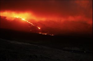
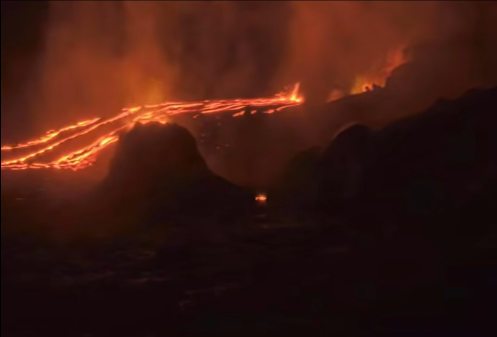
Overflows from the north vent resumed yesterday at 11:08 AM HST and continued intermittently throughout the day with 12 recorded by sundown, as well as one overflow from the south vent. Numerous instances of spatter from all three vents (north, south, and west) were also observed. Conditions overnight led to difficult viewing, nonetheless spatter was visible from all vents, as well as an additional overflow accompanied by gas jetting from the north vent at 4:46 AM. Glow and flames from the vents also continued consistently through the night.
Summit tremor continued throughout the day, with a return to irregular tremor bursts around 12:15 PM. In the past 24 hours, there were 20 shallow earthquakes located across the summit region of Kīlauea, predominantly in the south caldera region.
Summit tiltmeters have shown minor changes in tilt, with an overall slight inflationary trend over the past day. GPS stations on opposite sides of Halemaʻumaʻu (CRIM and UWEV) show a small increase in length since the end of September suggesting longer-term inflation of the summit magma reservoir.
During inter-episode pauses, the sulfur dioxide (SO2) emission rate from the summit typically varies between 1,000 and 5,000 tonnes per day. Plumes of volcanic gas are visible from the vents in day-time webcam views. Winds are currently forecast from the north-northeast through today.
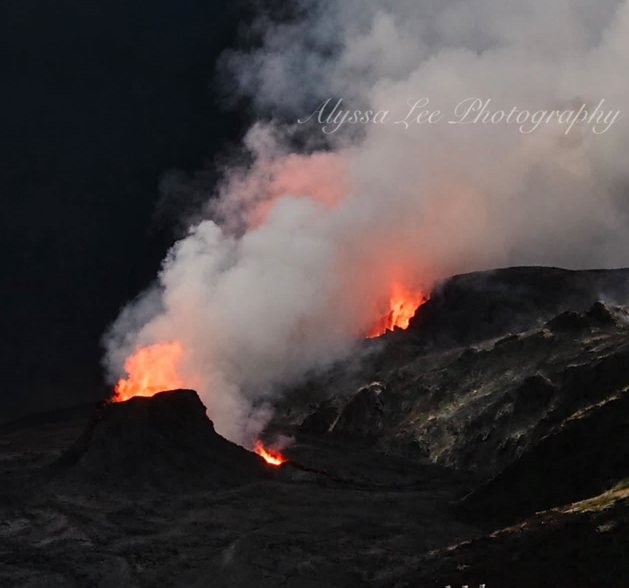
Overnight during 11-12 October moderate-to-strong incandescence was visible at the N vent, at the vent near its base, and at the S vent, while incandescence from the W vent fluctuated, with visibility potentially affected by fog. Intermittent flames and minor spattering associated with gas jetting occurred at all vents, including a short period of sustained spattering at the S vent that began at around 03h18 on 12 October. Spattering from the vent at the base of the N vent occurred intermittently. Visible spattering ended at around 06h35. Vigorous dome fountaining began at the N vent just before 11h30 on 13 October, lasted nearly an hour, and produced a lava flow that traveled about 1 km. This was the longest and most vigorous dome fountain since 30 September. Two other substantial fountain and overflow episodes occurred at 16h00-16h40 and at 17h00-17h20. Interspersed between and following these longer events were about 15 smaller events that lasted only a few minutes and produced flows less than 100 m long. Sustained fountaining was followed by gas jetting, often with sprays of spatter produced during drainbacks of lava within the vents. The Volcano Alert Level remained at Watch (the second highest level on a four-level scale) and the Aviation Color Code at Orange (the second highest color on a four-color scale).
Sources : HVO , GVP.
Photos : Alyssa Lee / FB.
Philippines , Taal :
The Philippine Institute of Volcanology and Seismology (PHIVOLCS) reported eruptive activity at Taal during 6-12 October. The seismic network recorded 0-34 daily volcanic earthquakes, including 1-9 periods of volcanic tremor each day during 7-10 October, with periods lasting between 2 and 82 minutes. Daily gas-and-steam emissions generally rose 600-1,500 m above the crater rim and drifted W, SW, and SE. Sulfur dioxide emissions averaged 952-3,071 tonnes per day during 6 and 8-10 October. A minor phreatomagmatic eruption at 18h06 on 8 October generated a dark ash plume that rose 4 km above the crater rim and drifted SW. Incandescent material and lightning were visible in the plume. The event lasted for five minutes based on seismic data and webcam footage.
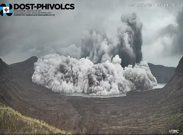
According to a news source at least 120 people, or 32 families, evacuated to centers as of 10h53 on 9 October. The Alert Level remained at 1 (on a scale of 0-5); PHIVOLCS reminded the public that the entire Taal Volcano Island (TVI) was a Permanent Danger Zone (PDZ) and recommended that the Main Crater and areas along the Daang Kastila fissure should remain prohibited.
Pilots were warned to avoid flying over TVI.
Sources: Philippine Institute of Volcanology and Seismology (PHIVOLCS), Philstar News , GVP.
Kamchatka , Sheveluch :
KVERT VOLCANIC ACTIVITY NOTICE (VAN)
Issued: October 16 , 2026
Volcano: Sheveluch (CAVW #300270)
Current aviation colour code: ORANGE
Previous aviation colour code: orange
Source: KVERT
Notice Number: 2026-106
Volcano Location: N 56 deg 38 min E 161 deg 19 min
Area: Kamchatka, Russia
Summit Elevation: 3283 m (10768.24 ft), the dome elevation ~2500 m (8200 ft)
Volcanic Activity Summary:
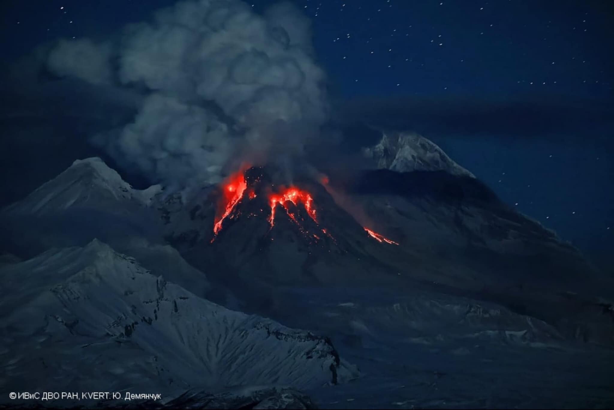
An explosive-extrusive eruption of the volcano continues, accompanied by powerful gas-steam activity; a new block of lava continues to grow in the northern part of the lava dome. Explosion sent ash up to 4.5 km a.s.l, ash cloud moved 70 km to northeast of the volcano.
An explosive-extrusive eruption of the volcano continues. Ash explosions up to 12 km (39,400 ft) a.s.l. could occur at any time. Ongoing activity could affect international and low-flying aircraft.
.
Volcanic cloud height:
4500 m (14760 ft) AMSL Time and method of ash plume/cloud height determination: 20261015/2310Z – Himawari-9 14m15
Other volcanic cloud information:
Distance of ash plume/cloud of the volcano: 70 km (43 mi)
Direction of drift of ash plume/cloud of the volcano: NE / azimuth 28 deg
Time and method of ash plume/cloud determination: 20261015/2350Z – Himawari-9 14m15
Start time of explosion and how determined: 20261015/2310Z – Satellite data
Duration of explosion: ~ 10 min
Source : Kvert
Photo : Yu. Demyanchuck / IVS FEB RAS KVERT via Olga Girina / FB. ( archive).
New Zealand , White Island :
Weak ash emission at Whakaari/White Island. Volcanic Alert Level remains at 2 and Aviation Colour Code remains at Yellow.
Published: Fri Oct 16 2026 5:40 PM
Ash has been intermittently observed in a low altitude plume from Whakaari/White Island. The Volcanic Alert Level remains at 2 and the Aviation Colour Code remains at Yellow.
From 10:06am today our webcams have observed a weak ash plume from Whakaari/White Island, which has continued to be intermittent throughout the day. This activity follows vigorous steam and gas plumes observed over the past week. While we can see ash on the webcam imagery, it has not been detected by satellite imagery, confirming only a small amount of ash is being emitted.
The vigorous steam and gas emission is likely eroding the vent wall, carrying eroded ash particles into the steam plume, rather than the ash being the result of explosive eruptive activity. This process is similar to activity seen in March 2026 and may occur intermittently over the coming days.
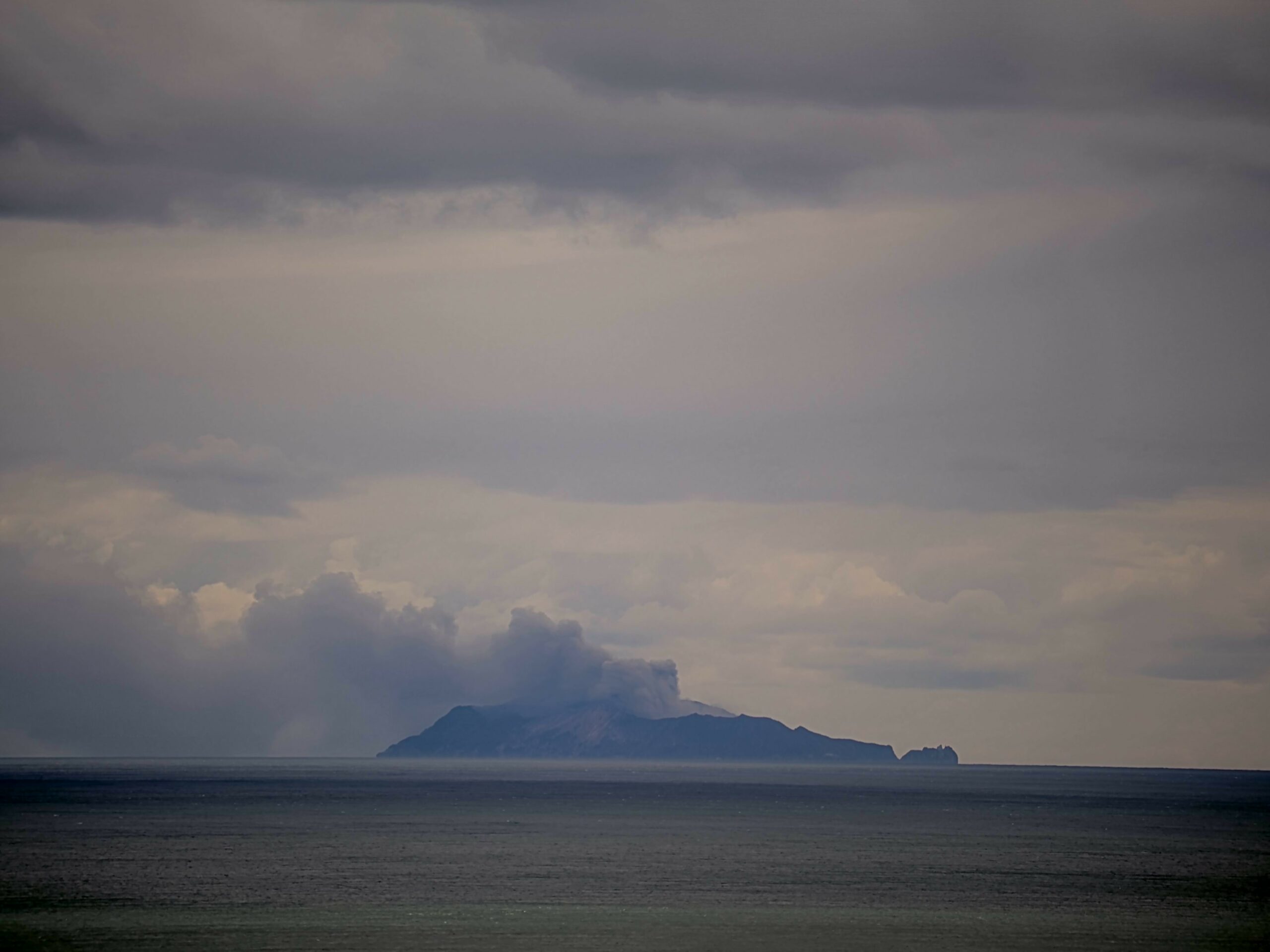
Photo showing the darker coloured plume blowing to the west of the island.
A small amount of ash has been falling from the plume around the volcano and is expected to be confined to within a few kilometres of the island.
However, volcanic activity could escalate with little or no warning – sudden, more explosive events could affect the crater floor and immediate vicinity of the island.
Earth Sciences New Zealand and National Geohazards Monitoring Centre will continue to closely monitor Whakaari/White Island for any changes in activity. We will provide further updates when information becomes available or the status changes.
Source : Geonet / Rebecca Fitzgerald / Duty Volcanologist
Japan , Sakurajima :
The Japan Meteorological Agency (JMA) reported ongoing eruptive activity at Minamidake Crater (Aira Caldera’s Sakurajima volcano) during 5-12 October. Crater incandescence was visible in nighttime webcam images during 5-9 October. A total of 15 eruptive events during 5-8 October produced ash plumes that rose 1-1.6 km above the crater and drifted in various directions. The Alert Level remained at 3 (on a 5-level scale), and the public was warned to be cautious within 1 km of both the Minimadake and Showa craters.
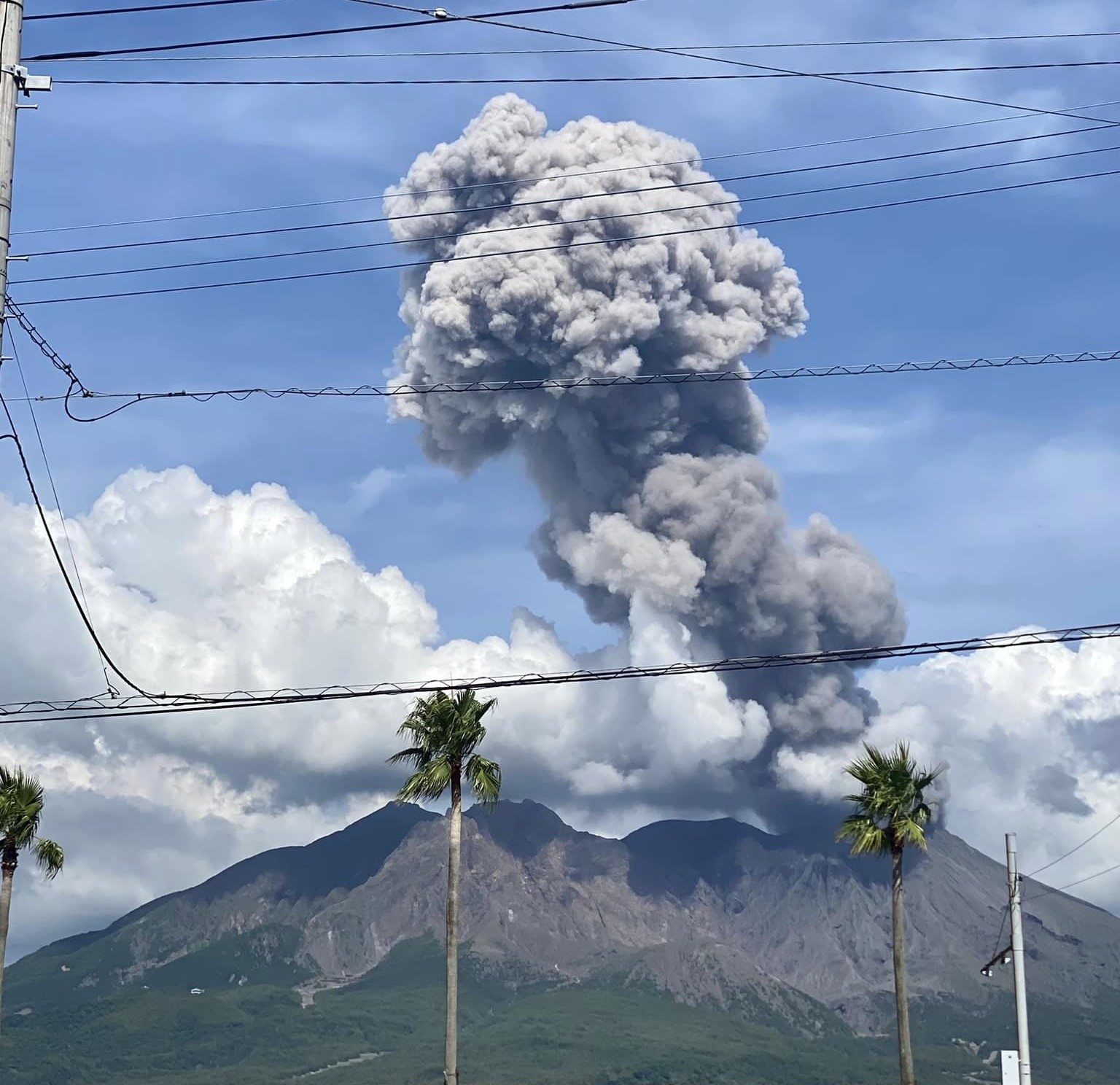
The Aira caldera in the northern half of Kagoshima Bay contains the post-caldera Sakurajima volcano, one of Japan’s most active. Eruption of the voluminous Ito pyroclastic flow accompanied formation of the 17 x 23 km caldera about 22,000 years ago. The smaller Wakamiko caldera was formed during the early Holocene in the NE corner of the caldera, along with several post-caldera cones. The construction of Sakurajima began about 13,000 years ago on the southern rim and built an island that was joined to the Osumi Peninsula during the major explosive and effusive eruption of 1914. Activity at the Kitadake summit cone ended about 4,850 years ago, after which eruptions took place at Minamidake. Frequent eruptions since the 8th century have deposited ash on the city of Kagoshima, located across Kagoshima Bay only 8 km from the summit. The largest recorded eruption took place during 1471-76.
Sources: Japan Meteorological Agency (JMA) , GVP.
Photo : Kumiko Nagai