October 15 , 2026.
Chile / Argentina , Nevados de Chillan :
SPECIAL REPORT ON VOLCANIC ACTIVITY, October 14, 2026
The Argentine Geological and Mining Service (SEGEMAR), through its Argentine Volcanic Monitoring Observatory (OAVV), reports that today, Wednesday, October 14, 2026, at 3:58 PM local time (6:58 PM UTC), volcanic monitoring stations installed in the vicinity of the Nevados de Chillán volcanic complex—operated by OVDAS—recorded an earthquake associated with fluid dynamics within the volcanic system (a « long-period » earthquake). This event was accompanied by the emission of a column of particles, reaching a maximum height of 400 m above the crater rim.
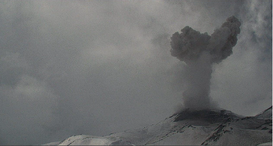
Column of particulate emissions, recorded by surveillance cameras at the Nevados de Chillán volcanic complex (operated by OVDAS).
Information on the seismic event
Origin time: 15:58 local time (18:58 UTC)
Reduced displacement: 360 cm²
Acoustic signal: 1.0 Pa, normalized to a distance of 1 km
Column height: 400 m above the crater rim
OBSERVATIONS:
Volcanic activity remains at levels comparable to those recorded in recent days. Given this context, the occurrence of similar events—or even events of greater intensity—cannot be ruled out. Based on available information, the recorded events have remained localized in the vicinity of the active craters; to date, no populations within Argentine territory have been affected.
CONCLUSIONS:
The technical alert level remains in effect, and monitoring of the volcano will continue in constant communication with Chile’s Southern Andes Volcanological Observatory (OVDAS). Any further developments will be reported.
Source et photo : Segemar .
Colombia , Chiles / Cerro Negro :
San Juan de Pasto, October 13, 2026, 4:10 PM
As part of the ongoing monitoring of the Chiles-Cerro Negro volcanic complex (CVCCN), the Colombian Geological Service (SGC)—an agency affiliated with the Ministry of Mines and Energy—
reports the following:
For the period from October 6 to October 12, 2026, the primary changes in the monitored parameters, compared to the previous week, were as follows:
● Amidst fluctuating seismic activity, a decrease in the number of events was observed, while the energy released increased.
Seismicity associated with rock-fracturing processes remains predominant, followed by activity linked to fluid dynamics.
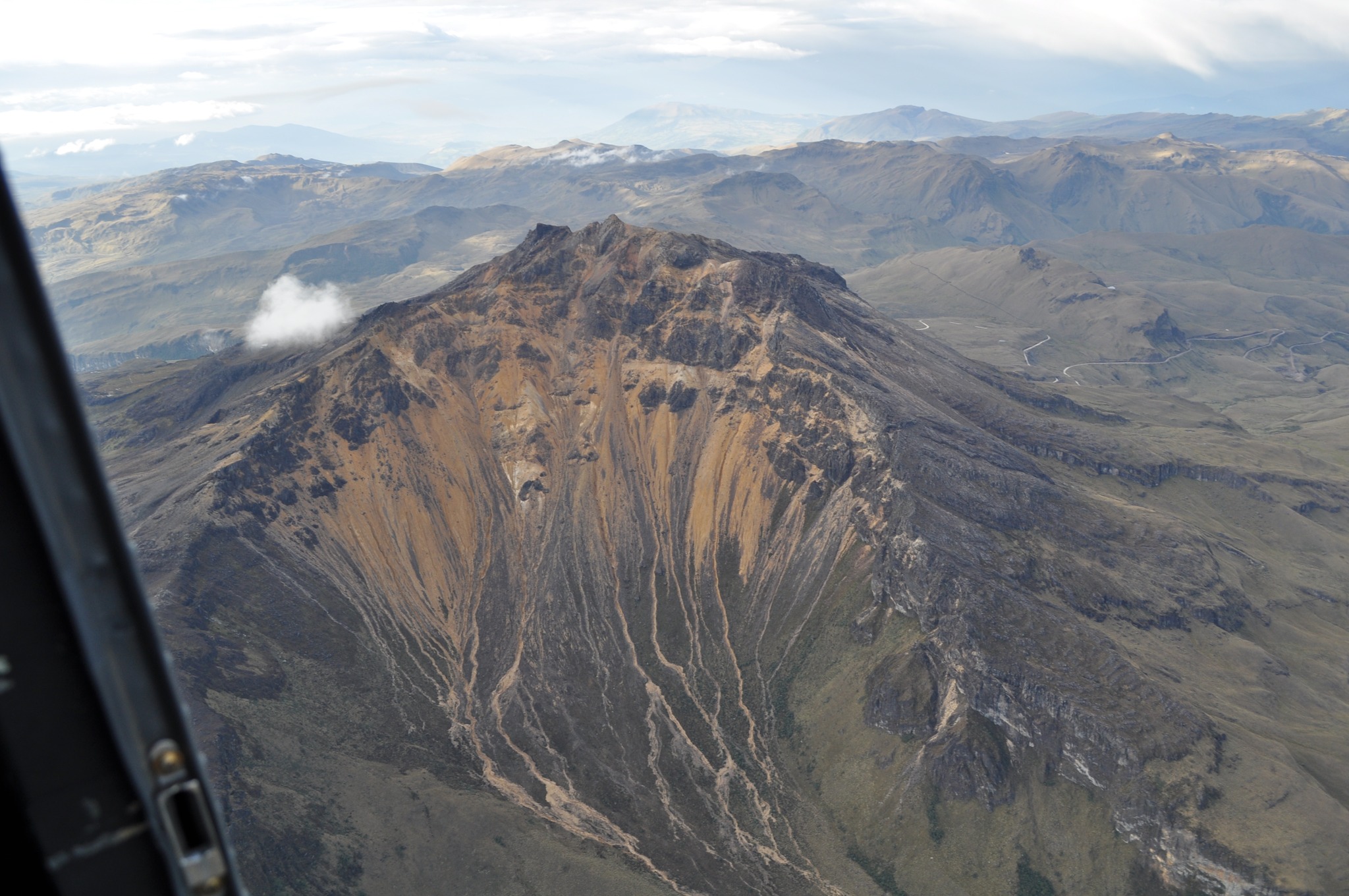
● The earthquakes were concentrated primarily in two zones. The first is located in the upper part of the Chiles volcano, with epicentral distances of less than 3 km and depths ranging from 2.8 to 4.3 km below the volcano’s summit (4,700 m above sea level). The second zone is located south of Chiles, with epicentral distances between 2.5 and 5.4 km and depths ranging from 4.7 to 7.8 km below the summit. Additionally, scattered seismic activity was recorded, mainly to the northwest, at distances of 3 to 14 km and depths of 3 to 10 km; the maximum magnitude recorded was 1.8.
● Analysis of data collected by satellite sensors and ground stations continued to reveal variations associated with deformation processes in the volcanic area.
Based on the assessment and correlation of the monitored parameters, the SGC recommends closely tracking their evolution via weekly bulletins and other information released through our official channels, as well as adhering to the instructions of local and departmental authorities and the National Unit for Disaster Risk Management (UNGRD).
Volcanic activity remains at the « Yellow » alert level: an active volcano showing changes in the behavior of monitored parameters relative to baseline levels, alongside other manifestations.
Source et photo : SGC.
Guatemala , Fuego :
Atmospheric conditions: Clear sky
Wind: From the east
Precipitation: 38.6 mm
Activity
During the night and early morning, light-gray gas emissions were observed at an altitude of 4,300 m above sea level. Between 4 and 7 explosions per hour—ranging from low to moderate or high intensity—have been recorded, propelling columns of gas and ash to altitudes between 4,300 and 4,800 m (14,107–15,748 feet). These columns are moving toward the west and northwest.
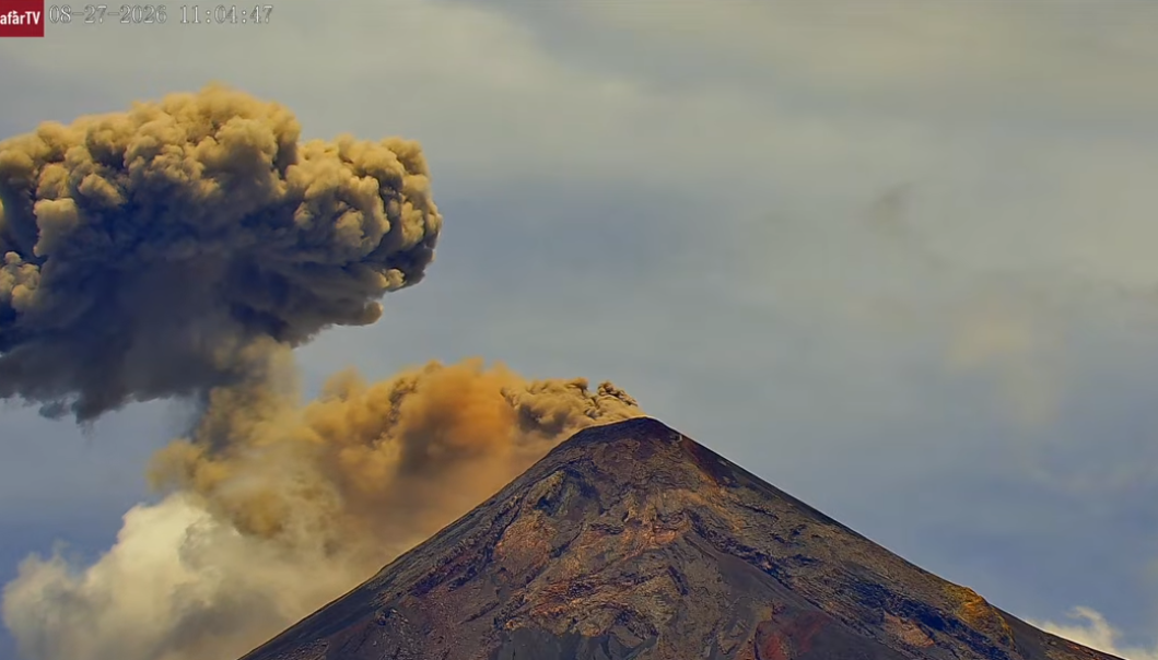
Some explosions are accompanied by noises, rumbling, and mild shockwaves. During the night, incandescent glows were observed, resulting in the fallout of burning material around the crater; this material flows into the Seca, Taniluya, Ceniza, Las Lajas, Honda, and other ravines, at times reaching the edge of the vegetation zone. Furthermore, fine ashfall has been reported in Panimaché I, Yepocapa, and the surrounding areas.
Should rainfall occur during the day, torrential flows and/or lahars could develop. It is therefore strongly advised to avoid remaining within or in the immediate vicinity of these ravines if rain falls on the volcanic edifice.
Source : Insivumeh
Photo : Afar TV
Indonesia , Ibu :
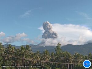
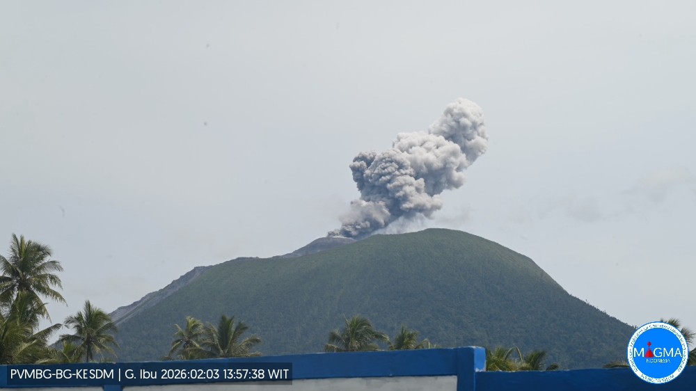
An eruption of Mount Ibu occurred on Thursday, October 15, 2026, at 01:23 (WIT); an ash column reaching approximately 600 m above the summit (about 1,925 m above sea level) was observed. This gray-colored, moderately intense column drifted toward the southeast. The eruption was recorded by a seismograph, showing a maximum amplitude of 28 mm and a duration of 56 seconds.
Seismic observations:
103 eruption earthquakes, with an amplitude of 15–28 mm and a duration of 32–88 seconds.
3 rockfall earthquakes, with an amplitude of 4–20 mm and a duration of 36–50 seconds.
3 emission earthquakes, with an amplitude of 4–8 mm and a duration of 37–41 seconds.
11 harmonic tremors, with an amplitude of 3–28 mm and a duration of 46–107 seconds.
89 low-frequency earthquakes, with an amplitude of 2–12 mm and a duration of 17–29 seconds.
114 shallow volcanic earthquakes, with an amplitude of 2–10 mm and a duration of 7–21 seconds.
1 deep volcanic earthquake, with an amplitude of 2 mm and a duration of 14 seconds.
2 local tectonic earthquakes, with an amplitude of 5–15 mm and a duration of 27–30 seconds.
17 distant tectonic earthquakes, with an amplitude of 2–28 mm and a duration of 29–143 seconds.
Recommendations
1. Communities living in the vicinity of Mount Ibu, as well as visitors and tourists, are advised not to conduct any activities within a 2 km radius—a distance that extends to 3.5 km in the direction of the crater opening located to the north of Mount Ibu’s active crater.
2. In the event of ashfall, individuals who are outdoors are advised to protect their nose and mouth (using masks) and their eyes (using protective eyewear).
Source et photo : PVMBG.
Peru , Sabancaya :
Date and local time: 12/10/2026 – 11:00 AM
Reporting period: October 5 to October 11, 2026
Volcanic Alert Level
Orange Alert Level: The volcano is experiencing a significant increase in eruptive activity. There is an intensification of seismic activity, frequent explosions, and the emission of ash and ballistic blocks.
Conclusions
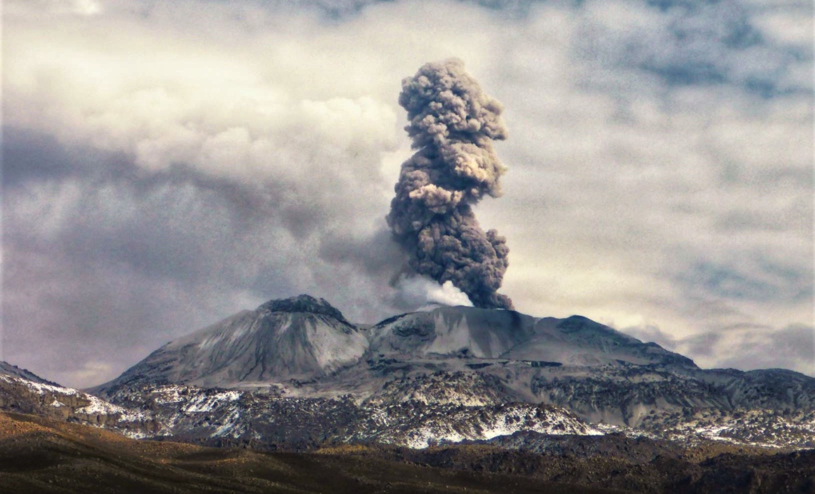
The IGP indicates that the eruptive process at the Sabancaya volcano is ongoing. During this period, no volcanic explosions have been recorded; only emissions of water vapor, ash, and gas—reaching up to 800 m above the summit—have been observed, accompanied by seismic activity linked to the movement of magmatic fluids and internal fracturing processes. Consequently, the volcanic alert level remains at orange.
Recommendations
It is advised to stay consistently informed about the activity of the Sabancaya volcano by consulting the reports and bulletins published by the IGP.
Outlook
Future volcanic explosions, potentially generating eruptive columns exceeding 2 km in height, are considered likely. Such events could affect districts located in the Colca Valley as well as surrounding areas due to the dispersal of volcanic ash; therefore, the volcanic alert level is maintained at orange.
Source et photo : IGP.