October 12 , 2026.
Italy / Sicily , Etna :
Statement on Etna’s activity, October 12, 2026, 04:03 (02:03 UTC).
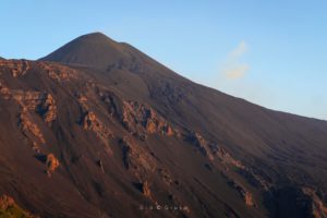
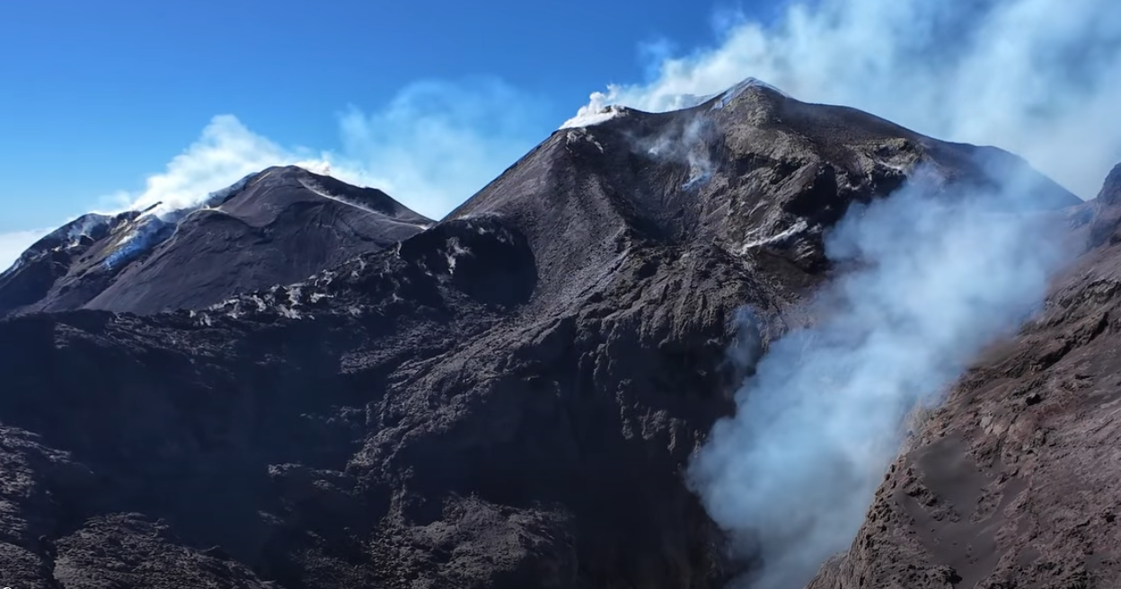
The National Institute of Geophysics and Volcanology (Osservatorio Etneo) reports that strong degassing is being observed at the Northeast Crater via surveillance cameras.
Seismically, an increase in volcanic tremor has been noted since 00:20 UTC; levels are currently at the upper limit of the average range. The tremor is located slightly east of the Voragine crater, at an elevation of 2,800 meters above sea level.
Infrasonic activity is very low.
The GNSS network shows no significant variations. Tiltmeter stations located in the northeastern sector of the Etna volcanic edifice indicate the onset of a phase characterized by low-amplitude, high-frequency oscillations on both components, starting at 00:42 GMT.
Further updates will be provided as soon as possible.
Source : INGV.
Photo : Gio Giusa ( capture d’écran).
Hawaii , Kilauea :
HAWAIIAN VOLCANO OBSERVATORY DAILY UPDATE , U.S. Geological Survey
Sunday, October 11, 2026, 9:42 AM HST (Sunday, October 11, 2026, 19:42 UTC)
19°25’16 » N 155°17’13 » W,
Summit Elevation 4091 ft (1247 m)
Current Volcano Alert Level: WATCH
Current Aviation Color Code: ORANGE
Summary:
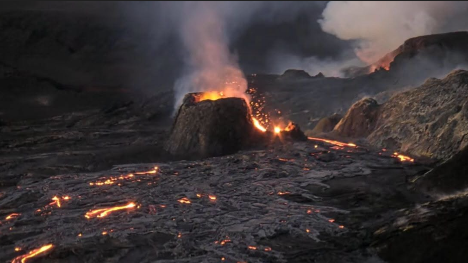
The north vent erupted spatter overnight feeding a short, tube-fed pahoehoe flow. Kīlauea’s summit remains at a high level of pressurization with changes in eruptive activity or location within the summit region possible in the coming days to weeks.
Summit Observations:
Both the north and south vents in Halemaʻumaʻu showed strong glow and flames in overnight webcam imagery. The small opening near the base of the north vent spattered intermittently until 11:15 p.m. HST when it began to erupt continuously feeding a small, tube-fed pahoehoe flow. Overnight this flow progressed as lobes a few hundred meters down the vent shield. The flow remains active this morning but the small incandescent breakouts are not visible in daylight.
In the past 24 hours, there were 26 shallow earthquakes located across the summit region of Kīlauea. The Uēkahuna tiltmeter (UWD) recorded an increase of 0.3 microradians in tilt over the past day. GPS stations on opposite sides of Halemaʻumaʻu (CRIM and UWEV) show a small increase in length since the end of September.
During inter-episode pauses, the sulfur dioxide (SO2) emission rate from the summit typically varies between 1,000 and 5,000 tonnes per day. Plumes of volcanic gas are visible from the vents in day-time webcam views. Winds are currently forecast from the east then changing to from the northeast this evening.
Analysis:
Kīlauea had been erupting episodically between December 23, 2024, and August 25, 2026, from two vents (north and south) in Halema‘uma‘u at the summit. Lava fountaining episodes generally lasted for less than 12 hours and were separated by pauses of two or more weeks. Irregular patterns of ground deformation at Kīlauea summit since the most recent lava fountaining episode, number 54 on August 25, 2026, prevent forecast modeling for when the next fountaining episode can occur. Ground deformation patterns indicate the magma chamber beneath Halemaʻumaʻu is pressurized beyond the level typically seen before recent fountaining events. This pattern was disrupted by the dike intrusion on September 30-October 1 and since then summit tilt has increased slowly with interspersed periods of decreased or flat tilt. The small tube-fed pahoehoe overflow that began last night is evidence that the top of the magma column in the north vent is right at the surface. Analysis of earlier samples of north vent overlfows and flows from vents 1-6 show that the erupted magma is cooled and degassed, and may be inhibiting hotter, gas-rich magma from reaching the surface. It is possible that another fountaining episode from the north-south vent complex could occur; however, intrusive activity underneath Kaluapele is also possible, or magma could exploit existing weak crack systems in the summit region to erupt passively (with little or no seismicity or deformation).
Source : HVO
Photo : Hawaii Volcanoes National Park
Indonesia , Anak Krakatau :
Announcement regarding the raising of the activity level of the Anak Krakatau volcano from Level II (WASPADA) to Level III (SIAGA).
The following is an assessment of the activity of the Anak Krakatau volcano (Lampung Province) for the period from September 21 to October 9, 2026:
I. Visual observations
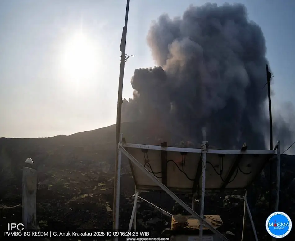
During the period from September 21 to October 9, 2026, the volcano was observed under conditions ranging from clear visibility to fog cover. Visual and CCTV observations revealed crater plumes—ranging in color from white to black and emitted under moderate pressure—with column heights varying between 5 and 50 meters above the crater. Weather conditions ranged from clear to rainy, with winds blowing at low to moderate speeds. Crater monitoring via Sentinel satellite imagery during the period from September 21 to October 9, 2026, indicated low-intensity sulfur dioxide (SO2) emissions (ranging from 71 to 237.5 tonnes per day) and low-intensity thermal anomalies (ranging from 15 to 25 N-pixels). Hotspots have been observed since October 6, 2026.
II. Instrumental observations
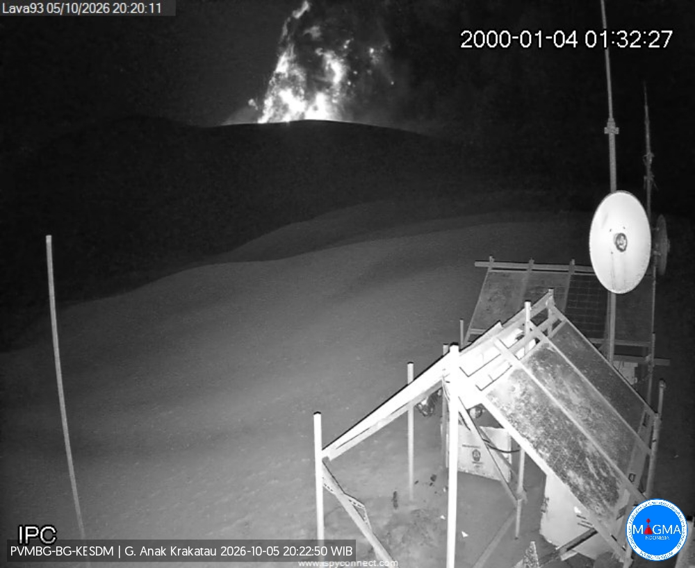
During the period from September 21 to October 8, 2026, the following seismic events were recorded: 5 eruption earthquakes, 8 emission earthquakes, 11 low-frequency earthquakes, 45 hybrid/multiphase earthquakes, 17 episodes of continuous tremor, 31 shallow volcanic earthquakes, 9 deep volcanic earthquakes, and 8 distant tectonic earthquakes. On October 9, 2026, up to 19:20, nine eruptions occurred, with a maximum amplitude of 55 mm and a duration of 32 seconds; the height of the eruption column was not observed. Volcanic activity energy, as indicated by RSAM values (Real-time Seismic Amplitude Measurement), generally showed fluctuations at low energy levels. Tiltmeter data from the Tanjung station for the period from September 21 to October 9, 2026, revealed a fluctuating trend, with a stable (constant) pattern on the Y-component.
III. Assessment
During the period from September 21 to October 9, 2026, volcanic seismicity at Anak Krakatau—whether associated with shallow magmatic processes (emission, low-frequency, and hybrid/multiphase earthquakes, as well as tremors) or deep processes (shallow and deep volcanic earthquakes)—showed no significant signs of intensification, with a daily average of fewer than five events. This finding is corroborated by the RSAM and tiltmeter charts, which indicated no increase. However, a slight increase in activity indicators began to appear in early October 2026. This trend manifested as 14 eruptions of Anak Krakatau between October 6 and 9, 2026.
IV. Recommendation
Based on a thorough analysis and assessment, the activity level of the Anak Krakatau volcano has been raised from Level II (Advisory/Waspada) to Level III (Watch/Siaga) effective October 9, 2026, at 21:00 WIB. The recommendations associated with Level III (Watch) are as follows:
Populations living near the Anak Krakatau volcano, as well as visitors, tourists, and hikers, are prohibited from entering or engaging in activities within a 5 km radius of the Anak Krakatau eruptive center.
Populations living near the Anak Krakatau volcano, as well as visitors and tourists, are prohibited from entering or engaging in activities within a 1 km radius of the new islands located in the northwest and southeast sectors of the Anak Krakatau volcano.
Source et photos : PVMBG.
Chile / Argentina , Nevados de Chillan :
SPECIAL REPORT ON VOLCANIC ACTIVITY – October 11, 2026
The Argentine Geological and Mining Service (SEGEMAR), through its Argentine Volcanic Monitoring Observatory (OAVV), reports that today, Sunday, October 11, 2026, at 10:12 p.m. local time (01:12 UTC on October 12), volcanic monitoring stations installed near the Nevados de Chillán volcanic complex (belonging to OVDAS) recorded an earthquake linked to fluid dynamics within the volcanic system (a « long-period » earthquake). This event was accompanied by an intensification of the nighttime incandescence observed at the active crater.
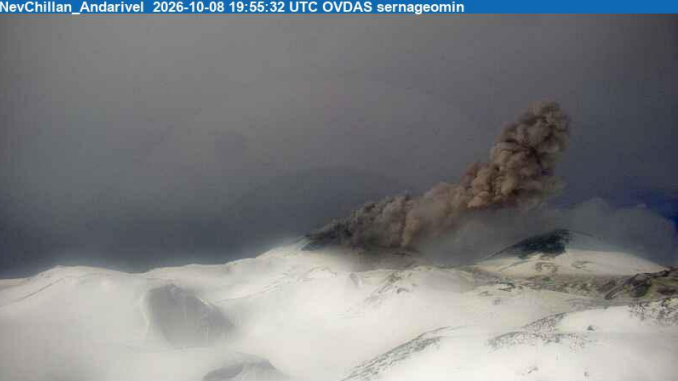
Image from the Andarivel camera, 16:55 local time (19:55 UTC) – Sernageomin
Seismic event information
Origin time: 22:12 local time (01:12 UTC on October 12)
Reduced displacement: 318 cm².
OBSERVATIONS:
Volcanic activity remains at levels comparable to those recorded in recent days. Consequently, the occurrence of future events of similar or greater energy cannot be ruled out. Based on available information, the recorded events have remained localized near the active craters; no impact on populations in Argentine territory has been observed to date.
CONCLUSIONS
The technical alert level remains in effect, and volcano monitoring continues in constant communication with Chile’s Southern Andes Volcanological Observatory (OVDAS); any changes in the situation will be reported.
Source : Segemar
Photo : Sernageomin
Costa Rica , Poas :
Latitude: 10.20° N;
Longitude: 84.23° W;
Elevation: 2,687 m above sea level.
Current activity level: Advisory
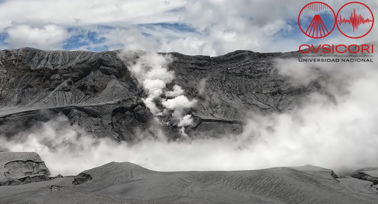
No eruptions were recorded this week. Although tremor amplitude generally remains moderate and stable, variations in spectral content continue to be observed, ranging from monochromatic to broadband spectra. No volcano-tectonic earthquakes were recorded this week. The number of long-period events remains stable over the long term (several weeks), despite some fluctuations. Over the medium term (6 months), a trend of subsidence and contraction of the volcanic edifice is observed. In the short term, no significant deformation has been recorded.
Multi-GAS stations measured an SO2/CO2 ratio of 1.0 ± 0.4, a value comparable to that of the previous week (0.8 ± 0.4). The H2S/SO2 ratio remains below 0.1. NOVAC stations recorded an average daily SO2 emission of 46 ± 31 tonnes, with a maximum of 531 t/d. This flux is lower than that of the previous week (73 ± 81 tonnes per day, with a maximum of 682 t/d); however, this apparent decrease could be linked to wind conditions that were unfavorable for measurements this week. The SENTINEL satellite continues to detect the SO2 plume almost daily, with a maximum atmospheric SO2 load of 84 tonnes recorded on October 4.
The level of the hyperacidic lake remained stable this week. The lake temperature remains very high but shows a slight decrease (>57°C, remote measurement). On September 23, the lake waters showed a chemical composition with lower sulfate and chloride ion concentrations compared to late 2025 and the first half of 2026. This change in composition indicates a decrease in the input of gases such as sulfur dioxide (SO2) and in the remobilization of hydrogen chloride (HCl) within the lake.
Source et photo : Ovsicori .