October 10 , 2026.
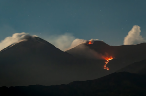
Indonesia , Dukono :
An eruption of Mount Dukono occurred on Saturday, October 10, 2026, at 15:05 (WIT). The eruption was not visually observed. It was recorded by the seismograph with a maximum amplitude of 20 mm and a duration of 35.47 seconds.
Seismic observations
3 eruption earthquakes with amplitudes of 6–19 mm and durations of 37.84–41.63 seconds.
3 low-frequency earthquakes with amplitudes of 3–4 mm and durations of 21.87–26.3 seconds.
3 distant tectonic earthquakes with amplitudes of 8–13 mm and durations of 53.01–103.67 seconds.
1 episode of continuous tremor with an amplitude of 1–2 mm (dominant amplitude: 1 mm).
Recommendations
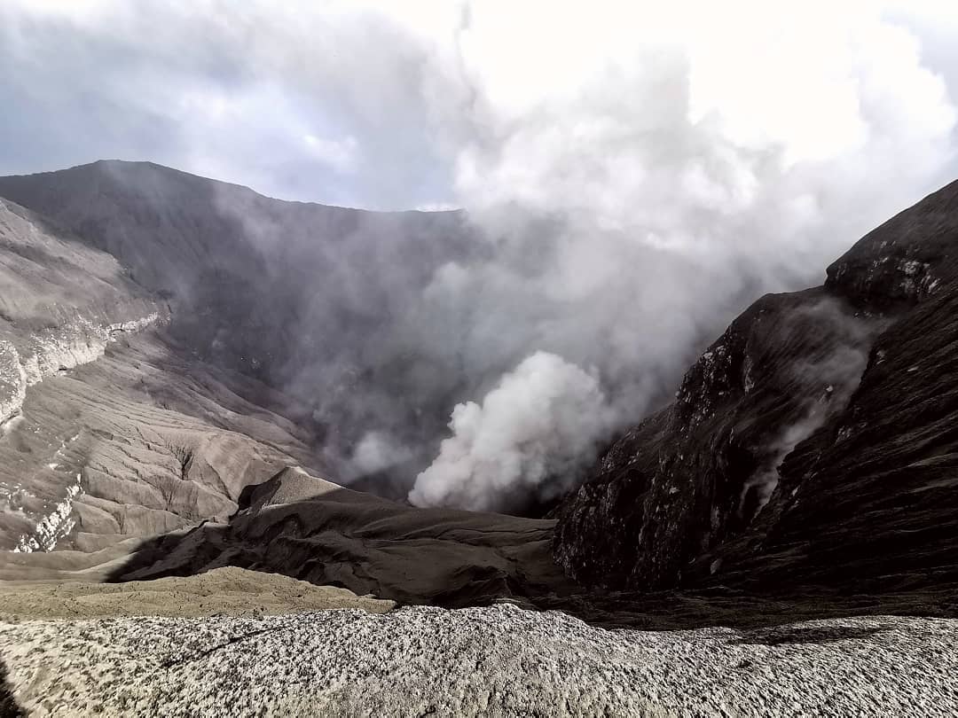
(1) Communities living near Mount Dukono, as well as visitors and tourists, are advised not to engage in any activities, hike, or approach the Malupang Warirang crater within a 4-kilometer radius.
(2) Given that eruptions involving volcanic ash occur periodically and ash dispersal depends on wind direction and speed—meaning the area affected by ashfall varies—communities near Mount Dukono are advised to keep masks or nose and mouth coverings readily available for use when needed, thereby avoiding respiratory health risks associated with volcanic ash.
Source : PVMBG.
Photo :Rainwater Media via Sherine France. ( archive).
Martinique , Mount Pelée :
Weekly Report, Institut de physique du globe de Paris / Martinique Volcanological and Seismological Observatory (OVSM)
Saint-Pierre, October 9, 2026, at 16:00 local time (GMT-4)
Volcano-tectonic seismic activity
Between October 2, 2026, at 16:00 (UTC) and October 9, 2026, at 16:00 (UTC), the OVSM recorded 145 earthquakes of volcanic origin:
• 143 volcano-tectonic earthquakes. Four earthquakes had a magnitude (local magnitude Mlv or duration magnitude Md) greater than 1. The largest had a magnitude of Mlv = 1.54; the others were of lower energy. These earthquakes were located at depths ranging from 0.5 to 4.2 km beneath the volcano’s summit.
• 2 hybrid earthquakes. These were located beneath Montagne Pelée at depths of 1.2 km and 5.6 km, with magnitudes of Mlv = 1.17 and Mlv = 0.11, respectively.
No earthquakes were reported felt by the population.
During the previous week, the OVSM had recorded 226 earthquakes of volcanic origin. As of October 9, 2026, and over the past four weeks, the OVSM has thus observed a total of 692 volcanic earthquakes, representing an average of 173 earthquakes per week.
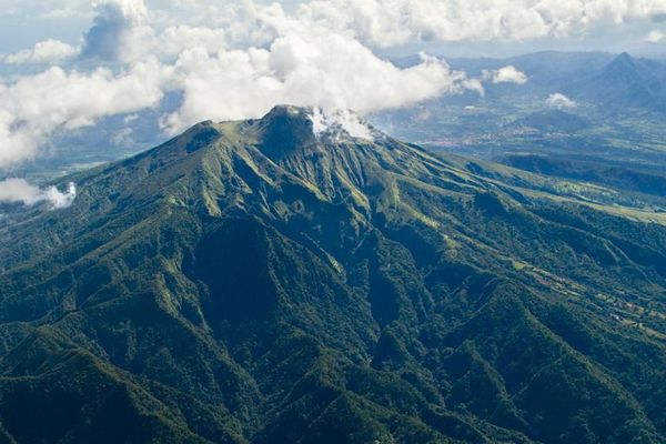
Deformations of Mount Pelée
Since May 2026, the OVSM has been recording ground displacements of several centimeters in the summit area of Mount Pelée. In the deformation zones near the summit, the maximum elongation recorded over the past four weeks is 0.7 cm (along an 880-meter-long profile). These displacements are consistent with deformation of the volcanic edifice caused by an inflating pressure source located at a depth of approximately 1 km beneath the summit.
The probability of short-term eruptive activity remains low. However, given the observations gathered over recent months and years, a change in the situation over the medium term (weeks to months) cannot be ruled out.
The volcanic alert level, in accordance with the measures established by the authorities, is currently YELLOW: vigilance.
Source : Direction de l’OVSM-IPGP
Photo : Parc Naturel
Guatemala , Fuego :
Weather conditions: Partly cloudy
Wind: Northeasterly
Precipitation: 29.2 mm
Activity
During the night and early morning hours, low to moderate degassing was recorded, with fumaroles reaching approximately 300 meters above the crater and dispersing towards the southwest. Currently, cloud cover over the volcanic complex hinders direct observation; however, explosive activity continues at a rate of 5 to 7 low-to-moderate explosions per hour, generating ash plumes rising between 4,300 and 4,800 meters above sea level, which have drifted towards the west and southwest.
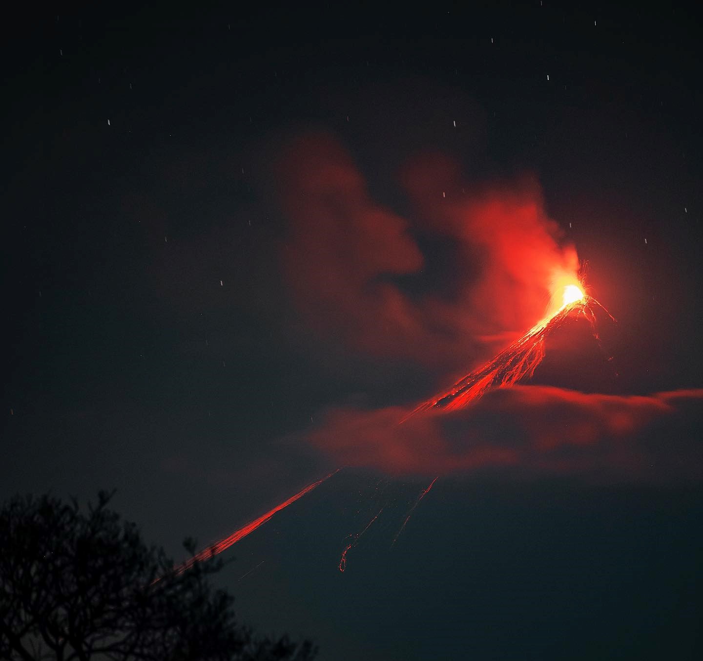
Some explosions were accompanied by low-to-moderate rumbling sounds. Incandescent material was observed being ejected up to 200 meters above the crater, accompanied by minor avalanches. Additionally, fallout of incandescent material was recorded around the crater; this material flows into the Ceniza, Taniluyá, Seca, Santa Teresa, Trinidad, and Las Lajas ravines, sometimes descending as far as the vegetation line. Due to the rainy season and the accumulation of material in the ravines, a risk of lahars persists during the afternoon and night. It is recommended to avoid the areas near the volcano’s ravines and to follow the instructions in special bulletin BEFG0-013-2026.
Source : Insivumeh.
Photo : Diego Rizzo ( archive).
Hawaii , Kilauea :
HAWAIIAN VOLCANO OBSERVATORY DAILY UPDATE , U.S. Geological Survey
Friday, October 9, 2026, 8:53 AM HST (Friday, October 9, 2026, 18:53 UTC)
19°25’16 » N 155°17’13 » W,
Summit Elevation 4091 ft (1247 m)
Current Volcano Alert Level: WATCH
Current Aviation Color Code: ORANGE
Summary:
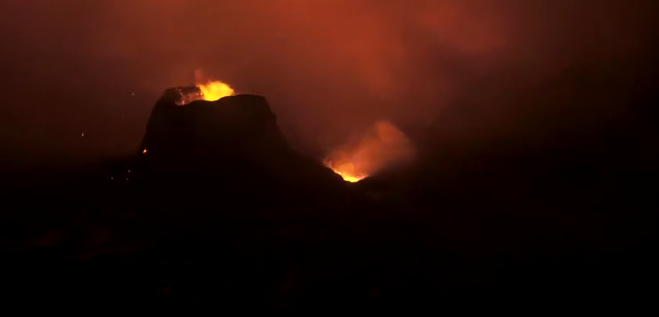
Kīlauea summit north and south vent erupted minor spatter overnight. Kīlauea summit is at a high level of pressurization. Fountaining, intrusions, or an eruption in a new location within the summit region could occur in the coming days to weeks.
Summit Observations:
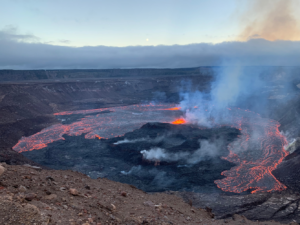
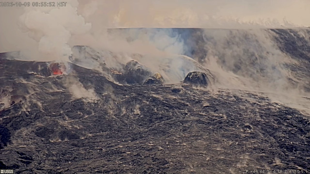
Both the north and south vents in Halemaʻumaʻu showed strong glow and flames in overnight webcam imagery, with minor amounts of spatter erupted by both vents. Robust plumes of volcanic gas emanate from both vents in day-time webcam views.
In the past 24 hours, there were 7 shallow earthquakes located across the summit region of Kīlauea. The Uēkahuna tiltmeter (UWD) recorded no appreciable change in tilt over the past day. GPS stations on opposite sides of Halemaʻumaʻu (CRIM and UWEV) show a small increase in length since the end of September.
Rift Zone Observations:
Rates of seismicity and ground deformation remain low in the East Rift Zone and Southwest Rift Zone. SO2 emissions from the East Rift Zone remain below the detection limit. No significant ground deformation was recorded in either rift zone.
Analysis:
Kīlauea had been erupting episodically between December 23, 2024, and August 25, 2026, from two vents (north and south) in Halema‘uma‘u at the summit. Lava fountaining episodes generally lasted for less than 12 hours and were separated by pauses of two or more weeks. Irregular patterns of ground deformation at Kīlauea summit since the most recent lava fountaining episode, number 54 on August 25, 2026, prevent forecast modeling for when the next fountaining episode can occur. Ground deformation patterns indicate the magma chamber beneath Halemaʻumaʻu is pressurized beyond the level typically seen before recent fountaining events. It is possible that another fountaining episode from the north-south vent complex could occur; however, intrusive activity underneath Kaluapele is also possible, or magma could exploit existing weak crack systems in the summit region to erupt passively (with little or no seismicity or deformation).
Source et photo : HVO.
Chile / Argentina , Villarica :
The Argentine Geological and Mining Service (SEGEMAR), through its Argentine Volcanic Monitoring Observatory (OAVV), reports that the technical alert level for the Villarrica volcano remains at YELLOW.
ANALYSIS OF THE PERIOD
During the period under review, volcano-tectonic (VT) seismic activity—associated with rock fracturing within the volcano—continued, with a number of events similar to that of the previous period.
The dominant seismic activity was linked to fluid movement within the volcano, manifesting as « long-period » (LP) and « tremor » (TR) events. LP events were the most frequent, showing lower energy release levels than in the previous period.
The maximum reduced displacement (RD) reached 26 cm².
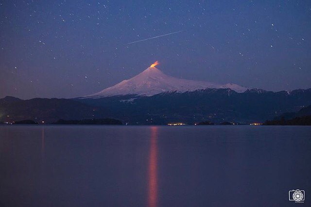
Analysis of images from OVDAS surveillance cameras revealed—weather permitting—degassing plumes rising just above the crater rim. Additionally, incandescence was observed on September 19.
During the period under review, satellite image processing detected very low-magnitude thermal anomalies via MODIS, VIIRS750, and VIIRS375 sensors, with a maximum radiative power of 1.38 MW.
Analysis of high-resolution satellite imagery (specifically PlanetScope and Sentinel 2-L2A) revealed no morphological changes to the volcano.
CONCLUSIONS
Throughout the assessment period, Villarrica volcano continued to show signs of instability, characterized primarily by fluctuations in seismic signals and surface activity.
Although cloud cover partially limited visual observations, minor explosions and degassing persisted at the active crater, with no emission of pyroclastic material. Furthermore, incandescence and satellite-detected thermal anomalies were recorded.
Based on these findings, the volcanic system is considered to be in a phase of instability consistent with an increased rise of fluids toward shallow levels. Consequently, sudden changes in activity—occurring without additional warning signs yet capable of affecting areas near the active crater—cannot be ruled out.
Source : Segemar .
Photo : horadelaluz_martinifotografia