August 4 , 2026.
Hawaii , Kilauea :
HAWAIIAN VOLCANO OBSERVATORY DAILY UPDATE , U.S. Geological Survey
Monday, August 3, 2026, 9:00 AM HST (Monday, August 3, 2026, 19:00 UTC)
19°25’16 » N 155°17’13 » W,
Summit Elevation 4091 ft (1247 m)
Current Volcano Alert Level: ADVISORY
Current Aviation Color Code: YELLOW
Summary:
Kīlauea volcano is not erupting. Reinflation indicates another episode is likely with the current forecast between August 7 and 14.
Overview:
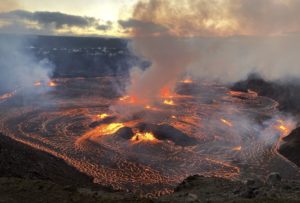
The summit eruption of Kīlauea in Halemaʻumaʻu is paused. Glow from the north vent continues. Summit tilt continues on a weak deflationary trend from yesterday to this morning. Models indicate that the forecast window for episode 53 is between August 7 and August 14.
No significant activity has been noted along Kīlauea’s East Rift Zone or Southwest Rift Zone.
Summit Observations:
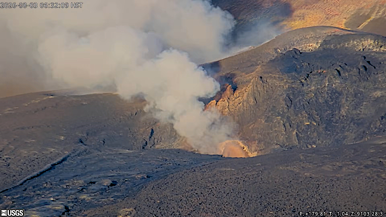
Intermittent, moderate glow continued from the north vent overnight. Rare glow was observed from the south vent and from a crack that opened upslope of the south vent in the early morning of July 30.
Summit tremor has become more continuous but is has small, ragged tremor peaks spaced 10-30 minutes apart.. One earthquake was detected beneath the summit region over the the last 24 hours.
Since episode 52 ended, UWD has recorded a total of 5.9 microradians of inflationary tilt. This amount has been reduced by weak deflationary tilt that has been recorded by summit tiltmeters throughout yesterday and continuing this morning. Deflationary tilt measured at a summit tiltmeter at Uēkahuna (UWD) totaled 14.4 microradians during episode 52.
The sulfur dioxide (SO2) emission rate from the summit is likely now varying within a typical range of 1,000 to 5,000 tonnes per day. Winds are currently from the north-northeast, and the degassing plumes are being blown to the south-southwest.
Rift Zone Observations:
Rates of seismicity and ground deformation remain low in the East Rift Zone and Southwest Rift Zone. SO2 emissions from the East Rift Zone remain below the detection limit.
Source et photo : HVO.
Indonesia , Lewotobi Laki-laki :
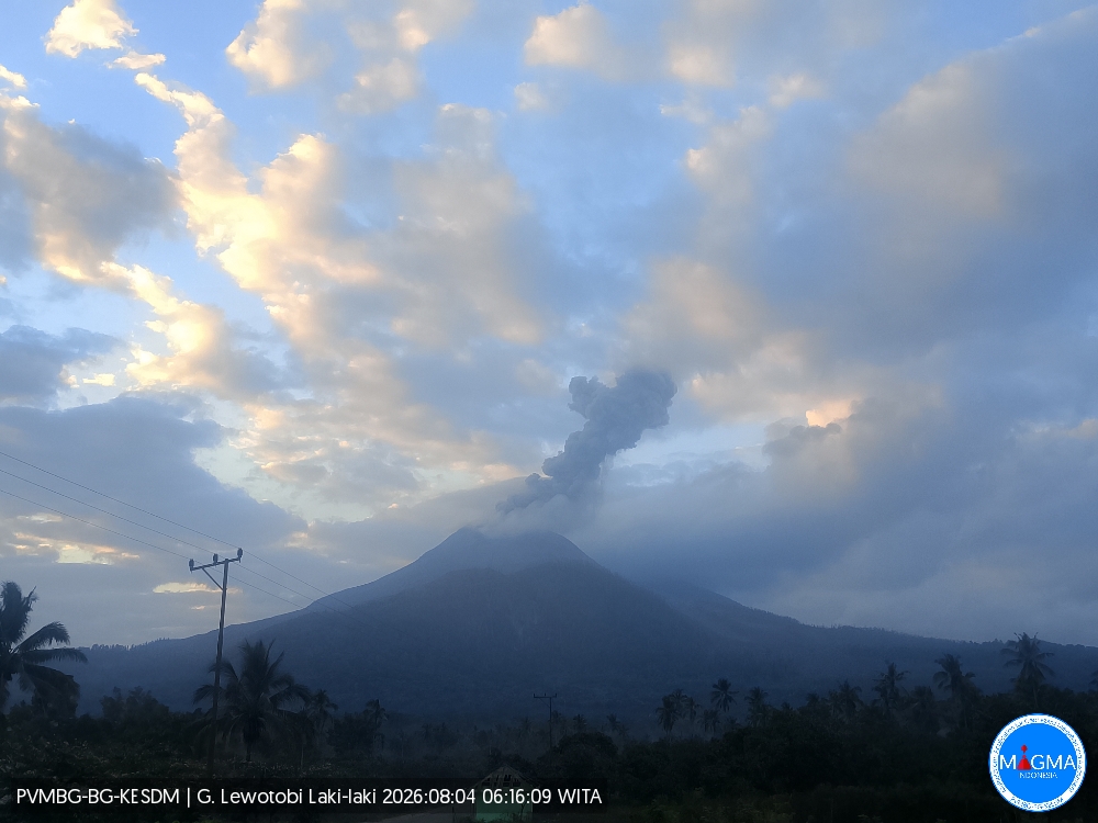
An eruption of Mount Lewotobi Laki-laki occurred on Tuesday, August 4, 2026, at 06:13 WITA; an ash plume reaching approximately 800 meters above the summit (or about 2,384 meters above sea level) was observed. This dense, gray plume drifted towards the west and northwest. The eruption was recorded by the seismograph with a maximum amplitude of 14.8 mm and a duration of 116 seconds.
Seismic observations
2 eruption earthquakes, with amplitudes of 7.4–14.8 mm and durations of 116–147 seconds.
9 episodes of non-harmonic tremor, with amplitudes of 2.9–7.4 mm and durations of 64–92 seconds.
1 low-frequency earthquake, with an amplitude of 2.9 mm and a duration of 18 seconds.
1 distant tectonic earthquake, with an amplitude of 14.8 mm and a duration of 60 seconds.
Recommendations
1. Communities near Mount Lewotobi Laki-laki, as well as visitors and tourists, must not conduct any activities within a 5 km radius of the Mount Lewotobi Laki-laki eruption center.
2. The public is advised to remain calm, follow instructions from local authorities, and disregard information from unverified sources.
Source et photo : PVMBG.
Martinique , Mount Pelée :
Weekly Report / Institut de physique du globe de Paris / Martinique Volcanological and Seismological Observatory (OVSM)
Saint-Pierre, July 31, 2026, at 2:30 PM local time (GMT-4)
Volcanic seismic activity:
Between July 24, 2026, at 16:00 (UTC) and July 31, 2026, at 16:00 (UTC), the OVSM recorded 124 earthquakes of volcanic origin:
• 124 volcano-tectonic earthquakes. None exceeded a magnitude (local magnitude Mlv or duration magnitude Md) of 1. The vast majority of these earthquakes were located at depths between 0.7 and 1.7 km below the volcano’s summit. However, one volcano-tectonic earthquake was located at a depth of 4.6 km below sea level, slightly to the west of the domes.
No earthquakes were felt by the population.
During the previous week, the OVSM had recorded 45 earthquakes of volcanic origin. As of July 31, 2026, and over the past four weeks, the OVSM has thus observed a total of 331 volcanic earthquakes, representing an average of 84 to 85 earthquakes per week.
Deformation of Mount Pelée
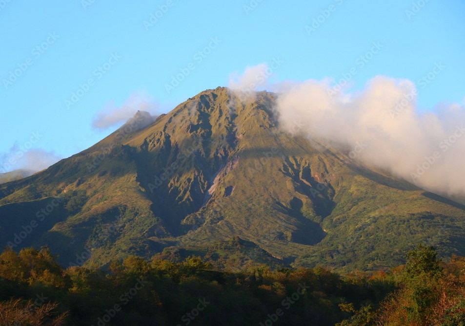
Since May 2026, the OVSM has been recording ground displacements of several centimeters in the summit area of Mount Pelée. Over the past four weeks, maximum displacement rates have been around 1.2 cm per month, a slight decrease compared to the previous month. These displacements are consistent with deformation of the volcanic edifice caused by an inflating pressure source located at a depth of approximately 1 km beneath the summit.
The probability of short-term eruptive activity remains low. However, given the observations gathered over recent months and years, a change in the situation over the medium term (weeks to months) cannot be ruled out.
The volcanic alert level, in accordance with the measures established by the authorities, is currently YELLOW: vigilance.
Source et photo : Direction de l’OVSM-IPGP
Guatemala , Santiaguito :
Weather conditions: Clear skies
Wind: Northeasterly
Precipitation: 0.3 mm
Activity
The Santiaguito volcano observatory reports partly clear skies. Activity at the Caliente dome crater is characterized by low- to moderate-intensity explosions accompanied by ash plumes reaching 3,200 meters above sea level; these plumes are drifting west and southwest for a distance of approximately 20 km, causing ashfall in Loma Linda, San Marcos Palajunoj, and other nearby localities. The extrusion of lava blocks continues to feed the lava flow on the southwest flank, triggering avalanches and pyroclastic flows that reach the base of the dome.
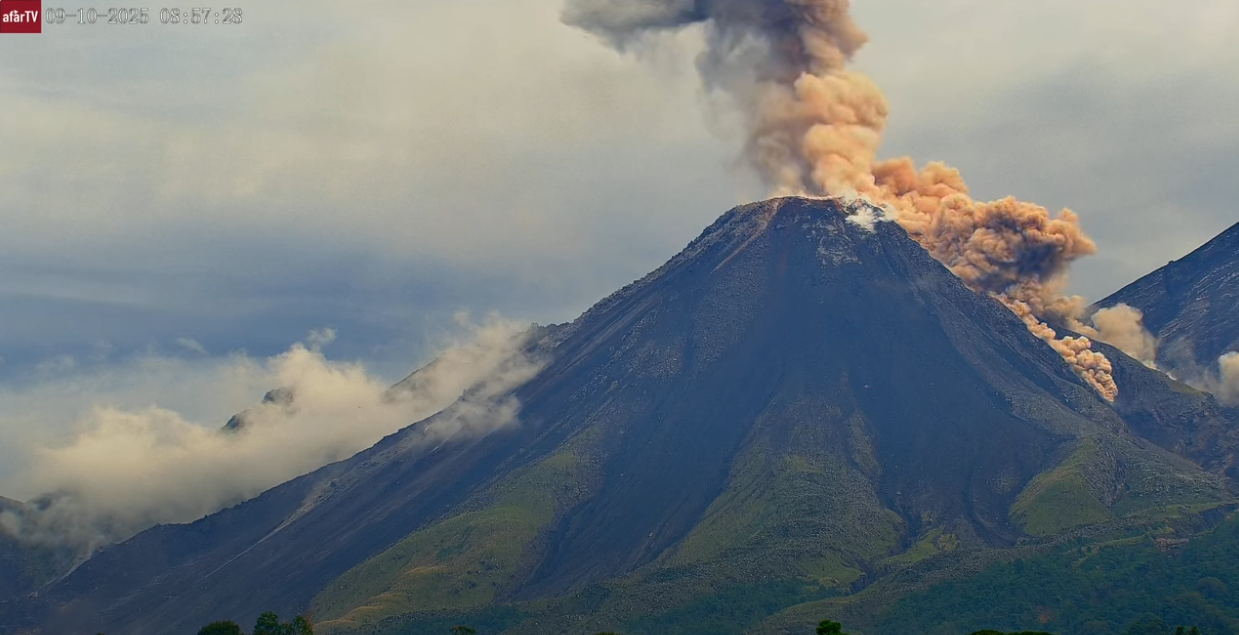
Incandescence was observed in the crater overnight and early in the morning, indicating the presence of active magma at the surface. Dome instability maintains a risk of partial collapses, which could generate longer-range pyroclastic flows. Consequently, it is recommended to stay away from the domes and to avoid entering or lingering in the ravines, as these areas present the greatest danger.
Source : Insivumeh.
Photo : Afar TV.
Peru , Sabancaya :
VOLCANOLOGICAL BULLETIN. Analysis: July 27 – August 2, 2026. Date of issue: August 3, 2026
ALERT LEVEL: Orange
Summary:
The IGP reports that the eruptive process at Sabancaya volcano is ongoing. During this period, no volcanic explosions occurred; activity was limited to emissions of water vapor, ash, and gas reaching up to 2,500 m above the volcano’s summit, accompanied by seismic activity linked to magmatic fluid movement and internal fracturing. Consequently, the volcanic alert level remains at orange.
Analysis
Forty-seven earthquakes linked to the movement of magmatic fluids within the volcano were recorded, in addition to earthquakes associated with rock fracturing. No volcanic explosions were recorded during this period.
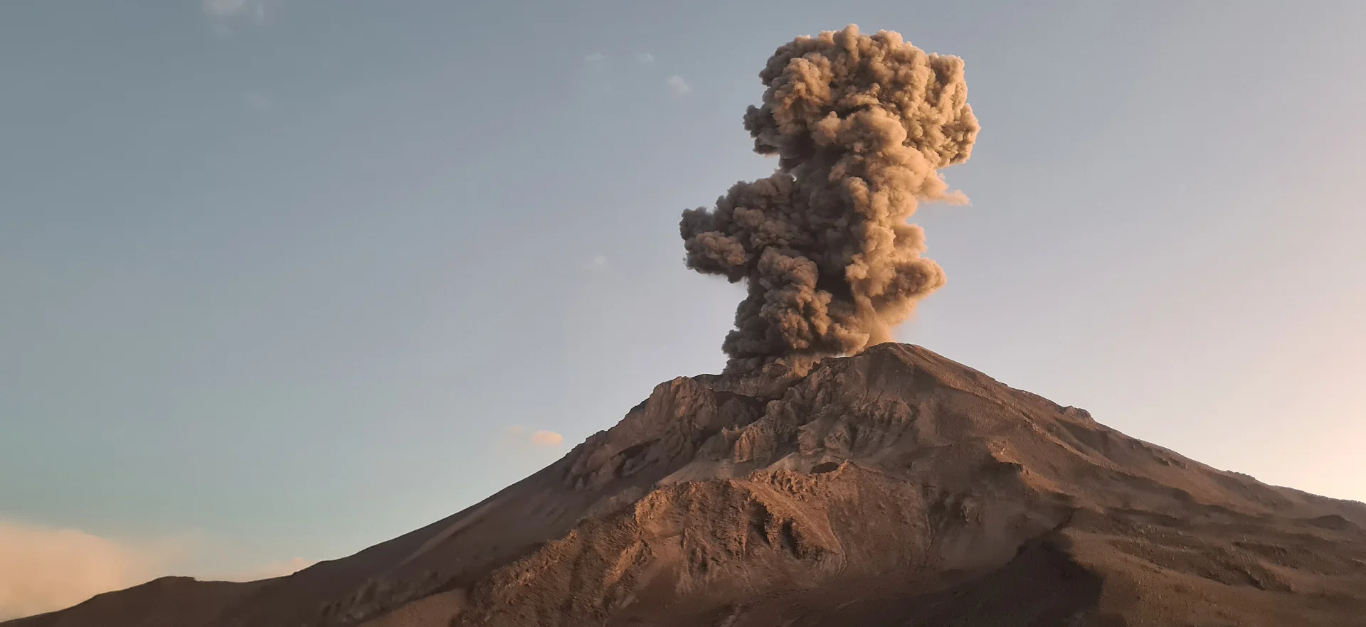
Plumes of water vapor, gas, and ash reaching up to 2,500 m above the volcano’s summit were observed. These emissions dispersed primarily toward the eastern and southeastern sectors of the volcano. The affected area extended within a radius of less than 10 km.
No significant deformation of the volcanic edifice was recorded.
Moderate sulfur dioxide (SO2) emissions (870 tonnes/day) were observed. Fourteen thermal anomalies (maximum value of 2 MW) were detected, associated with the proximity of a magmatic mass near the surface.
Outlook
Volcanic explosions generating eruption columns exceeding 2 km in height are considered likely. Such events could affect communities in the Colca Valley and surrounding areas through volcanic ash dispersion; consequently, the volcanic alert level remains at orange. Between August 3 and 4, ash emissions are expected to disperse toward the southeast sector of the volcano. From August 5 to 9, dispersion is expected toward the northeast and east sectors of Sabancaya, with winds reaching 50 km/h.
Recommendations
Adopt prevention and preparedness measures consistent with the current orange volcanic alert level.
Do not approach within 12 km of the crater. In the event of ashfall, cover the nose and mouth with damp cloths or masks. Keep doors and windows of homes closed.
Source : Cenvul.
Photo : IGP.