February 3 , 2026.
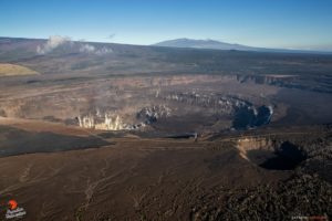
United States , Yellowstone :
YELLOWSTONE VOLCANO OBSERVATORY MONTHLY UPDATE , U.S. Geological Survey
Monday, February 2, 2026, 11:40 AM MST (Monday, February 2, 2026, 18:40 UTC)
44°25’48 » N 110°40’12 » W,
Summit Elevation 9203 ft (2805 m)
Current Volcano Alert Level: NORMAL
Current Aviation Color Code: GREEN
Summary
Yellowstone Caldera activity remains at background levels, with 100 located earthquakes in January (largest = M2.6). Deformation measurements indicate continued subtle uplift along the north caldera rim, as well as the onset of caldera subsidence in late December.
Recent Work and News
At least two small eruptions occurred at Black Diamond Pool in Biscuit Basin, site of a hydrothermal explosion in 2024. The eruptions occurred on January 19 and 24 and were detected by infrasound and seismic monitoring, but camera views were obscured (by darkness and ice) at the times of the events.
Seismicity
During January 2026, the University of Utah Seismograph Stations, responsible for the operation and analysis of the Yellowstone Seismic Network, located 100 earthquakes in the Yellowstone National Park region. The largest event of the month was a microearthquake of magnitude 2.6 located about 5 miles west-northwest of West Yellowstone, Montana, on January 10 at 12:06 p.m. MST.
January seismicity in Yellowstone was marked by two swarms:
1. A swarm of 10 earthquakes took place approximately 16 miles west-northwest of Lake, in Yellowstone National Park, during January 4–9. The largest earthquake in the sequence was a magnitude 1.8 event on January 9 at 2:01 a.m. MST.
2. A swarm of 13 earthquakes occurred approximately 12 miles northeast of Old Faithful, in Yellowstone National Park, on January 26. The largest earthquake in the sequence was a magnitude 2.1 at 6:31 a.m. MST on that date.
Earthquake activity in Yellowstone is at background levels.
Ground Deformation
Continuous GPS stations indicate continued uplift centered on the north caldera rim to the south of Norris Geyser Basin, although the rate may have slowed over the past few months compared to the rate at the onset of the deformation in July 2025. In Yellowstone Caldera, continuous GPS data appear to indicate the end of seasonal uplift in late December. Since overall caldera subsidence began in 2015, seasonal uplift (caused by groundwater and runoff conditions) usually starts in May or June and lasts until September or October, but the transition back to subsidence took longer in 2025.
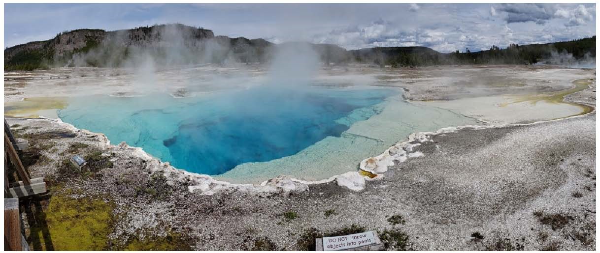
Source : YVO
Photo : Sapphire Pool , YVO.
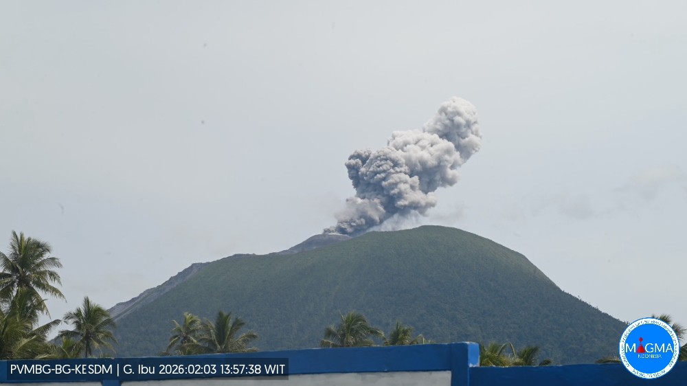
Indonesia , Ibu :
Mount Ibu experienced an eruption on Tuesday, February 3, 2026 at 1:56 p.m. (local time), with an ash column observed approximately 500 m above the summit (approximately 1,825 m altitude). This thick, gray ash column extended southward. The eruption was recorded by a seismograph with a maximum amplitude of 28 mm and a duration of 54 seconds.
Seismic Observations:
133 eruption earthquakes with amplitudes ranging from 11 to 28 mm and durations from 32 to 76 seconds.
2 emission earthquakes with amplitudes of 10 to 11 mm and durations of 42 to 43 seconds.
17 harmonic tremors with amplitudes ranging from 3 to 28 mm and durations from 56 to 233 seconds.
83 low-frequency earthquakes with amplitudes of 2 to 10 mm and durations of 17 to 29 seconds.
148 shallow volcanic earthquakes with amplitudes of 2 to 6 mm and durations of 7 to 21 seconds.
2 deep volcanic earthquakes with amplitudes of 5 to 12 mm and durations of 21 to 39.4 seconds.
A local tectonic earthquake with an amplitude of 13 mm, a magnitude of 6.95, and a duration of 30.3 seconds.
104 distant tectonic earthquakes with amplitudes between 4 and 28 mm, none with a magnitude of 6.95, and durations between 39 and 80 seconds.
s.
VOLCANO OBSERVATORY NOTICE FOR AVIATION – VONA
Issued : February 3 , 2026
Volcano : Ibu (268030)
Current Aviation Colour Code : ORANGE
Previous Aviation Colour Code : orange
Source : Ibu Volcano Observatory
Notice Number : 2026IBU048
Volcano Location : N 01 deg 29 min 17 sec E 127 deg 37 min 48 sec
Area : North Maluku, Indonesia
Summit Elevation : 4240 FT (1325 M)
Volcanic Activity Summary :
Eruption with volcanic ash cloud at 04h56 UTC (13h56 local).
Volcanic Cloud Height :
Best estimate of ash-cloud top is around 5840 FT (1825 M) above sea level or 1600 FT (500 M) above summit. May be higher than what can be observed clearly. Source of height data: ground observer.
Other Volcanic Cloud Information :
Ash cloud moving to south. Volcanic ash is observed to be gray. The intensity of volcanic ash is observed to be thick.
Remarks :
Eruption recorded on seismogram with maximum amplitude 28 mm and maximum duration 54 second.
Source et photo : PVMBG.
Peru , Sabancaya :
Local date and time: February 2, 2026 – 12:16 PM
Bulletin analysis period: January 26 to February 1, 2026
Volcanic alert level
Orange alert level: The volcano’s eruptive activity has increased significantly. Increased seismic activity, frequent explosions, and emissions of ash and ballistic fragments have been observed.
Conclusions
During this period, four moderate volcanic explosions were detected, generating columns of ash and gas up to 3,400 meters above the volcano’s summit, in addition to seismic activity associated with the movement of magmatic fluids and internal fracturing. Therefore, the volcanic alert level remains orange.

Recommendations
Adopt preventive measures in accordance with the current orange volcanic alert level.
Do not approach within 12 km of the crater. In case of ashfall, cover your nose and mouth with damp cloths or a mask. Keep doors and windows closed.
Stay informed about Sabancaya’s volcanic activity through reports and bulletins published by the IGP (Geneva Institute of Public Health).
Outlook
The occurrence of future volcanic explosions generating eruptive columns over 2 km high is considered likely, with a risk of impact on districts in the Colca Valley and surrounding areas due to the dispersal of volcanic ash. Therefore, the volcanic alert level remains orange.
Source : IGP.
Photo : Zintia Roxana Fernández Licla ( archive).
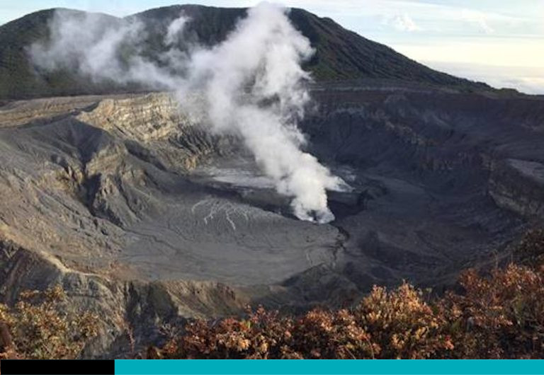
Costa Rica , Poas / Rincon de la Vieja :
Daily Volcanic Activity Bulletin. OVSICORI-UNA, Date: February 2, 2026
Updated at: 10:18 AM
Volcano: Poás
Latitude: 10.200
Longitude: -84.233
Altitude: 2,687 m
Observed Activity:
The seismic signal indicates slight tremor. The geodetic network records an uplift of the crater relative to the visitor center, as well as a slight extension in the southern sector of the volcano (VPCL and VPJA stations) relative to the same reference point. CO₂/SO₂ ratios remain within the values observed in recent days. The H₂S/SO₂ ratio shows an upward trend. SO₂ concentrations remain low.
Environmental Conditions:
Winds are blowing from the southwest. Heavy cloud cover persists over the volcano.
Activity level: Alert (2)
Volcano: Rincón de la Vieja
Latitude: 10.83
Longitude: -85.324
Altitude: 1,916 m
Observed Activity:
Seismic activity is low, with no significant tremor. Geodetic observations show no notable deformation, except for slight widening at the summit, consistent with a possible surface clogging process.
Environmental Conditions:
Winds are blowing from the southwest. Thick cloud cover persists over the volcano.
Activity Level: Alert (2)
Source et photo : Ovsicori.
Mexico , Popocatepetl :
February 2, 11:00 AM (February 2, 5:00 PM GMT)
Activity over the past 24 hours
41 low-intensity exhalations were detected, accompanied by slight emissions of water vapor and volcanic gases.
At the time of writing, a continuous emission of water vapor and volcanic gases is being observed, drifting towards the southeast.
The alert level for Popocatépetl volcano is at yellow (phase 2).
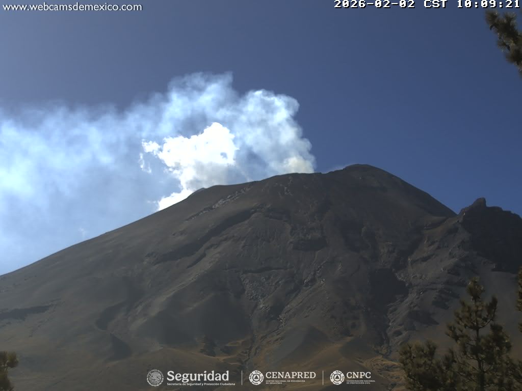
The scenarios considered for this phase are as follows:
A few low- to medium-intensity explosions
Earthquakes of varying magnitude
Light to moderate ash deposits over surrounding towns and some more distant towns
Ejection of incandescent fragments within the 12-kilometer exclusion zone
Possibility of lahars (mudflows) in ravines due to ash accumulation on the slopes and its interaction with the rainfall expected in the coming weeks
Possibility of pyroclastic flows not reaching inhabited areas
Source et photo : Cenapred.