November 26 , 2025.
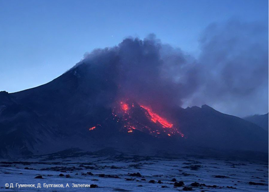
Kamchatka , Bezymianny :
VOLCANO OBSERVATORY NOTICE FOR AVIATION (VONA)
Issued: November 26 , 2025
Volcano: Bezymianny (CAVW #300250)
Current aviation colour code: RED
Previous aviation colour code: red
Source: KVERT
Notice Number: 2025-144
Volcano Location: N 55 deg 58 min E 160 deg 35 min
Area: Kamchatka, Russia
Summit Elevation: 2882 m (9452.96 ft)
Volcanic Activity Summary:
Explosive eruption of the volcano continues. Explosions sent ash up to 11.4 km a.s.l., and ash cloud 70×50 km is moving to the east-northeast of the volcano.
Explosive eruption continues. Explosions sent ash up to 11.4 km (37,400 ft) a.s.l. Ongoing activity could affect international and low-flying aircrafts.
Volcanic cloud height:
11400 m (37392 ft) AMSL Time and method of ash plume/cloud height determination: 20251126/0400Z – Himawari-9 14m15
Other volcanic cloud information:
Distance of ash plume/cloud of the volcano: 70 km (43 mi)
Direction of drift of ash plume/cloud of the volcano: ENE / azimuth 57 deg
Time and method of ash plume/cloud determination: 20251126/0400Z – Himawari-9 14m15
Source : Kvert.
Photo : D. Gumenyuk, D. Bulgakov, A. Zaletin . ( archive).
Hawaii , Kilauea :
HVO/USGS Volcanic Activity Notice
Current Volcano Alert Level: WATCH
Current Aviation Color Code: ORANGE
Issued: Tuesday, November 25, 2025, 2:59 PM HST
Source: Hawaiian Volcano Observatory
Notice Number: 2025/H508
Location: N 19 deg 25 min W 155 deg 17 min
Elevation: 4091 ft (1247 m)
Area: Hawaii
Volcanic Activity Summary:
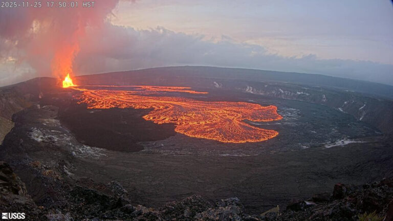
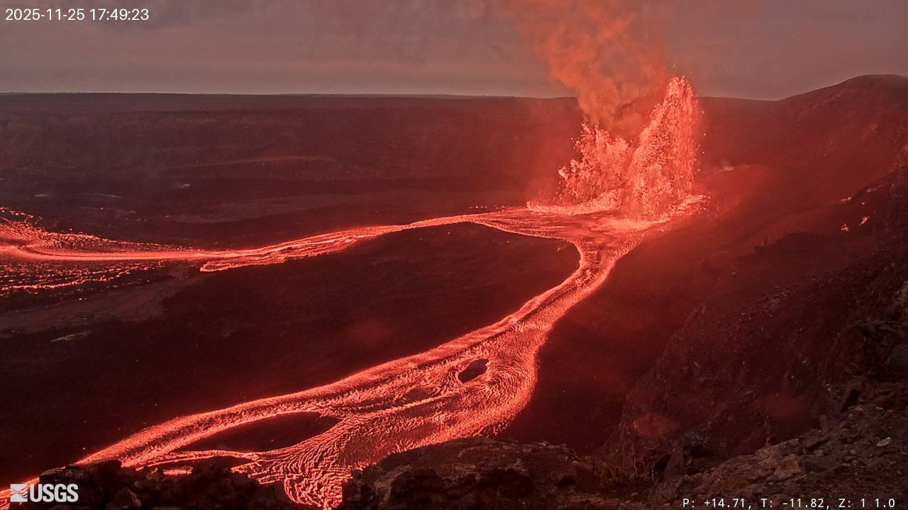
Episode 37 of the ongoing Halemaʻumaʻu eruption began at 2:30 p.m. HST on November 25. Sustained lava fountains approximately 400 feet (120 meters) in height are currently erupting from the north vent. Fountain heights are increasing rapidly.
Past episodes have produced incandescent lava fountains over 1000 feet (300 meters) high that produce eruptive plumes up to 20,000 feet (6000 meters) above ground level. According to the National Weather Service, winds are light and blowing from the northeast direction, which suggests that volcanic gas emissions and volcanic material may be distributed towards the southwest, but could spread more widely.
All eruptive activity is confined to Halemaʻumaʻu crater within Hawaiʻi Volcanoes National Park; commercial airports in Hawaii County (KOA and ITO) will not be affected by this activity.
Episode 37 was preceded by small, sporadic spatter fountains and overflows that began at approximately 9:27 a.m. HST on November 21 and alternated between the north and south vents. There were 76 overflows prior to the onset of continuous overflows on November 25 at 14:15 p.m. HST and continued until sustained fountaining began.
Seismic tremor increased significantly, and summit tilt switched from inflation to deflation at about the same time that sustained fountaining began. Inflationary tilt reached approximately 22 microradians since the end of the last episode.
Most episodes of Halemaʻumaʻu lava fountaining since December 23, 2024, have continued for around a day or less and have been separated by pauses in eruptive activity lasting generally at least several days.
No changes have been detected in the East Rift Zone or Southwest Rift Zone.
Kīlauea Volcano Alert Level/Aviation Color Code remain at WATCH/ORANGE. All current and recent activity is within Hawaiʻi Volcanoes National Park.
Source : HVO.
Photos : HVO.
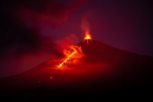
Italy , Stromboli :
WEEKLY BULLETIN, November 17, 2025 to November 23, 2025. (Publication date: November 25, 2025)
ACTIVITY SUMMARY
Based on monitoring data, the following points should be noted:
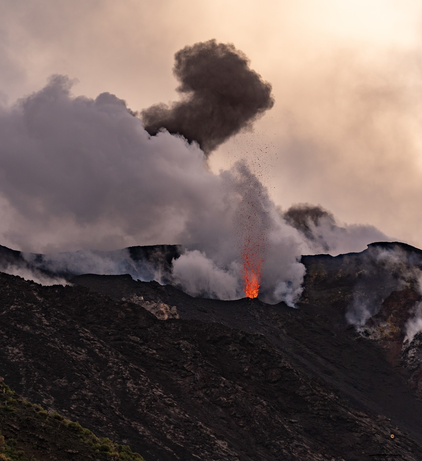
1) VOLCANOLOGICAL OBSERVATIONS: During this period, ordinary Strombolian-type eruptive activity was observed, with moderate ejecta and lava flow in the North Crater area. The total hourly frequency fluctuated between average (10 events/hour) and very high (26 events/hour). The intensity of the explosions was mostly low to medium in the North and Central-South Crater areas.
2) SEISMOLOGY: The monitored seismic parameters showed no significant variation.
3) GROUND DEFORMATION: No significant variation was observed in the data acquired by the GNSS network.
At the Timpone del Fuoco tilt station, signal disturbances persist, particularly noticeable on the N185E component, which is not reported.
4) GEOCHEMISTRY: SO₂ flux at an average level.
CO₂ flux from the ground in the Pizzo area (STR02) at high values.
C/S ratio in the pen: The C/S ratio is at average values.
Isotopic ratio of dissolved helium (R/Ra) in the thermal aquifer: increasing to very high values.
CO₂ flux from the ground in the San Bartolo area: at very high values.
CO₂ flux from the ground in the Scari area: at high values.
5) SATELLITE OBSERVATIONS: The thermal activity observed by satellite in the summit area was generally low, with some moderate thermal anomalies.
VOLCANOLOGICAL OBSERVATIONS
During the observation period, Stromboli’s eruptive activity was characterized by the analysis of images recorded by the INGV-OE monitoring cameras located at 190 m (SCT-SCV) and at Punta dei Corvi (SPCT). Explosive activity was primarily produced by five eruptive vents located in the North Crater area and by at least two vents located in the Central-South area.
A low-intensity lava flow was observed on November 17 in the North area.
Observations of explosive activity captured by the monitoring cameras:
Five active winds were observed in the North Crater area (N), two in sector N1 and three in sector N2, producing low-intensity (less than 80 m high) and medium-intensity (less than 150 m high) explosive activity. The eruptive products were primarily composed of coarse material (bombs and lapilli). In addition, lava ejection activity was observed in sectors N1 and N2.
This activity was intense in sector N1 on November 17, 18, and 20, and in sector N2 on November 19 and 21.
The average frequency of explosions varied between 9 and 22 events per hour.
On the morning of November 17, following intense lava ejection activity at the wind in sector N1, in the northern area, a modest lava flow was observed. It stopped a few hours later, having traveled a few tens of meters from the point of emission.
In the south-central crater (SC) area, two main winds were observed.
One produced explosions of fine material mixed with coarse material, while the other produced explosions of coarse material of low to medium intensity.
The average frequency of explosions varied from 0 to 4 events per hour.
Source : INGV.
Photo : Stromboli stati d’animo / Sebastiano Cannavo
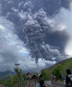
Colombia , Puracé – Los Coconucos volcanic chain:
Popayán, November 25, 2025, 8:00 PM
Regarding the monitoring of activity in the Los Coconucos volcanic chain, the Geological Survey of Colombia (SGC), an agency under the Ministry of Mines and Energy, reports the following:
Since the publication of the Weekly Bulletin and up to the date of this bulletin, the Puracé volcano has continued to register seismic signals related to fluid movements, including tremors (TR) and long-period (LP) shaking. Some of these shaking events have been associated with small ash emissions into the atmosphere, forming columns reaching 1.7 km in height above the volcano’s summit.
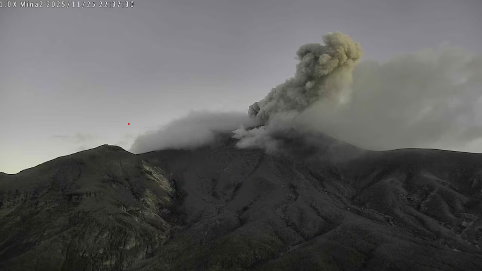
Ashfall has been confirmed in the village of Cristales (Puracé), located northwest of the volcano. The latest eruption occurred today at 5:35 PM, with ash dispersing westward from the volcanic edifice. It is important to note that sporadic ash emissions (minor eruptions) may continue. Therefore, communities within its area of influence are advised to stay away from the summit of the volcano.
Puracé volcano remains on yellow alert.
Given the above, the Colombian Geological Survey (SGC) recommends closely monitoring the situation by consulting special bulletins and other information published through its official channels, as well as instructions from local and departmental authorities and the National Unit for Disaster Risk Management (UNGRD). The volcanic activity level remains at yellow alert: active volcano with changes in the reference behavior of monitored parameters and other manifestations.
Source et photo : SGC
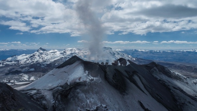
Peru , Sabancaya :
Local date and time: November 24, 2025 – 12:23 PM
Bulletin analysis period: November 17-23, 2025
2. Volcanic alert level
Orange alert level: The volcano’s eruptive activity has increased significantly. Increased seismic activity, frequent explosions, and emissions of ash and ballistic fragments have been observed.
3. Conclusions
The IGP reports that the Sabancaya volcano continues its eruptive process. During this period, no volcanic explosions were recorded; however, emissions of water vapor and gas were observed, reaching a maximum altitude of 1,200 m above the volcano’s summit, in addition to seismic activity associated with the movement of magmatic fluids and internal fracturing. Therefore, the volcanic alert level remains orange.
4. Recommendations
Adopt preventive measures in accordance with the current orange volcanic alert level.
Do not approach within 12 km of the crater. In case of ashfall, cover your nose and mouth with damp cloths or a mask. Keep the doors and windows of your home closed.
Source et photo : IGP.