November 8 , 2025.
Hawaii , Kilauea :
HAWAIIAN VOLCANO OBSERVATORY DAILY UPDATE ; U.S. Geological Survey
Friday, November 7, 2025, 8:41 AM HST (Friday, November 7, 2025, 18:41 UTC)
19°25’16 » N 155°17’13 » W,
Summit Elevation 4091 ft (1247 m)
Current Volcano Alert Level: WATCH
Current Aviation Color Code: ORANGE
During the lapse in appropriations, the USGS Hawaiian Volcano Observatory (HVO) continues to maintain monitoring networks and issue updates and notifications of volcanic activity via the Hazard Notification Service. Volcano monitoring data will continue to be available on the HVO website. Static website content will not be updated until further notice and information may become outdated over time.
Activity Summary:
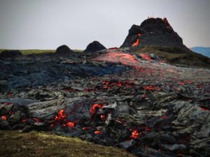
Overflows of degassed lava resumed from the north vent around 3:30 a.m. HST, about 24 hours after the last overflow was observed. Slow inflation of Kīlauea’s summit resumed yesterday, lengthening the forecast window. However, periods of strong glow overnight from the north and south vents and resumption of overflows from the north vent early this morning indicate the start of episode 36 may be close. Models suggest a likely forecast window of November 7–11 for episode 36.
Summit Observations:
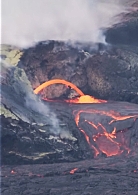
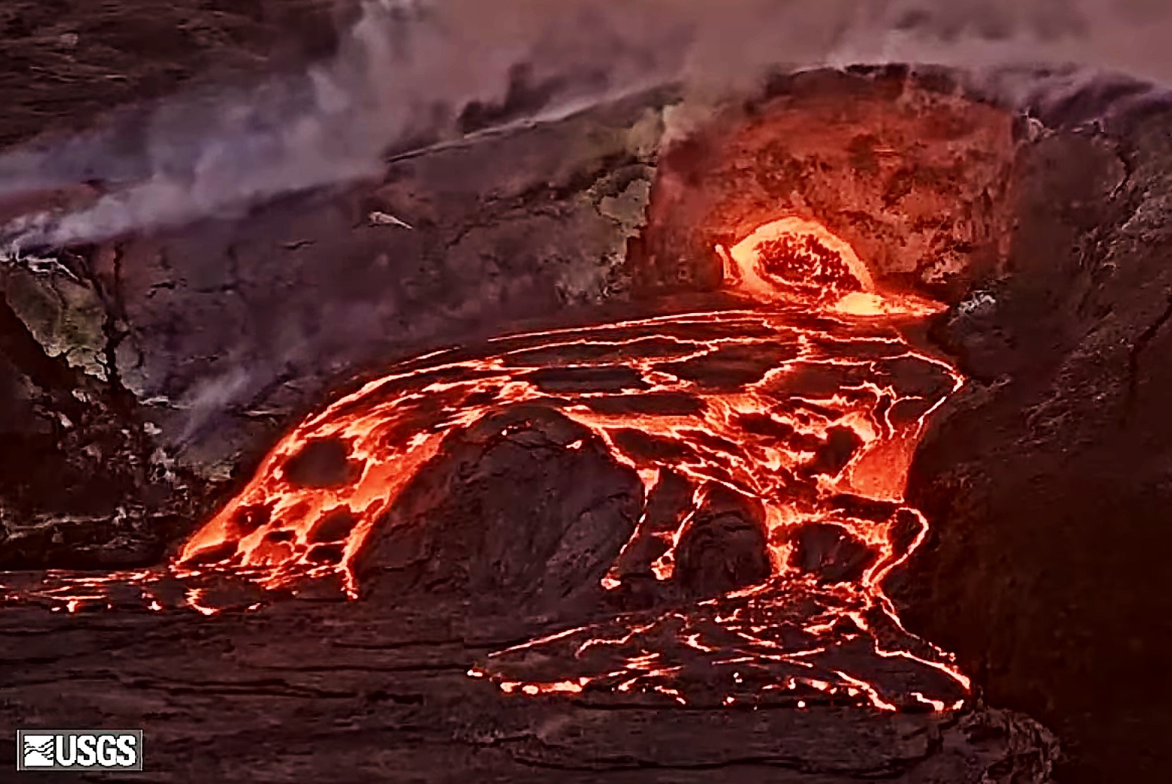
Since 3:30 a.m. HST this morning there has been a resumption in overflow activity at the north vent. Preceding this period, there was a 24 hour pause in overflows. Overflows at the north vent show limited spattering until drainback, indicating that mostly degassed magma is being erupted at this time.
Resumption of inflation at the summit began yesterday at 12 p.m. HST. The Uēkahuna tiltmeter (UWD) has recorded approximately 0.9 microradian of inflationary tilt over the past 24 hours yielding 26.1 microradians of inflationary tilt since the end of episode 35. During the pause in overflow activity, tremor was low. However, since overflow activity resumed at north vent, periods of low tremor correlating with pond filling and/or overflows is followed by 1-2 minute long tremor spikes related to drainback.
Plumes of gas continue from both vents this morning and sulfur dioxide (SO2) gas emissions remain at background levels, typically between 1,200 and 1,500 tonnes per day. Current wind conditions at the summit are light and variable from the northeast and could pose a problem for communities adjacent to Hawai’i Volcanoes National Park if high fountains began under these conditions. Yesterday wind conditions were favorable and the SO2 array southwest of the vent detected « puffs » of gas related to drainback events as is expected during gas pistoning events.
Source : HVO
Photos : Justin Hirako , USGS.
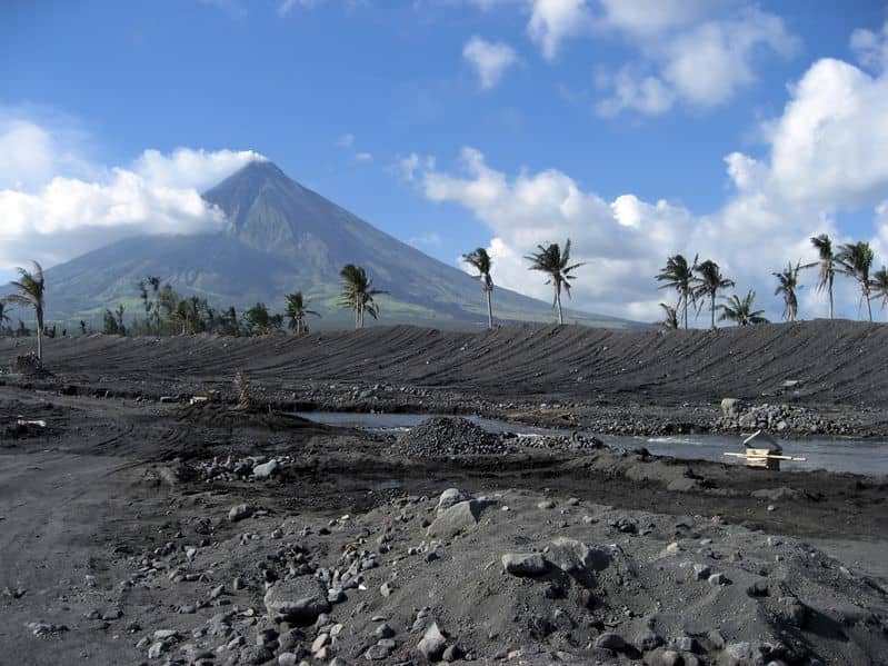
Philippines , Mayon :
LAHAR ADVISORY FOR MAYON VOLCANO UNDER TYPHOON UWAN , 8 November 2025 , 2:00 PM
Based on the Weather Advisory #6 and Preparatory Flood Information Forecast for the Bicol River Basin issued at 11:00 AM today by the Philippine Atmospheric Geophysical and Astronomical Services Administration (PAGASA), the passage of Typhoon Uwan is expected to bring intense to torrential (up to 400mm) rains over the Bicol Region between today until tomorrow, 9 November 2025. These rains could generate volcanic sediment flows or lahars, muddy streamflows or muddy run-off in rivers and drainage areas on Mayon Volcano. DOST-PHIVOLCS thus strongly recommends increased vigilance, readiness and if necessary, pre-emptive evacuation of communities in pre-determined zones of lahar and related hazards in the Province of Albay.
Intense to torrential rainfall can generate life-threatening post-eruption lahars on major channels draining Mayon Volcano by eroding loose material from remnant pyroclastic deposits of the 2018 and 2023 Mayon eruptions. The bulk of erodible deposits occupy the watershed areas of the Miisi, Binaan Mabinit, Buyuan, Anoling, Matan-ag and Basud Channels, such that communities along and downstream of these channels could be severely threatened by post-eruption lahars. In addition, older and erodible pyroclastic deposits on the southwestern slopes, which have been continuously brought down by intense rains through the Masarawag and Maninila Channels and even creeks within their immediate vicinities, could once again feed non-eruption lahars that could severely threaten communities in the Municipality of Guinobatan. Similarly erodible old pyroclastic deposits on other sectors of the volcano can be eroded by intense rains and generate non-eruption lahars and sediment-laden streamflows that could threaten communities along the Quirangay, Tumpa, Sua, Muladbucad, Nasisi, Nabonton, Buang, San Vicente, Bulawan and Lidong Channels. Mayon lahars, which are characteristically strong enough to transport enormous volumes of gravel and boulders, have historically and continues to threaten communities by their force of impact, inundation, burial and wash out to sea.
DOST-PHIVOLCS strongly advises the communities and local government units of the above identified areas of risk to continually monitor the rainfall conditions and take pre-emptive response measures for their safety.
Source : Phivolcs
Photo : Auteur inconnu.
Chile , Planchón-Peteroa Volcanic Complex :
Special Volcanic Activity Report (REAV), Maule Region, Planchón-Peteroa Volcanic Complex
November 7, 2025, 05:40 local time (Mainland Chile)
The Chilean National Geological and Mining Service (Sernageomin) publishes the following PRELIMINARY information, obtained through monitoring equipment from the National Volcanic Monitoring Network (RNVV), processed and analyzed at the Southern Andes Volcanological Observatory (OVDAS):
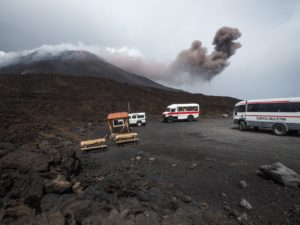
Images from monitoring cameras installed near the Planchón-Peteroa Volcanic Complex revealed the emission of a column of gas and pyroclastic material starting at 07:06 UTC (04:06 local time). This column reached an approximate height of 1,040 meters above the crater, dispersing in a southeasterly direction.
Furthermore, from 07:50 UTC (04:50 HL), an incandescence was observed, associated with the active emission center.
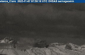
Image from the Claro monitoring camera, dated October 7, 2025, at 04:50 HL (07:50 UTC).
Based on the latest volcanic activity reports published by SERNAGEOMIN for this system, and considering the above, the occurrence of further episodes of similar or greater energy, with low to medium magnitude explosions, which could affect the immediate vicinity of the active craters, cannot be ruled out.
OBSERVATIONS:
At the time of writing this report, seismic activity shows no significant changes.
The volcanic alert level remains at: YELLOW Technical Alert.
Source et photo : Sernageomin
Canary Islands , Pico del Teide :
Mount Teide recorded a long-period earthquake this Friday morning in the southwest sector of the caldera, within Las Cañadas National Park. The signal was located at a depth of approximately eleven kilometers, and although these recordings do not allow for the calculation of the magnitude using conventional methods, experts from the Canary Islands Volcanological Institute (INVOLCAN) estimate it at around 2.2.
What makes this event significant and unique is its extent. It is, in fact, the largest long-period (LP) earthquake recorded on Tenerife to date. It surpasses other similar cases as well as the six groups of hybrid signals previously documented nearby.
What is a long-period earthquake? LP earthquakes do not result from the abrupt fracturing of rocks, characteristic of tectonic or volcano-tectonic (VT) earthquakes. On the contrary, they are distinguished by low frequency vibrations and by the absence or attenuation of the P and S phases. « These phenomena are linked to the circulation of hydrothermal fluids within the island and are part of the pressurization process of the magmatic-hydrothermal system observed in Tenerife since 2016, » says INVOLCAN.

The recurrence of similar events and hybrid swarms in the region justifies increased monitoring, even if none of them individually triggers an eruption alert. Their combined study allows for an assessment of the volcanic system’s evolution.
Teide, an active volcano in a dormant phase
Mount Teide, reaching a height of 3,718 meters, is the highest volcano in Spain and one of the most studied volcanic systems in the world. Despite its apparent quiescence, Tenerife exhibits constant geothermal activity, with diffuse gas emissions, ground temperature variations, and an active hydrothermal network.
Since 2016, Involcan has identified a slow pressurization process of the magmatic-hydrothermal system beneath the island, characterized by the occurrence of small LP-type earthquakes, variations in the composition of emitted gases, and slight ground deformations. These phenomena are interpreted as normal manifestations of an active volcano in equilibrium, and not as warning signs of an eruption.
Source : Lazaron , Diariodeaviso.
Photo : Involcan
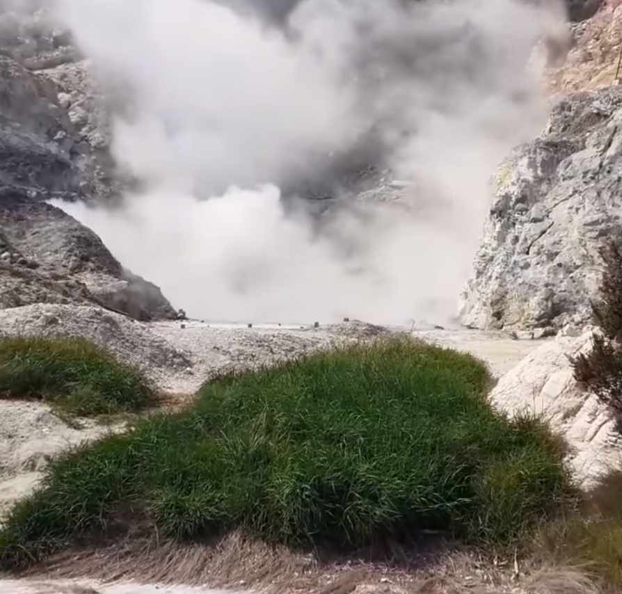
Italy , Campi Flegrei :
Weekly Bulletin, October 27, 2025 – November 2, 2025 (Publication date: November 4, 2025)
ACTIVITY SUMMARY
Based on monitoring data, the following points should be noted:
1) SEISMOLOGY: From October 27 to November 2, 2025, 149 earthquakes of magnitude Md ≥ 0.0 (Mdmax = 2.1 ± 0.3) were recorded in the Phlegraean Fields region.
2) DEFORMATION: Data from the last 20 days show an increase in ground uplift, with a preliminary average monthly uplift rate of approximately 20 ± 5 mm/month. This value should be considered provisional, pending further data that will be available in the coming weeks.
3) GEOCHEMISTRY: During the reference week, the monitored geochemical parameters confirmed the long-term trend of warming of the hydrothermal system and increased flow rates already known.
SEISMOLOGY
From October 27 to November 2, 2025, 149 earthquakes of magnitude Md ≥ 0.0 (Mdmax = 2.1 ± 0.3) were recorded in the Phlegraean Fields region.
30 earthquakes were recorded during two seismic swarms:
1. Starting at 02:20 UTC on November 2, 2025, 14 earthquakes of magnitude 0.0 ≤ Md ≤ 2.1 (± 0.3) occurred in the Pozzuoli-Gauro region;
2. Starting at 14:38 UTC on November 2, 2025, 16 earthquakes of magnitude 0.0 ≤ Md ≤ 2.1 (± 0.3) occurred in the Pozzuoli region.
GEOCHEMISTRY
During the reference week, continuous data collected by the geochemical network showed no significant variations in acquired parameters, confirming the trends of warming and pressurization of the hydrothermal system, as well as an increase in the flow rate of emitted fluids (see monthly reports).
In the Pisciarelli area (northeast slope of the Solfatara), which has experienced the most significant variations in the degassing process in recent years, soil CO₂ flux values, continuously recorded by station FLXOV8, showed no significant variations last week compared to previous periods.
Source : INGV Vulcani .
Photo : Quelli della zona rossa del vulcano Campi Flegrei.