October 23 , 2025.
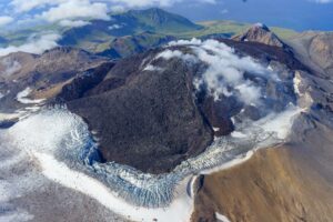
Kamchatka , Krasheninnikov :
VOLCANO OBSERVATORY NOTICE FOR AVIATION (VONA)
Issued: October 22 , 2025
Volcano: Krasheninnikov (CAVW #300190)
Current aviation colour code: ORANGE
Previous aviation colour code: orange
Source: KVERT
Notice Number: 2025-119
Volcano Location: N 54 deg 35 min E 160 deg 16 min
Area: Kamchatka, Russia
Summit Elevation: 1856 m (6087.68 ft)
Volcanic Activity Summary:
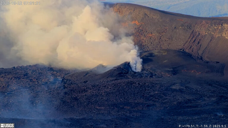
Moderate emissions of ash from the volcano continues. The explosions sent ash up to 3.3 km a.s.l., and ash plume is extending for 210 km to the southeast of the volcano.
The explosive-effusive eruption of the volcano continues. The danger of ash explosions up to 6 km (19,700 ft) a.s.l. remains. Ongoing activity could affect low-flying aircraft.
Volcanic cloud height:
3200-3300 m (10496-10824 ft) AMSL Time and method of ash plume/cloud height determination: 20251022/1230Z – Himawari-9 14m15
Other volcanic cloud information:
Distance of ash plume/cloud of the volcano: 210 km (130 mi)
Direction of drift of ash plume/cloud of the volcano: SE / azimuth 139 deg
Time and method of ash plume/cloud determination: 20251022/2050Z – Himawari-9 14m15
Start time of explosion and how determined: 20251022/1230Z – Satellite data
Remarks:
The first historical eruption of the volcano began on 02 August, 2025. The explosive-effusive eruption of the volcano continues. The previous effusive eruption of the volcano occurred 400-600 years ago.
Source : Kvert
Photo : Yuri Doubik (Institute of Volcanology, Petropavlovsk), via GVP.
Indonesia , Lokon-Empung :
The activity level of Lokon-Empung was reduced to Level II (Alert) on October 21, 2025, at 12:00 WITA (Central Indonesia Time).
Mount Lokon is located in the administrative city of Tomohon, North Sulawesi Province, at 1°21’30″N latitude and 124°47’30″E longitude, with a peak at approximately 1,579 m above sea level (volcanic reference data).
From October 1 to 20, 2025, volcanic activity generally emitted a thin to moderate white plume about 30 meters high. Seismic activity gradually decreased until October 20, 2025, with one shallow volcanic earthquake, one deep volcanic earthquake, and two emission earthquakes recorded per day.
The latest developments at Mount Lokon on October 20, 2025, from 00:00 to midnight WITA (Central Indonesia Time), were as follows:
Visual conditions remained unchanged, with white smoke of fine to moderate intensity rising from the crater, approximately 25 meters above.
Seismic activity, including one shallow volcanic earthquake, two emission earthquakes, one deep volcanic earthquake, and eight distant tectonic earthquakes, was recorded. RSAM data show a decrease in energy.

Instrumental data indicate a decrease in pressure in the superficial zone (surface) after the recording of shallow volcanic earthquakes, associated with the release of eruption gases.
The current potential threat from Mount Lokon’s activity is a sudden phreatic eruption (an eruption caused by the contact of magma vapors with hydrothermal fluid), with or without signs of a significant increase. During the rainy season or in the event of heavy precipitation at the summit of Mount Lokon, caution should be exercised regarding lahars in the rivers that originate from it.
Based on observations, analyses, and evaluation of visual and instrumental data, the activity level of Mount Lokon has been lowered from Level III (Siaga) to Level II (Waspada) on October 21, 2025, at 12:00 PM (local time).
Source : PVMBG
Photo : Auteur inconnu.
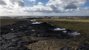
Colombia , Puracé – Los Coconucos volcanic chain:
Popayán, October 21, 2025, 5:00 p.m.
Regarding the monitoring of activity in the Puracé Volcano Chain and the Los Coconucos Volcanic Chain, the Colombian Geological Survey (SGC), an entity affiliated with the Ministry of Mines and Energy, reports that:
During the week of October 14 to 20, 2025, a signal classified as continuous volcanic tremor continued to be persistently recorded. This signal was associated with increased degassing in the Puracé Volcano crater in recent weeks.
The earthquakes related to fluid movements were characterized by low energy input and were mainly located beneath the western flank of the Puracé Volcano crater, at a depth of less than 1 km. Compared to observations from previous weeks, the number of fracture earthquakes remained stable and were located mainly between the Puracé, Piocollo and Curiquinga volcanoes, at depths between 1 and 4 km, with magnitudes less than 1. Satellite measurements and field instruments showed that sulfur dioxide (SO2) emissions remained similar to those of previous weeks.
Furthermore, the slow deformation process detected after the eruption of Curiquinga Volcano on January 20, 2025, persists. Images captured by satellite sensors and visible and infrared webcams have observed degassing processes, with a maximum column height of 1 km, measured from the summit of Puracé Volcano, and thermal anomalies inside the crater and in the fumarole field on the outer rim.
In conclusion, the variations observed in the volcanic chain of Puracé Volcano and Los Coconucos indicate that the system remains active and that monitoring parameters remain above their reference levels. The community is therefore advised to avoid any ascent to the upper part of the volcanic chain. Under yellow alert status, phenomena such as sporadic ash emissions (minor eruptions of limited magnitude and impact, whose dispersion depends on wind direction), the presence of incandescence, small explosions in the crater, low-energy thermal anomalies, noise, felt earthquakes, odors, precipitation of elemental sulfur near the crater, in hot springs and fumaroles, as well as degassing outside the crater, may also occur. Fissure formation and the presence of minor lahars, among other things, are also observed.
The alert status for volcanic activity remains yellow: active volcano with changes in the baseline behavior of monitored parameters and other manifestations.
Source : SGC
Photo : Cric-colombia .org
Hawaii , Kilauea :
HAWAIIAN VOLCANO OBSERVATORY DAILY UPDATE , U.S. Geological Survey
Wednesday, October 22, 2025, 8:28 AM HST (Wednesday, October 22, 2025, 18:28 UTC)
19°25’16 » N 155°17’13 » W,
Summit Elevation 4091 ft (1247 m)
Current Volcano Alert Level: WATCH
Current Aviation Color Code: ORANGE
During the lapse in appropriations, the USGS Hawaiian Volcano Observatory (HVO) continues to maintain monitoring networks and issue updates and notifications of volcanic activity via the Hazard Notification Service. Volcano monitoring data will continue to be available on the HVO website. Static website content will not be updated until further notice and information may become outdated over time.
Activity Summary:
Episode 35 of the ongoing Halemaʻumaʻu eruption ended on October 18 after 7.5 hours of continuous lava fountaining. Vent areas continue to exhibit incandescence, along with a few spots on crater floor lava flows as they cool and solidify. Kīlauea summit inflation continues along with seismic tremor and vent glow indicating that another lava fountaining episode is probable. Preliminary models suggest a likely forecast window of November 2–10 for episode 36.
Summit Observations:
The north vent had persistent weak to moderate glow yesterday evening with a few intermittent periods of weak glow from the south vent. This changed just before midnight with both vents having brighter periods that appear to have been at least partly correlated with spikes in seismic tremor. Only a few small spots of incandescence have been seen away from the vents. Most of the secondary lava flow movement after episode 35 appears to have slowed or stopped, but additional movement is possible in the next few days.
The summit continues to inflate. The Uēkahuna tiltmeter (UWD) has recorded 1.5 microradians of inflationary tilt over the past 24 hours and 10.3 microradians of inflationary tilt since the end of episode 35. Tremor changed from small irregular spikes just before midnight to more extended bursts with spikes at the onset and sometimes at the end of the bursts. These spikes were at least partly correlated with glow patterns from the vents.
Plumes of gas are rising from both vents this morning and sulfur dioxide (SO2) gas emissions remain at background levels, typically between 1,200 and 1,500 tonnes per day.
Source et photo : HVO.
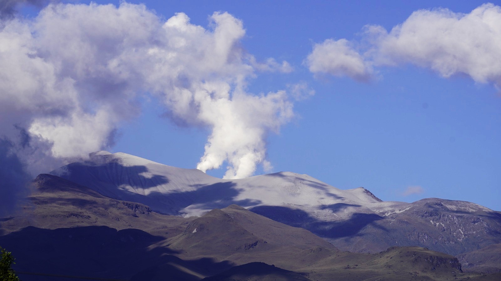
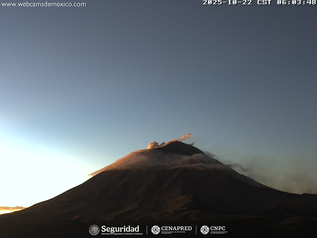
Mexico , Popocatepetl :
October 22, 11:00 a.m. (October 22, 5:00 p.m. GMT)
Activity in the past 24 hours
Eleven low-intensity exhalations were detected, accompanied by water vapor, volcanic gases, and occasionally small amounts of ash. In addition, 43 minutes of low-amplitude tremor were recorded, including two minutes of high-frequency tremor and 41 minutes of harmonic tremor.
At the time of writing, a slight, continuous emission of water vapor and volcanic gases is observed in a west-northwest (WNW) direction.
The Popocatépetl volcano fire alert is at yellow phase 2.
The expected scenarios for this phase are as follows:
A few minor to moderate explosions
Occurrence of tremors of varying amplitude
Light to moderate ashfall in surrounding towns and some more distant towns
Expulsion of incandescent fragments within a 12-kilometer exclusion radius
Lahars descending into ravines are expected due to ash accumulation on the slopes and its interaction with the precipitation expected in the coming weeks
Possibility of pyroclastic flows not reaching towns
Source et photo : Cenapred.