October 6 , 2025.
Indonesia , Ili Lewotolok :
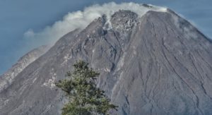
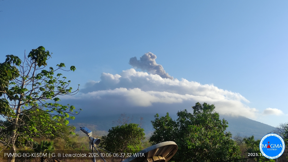
An eruption of Mount Ili Lewotolok occurred on Monday, October 6, 2025, at 6:35 a.m. (local time). An ash column was observed about 700 m above the summit (approximately 2,123 m above sea level). The ash column was white to gray in color, with a greater intensity, oriented toward the West. This eruption was recorded by seismograph with a maximum amplitude of 12.4 mm and a duration of 71 seconds.
Seismic Observations
49 eruption earthquakes with amplitudes ranging from 6.5 to 22.8 mm and lasting from 32 to 91 seconds.
91 emission earthquakes with amplitudes ranging from 1.8 to 6.7 mm and lasting from 27 to 58 seconds.
One local tectonic earthquake with amplitude of 3.5 mm and lasting 25 seconds.
Recommendations
At activity level III (SIAGA):
[1] Residents living near Mount Ili Lewotolok, as well as visitors, mountaineers, and tourists, are advised to refrain from entering within a 3 km radius of the activity center of Mount Ili Lewotolok and from engaging in any activity there. Be aware of the potential dangers of lava avalanches and pyroclastic flows emanating from the south, southeast, west, and northeast sectors of Mount Ili Lewotolok.
(2) The public is advised not to panic if they hear a rumbling noise coming from the crater of Mount Ili Lewotolok, as this noise is characteristic of volcanic activity during an eruption. This powerful rumbling noise can cause severe vibrations in several parts of the building, particularly windows and glass doors.
Source et photo : Magma Indonésie .
Colombia , Cumbal :
San Juan de Pasto, September 30, 2025, 4:10 p.m.
Following monitoring of the activity of the Cumbal Volcanic Complex (CVC), the Colombian Geological Survey (SGC), an entity affiliated with the Ministry of Mines and Energy, reports that:
During the week of September 23-29, 2025, the main variations in the monitored parameters compared to the previous week were:
• A slight decrease in seismic activity was recorded, while the energy released increased compared to the previous week. The predominance of seismic activity associated with rock fracturing within the volcanic structure continued. • Five seismic events were located close to the volcanic complex, within a radius of up to 2.0 km, at depths less than 4.0 km from the summit (reference level above 4,700 m asl) and with a maximum magnitude of 0.7.
When weather conditions permitted, white gas emissions with variable dispersion depending on the wind were recorded, mainly from the El Verde fumarole field, located northeast of the CVC.
Other volcanic monitoring parameters remained stable.
Based on the above, the SGC recommends closely monitoring their development through weekly bulletins and other information published through our official channels, as well as instructions from local and departmental authorities and the National Disaster Risk Management Unit (UNGRD).
Volcanic activity remains on alert. Yellow: Active volcano with changes in the baseline behavior of monitored parameters and other manifestations.
Source et photo : SGC.
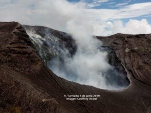
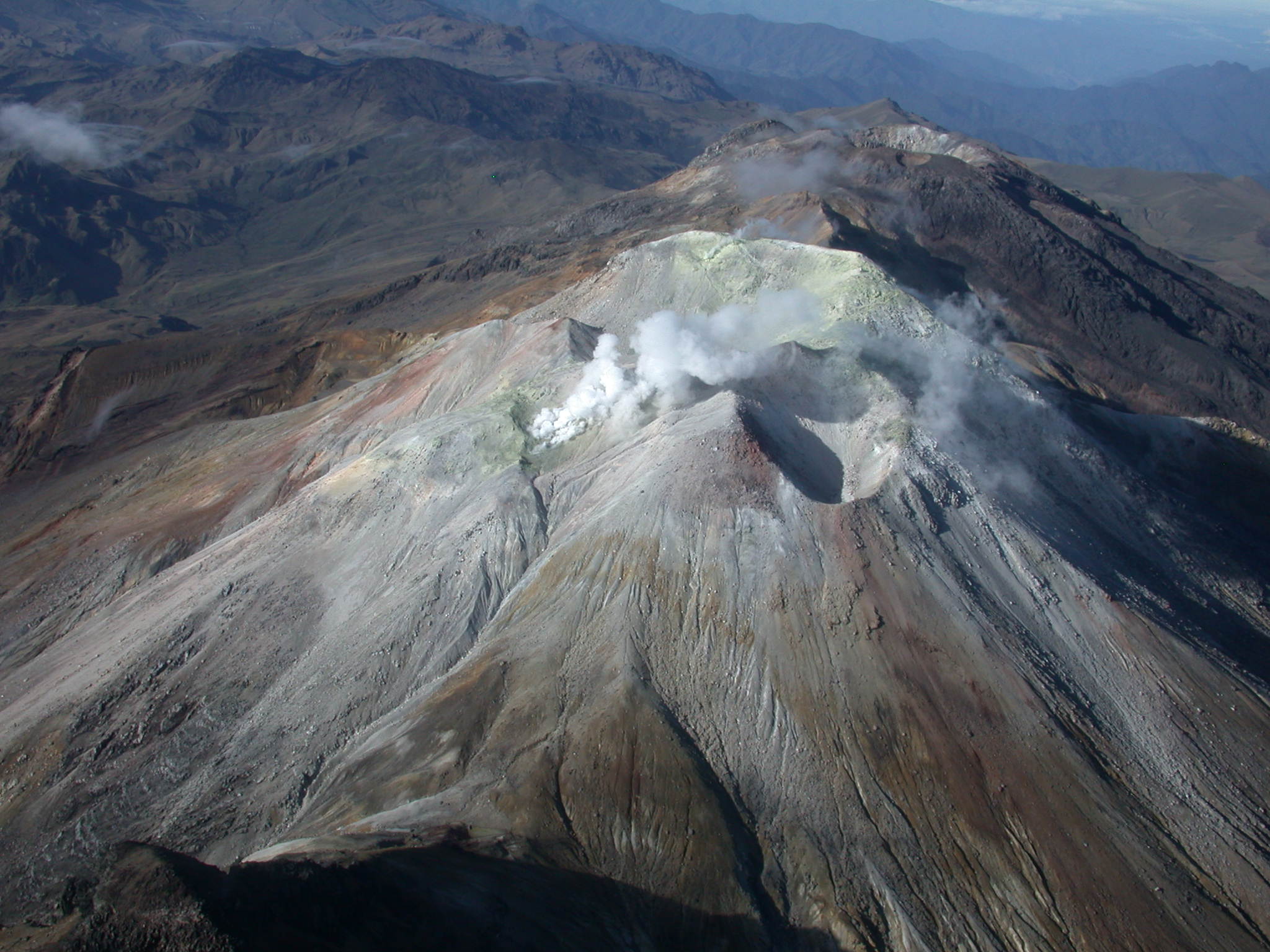
Costa Rica , Rincon de la Vieja :
Latitude: 10.83°N;
Longitude: 85.34°W;
Altitude: 1916 m
Current activity level: Alert.
A small eruption was recorded this week. The phreatic eruption occurred on September 28 at 6:20 a.m., generating a plume rich in water vapor and volcanic gases. Background tremor intensified this week. Brief pulses of low-frequency tremor are also recorded. Long-period « tornillo » events continue to occur, in addition to sporadic high-frequency distal volcano-tectonic earthquakes.
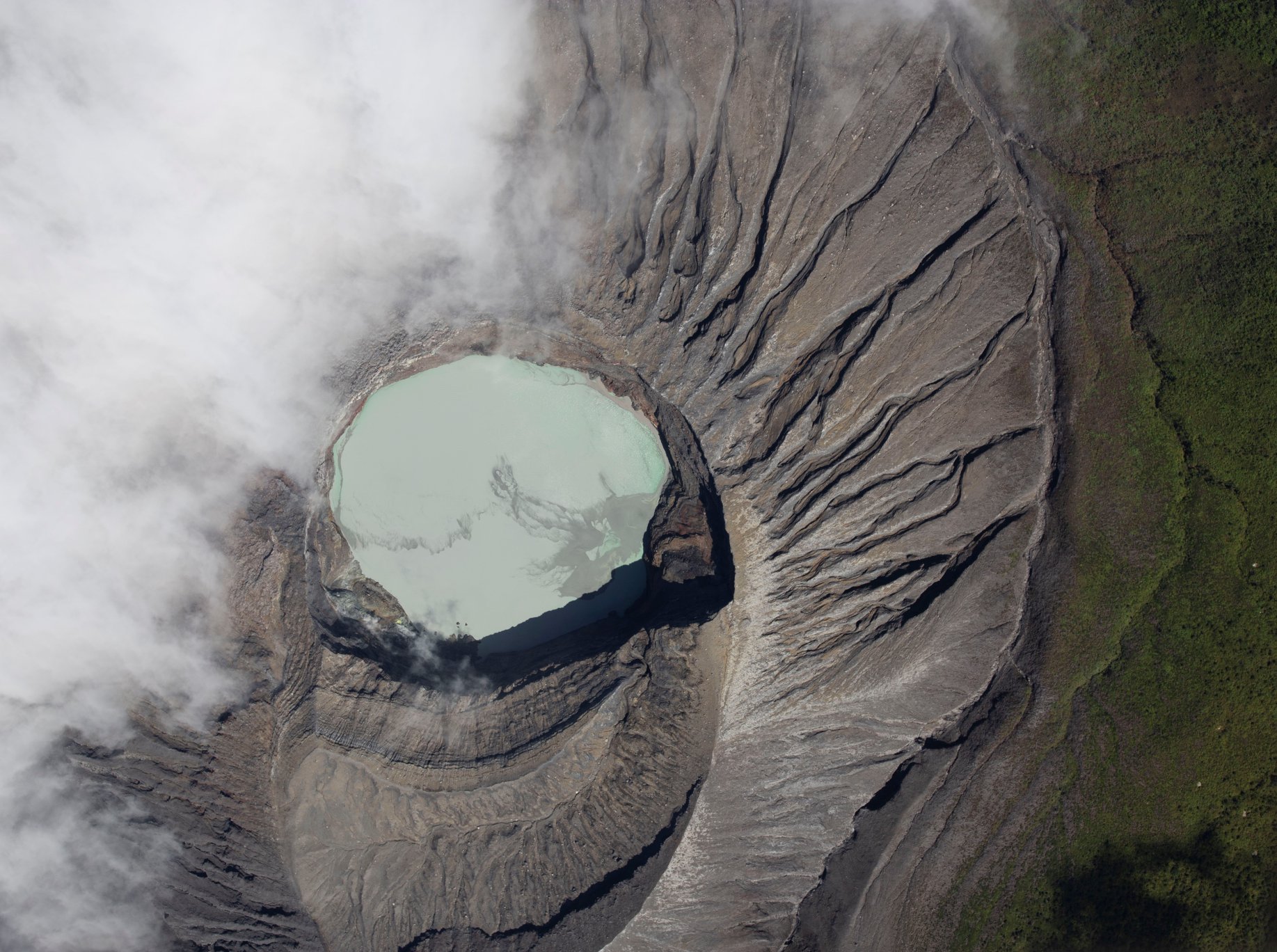
Geodetic observations show a contraction of the base and a displacement of the summit towards the crater. This week, DOAS stations recorded a SO2 flux of 65 ± 33 t/d, similar to the previous week (65 ± 41 t/d). The MultiGAS station measured low SO₂ concentrations (< 1 ppm) and H₂S/SO₂ ratios of about 0.7 this week. The last detection of atmospheric SO₂ by satellite was on September 7. Direct observations show low convective activity in the lake (green water color), a relatively high water level, and a significant amount of floating elemental sulfur.
Source : Ovsicori.
Photo : RSN
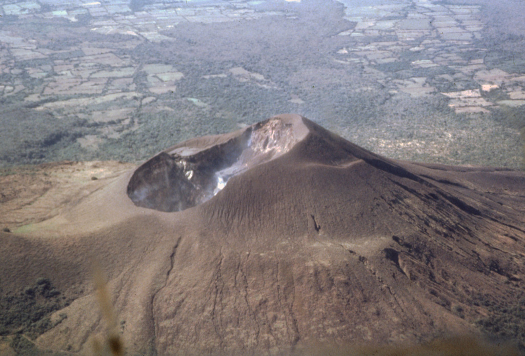
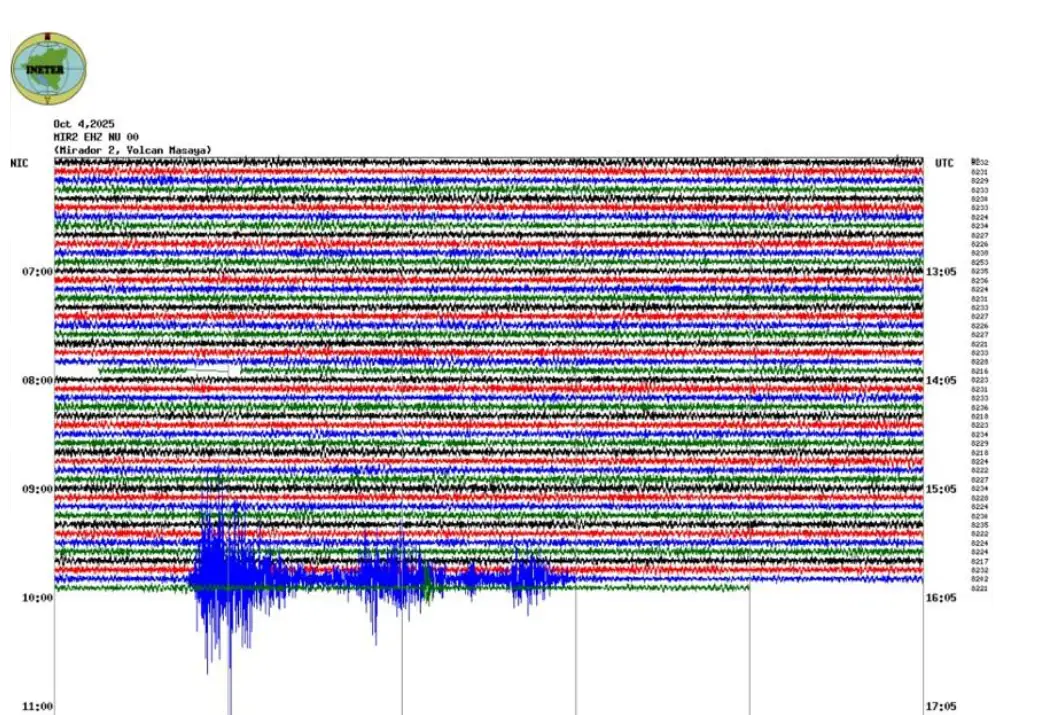
Nicaragua , Telica :
INETER reports a collapse in the crater of the Masaya Volcano.
The Nicaraguan Institute of Territorial Studies (INETER) reported that this Saturday, around 9:55 a.m., the Masaya Volcano collapsed on the southern inner wall of the Santiago crater, causing an impressive cloud of dust, ash, and sand to fall back into the crater. Experts explained that these events are due to the natural instability of the interior walls, which have suffered small landslides throughout the year.
A team of specialists visited the site to assess the conditions, which do not present any danger to the public.
Seismic values and gas production remain within normal limits.
Furthermore, the San Cristóbal, Telica, Cerro Negro, Momotombo, and Concepción volcanoes are also reported to be relatively calm.
INETER authorities will continue to continuously monitor volcanic activity in the country.
Source : nuevaya . com
Photos : Jaime Incer, 1991 , Ineter .
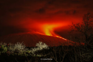
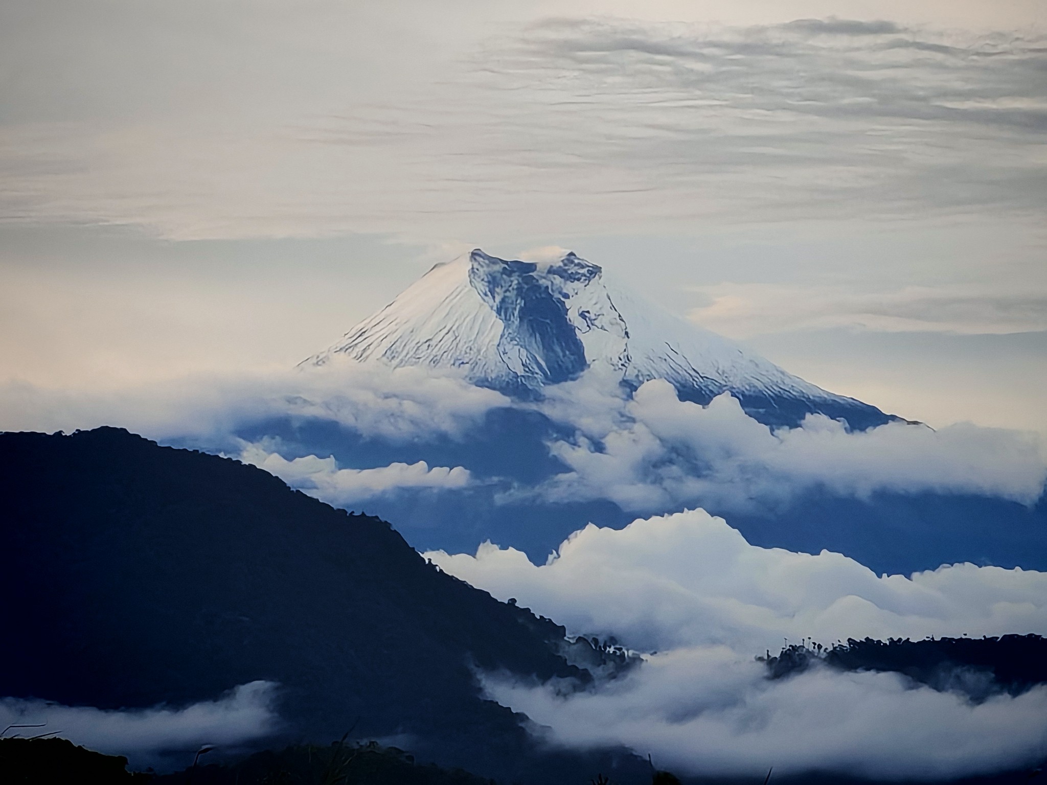
Ecuador , Sangay :
DAILY STATUS REPORT OF SANGAY VOLCANO, Sunday, October 5, 2025.
Information Geophysical Institute – EPN.
Surface Activity Level: Moderate, Surface Trend: No Change
Internal Activity Level: Moderate, Internal Trend: No Change
Seismicity: From October 4, 2025, 11:00 a.m. to October 5, 2025, 11:00 a.m.:
Seismicity:
Below is the count of seismic events recorded at the reference station.
Explosion (EXP): 53
Rainfall/Lahars:
No rainfall was recorded in the volcanic area. **Heavy rainfall could remobilize accumulated material, generating mud and debris flows that would cascade down the volcano’s flanks and flow into adjacent rivers**.
Emission/Ash Column:
Yesterday afternoon, several gas and ash emissions were observed by the surveillance camera network, reaching less than 400 meters above the crater, in a northwesterly direction. Regarding this activity, the Washington VAAC agency issued two reports of ash clouds reaching 900 meters above the crater, in a westerly direction.
Other monitoring parameters:
The MIROVA-MODIS satellite system recorded one thermal anomaly, the MIROVA-VIIRS system recorded three thermal anomalies, and the FIRMS satellite system recorded six thermal anomalies.
Observation:
Last night, incandescent material was recorded descending the flanks of the volcano up to 400 meters below the crater. At the time of writing, the volcano remains cloudy.
Alert Level: Yellow
Source : IGEPN
Photo : Fabricio Cadena Gómez/ Volcan Sangay / FB.