Hawaii , Kilauea :
HAWAIIAN VOLCANO OBSERVATORY DAILY UPDATE , U.S. Geological Survey
Monday, August 4, 2025, 9:56 AM HST (Monday, August 4, 2025, 19:56 UTC)
19°25’16 » N 155°17’13 » W,
Summit Elevation 4091 ft (1247 m)
Current Volcano Alert Level: WATCH
Current Aviation Color Code: ORANGE
Activity Summary:
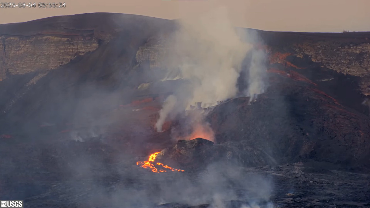
The onset of sporadic precursory activity associated with episode 30 of the Halemaʻumaʻu eruption began at 5:51 a.m. HST on August 4, 2025. A short gas-pistoning event occurred this morning and produced short overflows from the north vent from 5:51 to 5:59 a.m. HST. It was preceded by a weaker gas-piston event with visible lava in the vent from 5:14 to 5:18 a.m. HST, but no lava overflowed the vent. Low-level seismic tremor and degassing at the summit continues. Summit tiltmeter data continues to fluctuate and has recorded 1.5 microradians of inflation between yesterday morning and this morning, before switching back to slow deflationary tilt around 4:00 a.m. HST that flattened out at 6:00 a.m. HST. Currently, the summit is neither inflating or deflating. Models suggest that episode 30 sustained lava fountaining may start between now and Wednesday.
No significant activity has been noted along Kīlauea’s East Rift Zone or Southwest Rift Zone.
Summit Observations:
Lava overflowed from the north vent at 5:51 a.m. HST and drained back with little spattering in the vent by 5:59 a.m. HST in a typical gas-pistoning cycle that produced short overflows. This had been preceded by an earlier gas-pistoning event with lava appearing at 5:14 a.m. HST and draining back with no lava flows and little spattering at 5:18 a.m. HST. Glow was visible from the north vent overnight after re-appearing Thursday evening. Incandescence in other parts of the crater remains very low, with weak, intermittent glow from two areas higher up on the eruptive cone. There has been no movement or incandescent breakouts from lava flows on the floor of Halemaʻumaʻu. Slow slumping of the eruptive cone is possible as it cools.
Elevated degassing continues from the vent. Average sulfur dioxide (SO2) emission rates during inter-episode pauses are typically 1,200 to 1,500 t/d, though emission rates vary on short time scales in association with gas pistoning.
Background seismic tremor remains low during the eruption pause.
Summit tiltmeter records continue to fluctuate over the past several days. UWD recorded 1.5 microradians of deflation between Friday night and Sunday morning, followed by 1.5 microradians of inflation between Sunday morning and this morning around 2:00 a.m. HST. At about 4:00 a.m. this morning slow deflationary tilt began at the summit. Fountaining associated with episode 29 resulted in approximately 19 microradians of deflation. The UWD tiltmeter had re-inflated almost 18 microradians by Friday night, however, fluctuations in tilt since then has dropped the total down to 17.5 microradians since the end of episode 29.
Source et photo : HVO.
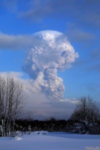
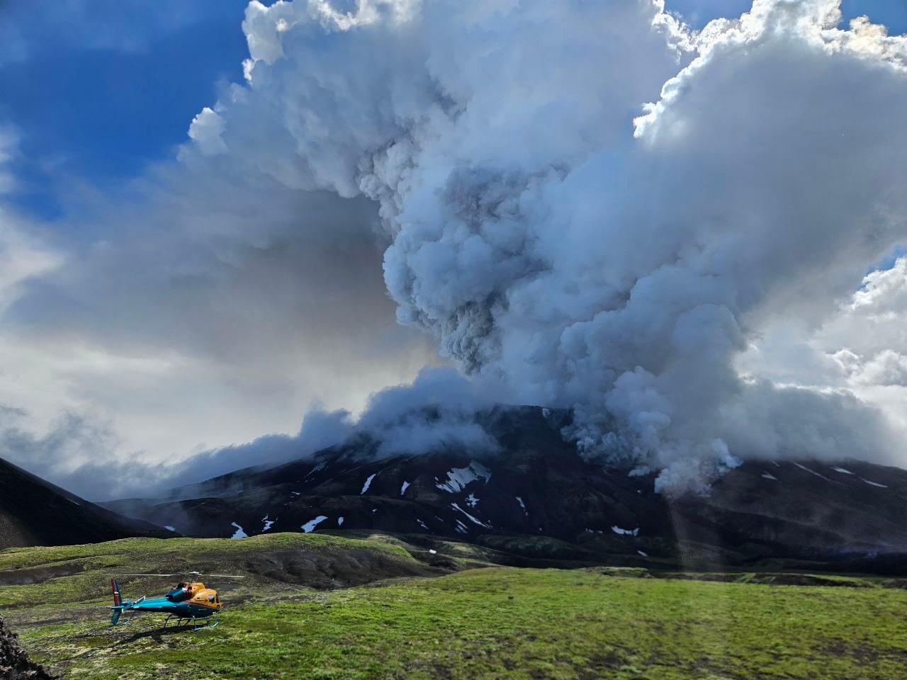
Kamchatka , Krasheninnikov :
« The plume extended southeast from the volcano towards Kronotsky Bay. There are no populated areas along the ash plume’s path. No ashfall was recorded in populated areas, » the report said.
This is the second ash emission from the volcano in 24 hours. On August 3, the Krasheninnikov volcano erupted for the first time since the 15th century, with the first ash emission reaching a height of 6 km. Moreover, its height is 1,856 m. The volcano has been assigned an « orange » air hazard code, the Ministry of Emergency Situations said.
Alexei Ozerov, director of the Institute of Volcanology and Seismology of the Far Eastern Branch of the Russian Academy of Sciences, told TASS that a volcanic eruption could threaten tourists in the Valley of Geysers, one of the world’s largest geyser fields, located in Kamchatka.
The eruption of the Krasheninnikov Volcano began after an 8.7-magnitude earthquake on July 30. It was followed by a tsunami and an eruption of the Klyuchevskaya Sopka Volcano.
Source : Expert . ru / news
Photo : Vulcaniya / FB.
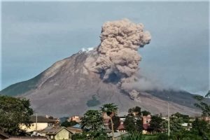
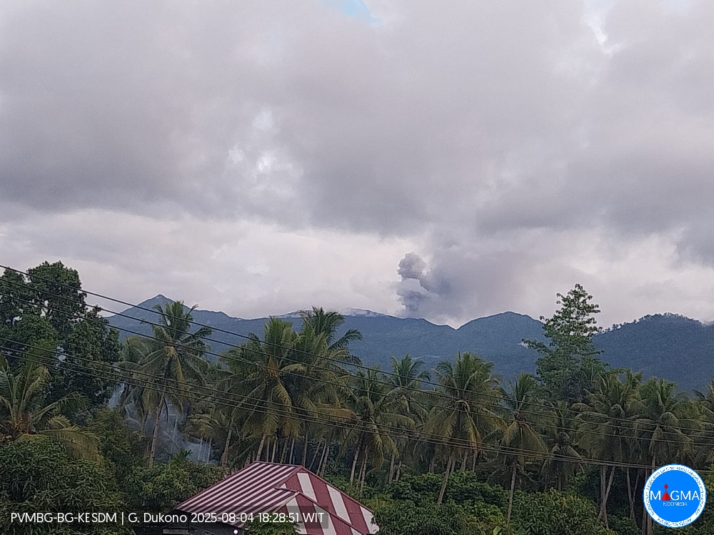
Indonesia , Dukono :
An eruption of Mount Dukono occurred on Monday, August 4, 2025, at 6:18 PM (Eastern Time). An ash column was observed about 400 m above the summit (about 1,487 m above sea level). The ash column was white to gray in color, with moderate intensity, oriented northwest. This eruption was recorded by seismograph with a maximum amplitude of 14 mm and a duration of 61.28 seconds.
Seismic Observations
47 eruption earthquakes with amplitudes ranging from 6 to 15 mm and durations ranging from 32.22 to 79.15 seconds.
A distant tectonic earthquake with an amplitude of 10 mm and a duration of 80.1 seconds.
A continuous tremor with an amplitude of 3 to 10 mm, mainly 5 mm.
Recommendations
(1) People living around Mount Dukono and visitors/tourists are advised to avoid any activity, climbing, or approaching the Malupang Warirang crater within a 4 km radius. (2) Since volcanic ash eruptions occur periodically and the distribution of ash follows the direction and speed of the wind, making the ash coverage area unstable, people living around Mount Dukono are advised to always have masks/nose covers and mouth masks available when needed to avoid the dangers of volcanic ash to the respiratory tract.
Source et photo : Magma Indonésie .
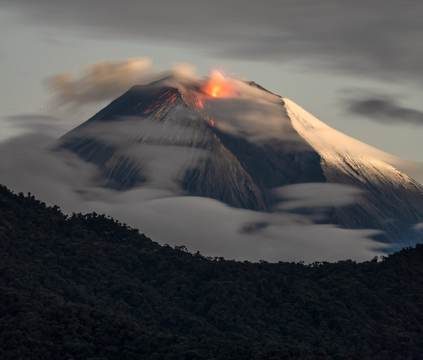
Ecuador , Sangay :
DAILY STATUS REPORT OF SANGAY VOLCANO, Monday, August 4, 2025.
Information Geophysical Institute – EPN.
Surface Activity Level: High, Surface Trend: Descending
Internal Activity Level: Moderate, Internal Trend: No Change
Seismicity: From August 3, 2025, 11:00 a.m. to August 4, 2025, 11:00 a.m.:
Seismicity:
Below is the count of seismic events recorded at the reference station.
Explosion (EXP): 45
Rainfall/Lahars:
Since yesterday afternoon, no rain has been recorded in the volcanic area. **Heavy rains could remobilize accumulated material, generating mud and debris flows that would cascade down the volcano’s flanks and flow into adjacent rivers**.
Emission/Ash Column:
Due to adverse weather conditions in the volcano area, no gas and/or ash emissions could be observed via the surveillance camera network. However, this morning, using the GOES-19 satellite system, an emission of gas and ash was observed at an altitude of 800 meters above the crater level, in a southwesterly direction.
In connection with this activity, the Washington VAAC has issued three reports of gas and ash emissions at altitudes between 600 and 800 meters above the crater level, in a westerly direction.
Observation:
From yesterday afternoon until the closing of this report, the volcano remained completely cloudy.
Alert Level: Yellow
Source : IGEPN
Photo : Robinsky
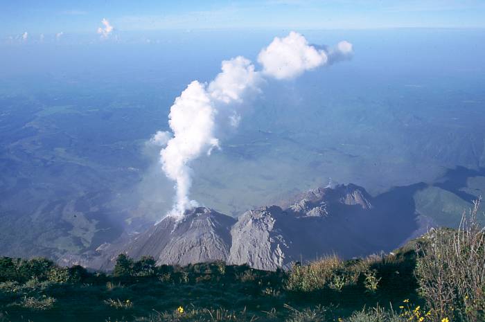
Guatemala , Santiaguito :
Weather Conditions: Clear
Wind: Northeast
Precipitation: 0 mm
Activity
Activity was reported from the Caliente dome of the Santa María-Santiaguito volcanic complex, with white outgassing up to 600 m above the crater. One to two weak to moderate explosions were recorded per hour, generating columns of gas and ash that rose up to 3,500 meters above sea level. These columns moved westward, causing ashfall on nearby farms and communities. During the night and early morning, incandescence was observed in the crater, as well as the collapse of incandescent volcanic material toward the flanks.
Due to the high activity, the generation of long-distance pyroclastic flows in different directions cannot be ruled out. It is therefore recommended to follow Special Bulletin BESAN-002-2025. In addition, lahars could descend in the afternoon and evening along the volcano’s various channels, so it is recommended not to approach them.
Source : Insivumeh
Photo : auteur inconnu .