July 19 , 2025.
Iceland : Reykjanes Peninsula :
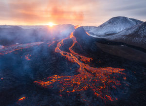
An eruption has started on Sundhnúksgígaröð crater row , Updated at 11:30, 18 July
Status of the eruption and volcanic haze across Iceland
The eruption at the Sundhnúkur crater row continues, though its activity has decreased over the past 24 hours. The main activity is now concentrated at the central part of the fissure, and little to no seismic activity has been measured along the intrusion. Tremor around the eruption sites has also diminished.
No ash has been produced by this er
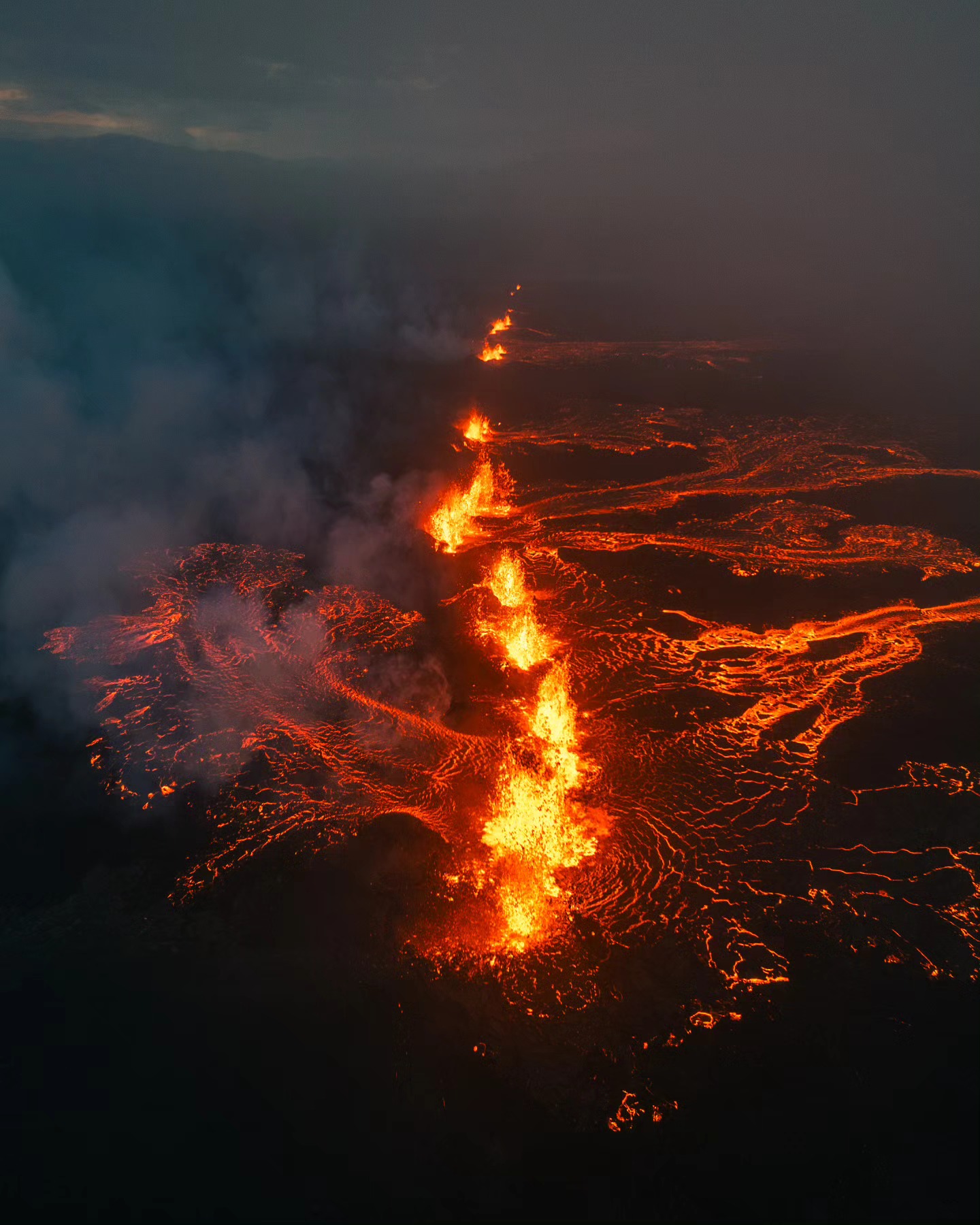
The eruption continues, but activity has decreased and is now confined to around 10 craters
Lava flow is mainly heading towards Fagradalsfjall within foreseeable areas
Low seismic activity and declining tremor
SO₂ pollution has temporarily reached hazard thresholds in some localized areas
Gas dispersal today towards Reykjanesbær, potential pollution in Grindavík tomorrow
Eruption status
The eruption at the Sundhnúkur crater row continues, though activity has decreased and is mostly confined to around ten craters. Lava is still flowing, mainly eastward towards Fagradalsfjall, and remains within expected areas.
Seismic activity is low and tremor is declining. Deformation measurements show no significant changes since yesterday. Fog and poor visibility are currently limiting observations of the eruption site.
The latest observations show that the eruption is no longer confined to a single fissure. The larger fissure at the Sundhnúkur crater row is estimated to be about 2.4 km long. In addition, a smaller fissure has opened west of Fagradalsfjall and was estimated at about 500 meters in length during an aerial survey by the Icelandic Meteorological Office and the Icelandic Coast Guard.
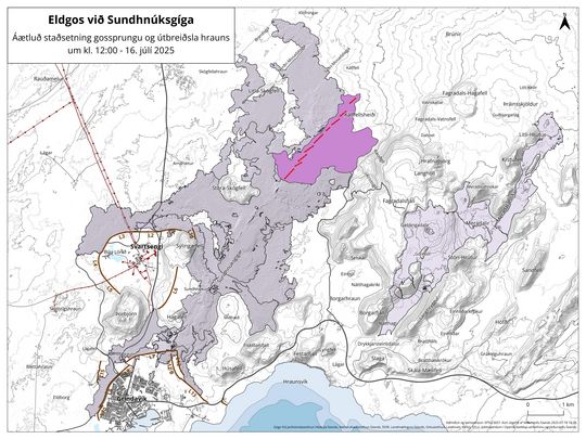
The light purple color indicates the new lava field, red lines mark fissures, and the brown grid delineates the observation area and populated areas.
Lava extent
The map is based on ICEYE satellite observations taken shortly before noon today and shows the extent of the lava from this eruption. At that time, the lava field covered approximately 3.2 km².
The map also shows the estimated location of the eruptive fissure at Sundhnúksgígaröð at around 12:00. Lava has flowed north and northeast from the source, spreading widely across Kálffellsheiði and toward Svartsengi.
Source : IMO
Photos : Hermann Helguson via FB , IMO
Alaska , Spurr :
Unrest continues to decline at Mount Spurr. The decrease in activity suggests that the magma intrusion beneath Mount Spurr has stalled, and the likelihood of an eruption has declined.
Earthquake activity continues, but a majority of the seismicity near Mount Spurr is non-volcanic as part of a small swarm related to glacial activity at Pothole Glacier 10 – 15 km (6 – 9 miles) to the west. Only about 40 earthquakes (with a maximum magnitude of 1.5) were located close to the summit of Mount Spurr or Crater Peak. The number of earthquakes and their magnitudes continue to vary from week to week but follow an overall decreasing trend. Ground deformation, as measured by GNSS (GPS) stations, remains paused as it has been since about mid-March 2025. Volcanic gas emissions continue, as would be expected from a passively degassing body of stalled magma.
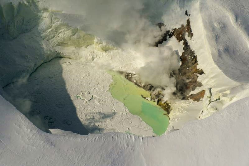
Fluctuations in unrest are common at volcanoes and eruptive activity remains possible, but unlikely.
AVO continues to closely monitor activity at Mount Spurr using local seismic, infrasound, and GNSS (GPS) stations, web cameras, airborne and satellite gas measurements, regional infrasound, lightning networks, and satellite images.
Source : AVO
Photo : Loewen, Matt / Alaska Volcano Observatory / U.S. Geological Survey.
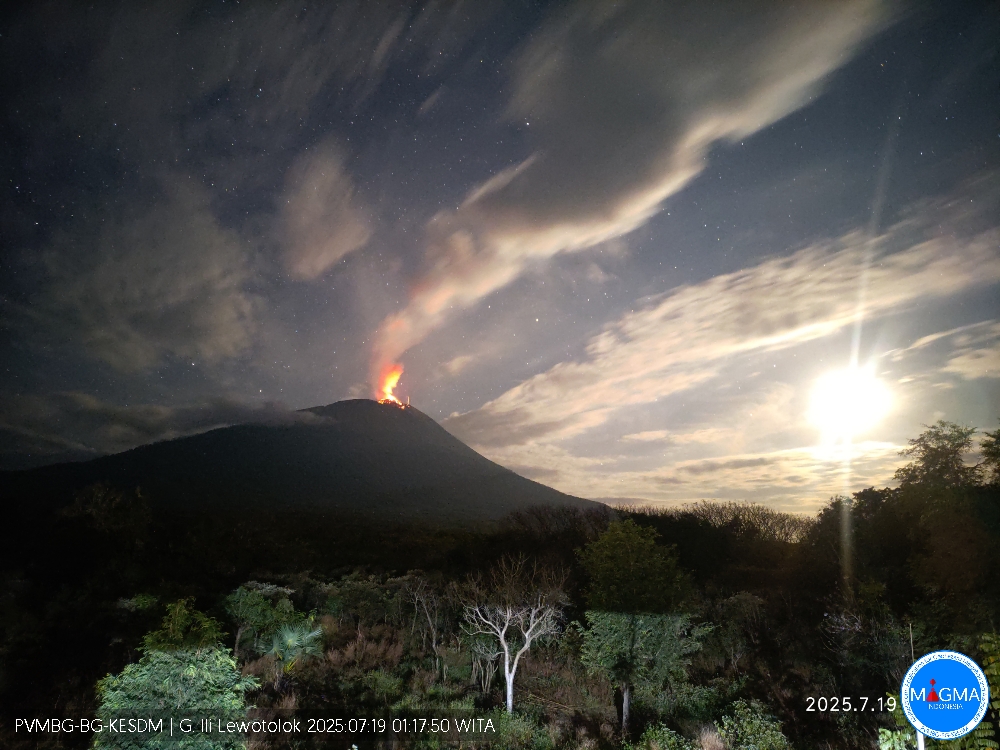
Indonesia , Ili Lewotolok :
An eruption occurred on Mount Ili Lewotolok on Saturday, July 19, 2025, at 1:17 a.m. WITA (Central Indonesian Time). An ash column was observed approximately 200 m above the summit (approximately 1,623 m above sea level). This thick, white to gray ash column extended southeastward. This eruption was recorded by a seismograph with a maximum amplitude of 23.3 mm and a duration of 48 seconds.
Seismic observations
40 eruption earthquakes with amplitudes ranging from 8.6 to 35.5 mm and durations ranging from 33 to 55 seconds.
38 emission earthquakes with amplitudes ranging from 1.7 to 8.3 mm and durations ranging from 25 to 50 seconds.
Recommendations
At Activity Level III (Alert):
[1] Residents living near Mount Ili Lewotolok, as well as visitors, climbers, and tourists, are advised not to enter or engage in any activities within a 3 km radius of the Mount Ili Lewotolok activity center. They should be aware of the potential dangers of lava avalanches and hot clouds emanating from the southern, southeast, western, and northeast sectors of Mount Ili Lewotolok.
(2) The public is advised not to panic if they hear rumbling or roaring sounds coming from the crater of Mount Ili Lewotolok, as these sounds are a sign of volcanic activity in the eruptive phase. These rumbling sounds can cause severe vibrations in some parts of buildings, particularly windows and glass doors.
Source et photo : Magma Indonésie .
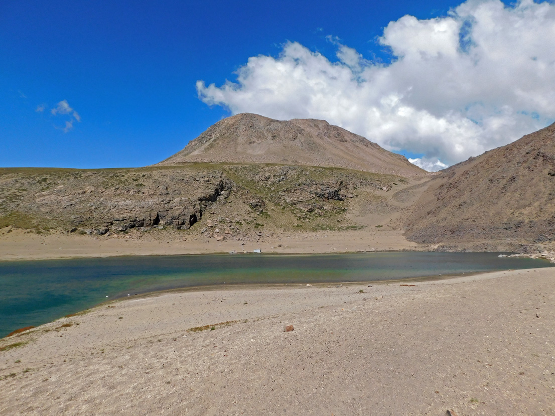
Chile , Laguna del Maule :
Special Report on Volcanic Activity (REAV), Maule Regions, Laguna del Maule Volcanic Complex, July 18, 2025, 3:55 p.m. local time (Continental Chile)
The National Geology and Mining Service of Chile (SERNAGEOMIN) announces the following preliminary information, obtained using the monitoring equipment of the National Volcanic Monitoring Network (RNVV), processed and analyzed at the Southern Andean Volcano Observatory (OVDAS):
On Friday, July 18, 2025, at 3:00 p.m. (19:00 UTC), monitoring stations installed near the Laguna del Maule volcanic complex recorded an increase in the occurrence of volcano-tectonic earthquakes (associated with rock fracturing within the volcanic system), reaching a total of 150 earthquakes in the last three hours, characterizing this episode. seismic like a swarm of earthquakes.
The characteristics of the highest-energy earthquake after its analysis are as follows:
TIME OF ORIGIN: 2:17 PM local time (6:17 PM UTC)
LATITUDE: 36.086°S
LONGITUDE: 70.4755°W
DEPTH: 6.1 km
LOCAL MAGNITUDE: 1.6 (ML)
Observation:
At the time of this report, volcano-tectonic events continue to be recorded at the Laguna del Maule volcanic complex, but at lower magnitudes.
The technical volcanic alert remains at GREEN.
Source : Sernageomin
Photo : Álvaro Vivanco , Photo prise au Sud-Ouest de la lagune de Maule.
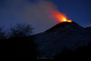
Hawaii , Kilauea :
HAWAIIAN VOLCANO OBSERVATORY DAILY UPDATE , U.S. Geological Survey
Friday, July 18, 2025, 9:15 AM HST (Friday, July 18, 2025, 19:15 UTC)
19°25’16 » N 155°17’13 » W,
Summit Elevation 4091 ft (1247 m)
Current Volcano Alert Level: WATCH
Current Aviation Color Code: ORANGE
Activity Summary:
The ongoing eruption of Halemaʻumaʻu is paused. The end of lava fountaining episode 28 on July 9 coincided with the return of inflationary tilt at the summit, which continues at this time. Low-level degassing and seismic tremor persist, and inflationary tilt has reached the level recorded at the onset of episode 28. These observations indicate that episode 29 is near, and the current summit inflation rate suggests it will likely occur sometime July 18 (today), or later, if additional pressurization is required
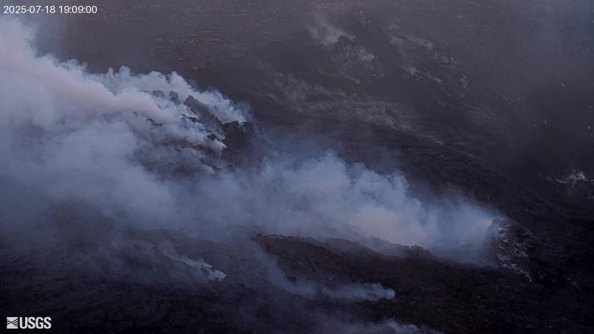
No significant activity has been noted along Kīlauea’s East Rift Zone or Southwest Rift Zone.
Summit Observations:
Incandescence in the crater last night was limited, mostly to a crack system on the tephra cone just above the north vent. Glow from the north vent itself was sporadic. Uncrewed aircraft systems (UAS, or drone) images captured yesterday morning showed no visible molten lava within the north vent at that time.
Tremor and degassing persist at lower but still elevated levels. Typical sulfur dioxide (SO2) emission rates associated with pause periods are 1,200 to 1,500 tonnes/day. Unlike many other recent pauses, gas pistoning has been minor thus far during this pause.
Lava fountaining associated with episode 28 resulted in 15 microradians of deflation on the UWD tiltmeter. At the time of this update, UWD shows about 15.8 microradians of re-inflation since the end of the episode.
Source et photo : HVO